The Atlantic is becoming more active as the tropical storm season ramps up. This is horrible news for Haiti where they had a 7.2 magnitude earthquake on Saturday. At least 304 people were killed in the earthquake, which overwhelmed hospitals, flattened buildings and trapped people under rubble in at least two cities. An untold number are missing. Tropical storm Grace is expected to make landfall in the Dominican Republic and Haiti tonight and Monday.
The remnant of TS Fred is moving into the Gulf of Mexico SW of Florida – there is an 80% chance it will reform into a tropical storm and move northward into the Florida panhandle continuing on to Alabama and Georgia.
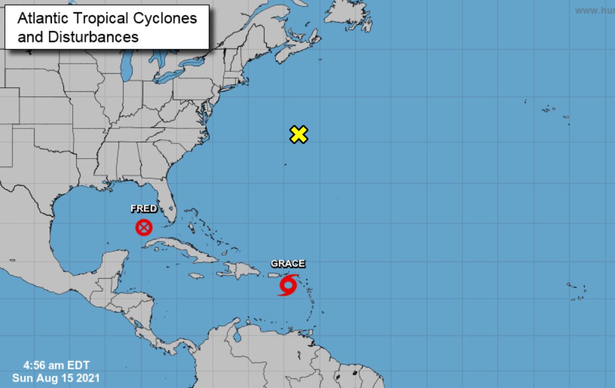
There is also a well-defined low-pressure system north/northeast of Burmuda which has a 30% of forming into a tropical storm. In the Pacific, we have hurricane Linda which is forecast to move west over open water. In the central Pacific, we have clear sailing with no threat of a tropical storm in the area around the Hawaiian Islands.
Sunrise/sunset times today are 6:49 am/8:44 pm giving us 13 hours and 55 minutes of daylight. By the end of the month, this drops to 13 hours and 12 minutes with sunrise/sunset times of 7:06 am and 8:18 pm. Our current temp at 7 am is 52.9°.
In Otsego, we have had 1.43 inches of rain thus far for August and 14.22 inches for the summer season.
Forecast Discussion
- Gradual warming trend this week

After a cool start today with temperatures running around 5 to 10
degrees below normal...we will see High temperatures reaching into
the 75 to 80 degree range...thanks to abundant sunshine. Then for
Monday we will be on the backside of the departing surface high
pressure system. This will allow for some warm air advection. High
temperature values will end up a few degrees higher as compared to
Sunday. By Tuesday the 850 mb temperatures will be in teens which
should allow for max temperatures reaching normal levels. Further
warming is predicted Wednesday. The temperature on Wednesday into
Friday is looking slightly above normal for this time of the
year.


- Potential for a few thunderstorms Tuesday into Friday

While the warming in taking place in the low levels over the next
couple of days...the atmosphere will be cooling off aloft. This is
the result of a weak mid to upper level trough moving in. This
feature maintains a positive tilt through the region.  The PWAT
values will climb as well...but overall they do not become overly
moist. Instability builds as well...especially each afternoon.
This is the window of when we will feature the highest potential
for thunderstorms. Bulk deep layer shear remains low so organized
severe weather is not predicted.
I love summers with no heat waves! Let the rock n roll party keep going! Rock
n roll will never die!
To bad we couldn’t get a Summer without multiple humid waves which feel far worse. Maybe next year.
Yes we have had a few days with some higher humidity, but overall not bad!
100% correct Rocky And it shows no signs of mokkiee hardly all Summer long wooo wooo! INDY
You know it! Facts are facts and rock n roll is incredible!