I think back to the days of my youth (pre-1970s) when Michigan was referred to as the Winter Wonderland. Those days before ski resorts had to use snowmaking machines to keep the hills and mountains white. Seems we were always sledding and skiing on the weekends. The graphic below shows the change in winter snow since the early 1970s. (click to enlarge)

Congratulations to the Wolverines for their third victory in a row over Ohio – a great game and a job well done!

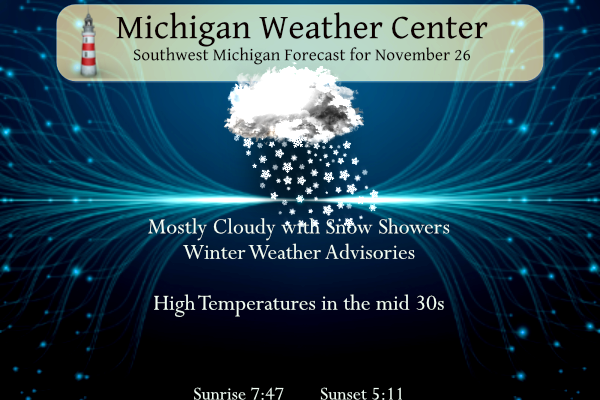
Snow will spread across the area from NW to SE this morning and continue through tonight. The highest amounts of 3 to 6 inches are expected along and north of I-96 and west of US-131 with lighter amounts outside of this area. Slick conditions are possible with any accumulations, so make sure to take it slow if you need to travel. West to northwest winds pick up tonight which could result in some blowing and drifting snow.
Here are the current winter weather advisories:
...WINTER WEATHER ADVISORY REMAINS IN EFFECT UNTIL 7 AM EST
MONDAY...

* WHAT...Snow. Additional snow accumulations of 3 to 5 inches.

* WHERE...Mason, Lake, Oceana, Newaygo and Muskegon counties.

* WHEN...Until 7 AM EST Monday.
...WINTER WEATHER ADVISORY REMAINS IN EFFECT UNTIL 7 AM EST
MONDAY...

* WHAT...Snow. Additional snow accumulations of 2 to 4 inches.

* WHERE...Osceola and Mecosta counties.

* WHEN...Until 7 AM EST Monday.
Snow will spread across the area from NW to SE this morning and continue through tonight. The highest amounts of 3 to 6 inches are expected along and north of I-96 and west of US-131 with lighter amounts outside of this area. Slick conditions are possible with any accumulations, so make sure to take it slow if you need to travel.
Forecast
Weather History for Southwest Michigan
1896: Record warm temperatures in the 60s occur across Lower Michigan. The warmth does not last long, though. A sharp cold front is followed by plunging temperatures for the end of the month. The high of 64 degrees at Lansing is followed by a low of 18 degrees on the next day and a low of 8 degrees on November 30th.
1949: Lansing falls to 5 below zero, the lowest November temperature on record there.
Weather History for Southeast Michigan
On November 26, 2018, a low-pressure system with a history of producing more than a foot of snow and blizzard conditions over the central Plains moved into the Great Lakes. Locations in Saginaw and Tuscola Counties saw over 7 inches of snow, while locations in Sanilac, St. Clair, and Macomb Counties only saw a trace of snow or none at all. Flint did break their daily snowfall record for the day with 4.2 inches.
On November 26, 2002, heavy lake effect snow developed over Lake Huron as cold north-northeasterly winds passed over the relatively warm waters of the lake. A lake effect snow band moved onshore in eastern St Clair County and far southeastern Sanilac County on the afternoon of the 26th. The band then remained nearly stationary through the rest of the afternoon and into the early morning hours of the 27th. The snow was the heaviest and persisted the longest in the city of Port Huron. By the morning of the 27th, 12-hour snowfall totaled 17 inches across the northern half of the city of Port Huron, while the south half reported amounts around 13 inches. In Sanilac County, 12-hour snowfall amounts were reported as; 8 inches in Lexington, Crosswell, and Applegate.
On November 26, 1977, snow continued to fall as cold air filtered into Southeast Michigan. The snow started on November 25 and continued into November 27. By the time it stopped snowing Detroit had 5.6 inches of new snow, Flint received 2.9 inches, and Saginaw recorded 6.0 inches.
Also on November 26, 1949, the overnight temperature dropped to a freezing -7 degrees in Flint! This is the record minimum temperature for the month of November in Flint.
U.S.A and Global Events for November 26th:
November 26, 2007:
Lightning and heavy rain delayed the start of the Monday Night Football game at Pittsburgh’s Heinz Field between the Miami Dolphins and the Pittsburgh Steelers by 25 minutes. The muddy field conditions contributed to one of the lowest-scoring NFL games won by the Steelers, 3-0. The teams combined 375 yards, and the winning field goal occurred with 17 seconds left in the game.
Forecast Discussion
Overall, the going advisory looks to be in solid shape, and we will
keep the advisory going as is. The expectation is for a 3-6 inch
snowfall event through Monday morning across the northwest CWA, with
totals on the order of 2-4 inches on the eastern edge of the
advisory. Locally higher amounts are possible. The heaviest snow is
expected from Ottawa and Kent Counties northward up the Lakeshore
and US131. Snow outside of this area will be in the 1-2 inch range,
remaining below advisory criteria.

The cause for this snowfall will be upper-level troughing over the
plains moving into the Great Lakes today. This trough will contain
two shortwaves, with one moving through today and another moving
through tonight. These will be the source of synoptic scale lift,
combining with deep moisture (deep moisture heights of 20-30 kft in
BUFKIT overviews) to provide snowfall across West Michigan.
Southwest flow off of the lake will also add some lake enhancement
to snow totals, particularly across the advisory area.

Snow is moving into the area near Big Sable at present and will
expand southeast across West Michigan after 4-5 am. Widespread snow
will occur across the area Sunday, with the advisory area seeing
snow covered roads and locally reduced visibilities, particularly
in any locally heavier showers. Road temperatures at present are
below freezing across the CWA, which will support greater
accumulations where snow begins before they warm. Outside of the
advisory area where less snow is expected, temperatures warming to
near freezing which may mitigate travel concerns.

After 00z Monday, and especially after 03z, widespread synoptic
snowfall transitions to lake effect snow as widespread deep-layer
forcing is lost. Moisture depth and inversion heights also fall to
5- 10 kft during this time frame, though a shortwave moving
through later Monday could provide a boost. There will be ample
lake induced instability with LI CAPE values above 500 J/kg as 850
mb temperatures fall well into the negative teens with lake
temperatures near 50 degrees. However, the limited moisture depth
will keep accumulations lower than today and tonight. At this
point, while locally heavy snow is possible in any lake effect
bands, expected impacts do not look to meet advisory criteria.
Will keep the advisory as is, though this can be re-examined with
the day shift Sunday if need be. The lake effect snow showers will
continue through the rest of the short term period.

- Lake Effect Snow Continues Monday Night

Additional light snow accumulations continue into Tuesday especially
toward the lakeshore. With temperatures dropping into the teens to
low 20s slick conditions continue into the Tuesday morning commute.

Northwest flow and colder 850 mb temperatures advect into the area
Monday night dropping to around -15 C. With lake surface
temperatures around 11 C currently and high relative humidity values
at 850 mb lake effect snow is expected. Drier air briefly works its
way into the area Tuesday along with warming 850 mb temperatures
giving us a brief break in the snow.

- Quick Round of Light Snow Tuesday Night

A more progressive shortwave trough will bring the potential (20 to
40 percent) for additional snow accumulations. At this time snow
looks to start after midnight tuesday night and might wrap up by the
Wednesday morning commute. There is an ample amount of warm air
advection along with positive vorticity advection to provide lift
with this quick hitting system. With the warmer 850 mb temperatures
the lake may not provide much enhancement to totals which look to
remain below advisory levels at this time. It still could cause some
issues for the Wednesday morning commute in those areas that see
snow accumulations.

- Temperatures Warm, Wintry Mix Possible Thursday Night

Wednesday temperatures begin to warm with highs in the mid 30s to
low 40s, overnight temperatures will mainly be below freezing
though. As we head toward the later part of the week there is a bit
more uncertainty with the track and timing of a couple shortwave
troughs. Ensembles do show a signal for Thursday night into Friday
with some members completely dry. There are a couple solutions that
keep precipitation south of the area. With that being said, if
precipitation moves in Thursday night into Friday morning there will
be a window for a wintry mix of rain, freezing rain, and snow which
again would bring concerns for the Friday morning commute. Will need
to continue to monitor trends with this system as a slight change in
timing could increase or decrease the potential for slick conditions.
A dusting on the grass. Asphalt and concrete are clear. Maybe a 1/2 or so on the lawn.
Tomorrow is looking pretty chilly. The high is at midnight and most of the day will be stuck in the 20s. A preview to come
So far it is looking like the first WWA is an overhyped bust! We will see how this evening pays out, but so far only a dusting here!
Snowing moderately at my house. Light dusting on the ground. Funny how the heaviest snow at least right now is outside the advisory area for the most part. I’m sure that will change with time.
Moderate snow all around GR yet only a few flurries in GR! Hopefully this is not a sign of how winter will play out this year!
The dry slot is impressive today, going to drop those totals down significantly 🙂
The ever popular GR dry slot?
It happens so often, comical really. 🤣
GR is in a snow donut hole currently! It should fill in soon! Get ready!
If you want big time snow go live downwind of Lake Erie just south of Buffalo or Lake Ontario north of Syracuse. Big snows on the way for those areas as usual. I’d love to spend winters in Buffalo just to experience some of the significant lake effect events.
I was in North Tonawanda (north of Buffalo near Niagara Falls) when there was a Lake Effect Snow Warning. Three feet of snow fell in about 12 hours. It was pretty amazing. Less than 24 hours later, the roads were cleared. They have the equipment and resources to handle it.
Tug Hill comes to mind!
Yep the Buffalo area can get some wild events. I’d like a home in Orchard Park or Hamburg, NY. Even if I just lived there a few years and went elsewhere just to experience it. Maybe one day.
And yes the Tug Hill can get buried with lots as well.
Bring on the SNOW! I love it!
The official H/L yesterday at Grand Rapids was 34/18. That 18 is the coldest official low of the season so far. There was no rain or snow fall. The sun was out just 13% of the possible time. For today the average H/L is 43/30 the record high of 65 was set in 1896 and the record low of 3 was set in 1949. The wettest November 26 was in 1965 with 1.16” of rain. The most snow fall is 5.7” in 1972 the most on the ground is 7” in 1950. Last year the H/L was 54/31.
Slim
In my youth, you could pretty much snowmobile at any time between December and February. Nowadays, you’re lucky if you get three days per winter. Winters are becoming shorter, warmer, and drier with each passing year. The data (and our eyes) don’t lie.
I will do a report on snow fall amounts, number of days with snow on the ground and temperatures some time in the upcoming weeks for Grand Rapids and Lansing. I think I will start with the 1950’s
Slim