If it weren’t for the smoke coming from the wildfires in Canada there wouldn’t be much to talk about in the weather department. With the east winds the warmest temperatures in the state will once again move into west Michigan as will the increase in the pollutants from the fires. Rain chances are still in the picture for Sunday into Monday with temperatures cooling into the 70s early next week.
...Air Quality Alert for Wednesday June 21st and Thursday June 22nd...

The Michigan Department of Environment, Great Lakes, and Energy
has declared Wednesday June 21st and Thursday June 22nd to be an
Action Day for elevated levels of ozone. Pollutants are expected to
be in the unhealthy for sensitive groups range.

The Action Day is in effect for the following Michigan counties...

Mason, Oceana, Muskegon, Ottawa, Kent, Allegan and Van Buren.

People and businesses are urged to avoid activities which lead
to ozone formation. These activities include refueling vehicles
or topping off when refueling, using gasoline powered lawn
equipment, and using charcoal lighter fluid. Positive activities
include car pooling, biking to work, delaying or combining
errands, and using water based paints.

It is recommended that active children and adults, and persons
with respiratory diseases such as asthma, limit prolonged
outdoor exertion.
Grand Rapids Forecast
6 22 grrU.S.A and Global Events for June 22nd:
1928: A farmer near Greensburg, KS looked up into the heart of a tornado. He described its walls as “rotating clouds lit with constant flashes of lightning and a strong gassy odor with a screaming, hissing sound.”
2003: A hailstone measuring 7.0 inches in diameter with a circumference of 18.75 inches and weighing 1.33 pounds falls in Aurora, Nebraska. The National Weather Service reports this is the second-largest hailstone ever documented in the U.S. by weight and the largest by size at that time. The world’s largest hailstone NOW was produced from storms in South Dakota; 8″ in diameter and 1.9375 lbs. on July 23, 2010.
2007: The first officially documented F5 tornado in Canada struck the town of Elie, Manitoba population of 500 people. Video of the storm showed a heavy van being whirled through the air. The storm also tossed an almost entire house several hundred yards through the air before it disintegrated. The tornado traveled across the landscape for about 35 minutes covering 3.4 miles and leaving a damage path 984 feet wide. Wind speeds in the tornado were later estimated at 260-316 mph. Fortunately, no fatalities or serious injuries were reported.
Forecast Discussion
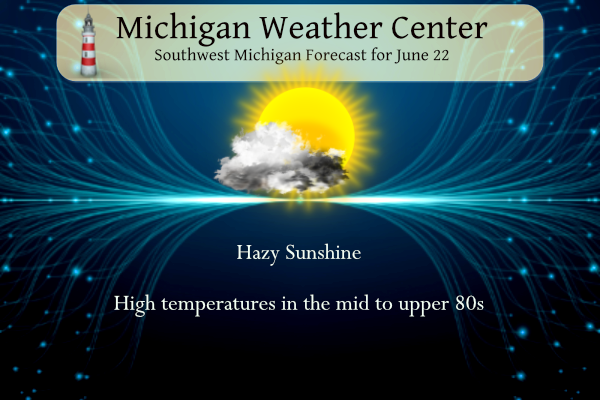
- Above normal temperatures persist today

The easterly wind continues today and that will favor areas along
and west of US 131 for the warmest readings. We will see some
increase in the cloud cover as moisture starts advecting in and
there will also be an increase in the smoke. Also, models show the
850 mb temperatures falling into the 12 to 14 deg C range today. As
a result, we are not likely to reach the hot conditions that we
have seen the past few days. However normal high temperatures are
around 80 degrees and based on the forecast 850 mb temperatures,
if we mix to that level, we should still reach the low to mid 80s.

- Small chance for showers Friday

Eastern zones including the Lansing to Jackson region will see
PWAT values climbing during the day. Projected values rise to
around 1.5 inches. This is when the mid to upper level low will
be lifting up into Ontario. Best height falls are in the eastern
portions of MI. Enough moisture and lift exist for at least a few
showers Friday for eastern parts of the CWA. Ensemble QPF from the
various models also show the eastern parts of the CWA favored for
showers Friday with almost no members showing precipitation for
Muskegon and several members shows lighter QPF for Jackson. Even
for Jackson though, most members in all the models keep it dry
Friday. However, we will still hold onto a low chance for showers
given the lift and moisture that will be around.


.LONG TERM...(Friday night through Wednesday)
Issued at 301 AM EDT Thu Jun 22 2023

Rain chances are going to increase as we go through the weekend into
early next week.

We`ll start off dry Friday night as one upper low will be moving
east of the state and another will be moving toward the state from
the Plains. Sfc low pressure will push a cold front into the cwa
Sunday. A decent short wave accompanies the sfc low and will provide
some lift. Precipitable water values climb to 1.5 inches by Sunday
afternoon. Throw in SBCAPE values around 1k j/kg and we have
ingredients for some thunderstorms. Almost all of the ECMWF ensemble
members support precipitation with the ensemble mean around 0.4
inches which would be very welcome.

Chances for rain will be present from Sunday afternoon through
Tuesday as the low slowly moves east across the state. Ridging will
follow Tuesday through Thursday along with dry weather. Late in the
week, another system moves across the northern portion of the
country toward the Great Lakes and rain chances will increase again.

Saturday and Sunday will be the warmest days with highs approaching
90, but 70s will follow early next week as cooler air associated
with the upper trough settles over the region.
Only mid 80’s in GR today and even cooler tomorrow! Thankfully no heat waves in sight! Bring on the rain baby!
Another warm, sunny, and dry day. A bit hazy, though. I’m done doing my rain dance. I am clearly doing it wrong. At least we’re not in south Texas where they have triple digit temps, dew points near 80 (I see multiple locations at 79), and heat indices nearing 120. In the 52 days since May 1st, 37 days have been sunny, 13 days have been partly cloudy, and just 4 days have been cloudy. That has to be some sort of record for sunny days and/or minimal cloudy days over an extended period. My son and I are off… Read more »
Severe droughts can even put a strain on trees. I know of one mature tree that died in the drought of 2012 in Kentwood. The guy that owned the property where the tree died in 2012 was hit by the Kentwood tornado in 2014. All the trees on his property were snapped by the tornado except the one that died in the drought. That dead tree was the only one left standing after the tornado in his yard. How crazy that is. Go figure.
The updated drought monitor puts all of Ionia County in severe drought which obviously is accurate as well as portions of surrounding counties. The farm field planted weeks ago across from my house is complete dirt the stuff planted has not surfaced yet and not sure if it even will. Other fields where things are planted are very short and not growing well. This is no doubt a serious drought situation and big changes are needed in the weather pattern.
https://droughtmonitor.unl.edu/CurrentMap/StateDroughtMonitor.aspx?MI
The official H/L at Grand Rapids yesterday was 91/64 there once again was no rain fall and the sun was out 94% of the possible time. There were 13 CDD’s The overnight low here in MBY was 65 and is now up to 70. For today the average H/L is 81/60 the record high of 97 was set in 1894 and 1923 the record low of 39 was set in 1992 the most rain fall of 1.92” fell in 1928.
Slim
The next 5 days continue to stay warm with a good chance of some rain on Sunday. After Sunday it looks to turn cooler with a chance of some more rain. Waiting for the updated drought monitor to come out.
Slim
https://droughtmonitor.unl.edu/CurrentMap/StateDroughtMonitor.aspx?MI
It looks like a small pocket of severe drought developed just to the SE of Grand Rapids (I think forest hills is right on the edge)
I thought the severe drought area would be larger.
Slim
Me too. Although the rainfall departure map is highest right over the severe drought area. I’m guessing all other areas are right on the border… if it doesn’t rain much early next week, then I think the severe drought will expand
I also think it should be bigger. I am right on the northern edge and got the same rainfall totals as those in the severe drought area. I really hope for a pattern change, although like it was said a few weeks ago it may take a hurricane or other major storm to disrupt this stationary pattern.
Phew 90 Tuesday, 91 yesterday. Maybe more 90’s this weekend?