Well, summer is definitely in full swing now with the warm and sticky air in place. We reached 85.6° yesterday with a feels like temp of 93 at 3 pm. The current temp is a warm 66° at 5 am. We and most of the neighborhood blew out the rest of our fireworks last night, I am sure there will be a few remnants over the next couple of days. We as humans like to make a lot of celebratory noise.
Traveling around Allegan and Kalamazoo counties the state of this year’s crops are in variable condition. Those areas with irrigation have corn which is five to six feet tall. In rain-dependent fields, it is knee-high to barely surviving. I have seen some fields which have been cultivated under and replanted. I am sure some of this has to do with soil conditions and types.

We have gone five days without rain this time around though chances increase tonight through Thursday morning. We are in the marginal outlook area for storms in the northern lower. Below is the discussion from the SPC:
A mid-level disturbance is forecast to move east-southeast across
   the northern Great Lakes during the day.  An associated cold front
   will push southeast over northern MI but the trailing portion of the
   boundary will become draped near the IA/MN border by mid afternoon.
   Strong heating and a relatively moist boundary layer will result in
   strong buoyancy by mid afternoon ranging from 2500-3000 J/kg from
   northern Lower MI into northern IA.  Modest west-northwesterly flow
   aloft will favor southeast-moving storms.  Damaging gusts and
   marginally severe hail will be the primary risks with the stronger
   storms.  If a cluster of storms can organize over the northern half
   of Lower MI, perhaps a focused and locally higher risk could
   materialize, given stronger 850-700 mb flow.  Uncertainty in the
   aforementioned scenario precludes a 15-percent wind probability at
   this time.
Forecast Discussion
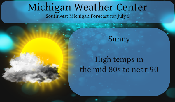
-- Another warm day with a chance of thunderstorms --

Similar to yesterday, temperatures will be approaching 90 degrees
away from Lake Michigan, and humidity will be moderate but not
overly oppressive as dew points will be in the mid to upper 60s.
This would give a heat index (feels-like temperature in the
shade) for many locations in the lower 90s today. Quite a lot of
sunshine is on tap, partially filtered through thin cirrus clouds
and forest fire smoke. As we are sandwiched between high pressure
to our south and low pressure to our north, southwest winds today
will frequently gust well in the 20s, perhaps 30 mph in some
windier spots.

A marginal risk of severe thunderstorms is in place for Central
and Northern Lower Michigan this afternoon and evening. Surface-
based CAPE around 1500 J/kg will build this afternoon, but we
think with little help from upper-level dynamics today, most
surface-based parcels will struggle to break through the cap. What
the HREF members are showing later in the afternoon and through
the evening is elevated convection developing in central Wisconsin
and north-central Michigan, originating from moisture advection
around 800 mb. Parcels in this layer would have MUCAPE greater
than 1000 J/kg with little convective inhibition based on forecast
soundings from HREF members. That said, very little upper-level
support and perhaps some speed divergence in the 800 mb layer may
temper the coverage and magnitude of convection a little. However,
storms that do form and move southeast into our area this evening
may produce isolated large hail due to the amount of CAPE
available through the upper troposphere. Additionally, downdraft
CAPE greater than 1000 J/kg with only a slight amount of near-
surface stability is possible this evening, especially if storms
develop early. Environmental winds 30 to 40 knots at 900-800 mb
may mix down with downdrafts, which could result in strong to
locally severe wind gusts.

Many of the HREF members show convection weakening substantially
late in the evening as it approaches I-96, though their soundings
continue to show MUCAPE with little inhibition. Knowing how these
models struggle with elevated convection (in fact, as of 3:30 AM
there is an elevated thunderstorm over Lake Michigan west of
Frankfort which the 00 Z HREF suite did not predict), we should be
prepared for the possibility of storms surviving longer and
making it farther south tonight than the models show.

-- Occasional chances for thunderstorms this week --

Broadly speaking, it will be difficult to discount convection
chances on any day this week, as a cold front sags through midweek
and upper-level waves propagating through quasi-zonal flow bring
occasional support for instability and forcing. But there are two
primary setups, one mid week, and one late week, which will give
us the greatest storm potential. First will be one or more rounds
of convection Tuesday night through Wednesday as a tendency for
regionwide upper-level troughing occurs and cold front sags south.
Then on Friday into Saturday is a more substantial upper-level
wave which could develop a more robust surface low in the Midwest,
with a warm front coming back north over Michigan. The ECMWF has
been delaying this in recent runs, now more of a Friday night
into Saturday concern.
Nice!…light show of the year to the NE of me…can hear awesome thunder. Just landed from a weekend in DC.
It sure is a hot one today. Only difference is we have had a nice breeze.
It definitely was a steamer of a day yesterday with the heat index in the mid 90’s! Had our first big party in 2 years, over 100 people showed up. Setup in the heat was brutal, and today the cleanup in the heat will be just as brutal. Fun time though!
Some of the warmest official temperatures in Michigan on July 4th were in the UP and northern lower Michigan. With 90 at Houghton, Iron Mountain. the Sault. It even reached 88 at Copper Harbor along with a 89 at Marquette. In norther lower Michigan it reached 92 at Traverse City and Gaylord 90 was recorded at Houghton Lake. In southern lower Michigan it was 90 at Flint, Saginaw and Detroit metro. At Detroit City it was 93. Here at Grand Rapids the official high was 89. It was cooler at Muskegon 82 and Holland 81. The overnight low here at… Read more »