Where did summer go? Yesterday we not only flipped the calendar to September we also are now at the start of meteorological autumn. I know there are some people that do not like the warmer temperature and high humidity of summer and look forward toward the fall season. While others like the cold and snow of winter. Well, I am a weather enthusiast so while I prefer the warmer months of the year I am interested in all types of weather. Before my sister passed away, we would go down to Fort Myers in the winter for a few weeks to get out of the cold and snow for a while. And even after she passed, we still would go down for a week or two. We have not gone since COVID, and I have not decided if we will go somewhere warm this winter or not yet. Anyway, it is now time to look at both some average and records or both September and meteorological autumn.
September
In September at Grand Rapids the 30 year mean is 63.5 and the 15 year mean is 64.2. The average 30 year high/low 78.6/58.3 on the 1st dropping to 68.0/47.6 by the 30th the 15 year average high/low starts out at 79.1/58.6 and drops down to 68.4/48.6 by the 30th so Grand Rapids drops over 10° over the 30 days. The warmest mean for any September is 69.0 in 1931. In that September there was a “heat wave” that lasted 6 days with 5 days in a row of 90 or better with two of the days at 94, one at 93 and two at 92. Yet another very warm September was the one in 2017 that year GR had a real heat wave with 6 days in a row of 90 or better and 7 days of 87 or better. The coldest mean was 56.2 in 1918. That September had 9 days that highs stayed in the 50’s. The highest temperature recorded at GR in September is 98 set on September 2nd 1913 the coldest low of 27 was set on September 27, 1991 during that cold snap lows of 31 and 32 were also recorded. The wettest September was in 1986 when 11.85” fell and the driest was in 1979 when just a trace was reported.
Meteorological autumn
For meteorological autumn (September, October and November) the new 30 year mean is 51.6 and the 15 year mean is 52.1. The average amount of precipitation is 10.53 for 30 years and 10.92 for 15 years. The 30-year average autumn snow fall is 7.4” but the new 15-year average is now down to 5.2” The most snow to fall in any October was 7.4” in 1967 and the most in any November was 31.0” in 2014. 2014 has the most snow fall for any autumn with 31.0” last year was the 2nd snowiest fall with 28.0” other snowy falls are 1951 with 26.9, 1991 with 25.6 and 1989 with 25.2. In 1907 no snow was reported in the fall season 1984, The autumns in 1948,1946 and 1931 only had a trace in the fall season. The warmest fall season was in 1931 with a mean of 57.5 in 1931 and the coldest was 45.8 in 1976. The most snow is 31.0” set in 2014 the least amount of snow is a trace in several years. The most days of 90 or better is 7 set in 1931 there were 6 days of 90 or better in 2017. The record hottest days in autumn are 98 on September 2nd 1913, it reached 97 on September 1st 1953 and that same 97 the next year on September 7th 1954. In more recent times readings of 96 and 95 and 94 were recorded in the 2017 heat wave. The record low for autumn was a bone chilling -10 on November 24th, 1950, there was also a -9 on the 23rd of that November. The low has dropped below +10 in 13 past autumns that last time it has happened was November 19th 1986.
We will now sit back and see how meteorological autumn will play out for 2023.
Yesterday the official H/L at Grand Rapids was 79/50 there was no rain fall and there was 100% of possible sunshine. With a mean temperature of 65 there were 0 HDD’s since July 1st there have been 14 HDD’s that is -4. With that mean of 65 there were also no CDD’s and since January 1st there have been 568 that is a departure of -88. So over all this summer season has had less than average energy use. For today the average H/L is 78/58 the record high of 98 was set in 1913 and that is also the record high for September at Grand Rapids. The record low of 37 was set in 1946. The record rain fall amount of 2.17” fell in 1923. Last year the H/L was 84/65 and there was no rain fall.
AREA FORECAST DISCUSSION
NATIONAL WEATHER SERVICE GRAND RAPIDS MI
553 AM EDT SAT SEP 2 2023
LATEST UPDATE…
AVIATION
SHORT TERM
(TODAY THROUGH SUNDAY)
ISSUED AT 327 AM EDT SAT SEP 2 2023
OUR MAIN FOCUS IN THE SHORT TERM PORTION OF THE FORECAST WILL BE ON
RAIN CHANCES AND ALSO THE POTENTIAL FOR SOME THUNDER TODAY.
OTHERWISE THE WEATHER WILL BE RATHER QUIET, AND WARM BEYOND TODAY.
RADAR IMAGERY OUT OF THE GATE THIS MORNING AS OF 07Z SHOWS A COUPLE
OF SHOWERS AND STORMS JUST NORTH OF OUR AREA ACROSS MANISTEE,
WEXFORD, AND MISSAUKEE COUNTIES. THIS CONVECTION IS LIKELY THE
RESULT OF THE NOSE OF A LOW LEVEL JET AND LEADING EDGE OF MOISTURE
TRANSPORT COMING IN FROM THE WNW. MU CAPES ARE ON THE ORDER OF 1,000
J/KG, ALL OF WHICH IS VERY ELEVATED IN NATURE. THIS SHOULD KEEP
EVERYTHING PRETTY TAME THIS MORNING.
IT LOOKS LIKE WE SHOULD SEE THESE FEW SHOWERS/STORMS PASS THROUGH
THIS MORNING AS THE LOW LEVEL JET MOVES EAST, ALLOWING FOR A BREAK
FROM MID-MORNING TO MID-AFTERNOON. WE SHOULD SEE ANOTHER WEAK SURGE
OF INSTABILITY CLIP OUR NORTHERN COUNTIES THIS AFTERNOON, BRINGING
AN ADDITIONAL CHANCE OF A SHOWER OR STORM TO AREAS MAINLY NORTH OF M-
20. THIS ACTIVITY ALSO LOOKS TO BE MOSTLY ELEVATED WITH THE
INSTABILITY MAINLY BASED ALOFT. SOME OF THIS WILL TRY TO DRIFT
FURTHER SOUTH THIS EVENING, HOWEVER A FAIRLY DRY ATMOSPHERE BELOW
12K FT SHOULD KEEP THIS MOSTLY VIRGA TO SPRINKLES.
WE WILL SEE THE UPPER RIDGE BUILD/SHARPEN UP OVER THE AREA FOR
SUNDAY. THIS WILL ACT TO KEEP THE AREA DRY WITH INCREASING
SUBSIDENCE, AND WILL ALSO HELP TO WARM SFC TEMPS A BIT COMPARED TO
TODAY. 850 MB TEMPS WARMING FROM AROUND D 20C TODAY WILL WARM TO 24-
25C FOR SUNDAY. THIS WILL SUPPORT MAX TEMPS PUSHING 90F AWAY FROM
LAKE MICHIGAN. HEAT INDICES SHOULD NOT BE MUCH WARMER AS DEW POINTS
WILL BE AROUND 60F.
LONG TERM
(SUNDAY NIGHT THROUGH FRIDAY)
ISSUED AT 327 AM EDT SAT SEP 2 2023
– SUNNY AND HOT LABOR DAY INTO TUESDAY
STILL LOOKING AT 500 MB HEIGHTS OF AROUND 590 DM AND 850 MB
TEMPERATURES OF 20C-22C FOR LABOR DAY INTO TUESDAY, AND LIKELY INTO
WEDNESDAY AS WELL. WITH LITTLE TO NO CLOUD COVER, THIS WILL
TRANSLATE INTO SURFACE TEMPERATURES IN THE UPPER 80S TO LOW 90S, AS
WE’VE BEEN SAYING FOR DAYS. WITH DEW POINTS IN THE UPPER 60S TO
AROUND 70 DEGREES, WE ARE EXPECTING MAX HEAT INDEX READINGS IN THE
MID 90S, WHICH IS CERTAINLY HOT FOR EARLY SEPTEMBER BUT NOT QUITE TO
HAZARDOUS LEVELS THAT WOULD WARRANT A HEAT ADVISORY. STILL, THIS
PERIOD LOOKS ABOUT AS HOT AS ANY WE’VE HAD THIS YEAR.
– MIDWEEK PATTERN CHANGE WITH INCREASING RAIN CHANCES
MEDIUM RANGE GUIDANCE CONTINUES TO ADVERTISE A PATTERN CHANGE FOR
THE MIDDLE TO LATER PORTION OF NEXT WEEK. THERE ARE A COUPLE OF MID
AND UPPER LEVEL FEATURES TO FOCUS ON. FIRST, ENSEMBLE GUIDANCE IS
INDICATING A MID LEVEL LOW, CURRENTLY SEEN ON GOES WV IMAGERY ACROSS
THE ARK-LA-TEX REGION, WILL RIDE THE PERIPHERY OF THE UPPER RIDGE
ACROSS THE MID CENTRAL U.S. AND MOVE IN OUR DIRECTION. AS IT DOES,
WE’LL SEE: 1) PWAT VALUES INCREASE TO AROUND 1.75″ BY 00Z WEDNESDAY
PER THE LATEST ECE GUIDANCE, AND 2) SURFACE BASED INSTABILITY
INCREASE WITH ECE MEAN SB CAPE VALUES AROUND 1000 J/KG BY TUESDAY
NIGHT. SOME OF THE ECE MEMBERS ARE SHOWING MEASURABLE PRECIPITATION
BY TUESDAY NIGHT ACROSS SW LOWER MICHIGAN. I THINK THIS MAKES SENSE
GIVEN SOME MID LEVEL LIFT MOVING IN ALONG WITH INCREASING LOW LEVEL
MOISTURE AND INSTABILITY. INDEED, THE LATEST NBM SHOWS SLIGHT CHANCE
POPS STARTING 00Z WEDNESDAY. ISOLATED TO SCATTERED SHOWERS AND
THUNDERSTORMS MAY DEVELOP BY TUESDAY NIGHT.
IN THE UPPER LEVELS, MODEL GUIDANCE IS SHOWING A BRANCH OF THE UPPER
LEVEL JET ARRIVING SOMETIME WEDNESDAY INTO WEDNESDAY NIGHT, WITH A
MID LEVEL SHORTWAVE MOVING IN AS WELL. A LLJ OF AROUND 30 KTS IS
SHOWN THOUGH WITH DIFFERENT DEGREES OF TIMING AND LOCATION BETWEEN
THE ECMWF/GFS/GEM. AT THE SURFACE, A COLD FRONT IS LIKELY TO MOVE
THROUGH WEDNESDAY NIGHT OR THURSDAY MORNING. AHEAD OF THIS FRONT, A
FAIRLY JUICY AIRMASS WILL BE IN PLACE WITH DEW POINTS AROUND 70F AND
SB CAPE POTENTIALLY REACHING 1000-2000 J/KG AS WELL. NOT HARD TO
IMAGINE SHOWERS AND THUNDERSTORMS DEVELOPING IN THE AREA ESPECIALLY
WEDNESDAY NIGHT. NBM POPS ARE STARTING TO STEADILY CREEP UP
WEDNESDAY INTO WEDNESDAY NIGHT, AND FEEL THIS TREND WILL LIKELY
CONTINUE IF THE SYNOPTIC SETUP DOESN’T CHANGE MUCH.
PRECIP CHANCES MAY LINGER INTO THURSDAY DEPENDING ON FRONTAL TIMING,
THEN COOLER TEMPERATURES WILL BE USHERED INTO THE REGION AS A WELL-
AGREED UPON COOL DOWN IS SHOWN BY THE MAJOR MEDIUM RANGE ENSEMBLE
SUITES. WE’LL BE LOOKING AT NEAR NORMAL TEMPERATURES MOVING IN
BEHIND THE FRONT LATE IN THE WEEK.
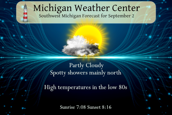
Detailed Forecast For Grand Rapids
TodayMostly sunny, with a high near 84. South southwest wind 5 to 15 mph.
TonightPartly cloudy, with a low around 67. Southwest wind 7 to 9 mph.
SundayMostly sunny, with a high near 88. Southwest wind 10 to 15 mph.
Sunday NightPartly cloudy, with a low around 69. Southwest wind 8 to 13 mph.
Labor DaySunny, with a high near 89. West southwest wind 10 to 15 mph, with gusts as high as 23 mph.
Monday NightMostly clear, with a low around 72.
TuesdayMostly sunny, with a high near 89.
Tuesday NightPartly cloudy, with a low around 71.
Detailed Forecast For Lansing
TodayMostly sunny, with a high near 85. Southwest wind 6 to 15 mph.
TonightPartly cloudy, with a low around 66. Southwest wind 6 to 10 mph.
SundayMostly sunny, with a high near 89. West southwest wind 11 to 14 mph.
Sunday NightPartly cloudy, with a low around 69. Southwest wind around 10 mph.
Labor DaySunny and hot, with a high near 91. West southwest wind 10 to 13 mph.
Monday NightMostly clear, with a low around 71.
TuesdayMostly sunny and hot, with a high near 90.
Tuesday NightPartly cloudy, with a low around 70.
Ada – Has been threatening to rain here all day. It finally did…47 drops.
What do you know! It did not even hit 80 degrees today and it ended up as yet another below normal temp day! Crazy stretch of below normal temps and I hope this carries forward right into winter!!!!!!
Officially it reached 81 today and the day was +1 above average.
https://forecast.weather.gov/product.php?site=GRR&issuedby=GRR&product=CLI&format=CI&version=1&glossary=0
What a summer! Plenty of rain, sun and below normal temps! Perfect!
RIP Jimmy Buffett & Jack Sonni (of Dire Straits)
Thanks for the fun beach songs Mr. Buffett. Dire Straits always had interesting videos in the 80s.
I loved all of Jimmy Buffett’s songs. He was fun to listen to. RIP.