Couldn’t get much info from the NWS sites for Michigan this morning, they are having server issues. Thankfully there are other sites in the realm of weatherdom from which I garner info.
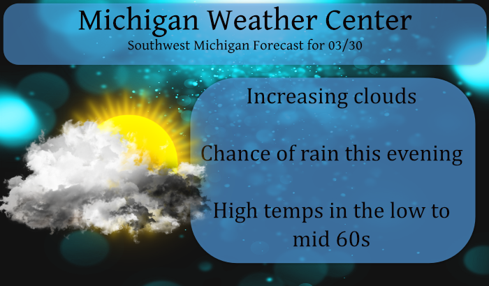
We currently have 49° in Otego with clear skies at 6 am. Temps will warm into the 60s today with increasing clouds and chances of rain increasing this evening.
As has been the case this month rainfall amounts are expected to be meager, less than a quarter-inch in most locations. Long-range models continue to show dry conditions persisting well into April. As I said the other day, the Great Plains, Great Lakes, Upstate New York on into New England have abnormally dry to drought conditions. Nearly half of the U.S. has persistent drought conditions.
Forecast Discussion
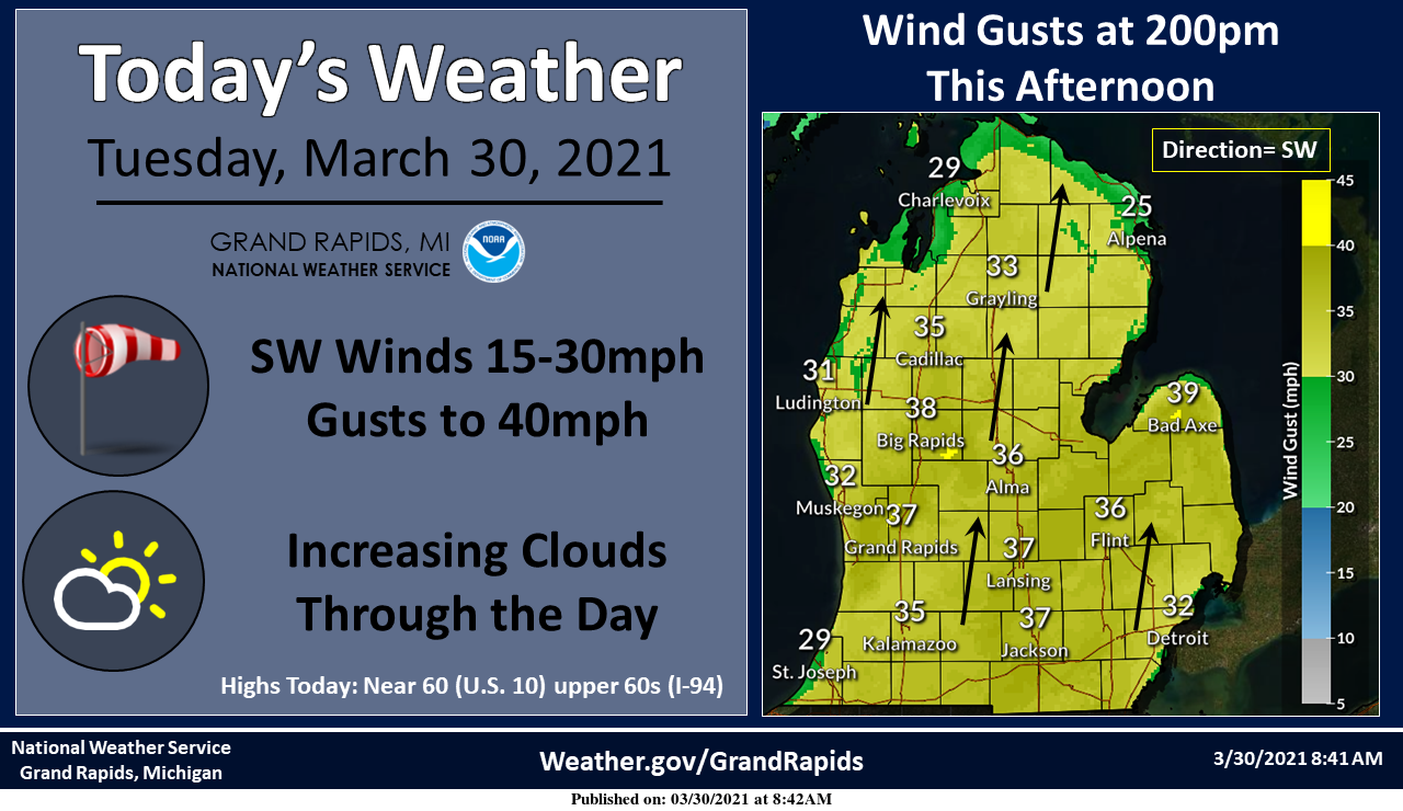
-- Windy Today --

Another windy day is expected today with strong southwest winds
ahead of a cold front. The tight gradient in place is a result of
deep low (sub 980mb`s) moving east across Canada and 1030mb high
off the east coast. We solidly tap into 30-35 knots today in the
mixed layer, with the potential to reach 40 knots. 39 knots (45
mph) is the threshold for a Wind Advisory. At this point we are
holding off, but certainly expecting some gusts up toward 40 mph
or slightly above. With no leaves yet on the trees, not expecting
much in the way of impacts.

-- Post Frontal Rain Tonight --

A rain will fill in across the area this evening, with
precipitation mainly confined to the 800pm this evening through
800am Wednesday time frame. The rain may mix with a few wet
snowflakes before ending. No snow accumulation expected.
Precipitation totals will be light, ranging from trace amounts on
the northern fringe to possibly around a quarter of an inch.

-- Touch of Lake Effect Snow Wednesday Night --

The lake effect potential looks pretty feeble mainly due to a lack
of deeper moisture. Some flurries and light snow showers are
possible near the Lake Michigan shoreline from around 800pm
Wednesday evening through about 1000am Thursday morning. Delta T`s
will reach the upper teens C, so solid instability will be in
place. The moisture will be rather shallow, mainly confined below
5,000ft. The moisture depth should really keep any snow shower
activity in check. The flow is pretty much due north, so the
Points and down towards South Haven will see the most activity.

-- Otherwise...Quiet Weather the Remainder of the Period --

Flat ridging the bulk of the remainder of the forecast period into
early next week should provide dry weather. Moderating
temperatures into the weekend will give more of a spring time feel
after a cooler period Wednesday into Friday.
It sure was nice today. The sun warmed things up fast but with the wind it didn’t feel hot. We put out our geraniums to get them started for the season. We bring them in when the sun sets before it cools down. I have 4 big pots and this will be the 3rd year we have done this. Last summer they were beautiful.
The snow maps to our West still look great!
https://www.pivotalweather.com/model.php?m=gfs&p=sn10_acc&rh=2021033018&fh=384&r=conus&dpdt=&mc=
The weather in Texas looks AWESOME!!
https://weather.com/weather/tenday/l/7472a7bbd3a7454aadf596f0ba7dc8b08987b1f7581fae69d8817dffffc487c2
Im thinking 70* degrees today if it wasn’t so darn windy outside but the sun’s out …INDY
Get ready for the next cold wave! The next three days will be below normal temps. Lows around 20 degrees! Incredible cold!
Better get it all out of your system over these next couple days!! After Friday, we’ll probably see you back in November??
https://weather.com/weather/tenday/l/b4ea0280869baa46799dc75eacef8904785ec43ad2f6fb098355fbc208a55e2c
Very mild again and yes very windy. Someone about a mile from our house thought it would be a good day for a fire. Now there’s several fire departments trying to contain a wild brush fire blowing around. 🤦♂️
Sounds like there are quite a few of those. Listening to a scanner right now…
Not good. It is very dry. Today we had to make a trip to GR and it was very windy driving.
It is now sunny and windy here with a temperature of 65.
Slim
This has been an incredible March! So much warmth and sunshine. The golf courses have been open for weeks already, and the grass is already looking green.
This March also has been very windy and of course not much in the way of snow fall.
Slim
With just two more days to go here is where March 2021 stands. With a mean of 40.9 at Grand Rapids as of this morning GR is in 11th place in the warmest March race. 2016 is in 12th place with 40.6 and in 10th place is 2021 at 41.0 then 1894 in 9th with 41.1 and 2000 is in 8th with 41.2. In the snow fall department with just a trace of snow fall Grand Rapids is now in 2nd place and that looks like where GR will end the month unless but we shall see. The overnight low… Read more »
As I mentioned in the post the NWS is experiencing issues on the national level since last night:
The National Weather Service webpages, especially at the local level (each NWS office), continue to experience technical difficulties. Technicians at the national level are working to resolve this issue.
and from their facebook page:
The NWS is experiencing a national outage impacting the distribution of products and access to our websites this morning. Our webpage, weather.gov/grr may appear, but many of the links do not work. We apologize for any inconvenience. Stay tuned to our Twitter and Facebook pages for updates on the forecast.
The NWS is back up and running