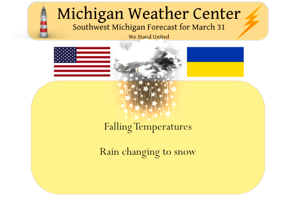
We have a temp of 55° at 5 am with some light rain falling. We have received .96 of an inch from our current system passing through. Yesterday’s high was 58° and the low 38°. The deep storm system passing by will track through the region today. Colder air will filter in from the northwest resulting in rain, mixing with and possibly changing to snow at times. The wind will be gusty today leading to scattered power outages. The cold weather will persist into Friday which will be a dry day.
Wind Advisory
Isabella-Montcalm-Gratiot-Ionia-Clinton-Barry-Eaton-Ingham- Kalamazoo-Calhoun & Jackson Counties
...WIND ADVISORY REMAINS IN EFFECT UNTIL 2 PM EDT THIS
AFTERNOON...

* WHAT...Southwest winds 20 to 30 mph with gusts up to 45 mph.

* WHERE...Portions of central, south central and southwest
  Michigan.

* WHEN...Until 2 PM EDT this afternoon.

* IMPACTS...Gusty winds could blow around unsecured objects.
  Tree limbs could be blown down and a few power outages may
  result.

* ADDITIONAL DETAILS...Strong winds will continue to impact the
  area this morning before gradually subsiding around mid-day.
  Wind gusts of 45 to 50 mph will be possible beginning first near
  I-94 and sweeping northward with time.
Winter Weather Advisory
Emmet-Cheboygan-Antrim-Otsego-Grand Traverse-Kalkaska-Manistee-Wexford-Mackinac Island/Bois Blanc Island-Beaver Island and
surrounding islands-Charlevoix-
...WINTER WEATHER ADVISORY IN EFFECT FROM 8 AM THIS MORNING TO
4 PM EDT THIS AFTERNOON...

* WHAT...Rain changing to snow. Blowing snow. Total snow
  accumulations of 1 to 3 inches. Winds gusting as high as 35 mph.

* WHERE...Portions of Eastern Upper and Northern Lower Michigan.

* WHEN...From 8 AM this morning to 4 PM EDT this afternoon.
Hazardous Weather Outlook
Wind gusts of 40 to 50 mph will be possible across portions of the
area this morning before tapering off this afternoon. Scattered
power outages will be possible.

Locally heavy rain is expected across the area this morning. Some
local ponding of water in low spots and fields is possible especially
for areas north and west of Grand Rapids.

Snow showers tonight into Friday morning may create some patchy
slick spots, particularly on bridges and overpasses.
Forecast Discussion
- Rain Through This Morning With Some Fog -

The bulk of the rain showers associated with a warm front have
passed north but additional showers are still expected through the
rest of the morning as the low pressure center tracks through Lower
Michigan. While reports of up to 1-2 inches have already been
observed as of midnight, an additional quarter to half inch of rain
is possible through 2pm today.

In regards to flooding, noticeable rises in rivers are occuring
on the Grand and Muskegon Basins but widespread flooding is not
expected. Low lying areas and areas with poor drainage will likely
experience ponding of water.

Patchy fog is also occuring near areas along the lakeshore thanks to
a surge moisture in the warm sector. This fog is expected to
dissipate later this morning as the low center tracks north and the
cold front passes through the area with winds shifting westerly and
drier air filtering in behind it.

- Gusty Winds East of US-131 -

Winds will peak this morning for the I-69 corridor north towards
Mount Pleasant and Clare as the deepening low pressure center
approaches. Latest model guidance suggest wind gusts up to 40 to
50 mph will be possible until noon today. Scattered power outages
will be possible. Meanwhile lesser wind gusts to 30-35 mph are
expected elsewhere through this morning.

- Rain Mixing With Snow Later Today and into Early Friday -

While the bulk of the moderate to heavier rain will exit east this
morning, some lingering wrap around precip will persist tonight into
early Friday. As temperatures continuously fall throughout the day
today following the passage of a cold front, this precip is expected
to mix with some snow starting this afternoon. Snow accumulations
are expected to stay limited to 1-2 inches. In regards to snowfall
impacts, initially warm ground temperatures should help to mitigate
surface accumulations. Temperatures will drop to below freezing by
this evening however, so we will want to monitor for any refreezing
of wet roads overnight into Friday morning.

High pressure will slide back into the region by Friday afternoon
allowing for the return of some much needed sunshine!

- A Few Systems Through Mid-Week -

Clouds increase again Saturday with the approach of our next weaker
system that will feature rain and snow chances. Additional waves
Sunday night into Monday and again near mid-week will present
chances for precipitation. Temperatures will start off cooler this
weekend but will trend warmer and closer to seasonal levels into the
start of next week.
Snow is heading right at us! Today ended up as average temp day! Rock n roll will never die!
There is light snow falling here at this time with a current temperature of 38. It has only snowed 8 times in the last 32 years on Mache 31. but snow has now been reported 4 years in a row on March 31.
Slim
Wow, some incredible cold and snow facts! They just keep coming even in late March! What a winter!
Is it only me or does it seem like it has been awfully cloudy the past couple months? More so than usual at least?
Don’t tell mookie he keeps saying a nice warm sunny Spring so far! We have had a few days of sun but definitely a lot of cloudy, cool, windy and wet days! Many days this month the wind chills have been in 30’s!!
Let it snow, let it snow, let it snow!
Another nice warm Springs golf day, right mookie! Temps stuck in the 30’s for the 48 hours, enjoy all of nice warm Spring weather! What a joke!
It’s actually another well above average temperature day.
No one promised you could golf everyday in March, but there has certainly been a number of good ones! 6 glorious months of warm temps ahead!
While in the record books the high will go down as 56 that mild temperature was wasted as it happened in the middle of the night and few people got to enjoy it. Since sun up it has been raining and times of snow and temperatures in the 30’s.
Slim
What an absolute joke of a comment! Ridiculous!
More snow and cold in the immediate forecast yet mookie is still talking about how nice and warm it has been and it will be! No, real nice warm Spring weather is not on the horizon! Too funny! What a winter it has been!
The only joke turned out to be you promising us countless times that we would see a cold and snowy March and that we would get pummeled with snow.
March was just the opposite.
Lol
Yesterday was a very wet day. The official rain fall amount at Grand Rapids was 1.13″ and around 0.33″ more fell after midnight. Yesterdays high of 58 was recorded just before 8:30 PM and todays high of 56 was recorded overnight. March 2022 will end up wetter, a little warmer and have less snow fall than the current 30 year average. At the current time it is windy and 38 in MBY.
Slim
GR hit 58 degrees yesterday. Looks like the high today will be 56 degrees which was hit overnight.
A mild end to a warmer than average March.
Temp has dropped almost 20 degrees since 5 am
What a strong cold front! Get ready for snow!
Waking up to a heavier burst of rain this morning. It’s a mild 54 but going in the opposite direction the rest of the day. Today is day 3 of being sick and having a fever, off to the doctor today. I hate going to the doctor but need to get better by this weekend when my sisters flys in from Tampa, FL for a visit.
I got up to let the dog out at 4am this morning and it was 63 degrees outside. Feels and smells like spring. It’s all downhill for the rest of the day.