The winter weather advisories will expire between 10 am to 12 pm as warmer air moves northward into the state. We have 37° here in Otsego at 4:30 am while Grand Rapids is near freezing. Today will be breezy with rain and a possible embedded thunderstorm. High temps will vary with the warmer air from Grand Rapids to the south in the low 60s to the 50s (or less) near Cadillac.
Yesterday’s high was 42° the low 17° in the Twin Cities area.
Weather History for Southwest Michigan
March 27
1991: A tornado outbreak hits the Midwest, wreaking havoc from Iowa to Ohio. In Michigan, at least seven tornadoes strike. Eighteen people were injured in Calhoun County as eight homes were destroyed there.
March 28
1904: Heavy rain and temperatures in the 50s during the last week of March combined with the melting of a deep snowpack to cause some of the worst floodings on record along the Grand and Kalamazoo Rivers. About half the city of Grand Rapids is underwater as the river reaches an all-time record crest of 19.6 feet, which was 2 feet higher than the previous record and 4.6 feet above flood stage. Water covered half of the city and floodwaters reached 2,500 houses and 14,000 people. Many people suffered from hunger and exposure. Several factories and between 200 and 300 businesses were flooded. Loses totaled $1,800,000. Lansing has the worst flood in 135 years of record. Battle Creek is also inundated by floodwaters.
1920: One of the worst tornado outbreaks in U.S. history strikes from Wisconsin to Georgia, killing more than 150 people. In Michigan, at least a dozen people were killed and hundreds of homes were either damaged or destroyed. The worst-hit areas in Michigan included Saint Johns in Clinton County, Maple Grove and Orangeville in Barry County, and Fenton in Genesee County.
March 29
1910: Temperatures peak in the upper 70s to lower 80s during one of the warmest months of March on record across Lower Michigan. The high of 82 degrees set a record for the warmest ever recorded in March at Grand Rapids.
1954: A snowstorm drops from 5 to 10 inches of snow across southern Lower Michigan. Kalamazoo records 8 inches of snow and Grand Rapids a record 7.5 inches.
March 30
1977: A tornado struck four miles north of Hart in Oceana County, injuring three people as it destroyed four trailers and damaged a business.
March 31
1923: March goes out like a cold lion with record lows in the single numbers and lake effect snow showers.
2006: A tornado hits a few miles east of Jackson, taking down hundreds of trees and causing minor structural damage in the town of Leoni.
April 1
1923: Winter persists into April as temperatures fall to a record cold 8 degrees at Lansing and 9 degrees at Muskegon.
1970: An April Fool’s Day snowstorm drops 10 inches of snow on Lansing. Another 7 inches of snow falls the next day.
April 2
1977: A tornado outbreak in southern Lower Michigan kills one person and injures about 50 others. One thunderstorm spawned two violent tornadoes in Kalamazoo and Eaton Counties. Several homes and businesses were destroyed on the southwest edge of Augusta by the first tornado. The second tornado destroyed 21 homes and 28 outbuildings as it moved from near Bellevue to Eaton Rapids. Other tornadoes hit near the north of Bath in Clinton County and southeast of Dansville in Ingham County.
Weather History for SE Michigan
March 27
On March 27, 1934, a record low temperature of 3 degrees was recorded at Detroit Metro Airport.
Also on March 27, 1991, one of the largest tornado outbreaks hit Michigan. Fifteen tornadoes moved across parts of the state, making it the third-largest tornado outbreak by the number of tornadoes, and certainly the earliest tornado outbreak in Michigan history. Three tornadoes hit portions of Southeast Michigan including two in Monroe County and one in St. Clair County.
March 28
On March 28, 1928, an early season tornado outbreak hit Southern Lower Michigan, Indiana and Ohio. 14 tornadoes were recorded in Michigan from Mason and Oceana Counties in West Central Lower Michigan to Genesee and Oakland Counties in Southeast Lower. Three of the Michigan tornadoes were estimated to be as strong as F4 including one that hit Genesee and Oakland Counties. That tornado started near Fenton and moved 10 miles northeast across far northwest Oakland County. Four deaths were recorded from this particular tornado including one person in an overturned car, probably just the second tornado-related death in a car at that point in U.S. history. Specifically for Southeast Lower Michigan, tornadoes hit Saginaw, Genesee, Oakland and Shiawassee Counties. In total across the state, there were 13 deaths and 59 injuries.
Also on March 28, 1945, the temperature soared to 82 degrees in Detroit.
March 29
On March 29, 1967, the daytime temperature rose to only 23 degrees in Detroit, which is 29 degrees cooler than the average high temperature for this day.
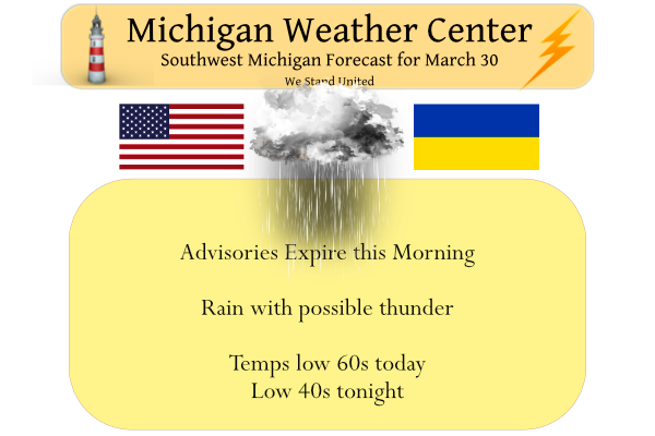
March 30
On March 30, 1922, 1.76 inches of precipitation fell in Detroit. This is the maximum daily precipitation record for the month of March in Detroit.
On March 30, 2012, 0.1″ of snow fell in Flint giving the city a grand total of 0.9″ for the month and making it the 4th lowest March snowfall total on record. No snow fell in Detroit that day, where the March total of 0.2″ was the 5th lowest on record.
March 31
On March 31, 2014, an extremely narrow band of accumulating snow developed just south and southeast of Saginaw Bay. The town of Caro measured 8 inches.
Also on March 31, 2014, Flint finished the month with an average temperature of 26.0 degrees, making it the 2nd coldest March on record for the area. This is in spite of a balmy high of 61 degrees on the last day of the month. Detroit and Saginaw also finished the month with their 11th and 5th coldest Marches respectively.
Also on March 31, 2006, severe weather broke out across much of Southeast Michigan. There were over 30 severe hail and severe wind/damage reports. Some of the one-inch diameter hail in southern Genesee County piled up to several inches.
April 1
On April 1, 1923, the overnight temperature dropped to a freezing 8 degrees in Saginaw, which is the daily record low as well as the monthly record low temperature. This day also marked the fifth day in a row (March 28-April 1) of record low temperatures in Saginaw!
April 2
On April 2, 1975, a snowstorm hit Southeast Michigan and continued into the 3rd. By the time it was over, Flint had its second-biggest snowstorm when 17.3 inches fell. Saginaw received 14.4 inches, making that storm the 9th biggest in Saginaw history. Even Detroit received 3.6 inches of snow from the storm.
On April 2, 1977, an F2 tornado hit Livingston County at 3:58 PM.
Also on April 2, 2010, record high temperatures were recorded across southeast Michigan including 80 in Detroit, 79 at Flint and 81 at Saginaw. This was just the start to a very warm April which was the 2nd warmest for Detroit, 5th warmest for Flint, and 3rd warmest in Saginaw.
Forecast Discussion
- Freezing Rain Risk Diminishes This Morning -

The forecast remains largely on track this morning with bands of
showers continuing to move northeast through the area. We`ve already
seen reports of sleet in Grand Rapids and Battle Creek, and icing of
elevated surfaces has been noted in Lansing. As of 3am, temperatures
along the I-96 corridor sit around 30F so the current placement of
the advisory appears effective. This icing risk will persist for the
next several hours ending near daybreak for much of the CWA and
closer to 10am for areas across central MI as temperatures quickly
warm. The highest icing is expected to fall across Central Lower MI
where up to a quarter of an inch is possible, including Lake,
Osceola, Clare, Newaygo, Mecosta, Isabella, Montcalm, and Gratiot
Counties. Meanwhile areas south of a line from Hart to Battle Creek
should see little to no icing.

Icy roads and sidewalks will be the primary concern for the
morning commute, particularly on bridges and overpasses. Some
scattered power outages also cannot be ruled out as winds continue
to gust up to 25 mph in conjunction with icing on elevated
surfaces. This risk should diminish fairly quickly as temperatures
warm to above freezing quickly this morning helping to melt any
ice accumulation. Highs this afternoon will easily break into the
50s, and even into the 60s across the I-94 corridor.

- Continuing Rain and Some Storms Today into Tonight -

The icing threat diminishes mid to late morning today, but rain
showers will persist through today and tonight as a warm front lifts
north. Heaviest rain showers are expected northwest of a line from
South Haven to Saginaw with up to 1-2 inches possible. While we do
expected to see some rises in rivers in response to the heavy
rain, flooding is still not expected.

In regards to storms, limited instability and poor mid-level lapse
rates will inhibit widespread storm development. Some rumbles of
thunder will be possible, but widespread storms are not expected.
If a stronger storm does manage to develop, winds will be the
primary concern with 50-60 knot winds available to mix down.

- Extended -

A cold front will sweep through the area overnight into Thursday
morning. Winds will shift westerly and temperatures will
continuously fall throughout the day Thursday. Lake effect snow
showers are expected Thursday into early Friday with little to no
accumulation expected.

While there are two chances for precipitation this weekend and again
early next week, conditions are expected to stay fairly quiet
through the weekend.
It has really rained a lot today. The flowers are popping up, the grass is getting greener and the birds are loving those earthworms. I have lots of them on the driveway. lol!!
Did GR make 60 or better today?? INdY
Moderate to heavy rain falling here with a temperature of 51. The rain should green up the grass a little more.
Slim
Yes I actually just noticed the grass is looking greener, also the birds are chirping
Rain has just started here with a temperature of 51.
Slim
50 degrees already. Temps have jumped 10 degrees in the past 2 hours.
Typical with a warm front now watch them drop like a rocky overnight with 1-3:inches or snow tomorrow DDDDDD….InDzy
Currently 42 degrees in my area still below average for the day and sprinkles we are waiting for the 60’s ….Indy
All I know is meteorological winter, the official way our government keeps track of winter, was -0.9F below average with snowfall -5.7” below average in Grand Rapids. Using the AWSI, this has been a slightly long winter, but neither snowier or colder than average in Grand Rapids. These are just the data. I do agree the AWSI is a good statistic because, for example, it highlights how bad 2014 was. If just looking at Dec-Feb then the record snowy November of 2013 would have not been accounted for, so I can see why the AWSI is useful. Also last winter… Read more »
Yep! According to AWSSI, we are in the 39th percentile. This means, on average, 61% of the winters in GR were more severe than what we just experienced.
The AWSSI is a good tool but as with many tools it can be some what miss leading to some extent. According to the AWSSI the winter of 2000/01 was a severe winter here at Grand Rapids and in a way it was a very front loaded winter season with a lot of snow in November and December but very little snow in January thru March.
Slim
It’s as good of a measurement as I’ve found.
I am going to continue to use it. Thanks for bringing it to my attention.
Slim
Note that the time period that AWSSI is from the winter of 1950/51 not the all time. So that percentage is the winters from 1950/50 on.
Slim
But having 30’s for highs in April is nothing new around here happens every year for Spring break but this time I will be in the 80’s in Cape Coral Florida real warmth no fairy tale wanting about it…InDzy
The GFS shows snow showers tomorrow for west Michigan great day to head south for Spring break find some real warmth…Im Excited…InDy
It seems like spring breaks are chilly in West MI. I seem to remember it being kind of chilly more often than not when going on break from school. Enjoy your trip to FL I was down there in January.
Yes it happens every year this is exactly why we are heading south im ready for some real warmth just so its not hot as you can tell I dont like the heat lol..
INdzy
Currently its 33 degrees in my area thats well below average….Indy
False. We actually had mild overnight temps last night for this time of year and will see above average high temps later today.
I have 33 outside currently thats below average sorry …whoes talking about later today ?? Indyy
Wrong again, nothing new. Average low for today is 31. 33 is higher than 31, hence above average. All the facts are here:
https://forecast.weather.gov/product.php?site=grr&product=cli&issuedby=grr
I see the CPC shifted big time yesterday!
We are now in average temps for the 6-10 day and the 8-14 day and above average temps for the 3-4 weeks and 1 month.
The CPC’s long range guess for April will be updated tomorrow.
Slim
Thanks Slim 😊….I will look tomorrow…Indy
I don’t put a lot of stock into their long-range guess. I much prefer the short-term CPC.
Only when its a blow torch right?? Indy
You been saying that since January its not getting any warmer outside lol…Just so you know ?? InDzy
We recently had 12 mild days in a row and today should hit 60 degrees once again. You’re welcome!
I forgot 40’s are mild and those 30’s overnight are really mild lol….Indy
GR should have 11 days in March that were in the 50’s and 60’s.
Yeah we also had highs in the 20’s and ??? Indy
It has deftly been a cold and snowy winter!
Mookie you Are hopeless! Again, we will not being in real nice Spring warm until late April or early to mid May! Happens every year! Incredible?
GR is above average for temps for March with two mild days upcoming to close out the month.
GR is -1.4″ below average for snow on the month and even more below average snow for the season.
Waking up this morning to a light glaze of ice on the deck. Also got some icicles hanging from the patio table and grill. We have climbed to 35 at my house now so it is slowly melting off.
It’s pretty icy at my house, worse than the last “ice storm” a few weeks ago. CMU delayed opening so I assume they got some too.
Yesterday was another double digit below normal temp day! Incredible cold snap! What a winter!
Our biggest snowfall was a measly 2” for all of March. What a short and weak winter!
We had over 80 inches of snow in my area thats plenty for a Winter season now lets be real hear and figure out when thses below normal temperatures are gone we are pushing April now and not seeing any warmth in sight whats up with that?? Indy
This winter produced one of the best snowstorms in years at my house. Double Digit amounts. I was very happy with this winter.
Unfortunately for the cold weather crazies, your area over there was the exception this winter and not the norm.
Nice …I probably went ice fishing more this Wimter in years that I can remember the ice on the lakes was fantastic and the fish in the freezer is full!! INDY
According to the Accumulated Winter Season Index the winter season at Grand Rapids is now at 136 days. With a index point total of 725 that puts GR at the borderline of average/moderate. At Grand Rapids there has been 70.6″ of snow fall. Now to the east at Flint they have a current Accumulated Winter Season Index of 718 and 135 days of the winter season and they are at the borderline of severe/average. Their total snow fall is now at 58.6″ So bottom line is that except for the lake shore areas this have been a near average winter… Read more »
GR remains in the below average winter category:
https://mrcc.purdue.edu/AWSSI/chart.html?stn=GRRthr
An “average” winter would be half way in the “average” yellow category on this chart. GR is far below that.
Grand Rapids is right at the borderline between moderate/average with a point total of 725.
Slim
Yes it was a colder and snowy Winter I agree Slim..InDy
The winter was near average with a little less snow then the 30 year average with a mild December. December was +4.1 with -10.7″ of snow fall. January was -4.6 below average with +3.2″ of snow fall. February was -2.0 below average with +1.8″ above average snow fall. March should end up above average with below average snow fall.
Slim
GR is in the orange category. Further, even if it was in the yellow (which it is not), it would still be below average because true average would be the half way point in the yellow category. GR is a far ways from that this winter.
Grand Rapids is right on the borderline between moderate and average.
Slim
Try blowing up your computer screen. Another way of looking at it is that GR’s current score is 725. The 40th percentile starts below 730. That means GR’s winter severity was in the lowest 40% of winters recorded (or 60% of GR’s winters have been more severe).
This is yet another stat that confirms GR’s winter was below average.
yes this past winter was not severe by Grand Rapids standards. And I did not say it was but it was a typical near average winter based on the current 30 year average. You don’t have to be from Oxford to see that.
Slim
We can agree to disagree. If more than 60% of winters were more severe than this past one, I would certainly call that below average and not “typical near average winter.”
To me, “typical near average winter” would be something like 51st or 52nd percentile. Not 39th.
I agree this past winter was not severe (the mild December with little snow was the big difference) but I also disagree the using the updated 30 year average it was mostly typical. Near average temperature and below average total snow fall amounts. The number of days at Grand Rapids with a reported 1″ of snow on the ground was 72 and guess what? The average mean number of days with 1″ of snow on the ground at Grand Rapids is 72.
Typical.
Woohoo! Another WWA for nothing. Seems to be the norm this year.
No freezing rain, no sleet, no snow. And 60 degrees today with storms!
Remember thats what wanted no freezing rain so why you complaining?? Maybe you should complain about the 8 to 14 day out look seeng lots of blue over Michigan….We all know what that means! Indy ..
I recorded 0.16″ of rain fall overnight. The low here was 33. At the current time it is cloudy and 35. So here NW of Grand Rapids there did not appear to be any freezing rain. The official high yesterday at Grand Rapids was 41 and 33 was the official low as well. The official high/low now is 50.6/31.2 and it rises to 53.3/33.3 by next Wednesday.
Slim
I think we dodged a bullet here. We got very little precip overnight and it appears that the temp remained above freezing.