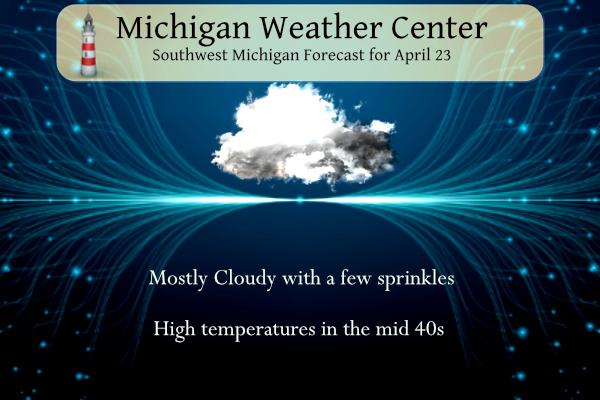
Temperatures are in the mid-30s this morning with radar indications of a few light rain and snow showers across our forecast area. Temperatures will continue to be below normal today with highs in the mid-40s with a few rain showers around the state.

Our long-range outlook from the CPC indicates below-normal temperatures through the first week of May. Looking further down the road this may be the case through mid-May. Looking at the May temperature forecast this should even out to equal chances of below or above-normal temperatures for the month. May’s precipitation forecast guess is for below-normal rainfall.

U.S.A and Global Events for April 23rd:
1948: A three-block-long section was devastated at the edge of Ionia, Iowa in Chickasaw County by an estimated F4 tornado. Six homes and a church were leveled, and nine other homes were severely damaged. Two deaths occurred in the collapse of the Huffman Implement Store. Overall, the tornado killed five people, injured 25, and caused $250,000 in damages. An F2 tornado touched down initially 5 miles northeast of Rochester. Barns, silos, windmills, and machinery were destroyed on four farms as this tornado tracked north.
1961: Severe weather struck the south suburbs of Chicago, IL. Joliet, IL reported an inch of hail with some hailstones the size of golf balls. Heavy rain from these storms also resulted in some flooding. A tornado struck the town of Peotone resulting in damage to nearly every building with damage also reported in Lorenzo and Wilton Center, IL. The estimated damage was $9 million with about 30,000 structures affected.
1989: Salina Kansas was the hot spot in the nation with a high of 105 degrees. The high of 105 degrees established an April record for the state of Kansas.
1999: On Friday, April 23, 1999, a horrific hailstorm moved southeast from Pennsylvania across Garrett County, Maryland and into the Eastern Panhandle of West Virginia. It had weakened some as it crossed Garrett County and the Allegany Front, but as it passed east of Keyser, West Virginia, hail began to increase in size once again. By the time it reached Capon Bridge in eastern Hampshire County, West Virginia, the size of the hail had grown from golf balls to baseballs. As it moved into Frederick County, VA, the hail storm continued to grow dropping golf ball size hail in a swath now reaching from the north of Winchester, south to Stephen City (about 10 miles). Hailstones grew to the size of Grapefruit (4 inches in diameter) east of Winchester. The storm continued east through Clarke County, southern Loudoun, and northern Fauquier doing considerable damage to Middleburg, then across Fairfax County hitting Centreville, Chantilly, Fairfax, Burke, Springfield, and Lorton with golf ball size to baseball size hail. It crossed the Potomac River and weakened slightly. It moved across northern Charles, clipped southern Prince Georges and then into Calvert County with 1-inch to 1.5-inch diameter hail and onto the Chesapeake Bay continuing southeast to the ocean. The damage left behind was incredible. In Northern Virginia alone, it amounted to over $50 million in losses to public and private properties. Some communities saw a third of the homes with siding and roof damage. Some required total replacement. Windows were broken, cars dented, and windshields smashed. Piles of shredded plant debris were left on the ground in the storm path. In about 6 hours of time, this one thunderstorm, moving at about 50 mph, did $75 million in damage. There have been other severe hail storms to hit this area before, but none to cause this much damage to property.
Grand Rapids Forecast
4 23 grrKalamazoo Forecast
423 kzoLansing Forecast
4 23 kzoForecast Discussion
-- Sprinkles/showers today and Mon --

A broad mid/upper low will remain situated over the Great Lakes
and southern Ontario today and Monday. Within this regime, the
combination of cold midlevel temperatures, lingering low-level
moisture, cyclonically curved low-level flow, and daytime
boundary-layer heating should support the development of scattered
sprinkles/showers today. RAP forecast profiles indicate
convective temps in the low 40s F, suggesting that diurnal cumulus
will readily develop by late morning, especially inland. Wet-bulb
0C heights will range from 500-1500 ft AGL across the
northwestern forecast area, where melting snowflakes or graupel
have the best chance of occasionally reaching the surface.

A similar environment will be in place on Mon, although low-level
cyclonic curvature will be less pronounced as a surface ridge
encroaches on the region, limiting boundary-layer convergence
somewhat. Even so, CAM guidance again indicates widely scattered
sprinkles/showers across the inland areas on Mon. Stable, lake-
modified boundary-layer air will favor relatively clear skies
(more sunshine) near the lakeshore.

-- Chance of showers Tue --

The mid/upper low will shift only gradually eastward through Tue.
Models suggest that a pronounced shortwave impulse within the
periphery of the upper low may approach Lower MI during the
afternoon/evening, although various solutions differ in the
placement of this feature. Forcing for ascent in advance of this
impulse, perhaps coinciding favorably with daytime boundary-layer
heating, should support showers over parts of the forecast area,
given indications of continued ample low-level moisture. Ensemble
guidance suggests highest PoPs (chance) near/south of I-96.

-- Nightly low temps near/below freezing through Wed night --

Several additional nights of near- or below-freezing temps are ahead
for at least portions of the forecast area. Diurnal cumulus should
largely dissipate each evening as the boundary layer decouples,
allowing for the possibility of at least partial overnight clearing.
Depending on the extent/duration of this clearing, and given the
expectation of light near-surface winds, frost and/or hard freeze
conditions are possible each night in parts of the forecast area.
With the growing season underway in many areas, growers/gardeners
may wish to protect prone trees and plants from the cold.

-- Thu night and beyond --

EPS and GEFS means indicate that an upper ridge will amplify over
the Pacific Northwest and British Columbia on Wed and Thu, followed
by the downstream amplification of a trough/low over the Northern
Plains on Thu night and Fri. Farther south, a separate trough will
likely emerge into the Southern Plains on Wed. Ensemble guidance
suggests that these troughs will spur separate instances of
cyclogenesis, with subsequent trough phasing/interaction possible to
some degree late in the week. While details are uncertain, ensemble
guidance supports chances of rain from Thu night into the next
weekend.
…FREEZE WARNING IN EFFECT FROM MIDNIGHT TONIGHT TO 8 AM EDT
MONDAY…
* WHAT…Sub-freezing temperatures as low as 28 expected.
* WHERE…Portions of central, south central, southwest and west
central Michigan.
* WHEN…From midnight tonight to 8 AM EDT Monday.
* IMPACTS…Freeze conditions will kill crops, other sensitive
vegetation without added protection.
Covered what I could… Lilac, bleeding heart and rhubarb
Breaking>>>>>the latest CPC still shows cold well into May!! Wow!
Anyone know if tonight might be a good night (cold) to see the northern lights???
It will not be a great night to see them.
Thanks
I did read before this article…https://newsnationnow.com/us-news/northern-lights-could-be-visible-in-us-sunday-monday-heres-where/
Canada looks good.
Frezzer warnings out lows in the mid 20’s overnight record lows possible turn the heat up …INDY
What? A freezer warning in late April? Who would have thought?
So my bleeding heart plant is starting to sprout. Would you cover it tonight?? I love seeing the hearts on that plant.
I’m no green thumb but I probably would just to be safe.
Now I see a freeze warning…will be covering. …again.
The roots will survive, but the flowing part could freeze and die if not covered!
It won’t even come close to 50 degrees today and then freezing temps the next four straight nights! Incredible April cold spell!
What an extremely cold late April day! Indy said to grab a jacket and I say grab your winter coat hat and gloves! Wind chills upper 20’s to low 30’s! The cool Spring is still rocking! Incredible!
Feels like a November day out there today. Quite chilly for late April
Looks beautiful outside but its cold grab a jacket going out the door today have a beautiful late Fall of a day …. INDY
The overnight low for today so far is 34. The average H/L for today is 61/40 the record high is 84 set in 1915 and 1925 the record low of 20 was set in 1986. The record snow fall of 0.7” fell in 2005. Last year it was a very warm 82/46.
Slim
As has been the case several times in the last year the high yesterday of 51 was recorded just after midnight. During the daylight temperatures were in the mid to low 40’s with wind chills in the 30’s The official low was 35. There was 0.04” of precipitation and a trace of snow fall. And just 2% of sunshine.
Slim
Just another lousy, cold, Spring day! Forget golf! Wind chills in the 20’s and 30’s all day! Get ready for freezing temps at night all week long! We are entrenched in a cool pattern and NO CHANGE IS IN SIGHT!!!!! Wow just wow, WOW!
Good morning! You’ll want a jacket if you venture out. It is a bit chilly. My son and spent a good part of the day yesterday wrenching on my father in law’s car. We shared some laughs and had a good time. It was a good day for the three generations. The local TV met showed (after tomorrow) mostly 50s and a couple 60s the next two weeks.
Have a great Sunday my friends and make someone smile 😃
What, mainly 50’s? Who would have thought?
I work at the Whitecaps and after the game yesterday there was a snow/ice pellet/rain shower. It was very cold during the game and a lot of customers were wondering when it was going to warm up. I told them summer was last week.
slim
What? snow? Incredible!