As you all have known we have been in a lull for severe weather for the past few years. According to the Iowa Environmental Mesonet, there have been 2159 days since the last tornado watch was issued by the NWS for SW Michigan and 2741 for northern and eastern Michigan. In the counties bordering Indiana, it has been 362 days. We have had brief tornadoes in the state but they have been the spinup variety which are hard to predict and are gone before a warning can be issued. The only other states with more days between watches are northern Maine (3640) and the desert SW. The same goes for snowstorms especially the past couple of years when we have had very little lake effect and fairly tame synoptic events. Ellen Bacca has a nice write-up on the lack of storms on WOODTVs site.

Due to well below normal rainfall, most of Lower Michigan is now in a moderate to severe drought. The two things to keep in mind until conditions improve are that your lawns and gardens will need more frequent watering, and that brush and wildfires can start and spread more easily.

The Michigan Department of Environment, Great Lakes, and Energy has declared Friday, May 21st…to be an Action Day for elevated levels of ozone. Pollutants are expected to be in the unhealthy for sensitive groups range.
The CPC update for June is guessing chances of above-normal temps and near to slightly above normal rainfall, we will see how this will play out.
Forecast Discussion
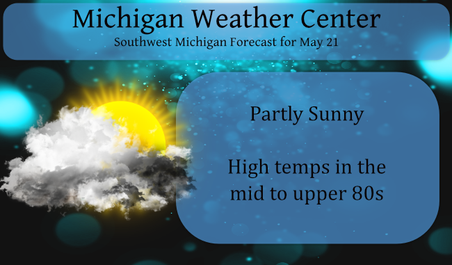
-- Another very warm and dry day today before a chance of rain
tonight and early Saturday --

We are looking at another very warm day today and dry conditions for
the daylight hours. The upper ridge axis has shifted east of the
area, but the moisture axis remains north and west. Even though the
surface has some decent dew points in place, there is a fair amount
of dry air aloft, and limited forcing through today.

Rain chances will arrive tonight, especially the further north you
go. A weakening short wave approaching the area will get a little
boost as the ridge re-establishes itself further west, and troughing
take place overhead.

The set up for rain is not ideal, but it is a chance in this pattern
of much below average precipitation for the area. A supporting low
level jet associated ahead of the short wave will move across
Central Lower, helping to fuel the rain chances. Instability indices
indicate that thunder chances are not zero, but they are fairly low.
The rain chances will linger into Saturday, before the trough moves
through by 18z Saturday.

-- Occasional chances of rain Sunday through Wednesday --

The recent dry spell will not be as pronounced as it has been over
the recent weeks. We will have multiple rain chances from Sunday
through Wednesday. However, we are not anticipating this being a
significant amount of rain that would put a big dent in the drought
conditions.

The next chance of rain will come on Sunday as a backdoor front
drops south through the area. A bit of mid level jet energy will
drop through to our NE across Canada. We will have some weak short
wave activity and moisture, but the forcing/lift will be quite
limited. There is a little bit of sufficient instability for a
rumble of thunder, but not enough for widespread or strong storms.

The front will drop down to almost the southern MI/IN border,
keeping a chance of rain in for Sunday night and Monday down there.
A better chance of rain, and maybe the best chance in the period,
will come Monday night into early Tuesday. This best chance comes as
the best low level jet moves through the heart of the area.

The front sinks south in the wake of this low level jet and wave,
but remains close enough for some lingering rain on Wednesday. The
front should sink far enough south by Thursday, to pretty much end
the rain chances.

-- Cooling down next week --

Once the front moves south of the area on Thursday, we will see a
decent flow from the NNE that will funnel in cooler air from Canada.
The upper ridge will have broken down over the area to allow this to
happen. The flow will be dry, so rain chances should end for that
time frame.
It sure felt warm out today. The breeze we had felt good.
Check out all of this snow out West! Maybe a Northern Rockies ski trip in June! Incredible!
https://www.pivotalweather.com/model.php?m=gfs&p=sn10_acc&rh=2021052118&fh=384&r=conus&dpdt=&mc=
Hey I just saw Rocky!
lol!!!
More red showing up on the CPC maps. Dry ground equals warmer than average temps ? Time will tell..
With the current official temperature of 85 today will be in the top ten warmest for this date. The record is 91 set in 1977 it was 90 in 1987. This will be the warmest May 21st at least since 1992 but remember in 1992 we had one of the coldest summers of record.
Slim
Just got back from a nice walk. While it is warm in the sun there is a nice breeze so all in all it is not too bad out at this time. It has been very dry but the grass is still mostly green. I would think if it stays this dry that will not be the case in a couple of weeks.
Slim
85 degrees as of 2pm. Wow!
After 20 days May 2021 has a mean temperature at Grand Rapids of 55.2 that is a departure of -2.1. The official high so far has been 86 and the official low was 30. There have been a total of 13 days of below average means and 7 days of above average mean. (today will be the 8th day) So far there has only been 0.70″ of rain fall. The overnight low here at my house was 60 while it looks like the official overnight low at GRR was 62. At this time there is hazy and 71 here.
Slim
Oh my goodness. 72° here already.
Feels like a mid-July day today. Definitely different than a week ago.
And an Action Day already? What a cool Spring we are having?
I have to wonder how many people really pay any attention to the so call air quality days?
Slim
2159 days since the last tornado watch? Wow! I knew it had been a while but didn’t realize it’s been that long. And yes it’s been the same with The lack of Winter storms as it’s been over 10 years since our last blizzard. Very dull weather pattern we’ve been stuck in for years.
Wow, 86 degrees yesterday. Even hotter upcoming! Could May soon turn above average temps?
Warmer days in May have became more common. In the last 20 years there have 15 years where the warmest temperature in May has been 85 or better. And during that time the mean high for May has been 86.
Slim
We will be much above average then this May!