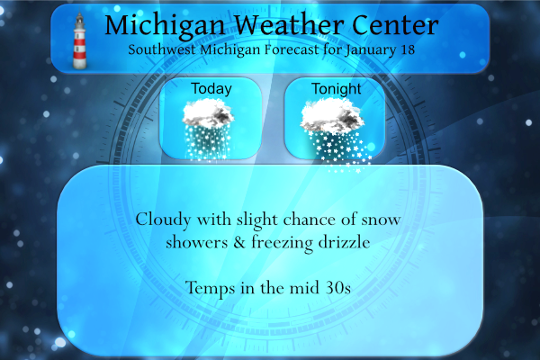
Yesterday we had a high temp of 30° and a low of 17°. We are much warmer this morning with a temp of 29° at 5:30 am. Expect mostly cloudy skies today and it will become breezy this afternoon with winds gusting to near 30 mph inland, while gusts to 40 mph are possible near the lakeshore. Light snow is expected north of Big Rapids, but accumulations will be less than an inch. Elsewhere expect flurries.
Today is expected to be the warmest day of the week. It may be the warmest day for the rest of the month. Some patchy freezing drizzle is possible in all areas into mid-morning. Then expect scattered snow showers into this evening as temps fall into the mid-20s.
We started out the month on a snowy note with accumulations of 10 inches in Otsego, however, we haven’t had any precip of note since the 7th. We still have about four inches of crunchy snow on the ground. We are not seeing any synoptic events on the horizon at this time and with drier air in place not much lake effect either.
Forecast Discussion
-- Changing and challenging weather with clipper system today --

Radar has showed very low reflectivity overnight, corresponding to
extremely light snow grains. Models show this low-level moisture
below an unsaturated DGZ persisting through mid-morning. Can`t rule
out very light snow grains or freezing drizzle as a result, though
the signal for enough lift to generate this precipitation is less
than yesterday.

Advection of warm air (relatively speaking) strengthens this
afternoon ahead of a clipper with a developed surface low. In a
matter of hours, the moisture profile will flip to create a
different forecast challenge: saturated DGZ in the mid-levels with
lift is likely to create snow over central to northern Michigan but
the question is how far south the lift extends and how well the snow
can survive its descent through several thousand feet of moderately
dry air. The HREF suite suggests a brief period of snow could make
it down to I-96, but accumulation (minor amounts) is likely to stay
near and north of M-20.

It will be blustery ahead of and just behind the cold/occluded front
late Tuesday night. Dew points could climb a little above 32 for a
few hours, softening and shrinking the snowpack a bit more as
condensation occurs. Some condensation could also occur on the cold
pavement, but not sure if it will be enough to cause problems.
Relative humidity at the surface behind the front may be low enough
to dry out the pavement by Wednesday morning anyway.

-- Cold reinforced with lake-effect snow --

Colder-than-normal air is quick to return Wednesday through at least
Friday (and the pattern supports additional shots of cold air going
into the final week of January). Lake-effect snow is likely to peak
Wednesday afternoon into the night as convective clouds climb into
the DGZ. A few inches appears possible in some locations west of US-
131. What is limiting the potential for more significant amounts are
a shallow convective depth Wednesday afternoon (low inversion
heights), followed by drier air and a tendency for more northerly
surface flow by Thursday as a strong surface high advances into the
Midwest.
What a winter ! The cold and snow just keeps coming! Rock on!
Lots of blathering again today. Here’s a fun fact…..we’ve just past the middle of Winter and we’ve had pretty much zero measurable snow in close to 2 weeks, and no big systems in sight! The snowblower has once again become a dust collecting ornament in the barn.
Reminds me of Summer time when it is rain free in zland for a month but rains everywhere els lol …. Blather onnnn…InDY
It’s called the “lake shadow”. Bills posted about this before.
https://www.woodtv.com/weather/bills-blog/lake-effect-showers-in-summer/
Channel 8 just said a more active patten on its way with below normal temperatures that could only mean on thing more SNOW …Who Knew?? InDY
Still over 2 months of winter left! Wow and keep it coming!
Only 41 days left of meteorological winter. And in Southern Lower Michigan, the weather usually starts to turn middle/late February. I love it!
Loved our frost and freeze warnings last May during Memorial weekend what a hoot ….IndY
Probably 3 well into April like the previous years ….InDY
Our below average snow totals continue to widen! And if you like the cold, enjoy the next week or two.
About a month away is when temps usually rise more often than not above freezing and it’s much more difficult to keep snow around. We’ve seen this play out the past few Februarys in a row. And then temps really start to rise!
Im thinking the past Februarys we have had above snowfall and more below temperatures not sure who you are trying to fool on here but please carry onn lol…One fact thats happening NO warm air in sight the ice fishing is amazing this Winter…InDY..
Last February was very cold and snowy here in GR. February 2020 was near average in temperature and just a little below average in snow fall. February 2019 was colder than average and above average snow fall.
Slim
I was not talking about all of February in my comment. Please see the post above to see how winter usually dies towards the middle/end of February.
Thanks for the fscts Slim ad always…InDY
LOL Please read my posts if you’re going to try to argue the facts. A month from now is the back end of February. Comparing the entire month is not what I said.
Feb 2021: the last 8 days were 33-48 degrees
Feb 2020: the majority of the last 14 days were 33-47 degrees
Feb 2019: mild stretch from Feb 14-Feb 24 mainly in the 30’s and 40’s
Feb 2018: the last 15 days were a blowtorch of mainly 40’s 50’s and 60’s
Feb 2017: the last 20 days were an even warmer blowtorch with 9 days between 50-66 degrees
You know the drill Indy, more warm weather fantasies and hype from mookie!
Im thinking its only mid January right lol…InDY
Low Temperatures negative??? Great Scotty look for our snow cover never to melt away woo woo ….InDY
There was (is) a coating of ice from yesterdays freezing mist. There remains 3.5″ of a snow/ice combination on the ground but there are some thin spots as well with some ground showing. There now has been 1″ of more of snow cover at Grand Rapids for 22 days in a row and a total of 29 for the season so far. The 30 year average is 67 days of snow cover the most on record is 124 in 1903/04 and the least on record is 23 in 1982/83. The last year there was 54. The overnight low here was… Read more »
Frost and frezze warnings down in Florida crazzy cold Winter we are having who would of thought.? NO WARM AIR IN SIGHT YES! INDY
Don’t tell the warm weather fanatics about the cold! They will come up with some propaganda about an easy/mild winter! Incredible!
They actually been pretty quiet since Christmas other then saying we are below average in snowfall over and over like the warm air theres not a lot out there incredible …InDY