We have one more hot day before rain and isolated storms move in tonight. Rain will continue off and on through the weekend with cooler high temperatures in the 60s for Thursday and Friday and in the 50s for Saturday and Sunday which is a reminder we are in October not July or August. Our high yesterday was 85° in Otsego.
SW Michigan Forecast
SW Michigan Weather History
October 1
1897: Temperatures reach record highs with both Lansing and Grand Rapids hitting 89 degrees. It is the highest temperature ever recorded in October at Grand Rapids.
1974: Cloudy and cold weather prevails with high temperatures in the 40s and snowflakes observed at Muskegon.
October 2
1880: A tornado cut a 15-mile-long path of destruction from southern Barry and Eaton Counties into northern Calhoun County. Two children were killed and several other people injured near Bellevue, when the tornado picked up a house and carried it 200 feet before it disintegrated. The roar of the tornado could be heard six miles away.
October 3
1898: Lansing hits 90 degrees for its highest October temperature.
1954: Heavy rains cause some minor flooding across southwest Lower Michigan. Grand Rapids and Muskegon both have their wettest October days on record with rainfall totals around 3.5 inches.
1974: Temperatures plummet into the 20s as very cold weather continues. Record lows include 22 degrees at Lansing, 23 at Grand Rapids, and 25 at Muskegon.
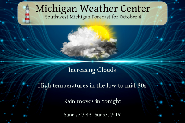
October 4
1935: Snowflakes are observed across Lower Michigan and Grand Rapids has a record cold high temperature of 42 degrees.
1951: Summer-like weather prevailed with lows in the mid-60s and highs in the 80s. Record highs include 87 degrees at Grand Rapids, 86 at Lansing, and 83 at Muskegon.
October 5
2005: Balmy weather prevails across Lower Michigan, especially along the coast of Lake Michigan, where the low temperature for the day at Muskegon is a record-warm 70 degrees, followed by a high of 80 degrees.
October 6
1998: A squall line moved across Lower Michigan producing tornadoes, downbursts, and some flooding. A tornado struck Ferris State University in Big Rapids, injuring seven students. Another tornado moved from northern Isabella County into southern Clare County, damaging several homes. Total damage from the storms was more than a million dollars.
October 7
1965: A tornado destroyed a trailer and several outbuildings southeast of Clare in Isabella County.
2007: Temperatures reach record highs as very warm weather prevails across Lower Michigan from the 5th to the 8th. Grand Rapids sets three record highs in a row with temperatures in the upper 80s from the 6th to the 8th.
SE Michigan Weather History
October 1
On October 1, 1974, the earliest snow was observed with a trace of snowfall in Detroit.
October 2
On October 2, 1963, thunderstorms in Wayne County brought winds of 63mph in the evening.
October 3
On October 3, 1954, 4.58 inches of rainfall fell in Saginaw. This is the greatest amount of precipitation recorded for the month of October in Saginaw and is almost twice the amount of rainfall that normally falls during the entire month.
Also on October 3, 1935, snowflakes were falling across Southeast Michigan. Detroit reported a trace for the second earliest observed snow on record.
October 4
On October 4, 1990, Genesee County experienced an F2 tornado at 5:00 p.m. that injured one person and cost $2.5 million in damages.
October 5
On October 5, 1900, record highs were set three days in a row of 88 degrees on the 4th, 5th, and 6th in Saginaw. It also ties with the highest temperature of the month.
October 6
On October 6, 1963, the temperature rose to 89 degrees in Flint. This ties in with October 1, 2002, and October 3, 1953, for the record maximum temperature for the month of October in Flint.
October 7
On October 7, 2017, a cold front tracked across Southeast Michigan between 9 PM – 12 AM. Thunderstorms ahead of the cold front produced severe winds that resulted in numerous downed trees and power lines, especially in Monroe County.
Also on October 7, 2009, a strong low-pressure system tracked north of the Great Lakes region, with the associated cold front swinging through lower Michigan. Winds gusted between 45 to 55 mph with isolated gusts to 58 mph over a six to eight-hour time frame during the morning hours. With leaves still on the trees, tree branches and trees were reported down in and around the Detroit Metro Area. About 110,000 customers were without power from this wind event.
Also on October 7, 2007, the third day out of a four-day early October heat wave brought record highs to Southeast Michigan. Saginaw reached 91, and Flint was 88, both of which were records. Detroit reached 89 falling shy of the record temperature for the date.
Also on this date in 1963, the temperature rose to 92 degrees in Detroit. This is the record maximum temperature for the month of October in Detroit.
Forecast Discussion
One more day of summer-like weather...then Fall.

Latest surface map shows a cold front stretching from NW MN
southwest to eastern SoDak. This cold front will move through the
cwa Thursday bringing rain and perhaps a few non severe
thunderstorms. Prior to that we`ll see clouds continue to increase
today; we`re already seeing that occur on the latest IR loop. The
increased cloud cover will keep our temperatures a bit
cooler...but still hot by October standards...than they were
yesterday. Lansing probably has the best chance to break their
record high of 86, since they will be the farthest east and last
to see the clouds thicken.

Showers and isolated thunderstorms will move over the lake by mid
to late afternoon and then start to move inland over the northwest
cwa late in the day. This will be slow march eastward due to the
upper flow more or less parallel to the front.

Most, if not all, locations should see rain. QPF around a half
inch is expected and both the ECMWF and GFS ensembles point to
that.

Colder air will flow into the cwa beginning this evening. After
highs in the 80s today, temperatures will top out around 70
Thursday.

Thursday night into Friday morning rain chances diminish as the
front moves through. This break in the rainfall will be short lived
though as 700mb moisture increases ahead of another front associated
with the upper level low. Positive vorticity and the increase
moisture along with some frontogenesis will provide enough support
for another round of showers Friday afternoon through Friday night.
A few rumbles of thunder will be possible closer to the lakeshore as
the environment will be less stable due to the warmer waters of Lake
Michigan. Northwest flow moves in on the backside of the trough as
it shifts east of the area Saturday. With the previously mentioned
warm waters of Lake Michigan with surface temperatures around 18 to
20 C and 850mb temperatures around 0 C lake effect rain showers are
expected into Sunday. Northwest winds will also be quite breezy with
gusts around 25 to 30 mph during the day. This will result in dreary
fall conditions especially with highs in the 50s this weekend and
into next week.

A positive note is that pressure heights increase toward the middle
of next week with a ridge that looks to move in. This break in
precipitation is highlighted in the ensemble guidance in both the
ECMWF and GEFS. Temperatures also look to warm into the 60s, so the
dreary conditions won`t last forever.
It is raining here. 🙂
Quite the impressive temp streak to begin October.
October 2nd was 86 at my house, 87 on the 3rd, and 82 today. Incredible!
Four consecutive days 15-20 degrees above average is very remarkable.
A little bittersweet with the cold front coming through. Kind of marks the official “end” to summer 2023, which started off strong in late May, tapered off in the middle of the season, and then finished off strong at the end. But seasons change and it’s almost mid-October… time for actual fall weather to arrive
Yep looks like summer may officially be over now. It was a nice long stretch of it though. Onto fall now.
Record tied at Muskegon. With the current temperature of 83 that ties the record high at Muskegon. Also with the current temperature of 80 at Grand Rapids that makes 2023 the warmest start to any October at Grand Rapids and Muskegon and I am sure at other locations in Michigan was well. This is the 1st time that the 1st 4 days of October have been 80 or better at both locations.
Slim
Thankfully the 80+ degree days will be thing of the past starting tomorrow! Goodbye heat and humidity! Good riddance baby!
History is being made. 1st time ever the 1st 4 days of October have been 80 or better at GR and Muskegon.
Slim
Anyone else see this? Thought it was cool you don’t see it to often. The general thunderstorm outlook strictly for just Lake Michigan on Day 3.
Oh nice catch, I haven’t seen that before. Maybe for water spouts with the cold air moving in?
Interesting!
Get ready for 35 to 40 degree temp drop! Wow!!!
Not really anything to get ready for. Last week in the mountains the temp would drop 35 degrees as we went higher up. And then it would rise 35 degrees on the way down. No preparation needed, stayed in shorts the whole trip.
Just another above normal temp day in GR! What a heat wave we’re in!! OUTSTANDING!
Big time cold front on the way. While there have been record highs lately, there should not be any record lows with the upcoming pocket of cold air. However, highs may be 30-35 degrees lower than what we’ve experienced lately. That is remarkable.
It will feel cold that is for sure. Not really related but I have had a nasty cold for the last week (not COVID) I can not remember having a cold in the fall before. My colds normally come in February or March.
Slim
There is a nasty bug going around. I had it for two weeks and just started feeling really better two days ago.
Slim, I know we are above average for the number of 90 degree days for the year, what about where we stand for 80 degree days for the year?
At Grand Rapids there have been 70 days of 80 or better the 122 year average us 71 (if it makes it to 80 today the year will have the average of 71) as for days of 85 or better this year as had 32 with the 122 year average of 36 and for 90 or better this year had 14 with 12 being the long term average.
Slim
What? High temps barely reaching 50 degrees! Incredible early October cold!
For the second day in a row new record highs have been set. Here is the updated records Houghton 86, Marquette 83,and Sault Ste Marie 83 in the UP Alpena 87 Traverse City 88. Grand Rapids 86. Muskegon 85. As the very warm start to October 2023 continues. While no new records were set at Detroit, Flint Saginaw and Lansing highs were in the mid 80’s
Slim
The official H/L at Grand Rapids yesterday was 85/57. There was no rain fall and 100% of possible sunshine. There were 7 CDD’s For today the average H/L is now down to 66/46 the record high of 87 was set in 1951 and the record low of 30 was set in 1913 and 1965. The record rain fall amount of 1.28” fell in 1991. Last year the H/L was 72/37.
Slim