We have a nice springtime temp of 52° at 4:30 this morning. Yesterday we reached 61° with lots of sunshine after a morning low of 24°. Our coldest temp in Otsego so far this year was -3.5° on the morning of February 12 and the warmest was 73° on March 20th.
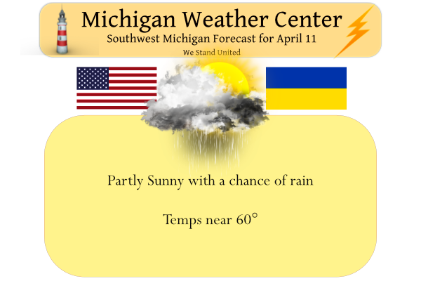
Temps today will be around 60° with slight chances of rain from Otsego to the north with greater chances the further south you go. Warmer temperatures are expected today through Wednesday with unsettled weather before another cool-down arrives later in the week.
Below is the SPC guess for severe weather in the Wednesday timeframe:

Day Three Convective Outlook
 ...SUMMARY...
   Scattered to numerous severe thunderstorms appear likely across a
   large portion of the lower/mid Mississippi Valley into the Midwest,
   Ohio Valley, and Southeast on Wednesday. Large to very large hail,
   damaging winds and tornadoes will all be possible. Strong tornadoes
   may occur.

   ...Synopsis...
   An upper trough/low will continue to eject eastward from the Plains
   across much of the MS Valley, Midwest and Great Lakes regions on
   Wednesday. A surface low is likewise expected to advance generally
   eastward across the Upper Midwest/Great Lakes through the period. A
   trailing cold front will sweep eastward Wednesday across much of the
   MS/OH Valleys and Southeast as well.

   ...Mississippi Valley into the Midwest/Ohio Valley and Southeast...
   A substantial severe threat is evident for a large part of these
   regions ahead of the cold front. Pronounced large-scale ascent
   associated with the negatively tilted upper trough will likely
   overspread the warm sector through the day. 60s surface dewpoints
   will be present ahead of the front, with greater low-level moisture
   likely in place from the lower OH Valley/Mid-South into the lower MS
   Valley and Southeast. Diurnal heating of this airmass and the
   continued presence of steepened lapse rates aloft should allow for
   moderate to strong instability to develop by Wednesday afternoon.
   Deep-layer shear generally in excess of 45-50 kt will support
   organized severe thunderstorms, and low-level shear is also forecast
   to be quite strong. Pre-frontal convection appears possible across
   parts of the Mid-South and lower MS Valley vicinity through the day.
   If this occurs, then supercells posing a threat for all severe
   hazards, including strong tornadoes, would be likely. Linear
   convection is also expected to develop along much of the length of
   the front, and this activity will pose a threat for both damaging
   winds and QLCS tornadoes as it spreads eastward Wednesday afternoon
   and evening.

   Have opted to include a broad Enhanced Risk to account for numerous
   to potentially widespread damaging winds, and several tornadoes. The
   main uncertainty precluding greater severe probabilities at this
   time is the possible effect of early-day convection across the lower
   MS Valley/Mid-South on prospects for substantial destabilization
   later in the afternoon. Given the strong flow and sufficient
   instability forecast, at least an isolated severe threat should
   continue with eastward extent across the OH Valley, TN Valley, and
   Southeast Wednesday night.
Forecast Discussion
...Showers and thunderstorms early this morning, then departing...

Elevated convection early this morning is being aided by strong
theta-e advection along a low-level jet (55 kts at 850 mb) amid
large-scale forcing for ascent. Modest MUCAPE (500-1000 J/kg),
along with steep midlevel lapse rates, may be sufficient for small
(pea sized) hail in a few storms, but weak effective shear will
continue to limit overall storm organization/intensity. Latest
deterministic CAM guidance--along with the 00z HREF--indicate
that this activity will quickly depart eastward later this
morning, likely exiting the forecast area by 7 AM.

The associated surface cold front will largely clear the forecast
area by 1 PM today. Farther south, a weak frontal wave will
propagate along this boundary into the Ohio Valley, possibly
bringing light rain into our far southern counties this
afternoon/evening. Otherwise, after ongoing activity departs, most
areas will remain dry through much of Tue.

...Areas of rain Tue night; thunderstorms possible...

A vigorous lee cyclone will consolidate in the CO high plains
tonight, then emerge into the central plains on Tue, likely reaching
the vicinity of IA/MN by early Wed morning. In response to this
system, the frontal boundary will return northward as a warm front
on Tue and Tue night, likely reaching northern Lower MI by 12z Wed.
South of this front, PW will increase to near 1.25 inches by 12z
Wed--near the 97th percentile with repect to CFSR climo
for this area/date. This deep moisture, in conjunction with
strong QG forcing for ascent, will yield periods of rain across
our central/northern counties on Tue night as the front lifts
northward. Rainfall may be be augmented--at least locally--by
elevated convection, with MUCAPE of 500-1000 J/kg, but convective
coverage is questionable on Tue night, given indications of
appreciable inhibition.

Regarding rainfall amounts through Wed morning, the axis of
heaviest mean QPF in the ECMWF ensemble (EPS) has shifted
northward in recent runs. Correspondingly, 1-inch/24-h QPF
exceedance probabilities have trended lower over the forecast
area. Overall, the risk of widespread heavy rainfall on Tue night
appears low at this time, but local swaths of heavy rain (> 1
inch) are possible. Area river levels will be monitored this week,
particularly along the Muskegon River basin, where levels are
presently high from previous rainfall.

...Conditional risk of severe thunderstorms on Wed into Wed night...

The warm sector of the aforementioned cyclone is expected to become
well established over much of Lower MI on Wed. The ECMWF and GFS--
along with their ensembles--show good agreement in depicting a
compact 500-mb shortwave impulse (possibly an MCV) traversing at
least southern Lower MI between Wed morning and early afternoon.
This feature will likely modulate warm-sector precip/cloud cover,
with implications for the degree of boundary-layer heating and
surface-based instability. If such instability can materialize,
severe thunderstorms will be possible on Wed afternoon and into
Wed evening along and ahead of the cold front, given deep-layer
(0-6 km) shear over 30 kts.

...Strong winds possible Thu...

While timing differences persist in the guidance regarding cold-
front arrival, the expectation is for frontal passage through the
forecast area between late Wed evening and early Thu morning. Of
note, the EPS mean position of the surface low at 12z Thu has
trended north into southern ON, giving broad agreement with the
GEFS mean. With this northward shift, the ensemble-mean surface
pressure gradient over the area is depicted as slightly weaker at
12z Thu, suggesting slightly reduced sustained winds in the wake
of the cold front. Nevertheless, the combination of low-level
cold advection and daytime boundary-layer warming should result in
efficient near-surface mixing on Thu, with strong wind gusts
(45-55 mph) possible.

...Cooler weather returns for late week...

Broad consensus exists between EPS/GEFS ensemble means indicating
that the midweek cyclone will evolve into a post-mature, vertically
stacked low over southern ON by Thu night, then progress eastward
into QC through Sun. A return to cool weather is expected from Thu
into the weekend, with daily chances for rain showers and possibly
snow showers during the overnight periods.
The latest CPC continues to pummel us with cold air into the last week off April! It looks like another below normal temp month is on tap! Incredible!
Was today the first Severe Thunderstorm Warning that NWS GR issued this year? It was for Gratiot County earlier this morning. Someone correct me if I’m wrong.
Im thinking damaging winds coming with the storm Wednesday we need to watch it 🤔….Maybe a moderate risk also in Michigan this could be a very dangerous situation stay tuned….Any thoughts?? InDzy
Early this morning we had a very surprising, yet short lived, thunderstorm. I was woken up by constant thunder and lightning strikes that were shaking the house, penny sized hail, and lots of rain. Overall, it made me excited for the upcoming summer storms.
Current temp in GR. = 58 degrees with clouds and wind!
It is definitely much cooler along and West of 131. I have 65 degrees now at my house but clouds are beginning to thicken up. It’s probably only in the mid to upper 40s right on the shoreline.
The forecasted high for today was 63. It is already 67. It is a “windows open” kind of day. It’s nice to get some fresh air blowing through the house.
Yes it’s 64 at my house currently. Getting some filtered sunshine. Feels great outside.
It is only 55 here at my house with cloudy skies.
Slim
It was quite a light show for a little while last night. A lot of it was distant lightning. I believe I only heard one rumble at my house everything else was distant. Still waiting on the first loud thunderstorm to roll through at my house this year.
Our tornado sirens are going off. Weird.
Just went off for the third time, ten minutes apart.
Watching the possibility of some good storms Wednesday..Did anyone hear the thunder very early this morning wasn’t a lot in my area but definitely music to my ears ..InDzy
We had two rounds – about 3am and 4:30am. Pretty loud.
I went biking for the first time of the season yesterday… over 55F is my threshold for biking, otherwise I go running.
And yes it looks like we have a chance at strong storms mid-week. We will see what happens but I wouldn’t mind a good storm
With the sun now up I can say that the grass has greened up nicely. It will not be too long before we will have to start the cutting season. And with this cool and wet pattern that grass could grow so that there may be a twice a week cutting coming up.
Slim
The lawn has really greened up in the past week. It’s really soggy, though.
After a brief warm up it looks like we return to a another cool/cold and maybe wet pattern. At this time it looks like April will end up cooler than average.
Slim
Who would have thought?
The official high at Grand Rapids yesterday was 58 and for a change there was a reported 77% of possible sunshine. There were just a few sprinkles here in MBY this morning and the overnight low here was 49 it looks like the overnight low at GRR will be 48 At this time with clear skies it its 49 here.
Slim
Yesterday was a gorgeous spring day. Getting quite a bit of thunder now.