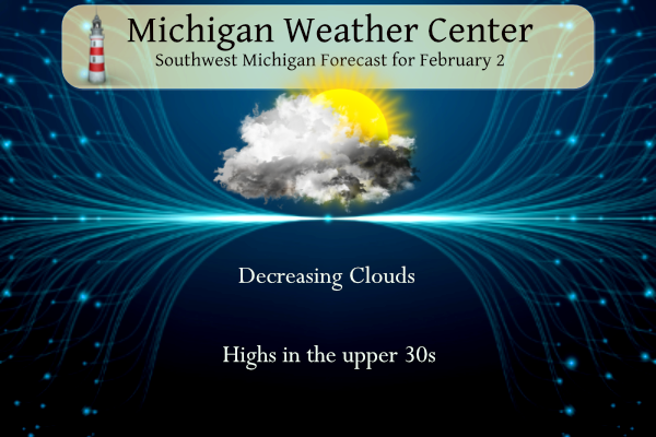
We have great expectations of an extended period of fewer clouds and more sunny conditions for several days. Little or no precipitation is in the forecast through next week. Today temperatures will be in the upper 30s rising into the mid-40s this weekend well into next week. We may even break 50° towards the end of next week. ENJOY!
Forecast
Weather History
1868: It is a chilly Groundhog Day as Lansing sets their all-time record low with a reading of 37 below zero.
On February 2, 2022, a winter storm produced a swath of heavy snow from Lansing to Owosso to Flint to Caro with 10 to 12 inches reported.
On February 2, 2011, the Groundhog Day Blizzard affected a large area of the country from Oklahoma to the New England States, including southeast Michigan. The snow started during the evening hours of the 1st and continued into the 2nd. Snowfall accumulations generally range from 6 to 12 inches. Isolated higher amounts were recorded across the Thumb and Tri-Cities Region. Northeast winds gusting between 25 to 35 mph caused some blowing and drifting of snow. Frequent wind gusts to 35 mph came off Lake Huron and Saginaw Bay, leading to blizzard conditions north of the I-69 corridor. Some of the higher snowfall reports across the area included: Pigeon 14 inches; Port Huron 14 inches; Lapeer 13.6 inches; Lexington 13.5 inches; Bridgeport 13 inches; Mayville 13 inches; Pinconning 12 inches; Flushing 11 inches; Lake Orion 10 inches; and Romulus 9 inches.
Also on Groundhog Day in 1967, Flint measured 9.3″ of snow from another snowstorm that occurred February 1st-2nd. The groundhog probably had trouble getting out of his burrow that morning, let alone see his shadow.
Also, on the 2nd back in 1936, this marked the last day of a streak of 11 days (Jan 23-Feb 2, 1936) with daily temperatures colder than 19 degrees
U.S.A and Global Events for February 2nd:
1870: Congressman Halbert Paine, who represented Wisconsin’s Second District, introduced a joint resolution in the House of Representatives “to authorize the Secretary of War to provide for taking meteorological observations at the military stations and other points in the interior of the continent, and for giving notice on the Northern Lakes and seaboard of the approach and force of storms.”
The House adopted the resolution by unanimous consent and, two days later, it passed the Senate. Five days later, on Feb. 9, President Ulysses S. Grant signed the joint resolution into law, officially creating the nation’s first weather service. The image below is from weather historian Sean Potter.

1898: The naming of hurricanes after women was always the center of controversy. In the Southern Hemisphere near Australia, tropical cyclones were once called Willy-Willies. An Australian Meteorologist, Clement Wragge, is credited for giving girls names to tropical cyclones by the end of the 19th Century. On this date, Wragge’s weather journal showed a Willy Willy named “Eline.”
1952: An area of low pressure moved out of the Gulf of Mexico and across southern Florida during the evening and late-night hours on February 2, 1952. It produced 60 mph winds and two to four inches of rain on February 2 and 3. The low pressure remains the only tropical storm to impact the United States in February.

1996: An Arctic outbreak that lasted from late January through early February produced nearly 400 hundred record lows, 15 all-time low readings, and over 50 new record lows. Four states recorded their all-time record low temperatures, including Tower, Minnesota, on this date with a reading of 60 degrees below zero, canceling Tower’s annual Icebox Days festival because it is too cold. Locations that reported their all-time record low or tied included: Cresco, IA: -36°, Osage, IA: -34°, Charles City, IA tied their record low with -32° and Lancaster, WI tied their all-time record low with -31°. International Falls, MN, and Glasgow, MT set records for February with -45° and -38°, respectively. The temperature at Embarrass, MN, plummeted to -53°. Rochester, MN, dipped to -34° for its coldest temperature in 45 years. Green Bay, WI only reached -16° for the high temperature for the day, their coldest high temperature on record in February. The place to be this day was in Orlando, FL, where it was a balmy 85 degrees.
The map shows most north-central United States experiencing average temperatures some 18 to 26 degrees below normal from January 29 through February 6, 1996. The map is courtesy of the Midwestern Regional Climate Center.

Forecast Discussion
-- Early morning showers in south-central Michigan --

Prior to daybreak this morning, scattered graupel or light rain
showers have developed between Grand Rapids, Lansing, Kalamazoo, and
Battle Creek. Finding a representative model forecast sounding is
difficult, though it is plausible that weak conditional instability
has been achieved from the surface to 3,000 feet (temperatures
at 3,000 feet are about -5 C). A deeper overlap of moisture and
cloud layers through much of this layer, plus what appears to
be weak mesoscale confluence/convergence in the surface winds
over this area, is also assisting in producing these showers.
Not expecting any impact from these, but figured it was worth
mentioning since they appear to be more than just a trivial
sprinkle or flurry, based on radar reflectivity of 15-25 dBZ.

-- Mix of clouds and sun Friday and Saturday --

Given more clouds than clearing over our area currently and plenty
more clouds upstream toward the northeast, would expect a mostly
cloudy start to the day, but with any luck, a trend to at least
partly sunny in the afternoon. Upper-level ridging today into
Saturday will provide us with a tendency for sinking air in the
mid to low levels. At the top of the diurnal boundary layer
around 2,000 feet, a capping inversion with very dry air will be
in place, and some of this dry air may mix into the BL this
afternoon and assist with reducing RH and evaporating the
stratus. Countering that, however, may be moisture contributed
from Lake Huron advecting southwestward. The HREF mean maintains
some low-level cloud cover near and east of US-127 this
afternoon.

The HREF spreads some cloud cover into western Michigan tonight, so
Saturday may start off with clouds over most of the area also.
Advection of air off the lakes will be less of a factor on
Saturday, so another attempt will be made at evaporating clouds
through subsidence and mixing down dry air. And at least for
now, it seems more likely that mostly sunny conditions will
eventually prevail.

-- Dry/mild early to mid next week, then precip chances late --

Mostly sunny skies are expected Sunday into Monday as deep
ridging persists and there is a lack of moisture, per medium
range RH layer analysis. Could see an increase in 925mb RH from
the NE later Monday into Tuesday, bringing some clouds back in
but likely not total cloud cover. Regardless, dry conditions
will persist into the middle of next week. High temperatures in
the 40s to low 50s are likely next week prior to the western
CONUS trough trying to move into the ridging across the Great
Lakes late in the week. NBM high temperatures notably have
inched upward mid to late week, with low 50s now forecast for
next Thursday and Friday. This is consistent with a consensus of
the ECE/GEFS/CMC.

As the trough approaches our region toward the end of next
week, rain shower chances increase. In fact, by next week
Friday, there is a possibility for some elevated instability to
move into Lower Michigan. Will have to see how models trend on
that risk. For now, just rain showers are being mentioned in the
forecast from next Thursday into Friday.
There’s something about days like today that just give you a nice charge!! Just gorgeous weather all weekend! Get out and enjoy it people! You don’t have to wear 18 layers of clothes and worry about losing fingers to frostbite either! Just a beautiful SUNNY, WARM weekend on tap! Who wouldn’t want sun and warmth this time of year?!?!
Well, it’s official. For the first time ever, the annual Black Lake sturgeon season has been canceled. It was scheduled for tomorrow. That’s a darned shame. It is such a great event.
Hey Mark and others,
I know you like different weather people… saw this guy and thought he did great job of explaining things .. let me know what ya think…
https://youtube.com/watch?v=RAfUYfdQNJw&si=1pPXDAG_aVVZTYOc
He is very good. He has great graphics too. So much good young talent out on the internet.
He used “normal” words and did to keep your interest and short. Will be interesting to see if his predictions play out.
We are more than 70% done with snow this winter according to long-term averages. After the continued blowtorch the next 10 days, we will only have about 15% or 20% of “winter” to go! I love short winters!
Will have to see how the next 10 days play out but, but if the forecast is correct this could be the warmest start to any February since 1991. In 1991 after a below average day on the 1st there were 9 days in a row of above average temperatures. Highs reached into the 50’s on 3 days in a row.
Slim
Now this is what I like to see going into the second week of February! WOW just wow!!
Mostly sunny skies are expected Sunday into Monday as deep ridging persists and there is a lack of moisture, per medium range RH layer analysis. Could see an increase in 925mb RH from the NE later Monday into Tuesday, bringing some clouds back in but likely not total cloud cover. Regardless, dry conditions will persist into the middle of next week. High temperatures in the 40s to low 50s are likely next week prior to the western CONUS trough trying to move into the ridging across the Great Lakes late in the week. NBM high temperatures notably have inched upward… Read more »
50’s in early February. Where is winter?
It has been winter for a long time just not what a topical winter in almost all of the lower 48. This will go down as one of the milder winter seasons but this maybe the new trend in the coming years.
Slim
I love it Slim! If only it could be like this every winter here!
First off Punxsutawney Phil did NOT see his shadow so spring is already here LOL. The official H/L yesterday at Grand Rapids was 43/34 That 43 was the warmest high since December 30th there was no rain/snow the sun was out just 1% of the time. For today the average H/L is 31/18 the record high of 50 was set in 2020 (that is the coolest maximum for any day at Grand Rapids) The record low of -11 was set in 1971 the most snowfall of 11.1” was set in 2011 the most snow on the ground is 19” is… Read more »
I wonder if there is a record of Phil’s shadow v no shadow during El Nino winters?
We got zero sun yesterday and it’s still completely cloudy now. We’re supposed to get some sunshine this weekend, which will be amazing.
It looks like this was only the 21st time he did not see his shadow. He reportedly seen it on 107 years. The last time he did not was in 2020. That was not a El Nino winter.
Slim
We were talking about this. I said if it is going to be dark still early-ish… just let it be cold. Lol. I would rather have light and nice weather….lol. I predicted 6 more weeks of winter… Phil said nope. 😂
We are about halfway done with the cold season on groundhogs day, so unfortunately spring isn’t here technically… but the 8 day sure looks like it
You missed the “joke” technically there are always 6 more weeks of winter on February 2nd. While March is the start of meteorological spring it can often be cold and snowy well into March. If fact I would not be too surprised if that happens this year.
Slim