February Averages and records.
As we now have flipped the calendar to February and the last month of meteorological winter it is time to look at some averages and extremes for the month. The average number of hours of daylight start out at 9hr 56min on the 1st end up at 11hr 12min on the 29th. The average H/L starts out at 30.8 on the 1st and by the 28th it is up to 37.8. The average low starts out at 17.5 on the 1st and is up to 22.4 on the 28th. The record highest reading is 69 set on February 11th 1999. It has reached 60 or better in 14 years in February the last time was in 2018 when it reached 63 on February 20th in February 2017 it reached 66 on the 22nd. The record low of -24 was set on February 14th 1899. Last year the highest was 54 on the 14th and the lowest was 5 on the 3rd. The average mean for February is 26.6 the warmest February’s at Grand Rapids are 2017 with a mean of 34.7 the coldest was 2015 with a mean of 13.3. Last year the mean was 31.0 it was the 13th warmest February on record at Grand Rapids. The wettest total precipitation is 5.77” in 1898 in more recent times 1938 had 5.30” Last year had 4.10” good for the 8th wettest. The driest year is 1902 with 0.21” in more recent times 1969 only had 0.33”. The average snowfall for February at Grand Rapids is 17.” The most snowfall is 41.6” in 2008 the least snowfall of 0.5” was in 1998. Last year there was 5.4” of snowfall good for the 20 lowest snowfall. The most snowfall in calendar day is 11.3” on February 3rd 2007 that event started on the 1st and the total 4 day event had 20.4” of total snow fall. The so called GHD snowstorm had a calendar one day snowfall amount of 11.1” on the 2nd the 2 day event has a total of 17.2” of snowfall. Note the 2007 event had more snowfall then the 2011 event.
Will have to see how the next 10 days play out but, but if the forecast is correct this could be the warmest start to any February since 1991. In 1991 after a below average day on the 1st there were 9 days in a row of above average temperatures. Highs reached into the 50’s on 3 days in a row. Note the reference to 2009 in todays discussion in 2009 the warmth did not happen until after several days of cold at the start of February.
The official H/L yesterday at Grand Rapids was 37/27 that 27 was the coldest low since January 22nd and it was also the 1st time it has gotten below 31 in that same time. There was no rain/snow yesterday as it was the sunniest day in a long time with 45% of possible sunshine. For this winter season Grand Rapids is now at 34.5” of snowfall that is -17.7” on the season. For today the average H/L is 31/18 the record high of 54 was set in 1991 and the record low of -17 was set in 1996. The record snowfall of 11.3” fell in 2007 the most on the ground was 19” in 2014 and 2011. Last year the H/L was 15/5 and there was 5” of snow on the ground.
AREA FORECAST DISCUSSION
NATIONAL WEATHER SERVICE GRAND RAPIDS MI
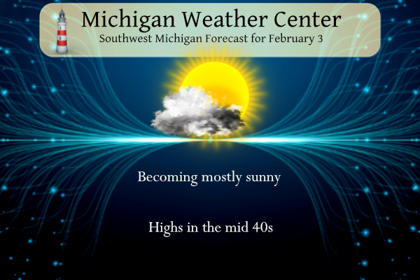
310 AM EST SAT FEB 3 2024
KEY MESSAGES
– CLOUDY EARLY SATURDAY THEN CLEARING AND DRY THIS WEEKEND
– UNUSUAL SUSTAINED WARMTH NEXT WEEK, LIKELY RAIN LATE THU-FRI
DISCUSSION
ISSUED AT 310 AM EST SAT FEB 3 2024
– CLOUDY EARLY SATURDAY THEN CLEARING AND DRY THIS WEEKEND
EASTERLY FLOW WILL CONTINUE OVERNIGHT AND THROUGH THE MORNING.
THIS WILL ALLOW LOW CLOUDS TO ENVELOP THE REGION EARLY THIS
MORNING. THE DRY SURFACE AIR WILL SLOW THE ENCROACH HOWEVER
EXPECT THESE SHALLOW LOW CLOUDS TO COVER MOST OF LOWER MICHIGAN
BY MORNING.
THE QUESTION TODAY IS HOW MUCH SUNSHINE WILL THE REGION SEE.
THE LOW CLOUDS WILL REMAIN THROUGH SUNRISE AND POTENTIAL
THROUGH MID MORNING. LATEST MODEL SOUNDS CONTINUE TO HAVE A
STRONG INVERSION IN PLACE TO AROUND 1000 FEET. HOWEVER WITH A
WARMING SURFACE AND DRY AIR, THIS SHOULD ALLOW FOR ANY CLOUDS TO
DISSIPATE BY MID TO LATE MORNING. WITH HIGH PRESSURE DOMINATING
THE PATTERN WITH A DRY AIR THROUGHOUT THE REST OF THE
ATMOSPHERE CLEAR SUNNY SKIES WILL BE WELCOME REPRIEVE FROM A
CLOUDY JANUARY. HIGH PRESSURE WILL CONTINUE TO DOMINATE THE
WEATHER PATTERN THROUGH THE WEEKEND WITH LOW CLOUDS AGAIN
POSSIBLE SATURDAY NIGHT INTO SUNDAY, ESPECIALLY WITH LOWS
DROPPING INTO THE MID 20S. HOWEVER, LIKE TODAY THESE CLOUDS
SHOULD DISSIPATE BY MID MORNING WITH A MOSTLY SUNNY SUNDAY
EXPECTED.
– UNUSUAL SUSTAINED WARMTH NEXT WEEK, LIKELY RAIN LATE THU-FRI
UPPER LEVEL RIDGING AND SURFACE HIGH PRESSURE WILL REMAIN IN CONTROL
EARLY-MID NEXT WEEK. THE GLOBAL ENSEMBLES CONTINUE TO SUPPORT THE
IDEA OF PARTLY TO MOSTLY SUNNY SKIES MON AND TUE, UNTIL ABOUT WED
WHEN UPPER-LEVEL CLOUDS START TO INCREASE.
THE SAME PARENT TROUGH ASSOCIATED WITH EXPECTED DANGEROUS AMOUNTS OF
RAIN IN THE COASTAL CALIFORNIA MOUNTAINS SUN-MON WILL PROGRESS INTO
THE CENTRAL US ON THU WHILE BROADENING. AHEAD OF IT, SOUTHERLY LOW-
LEVEL WINDS WILL STRENGTHEN IN THE MIDWEST AND TRANSPORT EVEN WARMER
AIR INTO OUR AREA. TEMPERATURES IN THE 50S ARE VERY POSSIBLE THU
INTO PART OF FRI. THERE EXISTS SOME SPREAD IN THE ENSEMBLES
REGARDING THE TROUGH/RIDGE PAIR’S AMPLITUDE AND EASTWARD PROGRESSION
THEN, BUT ULTIMATELY THERE IS GOOD CONSENSUS FOR THU’S WARM
TEMPERATURES. THE SPREAD IN THE TEMPERATURE POSSIBILITIES INCREASES
FOR FRI DEPENDING ON WHEN THE COLD FRONT MIGHT ARRIVE.
THU AND FRI SHOULD BE PRETTY BREEZY IF NOT DOWNRIGHT BLUSTERY AT
TIMES, WITH 30 MPH GUSTS LIKELY AND OVER 40 MPH POSSIBLE AT TIMES.
RAINFALL SOLUTIONS AMONG THE ENSEMBLES FROM LATE THU INTO FRI ARE
GENERALLY BETWEEN 0.1 TO 0.5 INCHES WITH SOME OUTLIERS AS HIGH AS 1
INCH. THERE IS A HINT OF DEEP-LAYER INSTABILITY IN IN THE GFS’S
FORECAST SOUNDING FRI MORNING, SO CONVECTIVE RAINS ARE POSSIBLE.
SOME PERSPECTIVE ON HOW UNUSUAL THIS SUSTAINED WARMTH IS IN THE
FIRST HALF OF FEBRUARY… OUR FORECAST AVERAGE TEMPERATURE
(ACCOUNTING FOR DAILY HIGHS AND LOWS) FOR MONDAY THROUGH FRIDAY IS
ABOUT 40 DEGREES IN THE GRAND RAPIDS AREA. FOR FEBRUARY 5-9, AN
AVERAGE TEMPERATURE LIKE THIS HAS HAPPENED NO MORE THAN 2 OR 3 TIMES
IN THE PAST 125 YEARS OF RECORD AT GRR, LAN, MKG, AND AZO. EXPANDING
THE SEARCH FOR ANY 5-DAY PERIOD BETWEEN FEB 1 AND FEB 15, THERE HAVE
ONLY BEEN ABOUT 10 CASES (GIVE OR TAKE A FEW) WITH A FIVE-DAY
AVERAGE TEMPERATURE OF 40 OR MORE, MOST RECENTLY FEB 7-11, 2009. THE
30-YEAR NORMAL HIGH FOR GRAND RAPIDS ON FEB 7 IS 32 DEGREES, THE
NORMAL LOW IS 18, FOR A NORMAL AVERAGE TEMPERATURE OF 25.
I see the high temp in GR was a whopping 35 degrees, even with all the warm weather hype! WOW!
The snow maps are starting to pick up on the pending pattern change! Bring it!
https://www.pivotalweather.com/model.php?p=snku_acc-imp&rh=2024020318&fh=384
So far so good…an easy Winter is a blessing.
The sun…finally! The only clouds in the sky are on the horizon. Washed my car this morning and just returned from a nice long walk with our pooch. Beautiful day.
This will be the 12th day in a row with temps above average and no snowfall and there is no end to that in sight!! What a beautiful stretch of weather as we wind down toward the end of winter! What a preview of goodness with spring right around the corner!
Sun is peeking out here in Northern Kent now! Great day to get out and do some yard work and enjoy the outdoors! Temp should start heading up now that the sun is out! Just gorgeous!!
Currently in Miami and it looks like a Slight chance of severe storms tomorrow with wind and maybe tornadoes. I’ll post any updates if a storm moves in
Almost noon and still fog and temps around 30 degrees! Wow!
It is taking a long time for any clearing for today and it is still on the cool side for sure.
Slim
Still 45 day of winter left! We are just getting started! Get ready to rock n roll! It could get wild around here!
What a fantastic stretch of winter we’ve been having! Wischcasting forecasts for the middle of the month are out, wishing for cold and snow, who knows, maybe we’ll add one week of winter to the two week winter we’ve had this year?? But then after that one week, the teleconnectors go right back to warmth and wonderful! Get out and enjoy the Sun and Warmth this weekend and all this week!!
Current conditions = freezing fog and 27 degrees! Sun, what sun?
We sure have seen some horrible winter weather lately! Temps in the upper 30’s and no snow! Now for the good news – the pattern will be changing to colder and snowier around the middle of this month! The AO will be tanking and that means colder temps! GREAT NEWS – we still have 7 plus weeks of winter left! Bring it on!!