On Tuesday we will flip the calendar over to August.
August is the eighth month of the year it is one of seven months to have 31 days. It is the last month of meteorological summer and is the month that many students return to school. On the weather front with an average mean of 71.1 it is typically the 2nd warmest month of the year. At Grand Rapids we start the month off with 14H and 30M of daylight and end the month with 13H and 13M of daylight. The average H/L on August 1st is 82.4/62.6 that falls to 78.8/58.6 on the 31st The warmest August was 77.7 in 1947 the next 4 warmest are 1900 with 76.3, 1937 with 76.0. 1959 with 75.5 and 1955 with 75.0. The coldest mean for any August was in 1992 with a mean of 65.0. The next 4 coldest are 1915 with 65.1. 1903 with 65.6. 1927 with 35.7 and 1904 with 65.9. The record hottest day is 102 set on August 6 1918. The record coldest low is 39 set on August 30, 1976 that was just 3 days after the high reached 94. On average there are 3 days with highs of 90 or better in August the most is 17 in 1947. There have been many years were it did not reach 90 in August in Grand Rapids including 2019, 2017 and 2014. On average there are 9 days of 85 or better that’s right just 9 days on average of 85 or better in August. The most is 26 days in 1947 the least number of days of 85 or better is 1 the most recent year was 2000. On average there are 2 nights when the low drops into the 40’s in August with the most being 11 in 1976. On average there is 3.55” of rain in August with the most being 8.46 in 1987 and the least being just 0.13” in 1899 there have been a total of 16 years with less than one inch of rain fall in August the last time was in 1996. Last year the mean at Grand Rapids was 71.4 that is a departure of +0.3. The high for the month was 89 and the low for the month was 52 there was 4.89” of rain fall.
Some of the more extreme weather events to occur in August. On August 1st, 1993, a storm in Kent County had grapefruit-sized hail. 1964 on August 3rd Grand Rapids hits 100° August 6, 1918, Grand Rapids reaches 102 the record for the month. August 13, 2002, several tornadoes hit SW Michigan including one near Rockford. August 14, 1987, 3.61” of rain falls at Grand Rapids. August 16, 1979, the temperature falls to 36 at Muskegon. August 19 1939 4.22” of rain falls at Grand Rapids August 20th 2016 several tornadoes are reported near Grand Rapids no one is hurt. August 22nd 1936 temperature reached 98 at Grand Rapids. August 30th 1976 the official low falls to 39 at Grand Rapids that is the coldest reading for any day in August so far. There were reports of some frost in the area. August 31 1953 August ends on hot note when temperatures reach the upper 90’s 2009 August ends on a cold note with readings in the lows of 34 at Big Rapids, 32 at Cadillac and a very cold 28 at Leota. So lets sit back as we see how August 2023 plays out.
Back to July, the official H/L yesterday at Grand Rapids was 88/70. That low of 70 is the warmest low for this year so far. There was a trace of rain fall before midnight. The sun was out a reported 60% of the possible time. The highest wind gust was 25 MPH out of the west. For today the average H/L is 83/63 the record high of 103 was set in 1916 the record low of 47 was set in 1971. The record rain fall amount of 1.74” fell in 1905. Last year the H/L was 78/60. So far for today I recorded 0.85” of rain fall from the thunderstorms overnight. The low so far and current temperature is 69.
AREA FORECAST DISCUSSION
NATIONAL WEATHER SERVICE GRAND RAPIDS MI
355 AM EDT SAT JUL 29 2023
LATEST UPDATE…
SHORT TERM/LONG TERM/MARINE
SHORT TERM
(TODAY THROUGH SUNDAY)
ISSUED AT 355 AM EDT SAT JUL 29 2023
A MESOSCALE CONVECTIVE VORTICITY MAXIMUM IS MOVING THROUGH CENTRAL
LOWER MICHIGAN EARLY THIS SATURDAY MORNING, WHICH IS SEEN AS THE
SWIRL OF CONVECTIVE RADAR ECHOES PIVOTING FROM MONTCALM TOWARDS
TOWARDS ISABELLA AND GRATIOT COUNTIES. RAINFALL RATES EARLY THIS
MORNING HAVE BEEN HIGH AS EXPECTED INTO THE 1-3 INCH RANGE. THOSE
HOURLY RATES HAVE PRODUCED STORM TOTAL RAINFALL OF IN EXCESS OF 3
TO 4 INCHES IN SPOTS. IN THE LIMITED AREA WHERE THIS TYPE OF RAIN
HAS OCCURRED, WE HAVE ISSUED AREA FLOOD ADVISORIES THAT LAST A FEW
MORE HOURS ENDING BETWEEN 600AM AND 900AM. WE WILL LIKELY BE ABLE
TO CANCEL ALL OF THESE ADVISORIES ON TIME AS WE EXPECT THE RAIN TO
LARGELY BE PIVOTING EAST OF THE AREA IN THE NEXT FEW HOURS.
WE HAVE SMALL POPS IN THE EAST THIS MORNING FOR ANY RAIN THAT
LINGERS BEYOND 800AM, BUT WE ARE LARGELY EXPECTING DRY CONDITIONS
FROM TODAY THROUGH TONIGHT AND SUNDAY. HIGH PRESSURE SHOULD
DOMINATE THE WEATHER SCENE BRINGING SUBSIDENCE AND DRY AIR.
HIGHS TODAY WILL BE MUCH CLOSER TO NORMAL IN THE LOWER TO MIDDLE
80S. WE SHOULD RECOVER TO THESE VALUES DESPITE MORNING
STRATOCUMULUS OVER THE SOUTHERN HALF OF THE AREA.
LONG TERM
(SUNDAY NIGHT THROUGH FRIDAY)
ISSUED AT 355 AM EDT SAT JUL 29 2023
MUCH OF THE LONG TERM PERIOD WILL HAVE DRY WEATHER AND SEASONABLE
TEMPERATURES IN A GENERAL NORTHWEST FLOW ALOFT. A RIDGE ALOFT WILL
REMAIN SOMEWHAT STATIONARY OVER THE SOUTHERN TIER OF THE COUNTRY
NOSING UP INTO MUCH OF THE WEST AS WELL. AN UPPER LOW WILL BE
SITUATED OVER EASTERN CANADA WHICH WILL PLACE THE GREAT LAKES IN A
NORTHWEST FLOW. MUCH OF THE PERIOD WILL BE DRY WITH SURFACE HIGH
PRESSURE NEARBY FROM SUNDAY NIGHT THROUGH TUESDAY. SOUTHERLY FLOW
TAKES HOLD AT THE SURFACE AS THE HIGH SLIPS EAST AND A COLD FRONT
APPROACHES FROM THE WEST IN THE MIDDLE TO LATTER HALF OF THE WORK
WEEK. THE COLD FRONT WILL MOVE THROUGH THE REGION ON THURSDAY AND
THURSDAY NIGHT WHICH IS WHEN WE EXPECT THE BEST CHANCES FOR
PRECIPITATION. AT THIS POINT WE ONLY HAVE 20 PCT CHANCES FOR
PRECIPITATION BUT I CAN SEE THIS NEEDING TO BE INCREASED WITH
TIME.
A GRADUAL WARMING TREND WILL BE NOTED FROM MONDAY THROUGH FRIDAY
AS 850MB TEMPERATURES WARM. 850MB TEMPERATURES WILL WARM FROM THE
LOWER TEENS C TO START THE WEEK AND END THE WEEK IN THE UPPER
TEENS C. LOWS WILL WARM FROM THE 50S INTO THE 60S AND HIGHS WILL
NUDGE UP THROUGH THE 80S DAY BE DAY. MUCH OF THE 7 DAY FORECAST
LOOKS UNEVENTFUL WITH NEAR NORMAL TEMPERATURES FOR THE MOST PART.
Detailed Forecast For Grand Rapids
Overnight
Showers and possibly a thunderstorm. Low around 68. Northeast wind around 7 mph. Chance of precipitation is 90%. New rainfall amounts between a quarter and half of an inch possible.
Saturday
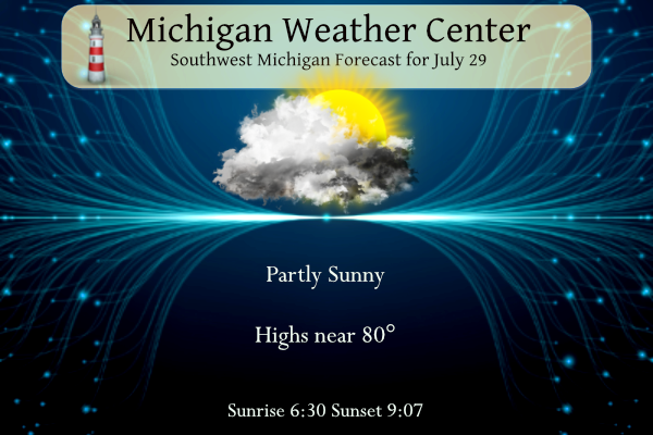
A 40 percent chance of showers and thunderstorms before 9am. Partly sunny, with a high near 83. North wind 6 to 8 mph.
Saturday Night
Partly cloudy, with a low around 61. Northwest wind 5 to 9 mph becoming north northeast after midnight.
Sunday
Mostly sunny, with a high near 78. North northeast wind 6 to 8 mph.
Sunday Night
Mostly clear, with a low around 56. Northwest wind 5 to 10 mph becoming light north after midnight.
Monday
Sunny, with a high near 80.
Monday Night
Mostly clear, with a low around 57.
Detailed Forecast For Lansing
Overnight
Showers and possibly a thunderstorm. Low around 67. Southwest wind around 9 mph, with gusts as high as 18 mph. Chance of precipitation is 90%. New rainfall amounts of less than a tenth of an inch, except higher amounts possible in thunderstorms.
Saturday
A 50 percent chance of showers and thunderstorms before noon. Cloudy, then gradually becoming mostly sunny, with a high near 82. North wind 8 to 10 mph.
Saturday Night
Partly cloudy, with a low around 59. Northeast wind around 6 mph becoming east southeast after midnight.
Sunday
Partly sunny, with a high near 78. Northeast wind 3 to 8 mph.
Sunday Night
Mostly clear, with a low around 56. North wind 5 to 9 mph becoming light north northwest after midnight.
Monday
Sunny, with a high near 79.
Monday Night
Mostly clear, with a low around 57.
ADA – can only come up with 0.65″ of rain overnight.
Wow and North Rockford 2.25 inches!
2.86 inches of rain from the storms which brings us to 5.15 inches for the month and 5.99 inches since June 1st (from my rain gauge). This will help put a dent in the drought for Allegan County. 2.55 inches was reported in Plainwell, 2.16 in Grand Junction, 1.31 inches in Kalamazoo, 2.93 inches in Paw Paw, 1.69 in Wayland, 2.12 in Hastings… these are all official CoCoRaHS reports.
Holy bananas! My house got 3.5” of rain last night.
Crazy the difference in a short distance. Probably only 0.5/0.6” here
I had a total of 0.87″ of rain fall. Looks like 0.79″ was the official rain fall total at Grand Rapids. 0.54″ at Lansing. 0.51″ at Muskegon. 1.33″ at Holland. And 1.12″ at Kalamazoo.
Slim
The drought is over baby!
Another Enhanced Risk area in West MI with not 1 severe weather report just like the last event. What a joke!
We got pummeled with rain! 2+ inches! Wow, just wow, WOW!!!