Hard to believe but here we are once again at the end of Met summer, (Astronomical summer ends on September 22). Our warmest day was 94° on June 13th, we had seven days that were 90° or better. (These are Otsego temps). We had two major storms which moved through the area this summer knocking out the power, the last one was, of course, August 29th which caused the most damage with estimated winds of around 60 mph. These we the worse storms we have had over the past five years which were calm by comparison.
Yesterday we had 75° for the high and 60° for the low. Our high temp for the month was 91° and the lowest overnight temp was 51°. We end the month with our wettest of the summer with 6.99 inches. Our summer total is 15.01 inches.
Weather History for SW Michigan
August 28
1982: A strong cold front pushes through and temperatures tumble to 36 degrees at Lansing, setting a record low for the date.
1986: There is an autumnal chill as morning lows fall to a record low of 41 at Grand Rapids and to 36 degrees at Lansing, tying the record low set only four years before.
August 29
1863: A hard freeze ends the growing season at many interior locations. Lansing falls to 26 degrees, the coldest ever recorded in August there.
1982: Cool air from Canada continues pouring in, with a record low of 38 degrees at Muskegon and 41 degrees at Grand Rapids.
August 30
1949: A weak tornado struck just north of Grant in Newaygo County, causing some minor damage to small buildings and crops.
1976: Grand Rapids falls to 39 degrees, the coldest ever recorded during the month of August. Scattered frost occurs in rural areas.
1984: A tornado struck about 5 miles northeast of St. Johns in Clinton County, damaging two homes, but causing no injuries.
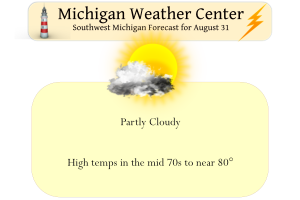
August 31
1993: Flash flooding hits Norton Shores in Muskegon County as slow-moving thunderstorms dropped about an inch and a half of rain. Elsewhere, three people were struck by lightning in Otsego in Kalamazoo County. One suffered cardiac arrest but was not killed. The other two were treated for minor burns. The lightning strike occurred while two stranded motorists were huddled under an umbrella, watching the wrecker operator connect their vehicle. The lightning struck the umbrella and the motorists, then struck the wrecker operator, jolting him to the ground.
1953: August ends with a late-season heat wave that will continue into September. Record highs of 97 are set at Grand Rapids, 96 at Lansing and 91 at Muskegon.
1975: Heavy rains on the last day of the month ensure that this will be the wettest August on record at Lansing and Muskegon. One to three inches of rain falls across the region, boosting the monthly total close to 10 inches.
2009: August ends on a cool note with a record low of 41 degrees at Muskegon. Some other readings include 34 at Big Rapids, 32 at Cadillac and 28 at Leota, in Clare County.
September 1
1953: A heat wave that began in late August continued into September, with record highs of 97 degrees at Grand Rapids and 96 at Lansing. The 95 degrees at Muskegon tied the record high for the month there.
2009: September begins with temperatures more typical of October. Lows include 41 degrees at Muskegon, 36 at Ludington, Hersey and Baldwin, and 35 at Harrison. Cadillac fell to 32 degrees for the second morning in a row, and Leota in Clare County fell to 30 degrees.
2018: Four tornadoes occurred within a two hour period during the evening. The first was a brief tornado that snapped trees near Gull Lake in Barry County. This was followed by a tornado with winds estimated at 100 mph that destroyed a manufactured home at Morley in Mecosta County. Two other tornadoes took down trees, some of which fell on houses, in Jackson and Clinton Counties.
September 2
1894: Lansing hits 99 degrees, setting their record high for the month of September.
1913: Grand Rapids hits 98 degrees tying their record high for the month of September.
September 3
1946: There was an early taste of autumn as Grand Rapids falls to 32 degrees for its earliest freeze on record.
Weather History for SE Michigan
August 28
On August 28, 2020, several rounds of morning showers and thunderstorms trained over the same areas, bringing 2 to 4 inches of rainfall over just a few hours and causing flooding throughout the Metro Detroit area. Scattered severe storms during the afternoon then brought damaging wind to the US-23 corridor as well as large hail (up to 2 inches near Flushing).
On August 28, 2018, a line of severe storms impacted the Tri-Cities and Thumb regions with damaging winds downing numerous trees and power lines.
On August 28, 2013, an EF0 tornado touched down near Brighton, Michigan. The path width was 0.3 miles wide and 2.8 miles long. Peak winds were estimated to be near 80 mph. Numerous trees were uprooted and minor siding damage to homes occurred.
Also, on August 28, 1992, the temperature rose to only 59 degrees in Flint!
August 29
On August 29, 2008, 0.10 inches of rain fell on Detroit, one of only six days during the month that had light rainfall. That pushed the monthly total up to 0.27 inches making August 2008 the third driest August on record.
Also on August 29, 1982, Detroit, Flint, and Saginaw set new record lows for the month of August. The temperature fell to a chilly 37 degrees in Flint and Saginaw and 38 degrees in Detroit.
Also on this day in 1979, one F0 and three F1 tornadoes were sighted over Monroe county between 6:45 pm and 7 pm.
August 30
On August 30, 1984, an F2 tornado moved through Wayne County at 4:40 am. It caused $4 million worth of property damage and caused 4 injuries.
August 31
On August 31, 2010, Detroit and Flint closed out August with three consecutive 90+ degree days with no rainfall. This marked the end of a very hot and dry August. When combining the two, it was the hottest and driest August combination on record for Southeast Michigan. Detroit had its sixth warmest and sixth driest August. Flint recorded its fifth warmest and driest August.
On August 31, 1980, there were peak wind gusts of 69 mph.
Also on August 31, 1894, marked the end of the driest summer month ever recorded in Detroit, with only 0.16 inches of rain falling throughout the entire month.
September 1
On September 1, 1967, Detroit experienced a record low of 42 degrees.
September 2
On September 2, 1984, an F3 tornado moved through Sanilac County at 5:40 PM. This tornado caused one injury and over $500,000 in damage. This was the strongest tornado to ever hit Sanilac County and also caused the only injury ever reported in Sanilac County.
September 3
On September 3, 2011, in the late afternoon and evening, several thunderstorms fired up ahead of a cold front that was draped across lower Michigan. Ahead of the cold front temperatures soared into the 90s with heat indices near 100 degrees. The areas hardest hit with strong winds and hail were along I-94 from Ann Arbor to downtown Detroit including River Rouge where festival tents were blown down injuring about 10 people and at the University of Michigan where the football game was ended early due to the thunderstorms. Another hard-hit area was from Huntington Woods to Madison Heights where winds were estimated up to 75 mph with numerous downed trees. About 100,000 DTE customers lost power due to the storms.
Also on September 3, 1953, the temperature rose to 100 degrees in Detroit, which is the record high for the day. This also marks the sixth day in a row (August 29-September 3) of record daily high temperatures!
Forecast Discussion
-- Dry and warm weather through Friday --

We will see a bit more sunshine/less cumulus development today and
max temps a few degrees warmer as compared to yesterday. The general
long wave trough and NW flow aloft will linger over the area today,
however the upper jet has retreated to the North and the cold pool
aloft is slowly moving out.

We will see the upper air pattern straighten out a bit into a
somewhat flat ridge/zonal pattern for Thursday and Friday. This will
only allow for some additional subsidence to suppress cloud cover,
and allow temps aloft to warm and support gradually warming sfc
temps through Friday. 850 mb temps are forecast to warm from around
13-14C today, to around 18-19C Friday afternoon.

-- Scattered mainly p.m. showers/storms Saturday and Sunday --

Small rain chances will creep back into the forecast for Saturday,
and will persist into Sunday while shifting a little further South.

The rain chances, focused on the afternoon and evening hours,
increase as a result of another trough digging SE into the region
and bringing an associated front down into the area. There will be
some moisture advection from the Gulf that makes it up over the area
in the form of 60+ F dew points. This will help to fire off some
scattered afternoon convection near the front, and along any lake
breeze convergence that develops.

The prospects for any organized severe weather does not look
favorable over the weekend. While instability is not too shabby with
sfc based LI`s at or less than -6C and MU CAPE values could be over
1500 J/kg. Deep layer shear values are not very supportive of severe
weather with 0-6km layer shear at or less than 20 knots with the
best mid level winds well north of the area.

The front will gradually sink further south through Sunday
afternoon, taking more of the area out of potential convection.
Conditions are similar to Saturday with plenty of instability south
of the front, and much less to the north, with little deep layer
shear everywhere.

-- Trend for drier weather for Labor Day and Tuesday next week --

Last night, our focus for the Labor Day holiday and beyond was an
upper trough that was looking to close off and bring additional rain
chances to the area. The trend over the last 24 hours in the
deterministic models and the ensemble members is for the upper
trough to be much less of a factor for the area.

This is occurring as the upper ridge is being forecast to be a
little stronger, and resulting with it being a bit more in control
over the state. This ridge being stronger is forcing the trough that
was forecast to be overhead, to now be a bit further east. This will
focus any rain chances further east, just allowing us to stay dry
and warm up a bit better.
The updated CPC outlook for September is now hinting at above average temperatures and close call between equal to dryer than average. The old outlook was for equal chances for both temperature and rain fall.
https://www.cpc.ncep.noaa.gov/products/predictions/30day/
Slim
Today is the last day of meteorological summer but it will be several weeks (maybe 4-6) until we really cool down into a consistent fall pattern. In recent years it seems like mid-October is when the weather changes. Last year was around October 12th once we started getting 50s-60s regularly. We still have a long ways to go with summer temperatures
Also not sure if anyone remembers this… but last year we had several warm nights the first half of October. I believe it was the record warmest string of nights for the first 2 weeks of any October in GR
In the next 30 days the average H/L at Grand Rapids is down by over 10 degrees. The average high/low for the 1st is 78.6/58.3 dropping to 68.0/47.6 by the 30th. October has a similar drop in average temperatures.
Slim
Yes that’s true, but we do not have consistent temperatures in the 50s-60s until mid-October. In recent years it seems we get a lot of 70s the first half of the month. Maybe this year will be different 😀
The official H/L at Grand Rapids yesterday was 76/63 there was no rain fall and there was 63% of possible sun shine. The official over night low at Grand Rapids was 61 while here in MBY the low was 59. For today the average H/L is now down to 79/59 the record for the date is 97 in 1953 and the record low of 43 was set in 1915 and again in 1967. It looks like with a west wind off of Lake Michigan the overnight lows were warmer near the lake last night with Muskegon only reporting a low… Read more »
When I woke this morning, it was 61 here, 62 in GR, but 71 in Muskegon, which I thought was odd. Nowhere else was nearly as warm as Muskegon.
I would think that that was because of the warm water in Lake Michigan. The low at Ludington was 67 but most of the night it was 68 or 69. At Benton Harbor it was 70 at 4AM before the winds went calm and dropping down to 58 at 7 AM.
Slim
That makes sense.