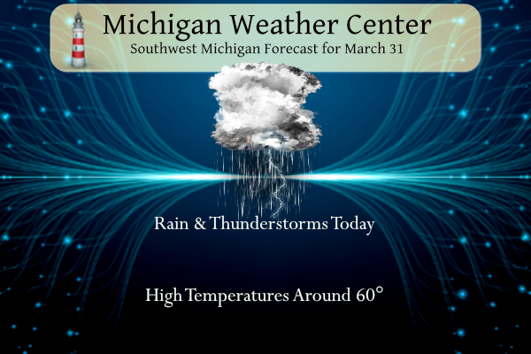
Rounds of showers and thunderstorms will affect Lower MI through tonight. Among storms this evening, there is a low risk for a few severe thunderstorms, mainly across southwest Lower MI. In this area, isolated 1″ hail and isolated damaging winds are possible in any stronger storms. An isolated weak tornado cannot be ruled out. Saturday will be windy across much of western Lower MI; gusts of 40–55 mph are likely.

Grand Rapids Forecast
3 31 grrLansing Forecast
3 31 lanKalamazoo Forecast
3 31 kzoForecast Discussion
-- Showers/storms through this evening then windy and colder --

We really have not seen much in the way of changes to the thinking
for this period of active weather through tonight. The gist of our
thinking is we will see rounds of showers and storms through about
midnight tonight, some of which could become strong mid-late evening
the further SW you go.

So far this morning through 330 am, we have seen plenty of scattered
to numerous showers develop overhead. There has only been one or two
cells with isolated lightning so far in our area. We expect an
uptick in thunderstorm potential over the next few hours. Better
instability with the low level jet nosing in will be crossing the
area through 12z and just a little beyond. The line of convection
over IL and WI is likely the peak of this period of storms this
morning. This will be all elevated, with only some smaller hail and
heavy downpours likely.

We will see a relative lull in the widespread showers and storms
from mid morning through later this afternoon. Scattered showers
will persist on and off through the afternoon. Then, more widespread
showers and storms should develop/move in after 21-22z from the SW.
This will be the case as the next low level jet with the main system
noses over the area at that time.

As far as severe potential is concerned, we continue to think that
the SW corner of the area is favored. We still believe that the
threat is kind of lower, but not zero. The main show for our region
remains over toward Eastern Iowa, NW IL, and SW WI where the sfc low
and front will initiate convection during peak heating in the warm
sector. That line, and additional storms will make a move toward the
area. We should have a band of storms develop before that line along
almost a secondary warm front that will form just to our south.

The elevated convection ahead of the main line will temp the heating
and instability a bit compared to further SW. In addition, by the
time the line gets here, it will be mid-late evening when we lose
any diurnal boost to the temps. The line will be moving into an
increasingly stable environment in the lower levels, keeping the
threat of severe weather limited. We feel the best chance of severe
will be some wind that is left over with the line that could barely
reach our area before diminishing more. Better sfc based instability
will stay south of the area, in the secondary warm sector ahead of
the cold front.

We do think there will be a burst of wind up to about 40 mph
immediately behind the front for a short while after midnight. This
will be with the pressure rises behind the front, and in the dry
slot of the system. A little bit of light precipitation starting as
rain, and changing to light snow on Saturday will be present as the
wrap around cold conveyor belt moves over the area. This will be
accompanied by 40-55 mph winds, especially along the lakeshore. We
foresee a wind advisory being needed for this. It will be more
appropriate for the day shift today to issue based on lead time
guidelines.

-- Unsettled weather for Sunday through Monday --

High pressure will build in quickly by Saturday night, before moving
out on Sunday. We have been mentioning that we get into a semi-zonal
pattern for a couple of days behind the strong system for today. The
models have been showing a wave moving by just to our north for the
Sunday night time frame. The latest trends show it bringing some
light precipitation to the northern half of the area after 00z Mon.

Another batch of precipitation, mainly rain will then affect the
southern half of the area late Monday afternoon and night. This will
be the initial rain that occurs with a wave riding along a
developing warm front as the large upper system out west organizes
and lifts toward the area.

-- Another strong storm likely next Tuesday/Wednesday --

A large long wave upper low becomes established across the Rockies
by Tuesday. This forces the upper air pattern to change from the
zonal flow early next week, to a strong SW flow for Tuesday and
Wednesday. This will draw plenty of moisture and warmth northward
over the area. We are looking at a warm and wet period for Tuesday
into early Wednesday. Severe weather is also possible with plenty of
instability expected to be around, strong shear profiles, and the
strong forcing with the system.

Much cooler air will follow then for Thursday in the wake of the
storm system. Much of the wrap around precipitation with the upper
low should stay just north of the area.
Lousy night of Tornado damage in several states. Hoping for a bit more sound/light in Ada…just a few flashes and a rumble or two. Light rain.
Severe thunderstorm warning here. Not much wind but lots of lightning strikes.
Yes, lightening and thunder here in Comstock Park.
What? No 60 degree days in March? The cool pattern continues to rock! Wow!
12 consecutive months with above average temps here.
Crazy! We had 110 inches of snow this winter with slightly above normal temps! What a winter!
Hit 61 here today. Officially 62 in Holland.
https://w1.weather.gov/data/obhistory/KBIV.html
Did anyone hear the thunderstorm at around 6:45 AM this morning? I was wondering if there was hail at that time.
Yes. Not sure. My mom said the same thing though. She wasn’t sure either.
MV is, but anyone else getting lightning and thunder?
Yes we are getting thunder and lightning.
Wow tornado emergency for that tornado in western Tennessee!
Looks like Bennet, IA may have just taken a hit. Large debris ball on radar
Just sighted a tornado near Iowa city. It was fairly large. Lost sight of it now.
* Severe Thunderstorm Warning for…
Northern La Porte County in northwestern Indiana…
Southwestern Berrien County in southwestern Michigan…
* Until 645 PM EDT/545 PM CDT/.
* At 548 PM EDT/448 PM CDT/, severe thunderstorms were located along
a line extending from near South Deering to near Lakes of the Four
Seasons to near Wheatfield, moving northeast at 65 mph.
HAZARD…60 mph wind gusts and half dollar size hail.
Typically cool and wet in GR with big storms just to our south ….. INDY
It is so calm ( I know before the storm). Temps are nice right now!!!
Humid too. Sure feels like spring.
Whoa, O’Hare airport has issued a ground stop for all air traffic due to incoming severe weather.
I just heard them say that on Ryan Hall
My daughter is at college about 10 miles from O’Hare, so I’m keeping a close eye on that area.
I bet…I would be too.
March will end up as yet another month with well above normal snowfall for GR! Definitely a snowy, cool month! Wow to the wow, WOW!
In looking at the radar trends (I know so old school) anyway the radar is now showing two areas of storms racing to the NE that would be towards our area. At the current time it is now 60 in far SW Michigan and up to at least 57 in Holland and 53 at GRR but so far here in MBY the temperature is stuck at 50 with a light mist falling. Up date GRR is now up to 54, Holland 59, Benton Harbor 63, Kalamazoo 59 Lansing 55 but it is still just 50 here in my yard.
Slim
Wood shows low 20’s tomorrow night! The UP is in a winter storm warning! Possible 12 inches plus! What a winter and it just keep keeps going! Incredible snowfall totals this year!
Breaking news>>>>it is still winter in MI wow the wow!
https://forecast.weather.gov/showsigwx.php?warnzone=MIZ006&warncounty=MIC003&firewxzone=MIZ006&local_place1=Munising%20MI&product1=Winter+Storm+Warning&lat=46.4102&lon=-86.6507#.ZCcreC0pDi0
Its cloudy for me rn. Barely windy. I’m in the slight risk for severe weather. Hopefully I’ll get to see some lightning, it fascinates me. But I hope there won’t be any tornadoes, as the town I live in is small (really small) also, the town I live in is inside Jackson County.
Ryan Hall is on now. He just said, “Major tornado outbreak is about to occur. Everything is off the charts.” He thinks only one time previously was there two high risk areas on the same day. It could be the biggest severe weather outbreak in the past decade.
Well my previous comment from 5 hours ago is not aging nicely…
Thank you GR NWS for the extremely accurate temp readings and comparisons!
Just outside Davenport, IA currently at a Loves Travel Center. Watching and waiting.
Memphis Public Schools closed early so the kids can get home.
High Risk! I’m in Western Illinois now. 66 degrees.
Oh my goodness.
The moderate risk areas around the Quad Cities and Memphis will be upgraded to tornado-driven high risk:
https://www.spc.noaa.gov/products/md/
https://www.spc.noaa.gov/products/md/md0390.html
https://www.spc.noaa.gov/products/md/md0392.html
Thanks for the update. Here in my MBY the temperature has now reached 50 so yes 60 is sure in reach later today.
Slim
Sounds pretty ominous. 🙁
50 here now too. The temp has increased quickly.
Sounds scary. Ryan Hall will be going live at 3pm
Looks like he’s moving up one hour – perhaps because of the high risk areas? I just opened the live feed and it has a countdown clock – T Minus 43 minutes….
You would think I could get some commission or something for spreading the word on his site. 😂
I’m right there with you. I have shared his site with several friends and relatives.
LOL!! Cool!!! You know what he can have my share, I know he takes stuff to those in need after a disaster.
Great job GR NWS with your accurate temp readings! I always check their site due to the fact it is extremely accurate and it is the main office for SW Lower MI! Keep up the great work!
The official temperatures at the airport are similar to what I have here in Walker. The departure issues started with the new 30 year averages so any issues are with how the the past records were tabulated not so much the current readings.
Slim
I would like to add that Lansing in the past was on average colder than GR.
Slim
Rock on Slim- their reading are spot on accurate and always have been!
Even NWS GR is aware of their temp departure issues – as we have illustrated many times on here.
The issues seem to have started with the new 30 year averages.
Slim
The current temperature here in MBY is now at 47. Temperatures are in the mid 50’s in Holland and Kalamazoo so the warm front is close by. So far Grand Rapids has had 0.75″ of rain fall, Lansing 0.60″ and at Holland .089″.
Slim
Amazing no 60’s in the month of March im thinking thats been awhile since this has happened but record snows have fallen I always say April is more the transition month then March and sure shows .. If we dont get any sun today 60’s will be out the window and so wlll a good thunderstorm….INDY
With the warm front close but and if we get into the warm sector than there is a chance that we could get into the 60’s for a few hours later today. Here is a fun fact the last time GR got up to 60 or better was on November 10th the high that day was 75 so that was also the last day it reached 70 or better. The average day for the 1st 60 day since 2000 is March 8th.
Slim
Detroit hit 74 degrees three times in November, 55 degrees in December, 60 degrees in January, and 60 degrees in February. Wow! What winter?
It’s possible the high risk area may be needed in parts of IL and IA.
I am currently in Illinois where there are breaks in the overcast with a current temp of 61.
The slight risk area has been expanded further northeast into the area, and the enhanced risk clips the very SW portion of the state
We will see how this all plays out.
https://www.spc.noaa.gov/
Slim
It’s all but confirmed. March will go down as another warm month for Lansing and Detroit (I no longer follow GR for temp departures due to their ongoing issues). I believe this will mark the 11th straight warm month in a row!
Just when I thought we wouldn’t hear any thunder here, Mother Nature just reminded me whose in charge.
It has been on and of thundering here all morning. One I call a house shaker came through earlier.
Just one rumble here so far.
Wow WOOD has 66 degrees for Wednesday now!
Warm weather and storms to close out March!
Guess March is heading our like a very Wet Lion!
Looking at the graphic above, Jonesboro, AR is in the bullseye. It’s been three years almost to the day since Jonesboro was slammed by a EF-3 tornado.
The worst of the storms today should stay to the SW of our area. Any storms that do get here should be elevated storms that don’t care that there is a cold lake to the west. But remember under the right conditions severe storms can get here in the early season remember 1956 and 1965. At the current time there is light rain falling with a temperature of 41.
Slim
This severe weather season is starting out quite intense. Hopefully nothing like 1974 or 2011…
Also I’ve seen a few flashes of lightning here and we are up to 42 now. Looks warm this afternoon and then very chilly for tomorrow
The official H/L yesterday at GR was 46/17 there was 0.06” of rain fall and a reported trace of snow fall. There was 72% of possible sunshine. For today the average H/L is 51/32 the record high of 78 was set in 1986 and 2010 the record low of 6 was set in 1923. The record snow fall of 3.7” fell in 1951..
Slim
That official low of 17 (the low was 16 here in MBY) at Grand Rapids yesterday was the 7th coldest at Grand Rapids Yesterday I reported it as being the 9th coldest but there were ties with 2 years at 14 and 2 years at 16. The official low at Lansing of 18 was the 10 coldest once again ties and Lansing records go back to 1964. And at Muskegon the low of 19 was the 5th coldest for any March 30th there.
Slim