Welcome To April
April is sort of a birthday month in our family as my dear departed month was born on April 7th My wife was born on the 22nd and my youngest son waw born on April 1st In 1986 the year my son was born the month of March 1.0° above average but the last 4 days all had highs in the 70’s with it being 78 on the 31st That month there were still large parking lot snow piles on March 31st I have a picture of my wife on that day she went into labor just after midnight.
We now have flipped the calendar to April. April is the first true month of spring. We gain about 1hour and 22 minutes of daylight. And the average daily H/L goes up from 52/32 to 64/43 buy the end of the month. Remember that is the average H/L it can be colder and or warmer. The record high for the month is 90 on April 29, 1899 it was as warm as 88 on the same day in 1970. The record low of +3 was recorded on April 7th 1982 the next night it was down to +7. It was 16 as recently as April 2nd 2021 and 16 on April 8th 2018. The average mean temperature for April is 47.6 the coldest top 5 are 1907 with a mean of 37.6, 1950 with a mean temperature of 39.6, 1975 with a mean of 39.8, 2018 with a mean of 40.1 and 1926 with mean of 40.4. The warmest means for April are 53.8 in 1915, 53.7 in 2010, 53.3 in 1996, 52.8 in 1955 and 52.0 in 1921. The wettest Aprils 11.10” in 2013, 8.29” in 1909, 6.69” in 1999, 6.33” in 1947 and 6.27” in 2017. The driest Aprils are 0.39” in 1942, 0.77” in 2005 and 1899. 0.85” in 1915 and 0.98” 1932. The snowiest Aprils are 15.6” in 1961, 12.4” in 1982, 11.2” in1926 10.5” in 1952 and 10.1” in 1936. There have been several years with no snow fall in April, the last time that happened was in 1998. There have been two major tornadoes to hit west Michigan in April. The April 3 1956 storm and the April 11, 1965 Palm Sunday storm. There is a very good bet that it will make it into the 70’s in April as only 3 years did not get that warm. And there is a good bet that it will get down into the 20’s as there have also been only 3 years that did not get that cold. Last year April was a cold one with a mean of 43.6 that is a departure of -4.0 the high for the month was 82 on the 23rd and the low was 23 on the 2nd there was 0.4” of snow fall. There were a total of 16 days that did not reach 50 and 4 days that did not reach 40. At night there 13 lows below 32. So now we will see how April 2023 will play out.
AREA FORECAST DISCUSSION
NATIONAL WEATHER SERVICE GRAND RAPIDS MI
308 AM EDT SAT APR 1 2023
LATEST UPDATE…
DISCUSSION/MARINE
DISCUSSION
(TODAY THROUGH NEXT FRIDAY)
ISSUED AT 308 AM EDT SAT APR 1 2023
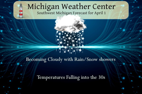
– WINDY WITH FALLING TEMPERATURES TODAY –
STRONG SW WINDS WILL GRADUALLY VEER TO THE NW WITH FALLING TEMPS
THROUGH THE DAY. TEMPS WILL FALL INTO THE 30S THIS AFTERNOON. THIS
WILL CAUSE SCATTERED RAIN SHOWERS WHICH WILL DEVELOP ON THE BACK
SIDE OF THE DEPARTING SYSTEM LATER THIS MORNING AND AFTERNOON TO
BECOME MIXED WITH/CHANGE OVER TO SNOW SHOWERS BEFORE PCPN ENDS
THIS EVENING. NO SNOW ACCUMULATION IS EXPECTED. WIND GUSTS WILL
REACH THE 30 TO 40 MPH RANGE WITH SOME HIGHER GUSTS TO NEAR 45 MPH
EXPECTED PARTICULARLY NEAR THE LAKE MI SHORELINE.
– FAIR WEATHER RETURNS TONIGHT THROUGH MONDAY –
A RIDGE OF HIGH PRESSURE WILL BUILD IN TONIGHT AND BRING A RETURN
TO TRANQUIL WX AND DIMINISHING WINDS OVERNIGHT. TRANQUIL WEATHER
WILL CONTINUE MONDAY ALONG WITH SOMEWHAT MILDER TEMPS AS SOUTHERLY
WINDS DEVELOP ON THE BACK SIDE OF THE DEPARTING RIDGE.
– RAIN AND A CHANCE OF STORMS LATE TUESDAY/WEDNESDAY –
ISENTROPIC UPGLIDE TO THE NORTH OF A WARM FRONT WILL RESULT IN
POTENTIAL FOR SCATTERED RAIN SHOWERS MONDAY NIGHT AND TUESDAY. A
COLD FRONT APPROACHING FROM THE WEST WILL BRING POTENTIAL FOR
SCATTERED SHOWERS AND THUNDERSTORMS TUESDAY NIGHT INTO WEDNESDAY.
MUCH COLDER WX WILL BRIEFLY RETURN THURSDAY WHEN HIGH TEMPS WILL
ONLY REACH THE MID 30S TO LOWER 40S
Detailed Forecast For Grand Rapids
Today
A chance of rain after 7am, mixing with snow after noon. Increasing clouds, with a temperature falling to around 38 by 5pm. Breezy, with a west southwest wind 11 to 20 mph, with gusts as high as 36 mph. Chance of precipitation is 40%.
Tonight
Mostly cloudy during the early evening, then gradual clearing, with a low around 23. North wind 5 to 14 mph, with gusts as high as 24 mph.
Sunday
Mostly sunny, with a high near 50. South southeast wind 5 to 13 mph, with gusts as high as 23 mph.
Sunday Night
A 20 percent chance of rain. Mostly cloudy, with a low around 41. Breezy, with a south southeast wind 11 to 16 mph increasing to 19 to 24 mph after midnight. Winds could gust as high as 37 mph.
Monday
A 20 percent chance of rain after 2pm. Partly sunny, with a high near 56. West southwest wind 10 to 13 mph.
Monday Night
Rain likely, mainly after 2am. Mostly cloudy, with a low around 40. Chance of precipitation is 60%
Detailed Forecast For Holland
Overnight
Mostly clear, with a steady temperature around 44. Breezy, with a southwest wind 21 to 23 mph, with gusts as high as 43 mph.
Saturday
A chance of rain after 7am, mixing with snow after noon. Some thunder is also possible. Increasing clouds, with a temperature falling to around 38 by 11am. Breezy, with a west southwest wind 16 to 23 mph, with gusts as high as 34 mph. Chance of precipitation is 40%.
Saturday Night
Mostly cloudy during the early evening, then gradual clearing, with a low around 24. North wind 10 to 15 mph becoming light after midnight. Winds could gust as high as 25 mph.
Sunday
Mostly sunny, with a high near 51. Southeast wind 5 to 11 mph, with gusts as high as 21 mph.
Sunday Night
A 20 percent chance of rain. Mostly cloudy, with a low around 41. Breezy, with a south southeast wind 14 to 24 mph, with gusts as high as 37 mph.
Detailed Forecast For Lansing
Today
A chance of rain after 7am, mixing with snow after noon. Increasing clouds, with a temperature falling to around 38 by noon. West wind 10 to 16 mph, with gusts as high as 30 mph. Chance of precipitation is 40%.
Tonight
Mostly cloudy, then gradually becoming mostly clear, with a low around 23. North northwest wind 7 to 15 mph, with gusts as high as 24 mph.
Sunday
Mostly sunny, with a high near 48. Light east southeast wind becoming south southeast 8 to 13 mph in the morning.
Sunday Night
Mostly cloudy, with a low around 42. Breezy, with a south southeast wind 13 to 23 mph, with gusts as high as 34 mph.
Monday
A 30 percent chance of rain after 2pm. Partly sunny, with a high near 59. West southwest wind around 14 mph.
EF-0 tornado confirmed in Dundee, MI between 11:03 and 11:08 this morning with peak winds of 80mph.
April first and the current wind chill is 28 cold degrees! Now that is incredible April cold!
I read that there were 130 tornado warnings and a total of 270 severe weather warnings issued yesterday. That is almost unbelievable.
Here is a list of some of the most tornadoes in the past for comparison. This in not warmings but the the number of tornadoes.
https://en.wikipedia.org/wiki/Tornado_records
Slim
Nice link. Thanks Slim.
On the avarage GR first 60 degree day is March 7th so the cool stretch continues… I believe GR a first avarage 70 degrees is today not seeing any 70’s as far as the eye can see so a new stretch starts coud you all imagine if the 1st inch of snow little streaky was a going it would be crazzy as all get out on here lol!! Basically in a nut shell our cool Spring continues and Thats okay with the INDay..
I work for the Whitecaps and as luck would have it the one warm day next week is before opening day. But for the opener it looks to be COLD.
Slim
Slim my daughters both work at the whitecaps they love it!! Small world…INDY
Thanks for the facts about the cool weather and no 60’s yet! This is a quite a stretch for a warm weather drought! Wow just wow! Let’s see another snowstorm!
The updated CPC outlook is out for April. It shows generally near average temps. The 6-10 and 8-14 are below average, so maybe that indicates a warm second half of April… we will see
I see that with the CPC long range guess. But in Looking at the CFSv2 weekly long range guess it looks like the first half of April could be cold with a possible warm up mid month and then average at the last week. We shall see.
https://www.cpc.ncep.noaa.gov/products/people/mchen/CFSv2FCST/weekly/
Slim
Yes forget about a nice warm beginning of April! The cool pattern continues!
The Soo is still getting pounded with snow! Wow just wow!
https://forecast.weather.gov/MapClick.php?lat=46.4923&lon=-84.3517#.ZCg_OC0pDi0
Golf? Yes, golf weather is getting closer. In a week or two I may dust off the clubs! Who would have thought?
Slim like you we have quite a few bdays in April. One being on the 22nd and 2 on the same day.
Need to check in on some family down south this morning.*Update* tornado missed family by 1/2 mile in TN. They are all ok.
Happy April!!!
One cool day on Thursday and right back to normal and above normal temps!! Golf, here I come!! Bring it!!
https://weather.com/weather/tenday/l/b523690bfd952b86fef3627c919dd9855281a8da16b83c10bdd381c64ae12cbc
1.95 inches of rain from this storm system with lots of thunder and lightning especially last night. I have a sneaking suspicion this is going to be an active storm season this spring.
It certainly has been active so far.
Wow!! What a storm!! Hours of thunder, lightning and heavy rain!!! Forget cold and snow and enjoy the light show and new life of SPRING!! Looks like round 2 of thunderstorms coming Tuesday and Wednesday!
A lot of heavy rain fall. Some lightning (must have been more to the southeast of GR) This should green up the grass but then again it is now April so that is expected. Will see how the mid week system plays out.
Slim
Yesterdays event is an event I won’t soon forget. There was a total of 737 reports of severe weather which is insane. I called in the tornado and was on the phone with NWS Quad Cities when the tornado was heading into Coralville.
I saw your pic on Facebook, that’s crazy! Have you seen any of the damage yet? I saw some pictures and it looks like EF-3+ easily in some of those storms
Well I got a great photo of a stovepipe tornado just before it moved into Coralville, IA which is the northwest side of Iowa City. I was about a quarter mile from the tornado itself as it crossed into a populated area. Sadly there are homes and businesses destroyed.
With all of the March snowfall and record breaking daily snowfall this season it has been a wild snowy winter!
I went to pick up my daughter from work last night at 9:30 (driving from Hamilton to Zeeland). I was about 1 mile down the road from my house, going about 50 mph when the sky just opened up. At one point, it was pouring so hard that I had to slow down to about 20mph and could only see about 10 feet in front of my hood! Rain was driven by strong winds, which only made it worse. I made it to the Hamilton gas station about a mile down the road and sat under the canopy until it… Read more »
With yesterdays record rainfall, I believe each month this year so far has had a day or two with record breaking rain, including January and February. We had just under 2 and a half inches, fields are flooded everywhere. It did hit 61 here yesterday and looks like Hollands official high was 62.
Lots of standing water in these parts too.
The warm front was around the Grand Rapids area. I was on the south side of town last night during the heavy rain none the less. And it was 57° near 28th street and when I got home it was just 52 it looks like that 52 was the high here at my house.
Slim
Forest Akers, MSU’s golf course, opened two weeks ago. Just drove by it and many of the holes are under water. Safe to say it’s going to be closed for a bit.
WOOD shows a big cold front coming through by the end of next week! Wow just wow, WOW! What a winter!
Yesterday was CRAZY. It was an event that won’t soon be forgotten. Just one tornado warning after another. It was continuous. Monster tornadoes. I have never see anything like it. Severe weather from Michigan and Wisconsin all the way down to Texas. 700+ reports of severe weather. Multiple fatalities, unfortunately. Catastrophic damage. It was unbelievable. Meanwhile at home, we had a dandy of a storm. Several hours of lightning and ton of rain. Spring kicked off with a big bang. It’s a good day to roll the lawn. Have a great day everyone, and make someone smile. 😀
Not much here other than rain and minimal thunder and lightning! No big deal at all! Now for UP it has been a blizzard for hours on end! Now that is INCREDIbLE!
Wow! I didn’t realize there were that many severe reports. I think April 27, 2011 was around 1000, but besides the 2011 outbreak, this is the most daily reports I remember since maybe the 70s?
Last night might have been close to the storms on Palm Sunday 1965 for sure. There was some lightning and thunder here but really not all that much.
Slim
Slim that is a lot of birthdays to keep track of in one month. Today would be my grandpas 106 birthday, it’s easy to remember because it’s on April fools day.
Forget thunderstorms, it is still winter in the UP! Check this out! What a winter!
https://forecast.weather.gov/showsigwx.php?warnzone=MIZ087&warncounty=MIC033&firewxzone=MIZ087&local_place1=Sault%20Sainte%20Marie%20MI&product1=Winter+Storm+Warning&lat=46.4923&lon=-84.3517#.ZCgD6y0pDi0
Yesterday’s official H/L at Grand Rapids was 58/39 That 58 was set around 9:30 last night. There was a new record rain fall of 2.02” there was no sunshine yesterday. Overnight the peak wind gust looks to be 43 MPH the temperature was in the upper 50’s just 2 hours ago but is now down to 41 here in MBY. For today the average H/L is 52/32 the record high of 82 was set in 2010 and the record low of 13 was set in 1954. The record snow fall amount of 4.8” fell in 1972. Last year April Fools… Read more »
Record rain fall at Grand Rapids. With several rounds of thunderstorm with heavy rain fall a new record was set for March 31st at Grand Rapids with a total of 2.02” the old record of 1.17” fell in 1967.
Slim
Looking back at March 2023 the mean at Grand Rapids was 35.4 the high for the month was 58 set on the 31st the low for the month was 15 set on the 18th there was a total of 5.22” precipitation of that there was 23.3” of snow fall that was the most snow fall since 1971. It was the 1st time it did not reach 60 or better since 2018. At Lansing the mean for the month was 35.8 the high for the month was 58 set on the 31st the low for the month was 18 set on… Read more »