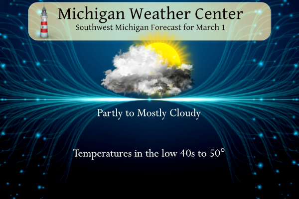
Our first day of meteorological spring will feature a wide spread of temperatures. Skies will be partly to mostly cloudy after the precipitation ends this morning. Highs will range from around 40 over Central Lower Michigan to around 50 over Southern Lower Michigan.
Weather History for SW Michigan
February 26
2000: Record-warm weather continues during a week-long spell of balmy weather across Lower Michigan. The temperature hits 66 degrees at Muskegon for a record high. The low temperature at Grand Rapids is 53 degrees, setting a record for the warmest low temperature for the month of February.
February 27
1976: Temperatures soar to the upper 60s during a spell of spring-like weather during the last week of February. Record highs included 62 degrees at Muskegon and 67 at Lansing.
February 28
1998: Record-warm temperatures include the high of 53 degrees at Muskegon and 54 at Grand Rapids, helping to make this the warmest February on record at those sites.
March 1
1882: March comes in like a lamb with high temperatures in the 60s. Lansing hits 64 degrees and goes on to reach 66 degrees the next day. This continued the warmth from the previous month, which was the warmest February on record at Lansing.
1962: Bitterly cold weather begins the month with morning lows below zero and high temperatures only around 10 degrees.
March 2
2002: A strong low-pressure center moves across the Ohio Valley bringing record snows to Lower Michigan. Grand Rapids has 13. 9 inches and Muskegon 10.5 inches, both set records for their snowiest March day on record.
March 3
1943: Arctic air dominates the first ten days of the month. Record cold temperatures this morning including the 10 below zero at Muskegon and the 9 below at Grand Rapids.
1983: Record highs are set across Lower Michigan with Grand Rapids hitting 72 degrees and Muskegon 69 degrees. The first week of March is incredibly balmy with six straight days of high temperatures of 60 or above at Grand Rapids.
March 4
1912: Subzero cold continues during one of the coldest months of March on record across Lower Michigan. Muskegon sets a record low of 2 below zero on this morning, during a spell of five straight days below zero.
Weather History for SE Michigan
February 26
On February 26, 2020, a long-duration snowstorm occurred with widespread reports of 3 to 6 inches of snow over much of the county warning area.
On February 26, 2019, a snowstorm brought about 2 to 4 inches across areas along and north of I-69, while areas to the south saw 2 inches or less.
On February 26, 1944, the temperature rose to 68 degrees at Detroit Metro airport. This is a record maximum temperature for the month of February in Detroit.
February 27
On February 27, 1994, the overnight temperature dropped to a frigid -14 degrees in Flint!
February 28
On February 28, 2015, residents of Southeast Michigan woke up to low temperatures of -2 degrees in Detroit, -4 in Flint, and 3 in Saginaw. The low in Detroit was a record for the date, which also rounded out the coldest February on record for Flint (11.3 degrees monthly average temperature) and Saginaw (11.5 degrees). The average in Detroit was 14.1, good enough for its 2nd coldest February on record behind 1875.
Also on February 28, 1974, a tornado hit Wayne County at 5:25 PM. Although the strength of the tornado was not recorded, this is still an impressive event to have happened in Michigan during the winter and is the earliest date of a recorded tornado in southeast Michigan.
March 1
On March 1, 2018, heavy, wet accumulating snow fell. Many areas only received between 1 and 3 inches of accumulation. However, the elevated terrain of Oakland, Washtenaw, Livingston, and far western Wayne County cashed in during the most intense portion of the storm. Rates briefly reached 1-2″/hour resulting in a relatively small corridor of 6-8″ from Ann Arbor to Wixom to White Lake. A peak measurement of 8.5″ was taken near the town of Wixom.
Also on March 1, 2016, yet another significant snowstorm occurred despite all of SE Michigan being 1 day removed from one of its warmest winters on record. Over a foot fell in the Thumb with Harbor Beach topping the list at 14 inches. Virtually everyone north of M-59 received at least 6 inches. At 9.5 inches, it ranks 22nd on the all-time list of snowstorms for Flint.
Also on March 1, 2014, light snow intensified during the afternoon and peaked in intensity overnight. Rather uniform snowfall totals of 3 to 4.5 inches were observed, although much of Bay and Midland Counties measured less than an inch.
Also on March 1, 1900, a snowstorm dropped 14.0 inches of snow on Detroit. This storm was the 4th heaviest snowstorm in Detroit history. It lasted from February 28th-March 1st. The storm was the second storm in a series of remarkable snowstorms which saw the 7th heaviest snowstorm on February 19, 1900, and then the 3rd heaviest snowstorm on March 4-5th, 1900. In fact, in that week period (Feb. 28th-Mar. 6th), more than 34 /34.2/ inches of snow fell on Downtown Detroit (see more on March 5th)!
Also on March 1, 2007, a winter storm left the thumb region with 2 to 4 inches of snow and up to 1 inch of ice. Thousands of people were left without power in the worst ice storm in the thumb since 1976.
March 2
On March 2, 1962, the overnight temperature dropped to a freezing -12 degrees in Saginaw, which is the record minimum temperature for the month of March in Saginaw!
On this date in 1976 a major snow and ice storm hit the Saginaw Valley and Thumb regions. The storm started on March 1 and continued through March 2. Snow fell first with anywhere from 2 to 10 inches. That was followed by about a half-inch to one-inch of glazing from the ice storm. The storm was accompanied by high winds. The storm struck a 29-county area in the central Lower Peninsula. This storm, one of the worst to ever hit the state, caused more than 56 million dollars in damage and widespread power outages for more than 400,000 electric customers. The storm impacts were so severe that a Presidential Major Disaster Declaration was granted for the 29 affected counties to assist in the recovery.
In 2006, parts of Tuscola county had reports of 12 inches of snow on March 2.
Also on March 2, 2010, Detroit had a high temperature of 39 degrees. While this high temperature is usually not noteworthy, it marked the only high temperature for Detroit in the month of March 2010 that did not get 40 degrees or higher, which is a record for Detroit in March. March 2010 was one of the nicest on record with Detroit having the eighth warmest, eleventh driest, and least snowiest March.
March 3
On March 3, 2014, Flint set a new record for its coldest temperature ever recorded in the month of March. The temperature fell to -16 degrees. Meanwhile, Detroit only fell to zero degrees while a temperature of -6 was observed in Saginaw. Neither were records.
Also on March 3, 2002, the coldest temperature of the season hit Detroit with a reading of -4 degrees.
March 4
March 4 has seen many snowstorms across Southeast Michigan. Snowstorms occurred in 1895, 1899, 1900, 1985, 1999, 2003, and 2008. Many of these storms rated in the top 25 heaviest snowstorms including:
Detroit in 1900 received 16.1 inches of snow for 3rd heaviest snowstorm
Detroit 1895 12.3 10th
Detroit 1899 11.4 15th
Flint 1999 9.1 14th
Saginaw 1985 12.0 16th
Forecast Discussion
-- This morning through Thu --

Mainly light precip continues to advance northeastward over the
forecast area as of 3 AM Wed. This precip is being maintained by
modest low/midlevel frontogenesis along a W-E-oriented baroclinic
zone over the southern Great Lakes. While some mesoscale banding
is evident, precip over southern Lower MI also exhibits a
cellular/showery presentation, and a few recent lightning strikes
have occurred as close as Cass County. Weak elevated instability
(MUCAPE < 100 J/kg) is noted in RAP profiles over IL/IN, but
guidance suggests that this instability will make little northward
advance.

The surface wet-bulb 0C isotherm runs approximately along the I-96
as of 3 AM. This suggests that areas north of I-96 have the best
chance of light accumulations this morning. Some locally
slick/slushy road conditions are possible, mainly if any brief
heavier bursts of snow occur. Short-range guidance suggests that
this ongoing activity will likely exit the area by late morning.

Meanwhile, the closed 700-mb low over SD this morning will continue
eastward today while evolving into an open wave. Guidance suggests
that ascent ahead to this feature should be sufficient to support
some rain/snow showers tonight. Dry weather is then expected on Thu
as surface high pressure passes north of the region.

-- Fri system --

A diffluent mid/upper trough currently over OR/northern CA will
continue to dig/amplify today while evolving into a closed low,
reaching the vicinity of AZ/NM by 12z Thu. In response the
approach of this feature, a surface low will consolidate over the
Southern Plains on Thu. This surface low will then propagate
northeastward along the baroclinic zone, while the associated
mid/upper trough becomes negatively tilted by Thu night.

Forecast confidence remains subdued regarding the particular impacts
of this system across the forecast area. Ensemble-mean (EPS and
GEFS) surface-low positions continue to exhibit run-to-run shifts,
with particularly notable waffling in recent GEFS runs.
Additionally, the latest (00z Wed) EPS-mean surface low is
positioned well northwestward of the GEFS mean at 06z Sat. These
factors lend uncertainty regarding overall precip amounts as well
as thermal profiles, with further implications for snowfall
amounts and the delineation of possible precip types.

The axis of heaviest ensemble-median snowfall (using a simplistic
10:1 SLR) in the EPS has been more consistent than in the GEFS.
Across the forecast area, EPS-median values range from 3-8"
(highest in central Lower MI). Regarding precip types, the 00z
deterministic ECMWF depicts a scenario with a rain-snow line over
the southern forecast area, while recent GFS solutions continue to
signal the possibility of sleet and/or light freezing rain in
this same area in conjunction with the arrival of an elevated
warm layer.

While precip-related details remain uncertain, confidence is higher
that strong winds will likely be a factor on Fri afternoon/evening,
with latest EPS-mean gusts ranging from around 35 mph in the
northern forecast area, to near 45 mph along I-94. The specifics of
wind-related impacts (e.g., possible blowing snow) will depend, of
course, on details of precip types and amounts.

Lastly, regarding hydrology impacts with continued wet/active
weather, several area streams and rivers are at bankfull, while
others are expected to reach bankfull in the days ahead. However,
area streams/rivers are not expected to reach flood stage. Latest
river-stage observations and forecasts (when available) can be
accessed via the "Rivers and Lakes" link from weather.gov/grr

-- Slight chance of snow Sat, then dry Sun --

Ensemble guidance continues to suggest that snow is possible on Sat
afternoon/evening as a midlevel impulse approaches the region. Dry
weather is expected on Sun as a mid/upper ridge axis approaches and
high pressure settles south of the region.

-- Rain/snow possible Mon --

ECMWF and GFS solutions suggest that another surface low will
develop in the CO plains on Sun, then continue eastward toward the
region on Mon. Across the forecast area, a sizable number of
ensemble members produce light precip on Sun night and Mon, with
rain/snow both possible.
WINTER STORM WATCH!! INDY
Who knew?
Venus & Jupiter beautiful tonight!!!
There are some people still with no power in Hillsdale County. Some have been out a full week. There are also new outages popping up even today. Likely tree limbs still coming loose that were hanging. Monster ice storm! Hope everyone is restored soon.
Anbody see the long range out look BLUE through mid March could you imagine it was red the word blow torch would be said on here a 100 times already lol…INDY
Actually cold all month, so no blowtorch – it will
be an ICE BOX!
+1000….INDY
Just went out to eat in GR, had some sunshine there when we were out to eat. If it would have come out earlier it would have been much warmer today. Back east again at my house and it’s cloudy here.
Snowing and temps in the 20’s in parts of MI! Wow!
– Impactful Storm for Friday Afternoon into Friday night This dynamic system will be featuring a coupled upper level jet… FGEN in the DGZ and favorable Div Q fields for a swath of heavier qpf in the CWA. There may even be some instability around when the system arrives. Uncertainty still exists with the track of the low but the GFS and ECMWF are closer with the tracks now, showing the low tracking from Central IL to near Toledo. This is a favorable track for heavier snow for much of the southeast half of the CWA. The Canadian model is… Read more »
Up to 57 degrees in Michigan right now! Hello spring!
Get ready – a snowstorm this week and next week the below normal temp pattern gets locked in for weeks! Wow, just wow!
The latest EURO absolutely hammers us with snow! I love long winters with above average snowfall! What a winter and it keeps coming and coming! It is going to be a wild month! Get ready and don’t expect an early Spring! Rock n roll will never die!
Up to 54 degrees in Southern Lower Michigan so far today!
In the NWS Detroit writeup, I see they had their 4th warmest February ever recorded along with the 6th least snowy February. Wow!
Good morning, people! Still so much uncertainty about Friday’s system. Local TV met said this morning he’s still thinking rain/snow mix for us, but that could change. No freezing rain anticipated, fortunately. I think we’ve had enough of that for this season.
I am enjoying the sun peering through the thin clouds. We have many sandhill cranes in this area and they are quite vocal this morning.
Have a great day, everyone. And remember, make someone smile. 🙂
Mark,
I have noticed the sounds of the sandhill cranes. Reminds me of my Dad. We would always talk about them and the weather!!
I love the sound of sandhill cranes. I haven’t heard any in this area yet but sure I will soon.
Not weather related, but I’m in the news again…
https://www.hollandsentinel.com/story/business/2023/03/01/zeelands-community-restaurant-to-start-rebuild-in-april/69949688007/
Good luck Barry. For some reason I thought your restaurant was already rebuilt. Keep everyone updated as to your opening. I think my wife and me can come over for dinner one night after.
Slim
That’s great news, Barry. “Table of knowledge.” Love that. Best of luck on the rebuild, my friend.
I’m looking forward to your reopening. Ill have to stop by
Best of luck on the rebuild, Barry!
Thanks everyone! Perhaps someday when we’re up and running we will have to have a Michigan Weather Center get together in the new building.
That would actually be pretty neat. Get to put some faces to the names on here and meet some people.
Great write up Barry!!!
Good luck with everything!!!
Great write-up. Let us know when you re-open.
So happy we have a snowstorm coming this week!
Whatever snow we do get will quickly melt. Just like it has all winter. I love that!
Lol! More delusion! Wow to the wow!
Welcome to meteorological spring. A brief recap of meteorological winter. This past winter was a very mild one with a mean of 30.9 that was above the average mean of 27.3. The highest temperature during this past meteorological winter was 54 on December 29,30 and February 14. The lowest temperature of +2 was on January 31st. There was a total of 58.1” of snow fall during meteorological winter.
Slim
For yesterday the official H/L at Grand Rapids was 43/33 there was a trace of snow fall. The sun was out 44% of the time and there was a trace of snow on the ground. The over nigh low was a mild one with a low of 34 and there was around 0.02” of rain fall. For today the average H/L is 38/23 the record high of 58 was set in 1992 and the record low of -5 was set in 1967 and the record snow fall amount of 7.4” fell in 2015.
Slim
Thanks for the stats Slim. I think you may have the mean numbers switched around. Very mild Winter indeed with most of the snow clumped around 2 or 3 events followed by an immediate meltdown.
Thanks Barry, I changed it. The average mean is 27.3.
Slim
We all know “spring” doesn’t magically begin March 1st just because is “meteorological spring”. We certainly are on our way to spring, but looks like it’s still going to be a while as the CPC 8-14 day and 3-4 week outlook looks colder than average.
The first half of March is often still cold.
Slim
They’ve been showing this for a while but actually the first week of March looks fairly warm.
To each their own, but I don’t consider mid 30s to mid 40s “warm”.
It is for Michigan this time of year. Average high is 38. We should be almost 10 degrees above that today.
So happy spring is here! Looks like more mild temps upcoming. Did we even have any subzero temps this winter? Can’t remember any arctic cold.
West Michigan and the Detroit area did not get below zero but Flint and Saginaw did.
Slim
We did get below zero once here at my home but officially at the Lansing airport, no subzero temps this winter. I’ve used the snowblower once and only needed to shovel twice. Shoot, I’ve only worn boots once this winter.
Happy meteorological spring! The “official” start of spring is not for a few more weeks, and it does look like the February pattern will continue for a while. As has been a trend in recent years, spring is warming the slowest of all 4 seasons.
Spring break starts this weekend (at least for MSU). Definitely a good time of year to head down south
If you like temps in the 30’s and snow chances then you will love the March weather! It looks colder than average with plenty of snow chances! Forget nice warm Spring weather and plan on skiing and snowshoeing most of this month! Wow, what a winter! The snow just keeps coming!
Check out all of the cold air and snow for the first couple weeks of March in the Northern half of the country! No winter is not dead! Bring it all month!
https://www.pivotalweather.com/model.php?p=snku_acc-imp&rh=2023030106&fh=384