We have picked up .21 of an inch of rain overnight bringing our total to 1.46 inches thus far for July and 10.46 inches for the summer. After a hot and humid week, we will see cooler temps today with lingering morning showers and isolated thunderstorms. Temps will be more tolerable, ten degrees cooler than we have seen the past several days.

Tropical storm Elsa continues to move up the eastern seaboard dumping up to four inches as it passes to the northeast heading towards Maine. There are no other disturbances in the Atlantic or Eastern or Central Pacific at this time.
NOAA’s Climate Prediction Center is predicting another above-normal Atlantic hurricane season. Forecasters predict a 60% chance of an above-normal season, a 30% chance of a near-normal season, and a 10% chance of a below-normal season. However, experts do not anticipate the historic level of storm activity seen in 2020.
For 2021, a likely range of 13 to 20 named storms (winds of 39 mph or higher), of which 6 to 10 could become hurricanes (winds of 74 mph or higher), including 3 to 5 major hurricanes (category 3, 4 or 5; with winds of 111 mph or higher) is expected. NOAA provides these ranges with a 70% confidence. The Atlantic hurricane season extends from June 1 through November 30.
Forecast Discussion
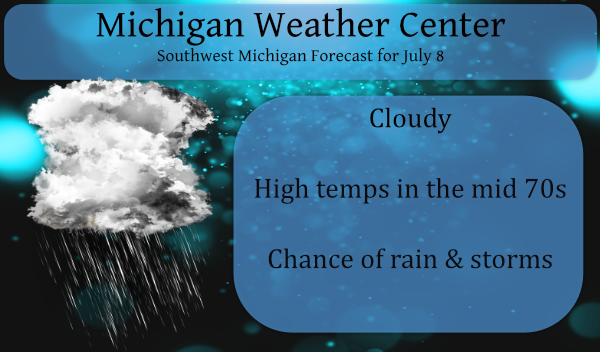
- Chance for showers and storms today

Surface low pressure is centered near Kalamazoo this morning with
a warm front extending to the east into Southeast Lower Michigan.
The low and associated fronts move east through the course of the
day with the warm sector being pushed off to the south and east of
the area through the day. The NAMnest forecast reflectivity and
the SPC HREF max reflectivity would both suggest our chances for
showers and storms today is rather limited. It appears the
convection moving out of the forecast area this morning into
Southeast Lower Michigan may be the back edge of the more
concentrated precipitation today. Some spotty showers and a few
storms will be possible in its wake, but many areas may not see
much in the way of rainfall. The focus for showers and storms is
going to the east. If we are going to see storms today the best
chance will be over South Central Lower towards BTL/LAN and JXN in
the mid morning through early afternoon time frame. Not expecting
severe as deep layer shear will be on the order of 20-30 knots and
we will likely have extensive cloud cover in the wake of the low.

- Mainly dry tonight through Saturday

Mainly dry weather is expected from tonight through Saturday as
high pressure builds into the region. Deep layer moisture is
limited during this time frame as seen in BUFKIT overviews. We are
thinking that Saturday will remain dry with a warm front and low
situated off to our southwest. Some guidance like the SREF is
showing pops into our southern CWA, but we are thinking the high
and drier southeast flow out of the high will win.

- Precipitation chances late in the weekend into next week

Precipitation chances increase for Sunday into Monday as the
eastern extension of an upper low pivots across the area. The
evolution has not been consistent in model runs and we will
continue to need to keep an eye on this time frame. Confidence is
increasing though in precipitation Sunday and Monday as model runs
are beginning to show some consistency. PWAT values climb back to
around 2.00 inches during this time frame so heavy rain may
become a concern once again.

Behind the Sunday/Monday precipitation, the flow becomes
southwesterly with models indication spotty precipitation from
Tuesday into Wednesday. There is upper support for precipitation
Tuesday into Wednesday as the upper low that will have been
upstream for days opens up and lifts our direction. Tuesday night
into Wednesday look to be the forecast periods with the best upper
support per the ECMWF.
64* here now. It has been a beautiful day the humidity left and it is cooler outside. I hope this sticks around for awhile. 🙂
Quiet Blog today just like the cool July weather outside currently 69* degrees out in my area refreshing as heck ahhhh forget the heat have a super night INDY
69 here too. Just finished mowing. The air feels drier now than it did earlier. I may actually be able to keep the windows open tonight for a change. BTW, the skeeters are RIDICULOUS.
Mark…couldn’t agree more about the skeeters. It was the fastest I have picked raspberries yesterday and weed whacked tonight. Lol. Even with spray on.
Why Mosquitoes Buzz in People’s Ears: A West African Tale is a 1975 picture book by Verna Aardema
I think of this book everytime I hear a skeeter in my ear. If you haven’t read it…it is cute. Lol
I doused myself with deet. It kept them off me, but swarms hovered about six inches from my flesh. I looked like Pig Pen from Peanuts. 🦟😁
I am not familiar with that book, but now you have me interested. Good timing too, as our local library recently reopened fully.
Start a fire smoke the Skeeters away ..INDY
It’s a picture book. So it’s a short read!!!
Our library has opened… but we have enjoyed the digital hoopla and other items the library offers!!!
Yes the Skeeter meter as Bill used to say on his blog is running high now ….INDY
1/10 overnight for Ada.
Elsa is making a beeline for Greenland. I do not recall a projected path so straight.
Woke to another booming storm with heavy downpours. My lawn is green again. Thank you, Mother Nature!