Yesterday tuned out to be pleasant with a high temp of 58° and a low of 33°. The CPC guesses seem to be ever-changing so we won’t even get into that this morning. We have a 100% chance of rain today which is moving into the area as I write this at 5 am.
Weather History for SW Michigan
April 3
1956: Eighteen people are killed and over 300 injured as four powerful tornadoes strike western Lower Michigan. Hudsonville and the northwest suburbs of Grand Rapids are the hardest-hit areas with 17 fatalities as homes and businesses were completely swept away by an F5 tornado.
1974: The worst tornado outbreak in United States history strikes from Illinois to Alabama, with 148 tornadoes killing over 300 people. In Michigan, a tornado kills two people as it tracks across Hillsdale and Jackson Counties.
April 4
2003: A devastating ice storm strikes central Lower Michigan. Heavy rain from thunderstorms falls into a layer of cold air near the ground and freezes on contact, creating sheaths of ice up to 3 inches thick that brings down thousands of tree limbs. It was estimated that 450,000 homes and businesses lost power during the storm and that nearly 50,000 people were without power for a week as persistent cold temperatures keep the heavy ice on the trees for 4 days after the storm. Crews came from four different states to help local utility companies restore power.
April 5
1982: Arctic air pours into Lower Michigan in the wake of a snowstorm and lake effect snows pile up over a foot across western Lower Michigan. The 12 inches of snow at Muskegon makes this the snowiest April day on record there.
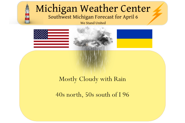
April 6
1882: A tornado outbreak strikes Lower Michigan, killing 10 people and injuring more than 50 others. Tornadoes struck Midland and Kalamazoo Counties, killing one person each. Four people were killed in a tornado that moved between Bedford and Charlotte. Three people were killed in Oakland County by a tornado that passed between Clyde and West Highland. A tornado that struck east of Dansville in Ingham County killed one person. A barn and home were destroyed by a tornado a mile west of Charlotte, but no one was killed.
1997: A strong cold front moved through with a line of thunderstorms producing wind gusts to 70 mph and causing widespread damage across much of southern Lower Michigan.
April 7
1954: A tornado destroyed two barns and damaged a house and apartment building near Fulton in Kalamazoo County.
1982: Temperatures plunge to near zero as arctic high pressure persists over the Great Lakes states. Lansing falls to 2 below zero for a record low for the date and the latest sub-zero temperature on record. Muskegon falls to one degree above zero and Grand Rapids to 3 above for their coldest April temperatures on record.
April 8
1938: A snowstorm drops several inches of snow across southern Lower Michigan. Lansing sets a record for the day with 5.1 inches and Grand Rapids with 4.3 inches.
1947: Three to five inches of rain and warmer temperatures combine with melting snowpack and partially frozen ground to cause some disastrous flooding along the Grand and Kalamazoo Rivers. Millions of dollars of damage occur as large sections of Grand Rapids, including the Comstock Park area, are under several feet of water.
2016: A spring snowstorm drops 4 to 6 inches of snow from Grand Rapids to Lansing. A total of close to 10 inches of snow fell at Grand Rapids during a wintry first week of April.
April 9
1969: A brief tornado damaged a house near Loomis in Isabella County.
1973: A snowstorm dumps 3 to 8 inches of snow across much of Lower Michigan. Record snowfall for the date includes 6.5 inches at Muskegon, 5.2 inches at Lansing and 4.4 inches at Grand Rapids.
2008: A tornado hit from near Plainwell in Allegan County to Doster in Barry County at 1:40 a.m. It did significant damage to a horse barn, lifted a trailer adjacent to the barn, damaged gravel yard equipment, lofted a tank, and uprooted numerous large trees.
Weather History for SE Michigan
April 3
On April 3, 1974, an F2 at 7:30 PM and an F3 at 8:56 PM moved through Monroe County. These tornadoes were part of the Super Outbreak that caused over 300 deaths, 5500 injuries, and $600 million in damage in 13 states and Ontario, Canada. The Super Outbreak was the worst tornado outbreak in U.S. history.
April 4
On April 4, 2003, a severe two-day ice storm ended over southeast Michigan. The storm was responsible for up to an inch of accumulated ice in Oakland County, which caused 500,000 people to be without power and $50 million in damage!
April 5
On April 5, 1995, Flint had a record low of 13 degrees for the day. The day before, on the 4th, Flint had the same record low of 13 degrees for that day.
Also on April 5, 1982, a snowstorm hit Southeast Michigan in the evening hours and continued into the 6th. The storm moved across the Ohio River Valley and left Detroit with 7.4 inches of snow, Flint with 7.1 inches, and Saginaw with 4.0 inches.
April 6
On April 6, 2010, a prolific hail storm moved from southern Livingston County to southern Macomb County. The storm produced 1.5-inch diameter hail in Brighton, 1.75 inches in Commerce, and 2.25-inch hail in Sterling Heights.
On April 6, 2009, a low-pressure system tracking northeast through the Ohio River Valley produced a late-season heavy snowfall across Southeast Michigan. Snowfall totals averaged 1 to 4 inches south of I-94, 4 to 8 inches between I-94 and I-69, and 1 to 4 inches north of I-69. Due to the heavy snow and winds of around 30 mph, tree branches came down which resulted in power outages focused along the M-59 corridor. Some of the higher snowfall included Grand Blanc 6.3 inches, Elba 7.0 inches, Cement City 6.0 inches, Howell 6.3 inches, Shelby Township 6.4 inches, White Lake 7.8 inches, Deckerville 6.0 inches, Ann Arbor 6.0 inches, and Romulus 6.7 inches.
On April 6, 1886, the biggest snowfall ever recorded in Detroit in a 24 hour period occurred with 24.5 inches. This snow had a very high water content (2.43 inches) and was therefore very heavy and packed. This made it difficult for residents and services, such as police and medical, to travel anywhere. Amazingly, the next day temperatures rose to 40 degrees and up into the 50s later in the week.
Also on April 6, 1882, the earliest recorded Michigan tornado outbreak hit Southern Lower Michigan. Six tornadoes rolled across the southern part of the state including Midland, Bay, Livingston and Oakland Counties. In the state, there were 10 deaths and 54 injuries as a result of the outbreak. The Midland tornado started just north of Midland and ended near Inwood in Bay County. This tornado was responsible for 1 death and 15 injuries. The Livingston tornado started near Hartland and moved to Clyde in Oakland County. Five homes were destroyed near Clyde where the 3 deaths and three injuries were reported.
April 7
On April 7, 2020, several clusters of severe thunderstorms tracked across the area including supercells, multi cells, and bowing segments. The first area impacted stretched from the Tri-Cities southeast into southern portions of the Thumb. The second occurred mainly across a stretch that included Livingston, Washtenaw, Lenawee, Monroe, and portions of Wayne counties. Numerous reports of large hail were reported with these storms with golf ball-sized hail observed in Midland and Lapeer Counties.
On April 7, 1954, an F2 tornado hit Genesee county at 6:40 pm causing 2 injuries and $25,000 in damages.
April 8
On April 8, 1980, Wayne County was hit by an F1 tornado at 7:15 PM.
On a temperature note, a high of 79 on this date in 2001 broke a 130-year old high-temperature record of 76-1871.
April 9
On April 9, 2016, a late-season snowstorm that begin the night before produced significant snowfall over southern portions of the area. Adrian measured 7.2 inches and 6 to 7 inches fell in Temperance, the Irish Hills, and Manchester.
Also on April 9, 2001, Ann Arbor, Manchester, Saline and Belleville had reports of golf ball size hail during the morning hours. Other areas in Metro Detroit reported 2-3 inch diameter hail.
Forecast Discussion
...Rain moving in...

Radar shows an extended band of showers stretching from the UP
southwest to Missouri inching eastward. These showers will cross the
lake prior to sunrise and slowly move across the cwa today. A deep
cut off low has occluded at the sfc and we`re seeing isentropic lift
near the warm front produce this initial band of showers. Little in
the way of instability so thunder isn`t expected.  A half to three
quarters of an inch of rain is expected before ending this
afternoon.

Given the slow moving nature of the cut off low, we`ll see little
bits of energy eject eastward from it Thursday and Friday
necessitating high pops through that time frame. Thursday night and
Friday evening, colder air entraining into the system may result in
mixed rain/snow.

...Dry this weekend...

As the upper low drifts east, high pressure will nose into the Great
Lakes resulting in a dry weekend. Saturday is going to be a pretty
chilly day with highs around 40, but then warmer weather will arrive
as heights rise under the ridge. Southwest winds will increase early
next week as the high drifts east. We`ll also see an increase in
moisture then. Another cold front over the Mississippi and Missouri
Valleys will see low pressure ride northeast along it and try to
spread some showers into the cwa, especially late Tuesday. Some
thunder may accompany these showers too.
The sun has officially made an appearance here at my house after a cloudy rainy day
Meanwhile in Cape Coral Florida its 91* degrees breaking or tieing a lot of records in the last couple days crazy hu Slim?? Thats the headline down here…From sweeting by the pool InDY
Too hot for me! I would be happy if the temp never got above 79 degrees!
There is a sharp cutoff of the cloud cover to the west at this time. The clearing line is advancing to the east and the sun should be out shortly. At the current time it is cloudy and 49 here.
Slim
Parts of West Michigan got hit with Quarter to Golfball size hail 12 years ago today. It was a complex of storms that came ashore at Holland and moved east towards Lansing. It hailed long enough at my house in Byron Center that it started to accumulate. Was one of the longest hail events I’ve seen living there. I think we still had some hailstones on the ground deep into the afternoon. The same storm moved east and produced a Tornado Warning for Parts of Eaton, Ingham, and Jackson Counties. I still remember the storm like it was yesterday!
There are indications that after a brief warm up next week there could be a another cool down and it could be cool and wet for the rest of April. We shall see.
Slim
Going for our second straight above average temp day today. And that’s before the big warm up coming!
Average is 54.0 today… it will be a close call later today when the sun comes out
While the average high is 54.0 the low for the day so far is just 41 and that is above average so the day as a whole should end up above average.
Slim
Ah good point
#lowtempsaretempstoo
#warmweatherhypeisfakenews
Lol, as we are entrenched in a cool wet pattern! Keep dreaming!
April 7, 1982: Temperatures plunge to near zero as arctic high pressure persists over the Great Lakes states. Lansing falls to 2 below zero for a record low for the date and the latest sub-zero temperature on record. Muskegon falls to one degree above zero and Grand Rapids to 3 above for their coldest April temperatures on record. The VEI-5 (Volcanic Eruption Index) eruption of El Chichon in Mexico occurred on March 28, 1982. I wonder if that had anything to do with our record cold temps ten days later? As per NASA: “The impact stretched far beyond Mexico. The… Read more »
If you like cool, cloudy, windy and wet weather this is right up your alley! I would describe the current weather and weather pattern as absolutely Horrendous! Where is all the warm weather and sun that some on here say is right around the corner? They have been saying this since February! Ridiculous! We are entrenched in a cool cloudy pattern and no change is in sight!
Imagine if all this rain was accumulating SNOW.
It would be Heaven on Earth!
Calm down. We just had a warm March and 12 consecutive warm days in a row. And another long duration warmup is already underway.
12 consecutive warm days when? The past 12? That would be false.
It was NOT the past 12 days. And at Grand Rapids March was just +0.5° The range of -0.5 to +0.5 is considered near average.
Slim
Thanks for the stats slim!
Keep the facts rocking Slim! This will help temper the fake
News a little bit!
March 14 – March 25
Old news and totally irrelevant! Get real!
You 100% wrong as usual and are hopeless. We are clearly in a cool pattern and definitely no long duration warm ups are in sight! You are totally nuts?
At the current time there is rain falling here at my house with a temperature of 48. The overnight low was 41. Yesterday was the 1st day of April that was above average with a official high at Grand Rapids yesterday was 56. That is the warmest it has been so far this month. In now looks like the the first 70 or better day has been pushed back as the forecasted high on Tuesday in now in the mid 60’s with a chance of showers. The average first day of 70 or better is April 4th So this year… Read more »
This has also been a pretty gloomy year so far. We had well below average cloud cover in March and that trend seems to be continuing
Definitely a cool pattern and cold Spring so far!