Yesterday we continued our period of above-normal temps with a high of 78° and a morning low of 55°.
Ever wonder why leaves fall off the trees? In order to cope with the grueling winter temperatures, trees slowly close off the veins that carry water and nutrients to and from the leaves with a layer of new cells that form at the base of the leaf stem, protecting the limbs and body of the tree. Once the process of new cell creation is complete, water and nutrients no longer flow to and fro from the leaf – this enables the leaf to die and weaken at the stem, eventually falling gracefully to the ground. Then, of course, we have to clean up after them.
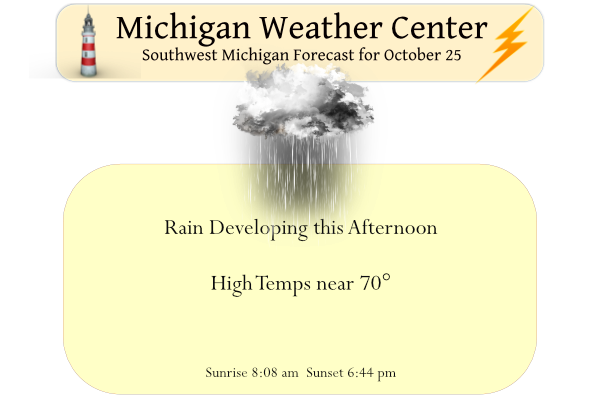
This may be our last 70° day of the season so enjoy it. Rain will develop this afternoon and evening, and will persist into Wednesday. Cooler weather is expected for the rest of the week. The weather pattern is shaping up to be favorable for warmer-than-normal temperatures in Michigan for Halloween and early November. High temperatures in the upper 50s to 60s would be considered warmer than normal at this point in the year.
Forecast Discussion
-- Warm and Wet Today through Tomorrow --

A large upper level low situated over the Central US will slowly
move to the north east across the Great Lakes. Bands of mid and
low level moisture will stream over high pressure that is situated
over the Atlantic. As the high is slowly diminishing, the latest
models have slowed the precipitation`s infiltration into Lower
Michigan.
 The models are in good agreement on the timing of this system,
though there remains questions on the amount of precipitation.
Ensembles have increased with QPF along Lake Michigan in the 1 to
1.5 inch range. inland it will be a half inch to one inch from
Lansing Westward. Warm air will advect into the area today into
tomorrow. So expect increasing clouds through day with
precipitation this afternoon and evening through Wednesday.

-- High Pressure Dominates Through the Weekend --

 As the three aforementioned systems propagate eastward, mid to
low level patterns will dominate the latter end of the week and
into the weekend. Mid level and surface high pressure will couple
dry mid levels to allow for clearing skies. Cooler air will
downslope into the lower Michigan so expect temperatures to
return to seasonal norms. Dry weather is expected through the
weekend.
GR is still headed for a below normal temp month! Get ready for the cold temps the rest of this week/weekend! The cool pattern continues to rock!
50’s and 60’s are now “cold” temps? Pretty sure no one thinks that.
Love seeing snow on the United states map soon it will be over west Michigan I bet the upper peninsula is loving there snowstorm last week here we go yeahhhhh to the yeahhhh INDY
Bring it!
Lansing, Detroit, and Flint are all about to go above average temps for October!
It always amazes me how trees (and other plants/animals) are able to survive the entire winter. Especially grass, which is buried for possibly many months
Yesterday Barry wanted to know how many days had a departure of 20° or more this year. Well that depends on if you are looking at the average for the day or the high or low for the day. For the mean yesterday was reported as +20 for the day but that has been updated to +19.1. For the year there have been 4 days with a mean of 19° above or below average for the mean. On March 12th the H/L was 18/12 the departure for the day was -19.2. Then on March 17th the H/L was 67/44 for… Read more »
Thanks Slim. Pretty rare territory to be in for sure. I’d forgotten about the wild temp swing back in March just a few days apart.
Yesterday was yet another very warm late October day. There was a new record high set of 77 set at Muskegon that broke the old record high of 76 set in 1975 and 1963. At Grand Rapids the official H/L of 77/58 that high of 77 was the 3rd warmest ever for any October 24th there was a reported 0.01” of rain fall and 34% of possible sunshine. The high yesterday of 78 at Lansing was their 2nd warmest high for the date and at Holland their high of 76 was their 4th warmest. Overall a very warm day. The… Read more »
When the leaves can be raked burned up and mostly gone by Halloween is a win win situation the snow shovels are out now brimg on Winter why not we are only 2 months from Christmas day … Have a great Fall of a Day DDDDDD INDY