Yesterday we had a high of 67° and a morning low of 56.5°. Our rainfall total overnight is .69 inches. We will continue to have some showers throughout the morning into this afternoon before moving out and clearing will move in with temps dropping to near freezing overnight.
Weather History for SW Michigan
October 23
1955: A cold front moving into warm and humid air results in severe thunderstorms across southwest Lower Michigan. High winds and hail caused considerable damage to windows, roofs, automobiles, and trees as a severe storm passed about 15 miles south of Grand Rapids.
1959: A tornado struck near Evart in Osceola County around 4 PM, with only minor tree damage.
1963: Michigan is in the midst of a spell of record warm weather. Lansing reaches 80 degrees or higher on five consecutive days from the 22nd to the 26th.
October 24
1967: A tornado injures four people as it destroys a trailer in Monterey Township, Allegan County.
2001: A squall line moves across southern Lower Michigan producing widespread wind damage and several tornadoes. The town of Schoolcraft in Kalamazoo County is hit by winds estimated up to 100 mph, causing extensive tree damage and some structural damage. The town of Marshall in Calhoun County also sustains some damage to homes as winds gust between 60 and 80 mph.
October 25
1962: Snow accumulates an inch or two across southwest Lower Michigan as an October cold snap continues. Low temperatures fall into the 20s at most locations for four straight days from the 24th to the 27th.
October 26
1869: Several inches of snow pile up across southwest Lower Michigan. The 5.5 inches at Lansing is a record for early-season snowfall and the high temperature there only reaches 34 degrees.
2008: Thunderstorms combine with a cool air mass to bring some hail to Lower Michigan. Small hail covered the ground in a few locations.
October 27
1967: The heaviest October snowstorm on record strikes southwest Lower Michigan with widespread amounts greater than 6 inches. A total of 8.4 inches at Grand Rapids is almost double the amount of the next greatest October snowstorm.
October 28
1869: Michigan is in the grip of an icy cold wave. The temperature falls into the teens for eight consecutive days at Lansing, where it is the coldest October on record.
October 29
1925: October feels more like December as snow and cold prevail for much of the last half of the month. Measurable snow falls for three consecutive days with high temperatures at or near freezing from October 28th to the 30th.
Weather History for SE Michigan
October 23
On October 23, 2020, a line of strong to severe storms tracked across Southeast Michigan, resulting in numerous wind damage and a few 1-inch hail reports. The hardest hit areas were around Elkton and Kinde in the Thumb, where a bowing segment caused damage to several structures and numerous trees and resulted in widespread power outages.
On October 23, 1951, 1.94 inches of precipitation fell in Flint. This is the record for the greatest amount of precipitation for the month of October in Flint.
October 24
On October 24, 2001, a strong cold front moved into the Great Lakes region during the early morning hours of the 25th. Ahead of this cold front, warm air surged northward into the Great Lakes. Thunderstorms developed ahead of the cold front late in the afternoon of the 24th and continued into the evening. These thunderstorms extended from the Great Lakes all the way to the deep south. Strong winds just off the surface allowed some of the thunderstorms that developed across southern Michigan to become severe. Most of the severe storms caused damaging winds gusts with a few hail reports. Most of the wind gusts were estimated between 60 and 70 mph, but isolated locations in Lapeer County gusted up to 100 mph. Some of the thunderstorms developed rotation, a few of which produced tornadoes. Three tornadoes were spawned from the thunderstorms including an F0 near Fosters, an F1 from Hartland to Davisburg, and another F1 from near Munger to Quanicassee.
On October 24, 1991, the overnight temperature dropped to only 63 degrees in Flint, which is the daily record for the highest minimum temperature in Flint. This also happens to be the second night in a string of four nights (October 23-26) in which record-high minimum temperatures were recorded!
October 25
On October 25, 1963, the high temperature rose to 82 degrees in Detroit and 81 degrees in Flint. Both set new records for the date that still stand today.
October 26
On October 26, 2008, a late-season severe thunderstorm moved across southern Oakland and Macomb Counties. The storm developed ahead of a cold front that ushered in much colder air. Many reports of severe hail were received. Berkley and Madison Heights reported the largest hail at one inch in diameter.
Also on October 26, 1963, the temperature rose to 81 degrees in Flint, which is the record high for the day. This marked the fourth day in a row (October 23-26) that record daily high temperatures were recorded in Flint!
October 27
On October 27, 2010, a historically deep low-pressure system tracked northeast through Minnesota and into Ontario. A tight pressure gradient over southeast Michigan led to prolonged strong westerly winds, generally in the 45 to 55 mph range, but a few gusts in the 55 to 60 mph range were observed north of M-59, blowing down dozens of trees and tree limbs within most of those counties.
On October 27, 1997, low pressure tracked northeast across Ohio late on the 26th through early morning on the 27th. Rain changed to snow over the Saginaw Valley and Flint area during the evening on the 26th, and snow continued until around daybreak on the 27th. Accumulations were mostly from 3 to 6 inches, with a maximum of 6 inches reported at Saint Charles, in Saginaw county. The combination of the heavy wet snow, and the fact that many trees had not yet lost their leaves, resulted in widespread tree damage and downed powerlines. Around 40,000 homes lost power on the 27th. Measurable snow fell as far south as the northern suburbs of Detroit.
Also on October 27, 1967, Saginaw had another early-season snowstorm that left 5 inches of snow covering the region.
October 28
On October 28, 1980, 2.9 inches of snow fell in Detroit on the 27th and 28th. This was the highest snow amount for the month of October in Detroit
Also on October 28, 1976, there was a two-day streak of record lows in Detroit. The temperature was 22 degrees on the 27th and 21 degrees on the 28th.
October 29
On October 29, 1999, record highs were set in Detroit at 77 degrees and in Flint at 75 degrees.
Also on October 29, 1906, Saginaw received 3.5 inches of snow.
Forecast Discussion
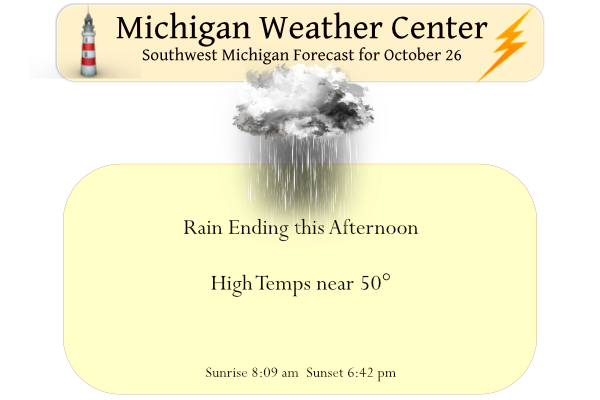
-- Rain through the first half of the day, clearing Tonight --

The biggest forecast concern will be the position and track of a
TROWAL moving in conjunction with a deformation band moving
across lower Michigan between 09Z to 12Z. A period of heavy rain
will move northward with an additional 0.5 inch to an inch
possible with the heaviest rain rates before sunrise.

The upper level trough that is driving this system and will
quickly move eastward this afternoon and continue east this
evening. Expect strong downsloping flow to follow in the wake of
this exiting system bringing strong gusty northerly winds. Cold
air will return to the region with Max temperatures today much
closer to normal, in the low 50.

--Drier and cooler weather ahead --

Baroclinic, zonal flow will dominate the upper pattern, with high
pressure through the mid to low levels. This will keep drier air
over the region through the weekend. Temperatures will rebound
into the weekend, with highs in the low 60s this weekend. The next
chance for precipitation will be early next week.
Slim, do you know the temp stats so far this month? It seems like we have had a lot of either really chilly or really warm days this month. If I’d have to guess I think GR is around -2F so far.
For Grand Rapids the mean so far this October is 51.4 that is a departure of -1.2. The high for the month will be 77 on the 24th and the low so far is 30 on the 8th. At Holland the mean so far is 52.8 that is average. The highest for October was 78 on the 23rd and the low so far in 34 set on the 3rd at Muskegon the mean is 53.1 that is +0.1 the high for the month will be 80 on the 23rd that is a record for that date. And at Lansing the… Read more »
GR once again the coldest relative to average. What a joke! That’s why I gave up on NWS GRR numbers.
Thank you GR weather service for your state of the art and very accurate weather data equipment! Keep up the great work!
https://www.weather.gov/wrh/climate?wfo=grr
Just another of many cold October days! What a month! Incredible!
Just over 1″ in my gauge for the previous 24 hours. I know that the leaf turn is based on length of daylight, soil moisture and cool nights and relatively warm days. The leaves seems to be on track for brilliant peak in this area, but then we had last week’s several days of cold rain. Since then, it appeared to me that the colors (in the trees that had not reached peak color yet) have been muted. Is this my imagination, or could those extended cold, wet days have caused it?
You are definitely correct, the leaves in my area are much more muted than even 3-5 days ago… not exactly sure what caused it.
Our maple out back has like four leaves left.
I enjoy the weekly Wednesday weather almanac – especially in the fall and spring when there’s a little bit of everything.
62 and sunny Saturday. Fantastic weather for Blue’s beatdown of my Spartans.
Lows in the 30’s is the best for bon fire nights so looking forward to this weekend! Burn baby burn hoodies and sprites on thsese cool nights … INDY
It was a wet overnight here in MBY as I recorded a total of 0.89” of rain fall from yesterday afternoon to 7 AM this morning. For Grand Rapids the official H/L yesterday was 67/53 up to midnight 0.33” of rain had fallen at GRR. There was a reported 12% of possible sunshine yesterday. With the cold front now thru the temperature has now fallen to 46 here in my yard. From what I can in the back yard light it looks like a lot of leaves have fallen overnight. For today the average H/L is now down to 56/39.… Read more »