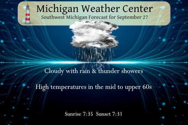
We had .71 of an inch of rain yesterday after 14 days of only .11 of an inch. Our monthly total for the month in Otsego is now 2.94 inches. We can expect scattered showers once again today in SW Michigan as a low-pressure system continues to meander across the state. Like yesterday we may have a few rumbles of thunder in the afternoon and evening.
Grand Rapids Forecast
9 27 grrWeather History for SW Michigan
September 24
1950: Smoke from Canadian forest fires gave the sun an eerie bluish cast and darkened the sky across western Michigan.
September 25
1961: Widespread, heavy rain causes some flooding across western Michigan. Record daily rainfall totals occur at Muskegon, Lansing, and Grand Rapids. The 3.52 inches of rain at Grand Rapids is a record total for any day in September.
September 26
1951: A tornado killed one person and injured three others near Bitely in Newaygo County. The tornado destroyed a tavern, carrying steel beams from the roof about 70 yards.
1965: Wet snow mixes in with rain across parts of western Michigan for a very early taste of winter.
1998: The temperature hits a record high of 89 degrees at both Grand Rapids and Lansing. The warm weather fuels a severe weather outbreak across the region as a cold front arrives during the late afternoon. A severe thunderstorm produced softball-sized hail in Clare County which smashed skylights, dented automobiles, and damaged roofs and antennas. Damage was estimated at up to half a million dollars.
September 27
1942: Snowflakes fly across Lower Michigan as temperatures fall to the lower 30s and only rise into the 40s during the day.
2009: A microburst with winds up to 70 mph struck just northeast of Greenville in Montcalm County. About a dozen trees were downed and a travel trailer was tipped over.
September 28
1991: A record freeze hits western Michigan. Grand Rapids falls to 27 degrees, setting record lows for the date and month. Muskegon also hits 27 degrees, setting a record for that date and tying the monthly low. Lansing plunges to 22 degrees, tying the record low for the date set in 1893.
September 29
1953: Temperatures soared to the 90s across western Michigan. Grand Rapids hit 93 degrees and Muskegon 92 degrees, both record highs and records for the latest date of a 90-degree reading.
1967: Wet snowflakes fell at Grand Rapids and Lansing. The high of 42 degrees at Lansing is the coldest high temperature for the month of September.
1986: A severe weather outbreak produces high winds, large hail, and two tornadoes across Lower Michigan. One person was injured in Van Buren County as a tornado hit near Mattawan. Six houses were destroyed by a tornado near Rankin in Genesee County.
2006: Several waterspouts were observed on Lake Michigan. One was about 5 miles offshore of Holland, while another was sighted just offshore of Saugatuck. This waterspout approached the coast and may have come onshore, but no damage was noted.
September 30
1899: September ended on a very cool note with a record low of 21 degrees at Lansing and afternoon highs only in the 40s. The high of 44 degrees at Muskegon made for the coldest September maximum temperature on record there.
Weather History for SE Michigan
September 24
On September 24, 1997, southeast Lower Michigan saw its first frost of the year. The temperature fell to 32 degrees at Flint. This missed tying the record by one degree.
September 25
On September 25, 2018, three tornadoes occurred over northern Monroe and southern Wayne Counties, impacting Frenchtown Township – EF1, South Rockwood/Rockwood – EF0, and Gibraltar – EF1. No injuries were reported, but numerous homes were damaged. The Gibraltar tornado even crossed the Detroit River to impact Grosse Ile.
On September 25, 2007, thunderstorms ended a dry eight-day stretch of well above average temperatures in the upper 70s to upper 80s. Some of the storms were severe with the most damage occurring in Flushing. A downburst produced estimated 80 mph wind gust which blew in garage doors and down hundreds of trees and large limbs.
Also on September 25, 1941, the remnants of a former Category 3 hurricane passed over Detroit. What was remarkable about the remnants of this storm was the high wind speeds and low pressure that accompanied it. Winds speeds remained steady at 56mph with wind gusts of up to 75mph! Dozens of people were injured by these winds. The pressure dropped to 990mb that day, which is the second-lowest pressure reading ever recorded for Detroit during the month of September.
September 26
On September 26, 2017, the temperature reached 93 degrees in Detroit, Flint, and Saginaw all of which are record highs for the date. In Flint and Saginaw, it was the 6th consecutive day of record-setting temperatures in the 90s and the latest such streak (6 days) of 90-degree-days on record for both sites. The 26th is also the latest date in the calendar year that Flint has ever reached or exceeded 90 degrees.
September 27
On September 27, 1998, Flint experienced a record warm temperature of 86 degrees for the day.
September 28
On September 28, 1991, Flint experienced a record low temperature of 26 degrees for the day.
September 29
On September 29, 1966, the pressure dropped to 989mb during the passage of an intense early fall low-pressure system. This is the lowest pressure reading ever recorded for Detroit in the month of September.
September 30
On September 30, 2002, the very warm and dry month ended with record-high temperatures of 86 degrees at both Saginaw and Flint. Flint ended the month with their driest September, 0.29 inches, and Saginaw had their second driest September, 0.39 inches. After an extremely hot and dry July and August, the weather of September 2002 only exasperated drought conditions. During the first half of the month, hundreds of communities across the area were under water restrictions. The hardest hit by the drought was the agricultural industry. September yields across most of the area were estimated at under 50 percent and many counties across eastern Michigan were declared agricultural disaster areas.
On September 30, 1987, a thunderstorm brought 3/4-inch hail and winds gusting to 65 mph in Wayne County.
Forecast Discussion
Main forecast concern for this update is assessing the thunder
threat today and this evening. Current SPC SWODY1 outlook area
for thunderstorms extends well north of I-96/I-69. We chatted
with SPC about this and all agreed that the actual cutoff is a
bit fuzzy, but justified somewhere across the lower half of Lower
MI. Some convection allowing guidance suggests that we might see
an outflow dominant multicell cluster making a run north towards
I-96 after 8 PM prior to it "splashing out" (that is,
dissipating). So yes, the northward extent of thunder is a bit
uncertain, but it will be more of a sure bet from the I-94 area
southward.

Otherwise, we are continuing high precipitation chances tonight
into Thursday mainly south of I-96/I-69 with an accompanying
thunder threat concentrated slightly farther south of that. At
upper levels, the persistent upper low will gradually open into a
wave with an associated longitudinally deep and narrow PV
maximum. As this feature marches east across the western Great
Lakes Thursday afternoon, this will bring a sharp end to
precipitation.

Upper troughing moves east on Friday with rising heights and upper
ridging building in for the weekend. An omega block is established
across the CONUS this weekend as the western longwave trough cuts
off from a belt of stronger westerlies across Canada. The upper low
settles over Nevada with another upper trough/cut off low along the
mid-Atlantic coast and upper ridging in between. Sensible weather
will feature warm and dry conditions under the upper ridge from
Friday into the first half of next week.
Only 85 days till winter and multiple snowstorms! Incredible!
I see some are already jumping in the winter bandwagon. Once again it’s simply way to to early to know what will happen. We might as well start throwing out our summer 2024 forecasts while we’re at it! What a joke!
Better forecasts are after Halloween.
184 days til Spring!
I would love a winter like 2020/2021 again! Only like 40 inches of snow all winter in GR and 3 of the 4 months had temps way above normal! Heaven on earth! With the STRONG EL NINO, we have a great chance of that again!
I would love a winter like 2013/14 again!! 116 inches of snow!! Wow, just wow, WOW!!
Who wouldn’t love beautiful warm temps and Sunny skies this time of year?!?!
We got 0.1” yesterday. Brings my house to 0.7” for the month. Pretty sad.
I feel like I have had more rain that anyone else’s yard up to this point. My lawn looks great and is regularly mowed. Mosquitos are also very thick so bug spray is recommended. Amazing considering I had probably the driest front yard of anyone a few months ago under a severe drought.
The farmers almanac says cold and stormy! Who wouldn’t want that this winter? Bring it!
https://www.farmersalmanac.com/winter-forecast-2024-the-brrr-is-back
. The almanacs say they can predict weather with around 80 percent accuracy, but a University of Illinois study disagreed, saying the Almanac was only about 52 percent accurate—which is essentially random chance.
I’ll stick with the climate scientists and not these old hocus pocus guesses!
Looking GREAT! I love the polar vortex!
https://witl.com/polar-vortex-michigan-winter-2023-24/
Winter is looking good! This years El Niño = plenty of SNOW! Get ready!
https://www.severe-weather.eu/long-range-2/winter-2023-2024-forecast-polar-vortex-el-nino-qbo-strong-impact-cold-weather-united-states-canada-europe-fa/
Cool if you actually scrolled down and read the forecasts they are predicting warmer and dryer for the midwest! I agree that is looking good! Here are the key excerpts: Over North America, ECMWF suggests much less snowfall than usual in the western United States and across the Midwest. That is mainly due to less precipitation. But you can see trends of increased snowfall forecast over the central plains and the southern United States. Glad we don’t live in the central plains and then this excerpt: Over North America, the ECMWF forecast shows much above-average temperatures over most of Canada.… Read more »
Personal opinion: I’d say this fall and winter will *likely* trend warm overall, particularly because of the strong El Nino. However it’s still a bit early… Bill S. always mentions Siberian snow cover in October can hint at our early winter conditions, plus we don’t know the exact strength of the El Nino for certain yet. So I’d personally say a *likely* warm fall/winter overall, but it’s still only September and it’s early. Also in an El Nino the jet stream usually runs along the south US, which is why a lot of the storms miss us to the south.… Read more »
Winter is cancelled! You better move north about 300 miles!
That probably won’t even be far enough north for winter weather this year! LOLLOLLOL!!
More like late June weather coming up! Showing 70’s and 80’s as far as the eye can see! Wow, just wow, WOW!
What a sight! I always say we have the absolute best weather from May to Mid October!
Oh yeah and there’s a very good chance the warm weather may run right into November this year!
Yet another above normal temp day! This has been about a week straight! What an incredible stretch of warm weather!!!! The above normal temp pattern is awesome!
It looks like we are going to start October on the very warm side. With highs forecasted from the upper 70’s to low 80’s it will be the warmest start to any October since 2017. And there is a good chance that this year will be warmer than October 2017. There has been some discussion on if there is a warm fall (October into November) if the winter that followed was a snow one or not. In looking at some past warm Octobers that is not always the case. In fact more cold falls have had more snow winter snow… Read more »
If I remember correctly, I think October 2017 had a crazy string of “warm low temperatures” for the first couple weeks. Things finally cooled off in the middle of the month
Just checked the data and looks like I am referring to October 2021… we have had a lot of warm starts to October in recent years. I have no complains. We get to enjoy the leaves a bit longer before the November pattern sets in
Only 85 days till winter and the best season!!
I think winter has been cancelled this year. Better luck next year?
LOL!!!
Lol!!! I agree Mookie!! The STRONG EL NINO is going to annihilate winter this year! BRING IT!!
Can you say “foot in mouth” too funny!
Why?