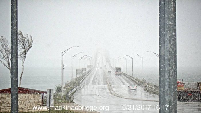
The feature image is the snow at the BIG Mac yesterday.
As the title says – this is preliminary as in goes before a fuller, more detailed report. As usual the disclaimer would be as with all forward looking statements, this is just a guess and anything which actually happens in reverse of these statements is fully up to mother nature herself and one mustn’t hold the meteorologist accountable for what may or may not actually happen. All forecasts are subject to change….
 Over the past few weeks I have presented various forecast guesses from other agencies and all the variables which account for a winter forecast.
In all fairness all forecasts further than a week out are a guess at best and the further out we try to read what is going on is pure conjecture, more or less a shot in the dark.
Last year I held that the winter for Michigan would be normal with the exception of the lake shore counties which would see above normal snowfall. This guess held true for three weeks in December and then fell apart.
If I wanted to take the easy way out I could say we will have chances of rain, snow, cloudy and windy weather conditions with intermittent chances of sunshine during this winter. I should be safe in saying we will have more clouds than sun especially in the western side of the state as winter is our gloomy period for the year.
Last year I did note that due to the jet stream separating the cold and warm air so close to Michigan might cause some icing events or more rain events for the southern part of the state – I think this may hold true for November and December this year also.
The CFSv2 animation above goes through December 3rd shows the really cold air (the purples and grays) staying well north of Michigan (for the most part) through that period which may keep us in a pattern similar to what we are seeing currently, mainly rain with some snow showers mixed in to the south and snow in the U.P. which may hold true up until around Christmas.

This is not saying we will not have snow the early part of winter, I am not seeing any major state wide snow events through November as we remain in our current pattern of cool unsettled weather.
I think the pattern of snow consistently staying on the ground will hold off through December as temperatures reach normal or perhaps slightly above normal for the month.
There are hints of accumulating snow around the 7th (less than and inch) and the 17th of this month (2 to 4 inches) in central Michigan, we will see if that holds true. If it is so it will be our first snowfall which will stick to the ground.
The U.P. and from Gaylord to the north could be a different story as I believe the colder air will stay north of US 10. This could be similar to last year where the snow stayed north and the rain to the south most of the season, this pattern we are in now is eerily similar with the exception of the December period of snow last year.
The CPC is showing our coldest months of the winter to be January and February which I would assume something is seen in the models which brings in the Siberian air during this period – I will look at that around Thanksgiving when I come out with my ‘official guess’.
For now I believe my guess will be for a pattern similar to what we have seen the past couple weeks with more rain than snow until we get closer to Christmas then our pattern will feature more snow than rain with the snow being at normal accumulations for the inland counties, more for the lake shore when we get into January and February – I think our ‘brutal’ months will be late January and through February when we will be reminded that we can still have a winter here in southern Michigan…
As I said early I won’t put out the Official forecast until after Thanksgiving when I will hope to have a better handle on ‘if’ the Siberian’ cold will be allowed into the northern CONUS or will remain as it did last year across northern Michigan and the U.P..
Storm Team 8 put out their winter guess this afternoon – should be on the 6pm news….
Well I just took a look at WOOD TV winter guess. My impression? Not impressed! While the general guess is I “guess” OK As they did not stick their neck out. Their snow fall records for Grand Rapids, Muskegon and Lansing are all wrong. And my guess the information for the other locations may be wrong as well. Not sure what year they started with the oldest year on their list in 1986 that that maybe their start year?
Slim
We will be getting hammered with snow this winter!
I would be completely fine with a repeat of the past several years. 2 weeks of snow, then poof, it’s all gone and it’s 50 degrees the rest of the Winter. Sure looks to be setting up again this year the same way.
At this time I am going to stick my neck out and say if the pattern stays the way it is now we will be warmer than average at least up to the first of the year. It looks to be wet and with that there is a chance of a snowstorm or two. For the winter as a whole? it could be mild and wet. Stay tuned.
Slim
Here is the October wrap for Grand Rapids, MI the average high/low for the month was 64.2°/45.9°. The highest was 82° on the 2nd and 3rd The coldest for the month was 28° on the 26th The mean for the month was 55.2° and this was the warmest October at GRR since 2007. With 9.69” of precipitation it was the wettest October in Grand Rapids recorded history and the 5th all-time wettest month at Grand Rapids. There was 0.4” of snow fall all falling on the 31st but that was -0.1” below average.
Slim
Finished October +4.2 degrees above average. Another very warm month.
With the warm Great Lakes and the long-term warm pattern we are in, it may still be awhile before we see any big snowfalls around here.