We have been holding fairly steady temperature-wise during the daylight hours over the past week or so with very limited precipitation. In the Otsego/Plainwell area, we are still holding onto an inch or so of snow left on the ground though many large patches of open ground are showing through.
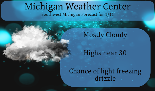
We have some moisture in the low-level clouds which is causing some light drizzle in the area and with the temps slightly below freezing, this could cause some slick spots on the roads and sidewalks. This should decrease during the day but may redevelop tonight into tomorrow morning.
After a long period of above-normal temps, the northern CONUS should settle down into a more normal winter pattern by the end of the week. The warmer than normal air will still put up a fight this week as temps will approach 40° midweek into Thursday. After that temps should fall back into the upper 20s to near 30 which would be normal for this time of year. We should see the development of some snow sometime Thursday night through the weekend.
THINK SPRING!!!!!
Ding Ding….
YES!!
Winter Weather Advisory URGENT – WINTER WEATHER MESSAGE National Weather Service Grand Rapids MI 912 PM EST Mon Jan 11 2021 MIZ037>040-043>046-050>052-056>059-064>067-071>074-121015- /O.CON.KGRR.WW.Y.0002.000000T0000Z-210112T1700Z/ Mason-Lake-Osceola-Clare-Oceana-Newaygo-Mecosta-Isabella-Muskegon- Montcalm-Gratiot-Ottawa-Kent-Ionia-Clinton-Allegan-Barry-Eaton- Ingham-Van Buren-Kalamazoo-Calhoun-Jackson- Including the cities of Ludington, Baldwin, Reed City, Clare, Hart, Fremont, Big Rapids, Mount Pleasant, Muskegon, Greenville, Alma, Grand Haven, Jenison, Grand Rapids, Ionia, St. Johns, Holland, Hastings, Charlotte, Lansing, South Haven, Kalamazoo, Battle Creek, and Jackson 912 PM EST Mon Jan 11 2021 …WINTER WEATHER ADVISORY REMAINS IN EFFECT UNTIL NOON EST TUESDAY… * WHAT…Freezing drizzle expected to develop later this evening and overnight. A glaze of accumulation is expected. * WHERE…Portions… Read more »
FACTS! We still have 68 days of WINTER left and plenty of time for snow, cold, and wind! Get ready to rock! I love It!
NO artic air in site. Not much snow in the forecast for the weekend. Below normal snowfall continues. Facts.
+1
Friday marks the halfway point of meteorological winter. Now I am sure we will get snow in the 2nd half of meteorological winter and it could snow well into March and even April. But that said the 1st half of this winter has been one for the record books for how mild it has been and the lack of snow fall. The one issue is with the lakes still wind open and now midwinter one has to be concerned for any cold and how much lake effect that could bring. At this time it is 29 here with cloudy skies.… Read more »
Bring on the lake effect and lake enhanced snowstorms!
The strange thing this Winter as well as the past several is the complete lack of lake effect snow. Having lived in and near the lake effect zones my whole life I don’t ever remember a stretch of as many years in a row without lake snow. Sure there’s a inch here or there, but nothing close to what we used to get.
Well, we are now more than halfway through winter snowfall-wise. And we are almost 30″ below average!
Get ready for another mild and quiet week. Best winter ever!
Along with the lack of snow fall it also has be mild. The coldest it has gotten so far this winter season is 14. At this point there have only been 9 days where the high has been 32 or less and the coldest high so far has been just 25.
Slim
+1