We have a few showers moving onshore in Ottawa County this morning. It appears areas from Ottawa County to the south will have the best chances as they move off to the southwest. Any shower activity will be welcome as we are running a slight deficit in the rain department. Skies will become sunny today with highs in the 80s. There is another slight chance of rain late tonight into Thursday.
SPC Day Two Outlook

Weather History
1996: Extensive flash flooding in and around Mt. Pleasant was the result of 1.82 inches of rainfall in 30 minutes with storm totals exceeding 2 inches. At one point parking lots had water 12 inches deep, several fields and ditches were flooded, and some motor homes and campers were set afloat.
1998: A tornado touched down in Bedford Township in northwest Calhoun County, doing minor damage to a few homes and shearing off trees like a large weed whacker.
2008: Historic flash flooding results from up to a foot of rain near Ludington and Manistee. More than 40 roads were washed out and some of them were not repaired for several months. The torrential rains are preceded by a severe thunderstorm that drops two tornadoes. The first tornado came ashore north of Ludington at the Nordhouse Dunes Wilderness Area, downing hundreds of trees. A second tornado hit near Stronach in Manistee County.
On June 12, 2021, an isolated supercell developed near Mount Pleasant and tracked south-southeast toward Ann Arbor during the late afternoon and evening. This storm produced baseball-sized hail in Ovid (Clinton County) and golf ball-sized hail near Laingsburg (Shiawassee County) as well as isolated wind damage to trees in its path.
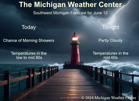
On June 12, 1984, an F3 tornado hit Bay County at 6:20 PM and caused $2,500,000 in damage. Two individuals were reported injured, but there were no deaths. This was the strongest tornado ever reported in Bay County.
1915: An estimated F4 tornado moved northeast from northwest of Waterville, Iowa crossing the Mississippi River two miles south of Ferryville, Wisconsin. A man and his daughter were killed in one of three homes that were obliterated southwest of “Heytman,” a small railroad station on the Mississippi River. 60 buildings and eight homes were destroyed in Wisconsin. This tornado caused approximately $200,000 in damage. In addition to this tornado, another estimated F4 tornado moved northeast across Fayette and Clayton Counties in northeast Iowa. One farm was devastated, the house and barn leveled. Heavy machinery was thrown 300 yards. Clothing was carried two miles.
1948: The Columbia River Basin flood peaked on this date in the Northwest. The flood produced the highest water level in the basin since the flood there in 1894. The damage estimate for the 1948 flood was $101 million, and 75 lives were lost. Click HERE for a detailed report from the USGS.
Forecast Discussion
- Showers and storms possible late tonight through Thursday

The main focus over the next 48 hours will be on the storm potential
for Thursday afternoon and evening.

Before the main chances of showers and storms begin later tonight
and Thursday, we are looking at some small rain chances mainly this
morning. There are a couple of showers and even a storm out over
Lake Michigan early this morning. These are associated with both a
short wave and weakening low level jet that are both moving toward
the area. Both features are weakening, and instability progs show it
weakening also as it approaches. We will have some small chances to
account for this through noon today, before clearing skies will be
the rule and temperatures will be about 10 degrees warmer than
Tuesday with 850 mb temps about 6-8C warmer.

Shower and storm chances will increase once again tonight after
midnight from NW to SE. We will see a low level jet core out ahead
of the next system that will move across WI/U.P./Nrn Lower later
tonight and Thursday morning. The leading edge of it and the
instability gradient will bring scattered to numerous showers and
storms. The highest concentration will be the further north you go,
closer to the better theta e advection. This activity will be
elevated in nature, with little to no threat of severe weather.

It will linger over the area Thursday morning before the low level
jet moves mostly east of the area. The cold front will remain NW of
the area much of the day, dropping in during the afternoon hours.
This normally would be favorable for severe weather. In addition,
there is a good deal of instability (1500-2000 J/kg of CAPE), and
good shear values of 40 knots with mid level winds on the favorable
side. The potential is definitely there, and we agree with the SPC on
their Marginal to Slight Risk.

The severe threat is a conditional one however on if storms can even
develop. There are multiple factors that many of the hi-res CAMs and
synoptic models seem to agree on limiting the afternoon development.
First, is the early convection will likely temper the instability a
bit. Also, the low level jet moving away will not help. The
divergent flow downwind of Lake Michigan with a westerly component
to the wind will not help. Finally, forecast soundings show the
atmosphere capped a few thousand feet agl. The gist of this is that
we will have small pops Thursday afternoon, focused on the SE
portion of the area further away from the lake and with the best
instability.

- Showers/storms ending Thursday evening

Many of the CAMs really don`t show much convective development
Thursday evening. However, the 00z HRRR shows a line of storms
developing around 00z from Greenville southwest to west central IL
along the cold front. If the HRRR is correct, then strong to severe
storms will be possible during the evening, given SBCAPE aoa 2k
j/kg, bulk shear aoa 40kts and surface dewpoints in the mid 60s. The
location of convective development will likely be modulated somewhat
by the degree/coverage of potential convection earlier in the
morning and whether that convection can push the frontal boundary
farther south and out of the cwa during the day prior to any
afternoon convection developing. We`ll continue to monitor the
development of this event.

- Significant warmup expected over the weekend

Once the front moves through Thursday afternoon/evening, high
pressure will nose into the region with a brief push of cooler air;
highs Friday will be 75-80. As the high moves east Saturday, south
flow will develop and an upper ridge will move from the Plains
toward the Great Lakes. Surface temperatures will rise in tandem
with upper heights. Highs Saturday will be around 80, Sunday 85-90,
Monday through Wednesday in the lower to mid 90s. Dewpoints will
reach the 60s Sunday and that`s when we`ll feel the humidity; heat
indices will be in the mid to upper 90s Monday through Wednesday.

Late in the weekend and early next week, the ridge axis will be just
east of the cwa, which means we`ll be susceptible to minor short
waves riding up the west side of the ridge. Chances of rain aren`t
very high during this time, but they aren`t zero either. The west
and northwest parts of the cwa have the best chance at seeing
precipitation.
Really warmed up quickly this afternoon. 85 here currently and the temp still may increase another degree or two.
Looks like the storms may remain off to our SW tomorrow. I hope we get at least some precipitation.
Really nice stretch of weather we have been having… a bit dry, but otherwise no complaints. Looks like quite the soaking rain in Florida right now… there is a Flash Flood Warning for 4-6″ per HOUR rates
They’ve had 10” already and expecting another 10”. The flooding is incredible.
Phew, blowtorch alert!
Lake effect rain showers this morning is it October or June lol… INDY
Boy I am in another great mood today! I think I will get some yard work done and have a Sprite! Have a great rest of your week everybody!
That’s the spirit its beautiful day for it!! Enjoy my friend INDY
Thanks INDY!! You too buddy!
The overnight low in MBY was 58 there was a trace of rainfall and at the current time with a few sprinkles it is 61.
Slim
The official H/L yesterday was 73/45 that 45 should be the coldest low for this June. There was no rainfall the sun was out 71% of the possible time. For today the average H/L is 79/58 the record high of 96 was set in 1901 the record coldest high of 56 was set in 1985 the record low of 38 was set in 1903 the warmest low of 70 was set in 2005. The most rainfall of 1.89” fell in 1996. Last year it was a cool 64/50.
Slim
Yes, it is another great day! Some sun, lower humidities and near normal temps! Rock n roll baby!