When I went to bed at 11 pm last night it was 81° – thank the good Lord for the blessing of air conditioning. Our high yesterday was 88° mainly due to cloudy skies and a few showers around much of the day with temperatures holding in the upper 70s until the sun came out later in the afternoon. Heat and humidity will continue today with heat indices reaching the upper 90s. A few showers and storms are possible in the afternoon. The heat and humidity will persist through the end of the week.
Weather History
1954: A tornado strikes in Jackson County at Gillett’s Lake, damaging several houses and cars but causing no injuries.
1995: Muskegon hit 98 degrees, their highest temperature on record in the month of June. Their second hottest June reading of 95 degrees would occur the following day.
2009: Severe weather strikes with three tornadoes and downburst winds. A tornado partially unroofed a home south of Allegan and another tornado took the roof and deck off a home near Richland in Kalamazoo County. A weaker tornado downed trees and did minor damage to a house in Alamo Township, Kalamazoo County.
On June 19, 1948, the daytime temperature in Flint rose to only 59 degrees.
1794: A violent tornado commenced west of the Hudson River in New York. The tornado traveled through Poughkeepsie and then crossed the border into Connecticut where it went through the towns of New Milford, Waterbury, North Haven, and Branford. It then continued into Long Island Sound. The tornado did extensive damage, and the funnel was reported by one observer to look like the “aurora borealis.”
2004: Annette Island, Alaska set an all-time record high temperature of 93 degrees. Since record-keeping began in 1941, Annette Island has seen 90-degree temperatures four times.
Forecast Discussion
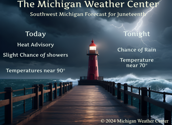
- Hot/humid today with a chance of storms

Another hot and humid day is expected. As of 3am, it`s still 82 at
Holland. Needless to say, temperatures won`t have to rise much to
reach the 90s today. As dewpoints close in on 70 this afternoon,
heat indices will rise into the mid to upper 90s. CAMs show a
seasonably robust short wave lifting north today from the MO
bootheel. As it arrives this afternoon, we`ll see isolated
convective develop within a weakly sheared environment that will
see 1500 j/kg SBCAPE and PWATs near 2 inches. A marginal risk of
severe storms exists for the southeast cwa mainly for the
potential of gusty winds.

- Not as hot Thursday

GFS and ECMWF show a weak cold front dropping south tonight and
northeast winds developing that will continue Thursday. It`s
likely temperatures will be a little cooler Thursday with highs
around 80 near US-10 to around 90 near I-94. If the cooler trend
continues in the models, we may be able to drop the Heat Advisory.
The ECMWF also showed weak low pressure riding east along the
frontal boundary Thursday resulting in showers/storms over the
eastern cwa. Given the humid environment in place, any storms that
develop will be capable of producing heavy rain.

- Sct`d storms Friday through Sunday; highest chance Saturday night

The center of the upper high continues to drift southwest over the
weekend, from the TN Valley on Friday to Texas by Sunday. Shortwaves
riding around the periphery of the upper high combined with weak
surface convergence and peaking afternoon/evening instability will
continue to support a daily risk for showers and storms through the
weekend.

The highest chance of storms comes on Saturday night when a cold
front presses southeast through the region ahead of an approaching
nrn stream shortwave. Deep layer shear values will be ramping up by
then as the influence of the upper ridge slips away so we may be
looking at a round of severe weather as that system comes through.

- Hot and Breezy Saturday

Ahead of that cold front/shortwave a surge of even warmer air
arrives for Saturday with guidance temps as suggesting readings as
high as 95 well inland from Lk MI. Southwest winds may gust over 30
mph.

- Dry and more comfortable Sunday through Tuesday

It is that nrn stream shortwave which ushers in less humid and not
as hot weather for a few days early next week with lows in the lower
to mid 60s and highs in the lower 80s. Confidence in a dry Monday is
fairly high as high pressure passes overhead, before low pops creep
back in with returning warm air by midweek.
LOL!!! Told all Cold Weather Crazies this was going to be a hot, hot, HOT summer and they refused to listen!! We’re in an extended heat wave and it’s not even summer yet!!!
My teacher that I text with said Happy last day of spring …I hope summer is cooler. 😂
Haha SS!! Yeah, been a hot spring!
Heat Advisory expires at 8pm today for the following counties:
Gratiot, Isabella, Mecosta, Montcalm, Clinton, Ionia, Muskegon, Newaygo, and Oceana Counties.
More may be dropped per the latest NWS discussion. In the meantime, stay cool everyone
89 degrees – dewpoint 72.6 – feels like 97
Bring on Winter!
Summer weather in the Southern Arctic!…soak it in while it’s here. We’re on the road to Winter at weeks end. Enjoy.
Only 9 months til Spring and the best time of the year! Maybe spring will start in February again like it did this year?? BRING IT!
81 degrees this morning at 5a.m. when I went in to work. Ridiculous. I can only think of a handful of times in the past 40 years where it’s been 80 or better at that time of the day. And Summer hasn’t even started yet.
Wow VERY warm last night. This is more typical of Florida weather than Michigan weather… especially for June. Like you said, thank goodness AC exists
Wish tht cooler weather would push through before Saturday…have 2 grad parties… Lol
Bring on a rainstorm and a cold front and fast!
Absolutely horrible weather! Give cold and snow over this garbage any day and everyday! Incredible!
Steamy this morning. It’s never fun to wake up to 75 degrees and humid. On the bright side, we’re nearly halfway through the heatwave. Further, the lake water temps should be warming up nicely just in time for the Independence Day weekend.
Late Monday I had a surprise. It started getting warm in the house and guess what, right in the middle of a hot night the AC went out. I called the people who put our furnace/AC in and they were able to come out yesterday afternoon and fix the AC. The fan motor just died. Well we survived yesterday and the AC is now back on.
Slim
The overnight low here in MBY so far is a warm 77 and that is the current temperature with cloudy skies. The official low so far at GRR is 76 so that record warm low of 77 in 2012 will stand. Yesterday had the warmest lows for any June 18th at Grand Rapids and Muskegon 76 and Lansing with 75.
Slim
The official H/L yesterday at Grand Rapids was 90/76 that 76 set new record warmest minimum for any June 18th at Grand Rapids. There was a trace of rainfall the highest wind gust was 32 MPH out of the SW. There was 36% of possible sunshine. For today the average H/L is 81/59 the record high of 98 was set in 1953 the coldest high of 60 was set in 1948. The record low of 45 was set in 1926 and 1945 the warmest low of 77 was set in 2012. The most rainfall of 3.15” fell in 2009.
Slim