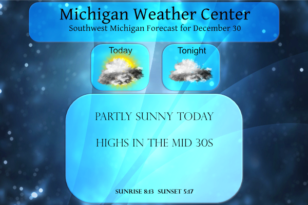
We have a temp of 27° at 6 am this morning which is fairly consistent across southwest Michigan. Yesterday we made it up to 36.5° and overnight we dropped to 28.6°. We had a dusting of snow overnight to freshen up the crunchy base we have left on the ground.
Look for mostly cloudy but dry conditions today, with areas of fog expected tonight and into Friday morning. A storm system is expected to bring accumulating snowfall to much of southern Lower Michigan on Saturday afternoon (New Year’s Day) into early Sunday. I am not one to get overly excited about snowstorm paths until we get out to a day before the event in regards to accumulations but this one could be our first major storm of the season for southern Michigan with half a foot or so. The snowblower is getting restless out in the shed.
As the path of the storm becomes clearer we may see watches and warnings coming tomorrow for the impacts of this system.
Forecast Discussion
- Widespread accumulating snowfall Sat afternoon into Sat night -

The main story in the forecast remains the system for New Years
Day (Saturday). The trend in the models the last 24 hours has been
for a bit slower system and a bit further south system. The slower
trend is not surprising given we are talking about a Western U.S.
trough with shortwave energy still digging into the back side of
it as if the current time. These types of patterns usually lead to
a slower downstream evolution. The further south trend is not
surprising either given the fast zonal flow that will be in place
from the Plains through the Great Lakes on Saturday. The fast
upper flow yields to a flatter path of the surface low.

As for the details it looks like snow moves into the area in
earnest Saturday afternoon into Saturday evening. The ECWMF is a
bit quicker (afternoon) and the GFS is a bit slower (evening).
This event is still out in the 5th and especially 6th forecast
periods so there is still some wiggle to be expected in both
timing and location. That said it seems like the heaviest snow in
our forecast area will be closer if not over the I-94 corridor.
Accumulating snow will occur over our entire forecast area it
appears though with inch or two amounts along U.S. 10, to maybe
3-5" totals along I-96 and potentially 5-7" along I-94. Model QPF
amounts do not support much more than that at this point despite
what you might see from some model algorithms on the web.

The main low path is well off to the south of the State of
Michigan over the Ohio Valley. Our snow is well on the backside of
the system and is associated with an 850mb low that traverses
portions of Northern Indiana and Ohio. This is a more favorable
track for us. This low also produces strong isentropic upglide
Saturday night across much of our area. A good cross hairs
signature is seen in BUFKIT overviews where strong lift extends
below, through and above the DGZ. The DGZ is not overly large in
depth though so I wonder about flake size a bit, but given the
depth of lift we should see good dendrites (big flakes). The bit
further south track allows more cold air to filter in ahead of the
system and we are now not concerned with a wintry mix as it looks
to be all snow.

No headline decisions with this shift given the time frame in the
forecast yet and variability still going on with track and
timing. Headlines will be coming though likely within the next 24
hours.

- Rather quiet weather either side of the weekend snow -

We should remain precipitation free for much of the time between
this morning and Saturday morning. BUFKIT overviews show shallow
moisture with an unsaturated DGZ from now through Saturday
morning. We should be dry despite a frontal boundary working
south and southeast through the area Friday and Friday night.

Behind the system zonal flow aloft will be in place Sunday into
Monday with ridging at the surface. The next threat for
precipitation will come Tuesday night into Wednesday it appears as
we trend towards troughing aloft.
Just based on the lack of Rocky and INDY posts today, seems like this storm is fizzling out! Watch out for the storm in two weeks though!!
GO BLUE!!
GO GREEN!! 🙂 .DISCUSSION…(This evening through next Thursday) Issued at 300 PM EST Thu Dec 30 2021 – No headlines yet at this time – We will not be issuing any headlines yet for the snow event expected for Saturday afternoon and Saturday night. The latest trends have backed off on snow amounts a little more, and confidence in a warning event is not high enough at this time for our area to issue a Winter Storm Watch. This is looking more and more like a solid advisory type of event. The Euro has really backed off – like 1/2… Read more »
Wow, 44 degrees forecasted for tomorrow to close out a warm month and a warm year!
3-5″ for most of GR per NWS. Not that big of a deal. We need way more than that just to get back to average. The snow drought continues!
GO BLUE!
Yea I was surprised they are only forecasting 3-5 inches. For as much as they have discussed this system the past 7 days it seems like an awfully low amount. We have had multiple 3 inch clipper systems the past couple of months so this doesn’t seem as big of a deal as they have been expecting?
They said 4-8 yesterday and I saw one met say 6-10. Then the models shifted the path to the south near the Ohio River. Based on that, SE Michigan will get more than us. BUT, it’s still way to early to know the path of the system. We’ll have a better idea tomorrow.
Looks like the storm setups from last year. The storm track was always way to the south.
There was a brief period of heavy snow fall here last night. The total here at my house was about 1 inch and there is a total of 3″ on the ground at this time. Last night was one of the few times were the overnight low at the airport was colder than here at my house. The official low was 25 and here at my house I had a low of 27. At this time it is cloudy and 28 here at my house. Later today or tomorrow I will go and get some gas for the snow blower… Read more »
I see the NWS us falling for the model game of back and forth with the heavy snow now moving to the South! Mark it down>>>>this storm will not continue tracking to the South! By the time it hits the heavy snow band will be tracking right up towards the I 96 corridor! The preliminary RDB gives GR 5 to 8 inches of snow! Stay tuned and the final RDB forecast will be hot off the press on Saturday morning! Incredible!