Yesterday we reached 78° in Otsego! We have 62° at 6 a.m. this morning with a bit of light rain.
Mild with Occasional Showers into the end of the Week
Southerly winds will prevail into Friday which will keep the mild to warm weather going. There will also be some moisture arriving so the showers will be on the increase today. Unsettled weather will persist into Friday when a cold front pushes through. Temperatures will fall steadily into early next week when we will see much colder than normal values. Looking into Monday and Tuesday the mention of snow showers is in the forecast with temperatures in the upper 30s to low 40s.
Forecast
Weather History for SW Michigan
October 22
1953: An extended October warm spell culminates with record highs around 80 degrees. At Grand Rapids, it is the third consecutive day with record-high temperatures.
October 23
1955: A cold front moving into warm and humid air results in severe thunderstorms across southwest Lower Michigan. High winds and hail caused considerable damage to windows, roofs, automobiles, and trees as a severe storm passed about 15 miles south of Grand Rapids.
1959: A tornado struck near Evart in Osceola County around 4 PM, with only minor tree damage.
1963: Michigan is in the midst of a spell of record-warm weather. Lansing reaches 80 degrees or higher on five consecutive days from the 22nd to the 26th.
October 24
1967: A tornado injures four people as it destroys a trailer in Monterey Township, Allegan County.
2001: A squall line moves across southern Lower Michigan producing widespread wind damage and several tornadoes. The town of Schoolcraft in Kalamazoo County is hit by winds estimated up to 100 mph, causing extensive tree damage and some structural damage. The town of Marshall in Calhoun County also sustains some damage to homes as winds gust between 60 and 80 mph.
October 25
1962: Snow accumulates an inch or two across southwest Lower Michigan as an October cold snap continues. Low temperatures fall into the 20s at most locations for four straight days from the 24th to the 27th.
October 26
1869: Several inches of snow pile up across southwest Lower Michigan. The 5.5 inches at Lansing is a record for early-season snowfall and the high temperature there only reaches 34 degrees.
2008: Thunderstorms combine with a cool air mass to bring some hail to Lower Michigan. Small hail covered the ground in a few locations.
October 27
1967: The heaviest October snowstorm on record strikes southwest Lower Michigan with widespread amounts greater than 6 inches. A total of 8.4 inches at Grand Rapids is almost double the amount of the next greatest October snowstorm.
October 28
1869: Michigan is in the grip of an icy cold wave. The temperature falls into the teens for eight consecutive days at Lansing, where it is the coldest October on record.
SE Michigan Weather History
October 22
On October 22, 1972, Flint reported 2.4 inches of rain on the 21st and the 22nd. A three-day period of cold rain engulfed Southeast Michigan. Around 3″ of rain fell around the Flint area into the Saginaw Valley while Detroit received about 1.5″. Temperature highs were mainly in the 40s and 50s. Later October of 1972 was the 3rd coldest in Saginaw and 7th coldest in Flint and the 11th coldest in Detroit.
October 23
On October 23, 2020, a line of strong to severe storms tracked across Southeast Michigan, resulting in numerous wind damage and a few 1-inch hail reports. The hardest hit areas were around Elkton and Kinde in the Thumb, where a bowing segment caused damage to several structures and numerous trees and resulted in widespread power outages.
On October 23, 1951, 1.94 inches of precipitation fell in Flint. This is the record for the greatest amount of precipitation for the month of October in Flint.
October 24
On October 24, 2001, a strong cold front moved into the Great Lakes region during the early morning hours of the 25th. Ahead of this cold front, warm air surged northward into the Great Lakes. Thunderstorms developed ahead of the cold front late in the afternoon of the 24th and continued into the evening. These thunderstorms extended from the Great Lakes all the way to the deep south. Strong winds just off the surface allowed some of the thunderstorms that developed across southern Michigan to become severe. Most of the severe storms caused damaging wind gusts with a few hail reports. Most of the wind gusts were estimated between 60 and 70 mph, but isolated locations in Lapeer County gusted up to 100 mph. Some of the thunderstorms developed rotation, a few of which produced tornadoes. Three tornadoes were spawned from the thunderstorms including an F0 near Fosters, an F1 from Hartland to Davisburg, and another F1 from near Munger to Quanicassee.
On October 24, 1991, the overnight temperature dropped to only 63 degrees in Flint, which is the daily record for the highest minimum temperature in Flint. This also happens to be the second night in a string of four nights (October 23-26) in which record-high minimum temperatures were recorded!
Also on October 24, 1933, an early-season snowstorm left the Saginaw area with 5 inches of snow.
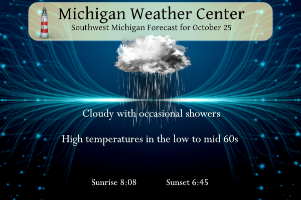
October 25
On October 25, 1963, the high temperature rose to 82 degrees in Detroit and 81 degrees in Flint. Both set new records for the date that still stands today.
October 26
On October 26, 2008, a late-season severe thunderstorm moved across southern Oakland and Macomb Counties. The storm developed ahead of a cold front that ushered in much colder air. Many reports of severe hail were received. Berkley and Madison Heights reported the largest hail at one inch in diameter.
Also on October 26, 1963, the temperature rose to 81 degrees in Flint, which is the record high for the day. This marked the fourth day in a row (October 23-26) that record daily high temperatures were recorded in Flint.
October 27
On October 27, 2010, a historically deep low-pressure system tracked northeast through Minnesota and into Ontario. A tight pressure gradient over southeast Michigan led to prolonged strong westerly winds, generally in the 45 to 55 mph range, but a few gusts in the 55 to 60 mph range were observed north of M-59, blowing down dozens of trees and tree limbs within most of those counties.
On October 27, 1997, low pressure tracked northeast across Ohio late on the 26th through early morning on the 27th. Rain changed to snow over the Saginaw Valley and Flint area during the evening of the 26th, and snow continued until around daybreak on the 27th. Accumulations were mostly from 3 to 6 inches, with a maximum of 6 inches reported at Saint Charles, in Saginaw County. The combination of the heavy wet snow, and the fact that many trees had not yet lost their leaves, resulted in widespread tree damage and downed powerlines. Around 40,000 homes lost power on the 27th. Measurable snow fell as far south as the northern suburbs of Detroit.
Also on October 27, 1967, Saginaw had another early-season snowstorm that left 5 inches of snow covering the region.
October 28
On October 28, 1980, 2.9 inches of snow fell in Detroit on the 27th and 28th. This was the highest snow amount for the month of October in Detroit
Also on October 28, 1976, there was a two-day streak of record lows in Detroit. The temperature was 22 degrees on the 27th and 21 degrees on the 28th.
Forecast Discussion
Sustained broad and deep southwesterly flow in the region will
supply anomalous moisture, which will be converted into frequent
rain showers as shortwaves within the synoptic flow pattern
propagate through. Both today and Thursday, PWAT values will be in
the range of daily maxima for this time of year per DTX-area
sounding climatology. And in turn, daily low temperatures will
vie for record warm.

Rain amounts today won`t be particularly heavy and lightning
potential is low given meager instability. Somewhat better
instability should allow for periods of heavier rainfall rates with
occasional lightning late tonight through Thursday. Heavier rain
totals around 1 to 2 inches are more favored north and west toward
Ludington, while totals around 0.25 to 0.50 inches are more likely
south and east toward Jackson.

Dense fog is possible late tonight especially in central Michigan.
Higher resolution models show saturation in the stable low levels of
the atmosphere from the surface to 7000 feet, underneath dry mid-
levels and amid relatively weaker winds prior to the arrival of the
next low-level jet. Some upward vertical velocity within this low
stratus layer may be present, so drizzle may also happen.

- Risk for showers/storms with cold front Friday

An axis of surface based instability advects in from the southwest
during the day on Friday, ahead of the afternoon cold frontal
passage.  Mean values are highest over southern parts of the CWA,
around Kalamazoo and Battle Creek, but are shown to be low with 300
to 500 J/kg.  Several ensemble members from the models do show
values topping 1000 J/kg, which given the strengthening deep layer
shear, would be a favorable setup for organized convection.  Close
monitoring of the setup in the coming days will be needed.  We will
continue to feature and afternoon risk for storms.

A strong 925 mb low level jet will be around to start the day,
possibly over 50 knots.  As we start to mix during the morning,
gusty winds should develop.

- Another round of rain still looks likely for Sunday

The right entrance region of a strengthening upper level jet will be
over southern Lower MI Sunday.  Decent FGEN sets up in the moist DGZ
especially for the southern half of the CWA Sunday.  This supports
high POPs for Sunday, which we will keep in the forecast.  However,
there are a fair number of ensemble members showing little or no QPF
for places like Kalamazoo and Battle Creek, and the trend has been
for less qpf.  If this trend continues, we may end up featuring
lower POPs.

- Lake effect clouds/showers for early next week

Behind the departing Sunday wave, a surge of cold air spreads over
the region with 850 mb temps dipping down into the -8 to -12 deg C
range.  This will be plenty cold enough to support cloudy skies and
occasional lake effect precipitation.  The models do show a lot of
spread with the qpf and this is partly related to the poor agreement
in the mid level pattern for Tuesday into Wednesday.  The High Res
Euro is showing a deepening mid level wave over MI with the other
models showing a positively tilted trough off to the west.  For now
we will continue to feature relatively high POPs given the favorable
lake effect setup.
Seems like leaves are starting to peak here. Bill S said peak is usually Oct. 23, so basically right on track
Temps in the 30’s for Halloween great scotty …INDY
Looks like I was in the sweet spot for rain today. Raining pretty hard here right now. Good thing we were able to mow here yesterday.
Just another above average temp day!
Looks cold and possible snow showers for Halloween! This a week after some of the warm weather fanatics said “no cold and snow for Halloween this year”! Incredible!
Let it snow let it snow let it snow …. honestly I forgotten about the warm fanatics becouse its been so cold this year ha ha ha ha . No long lasting heat waves or dewpoint days this past Summer.. love it!!! INDY
Great below normal temp!
The official H/L yesterday at Grand Rapids was 76/46 that 76 was the 4th warmest for any October 24th There was trace of rain at the airport here in MBY I had 0.10” is a short but heavy thunderstorm. The sun was out 56% of the possible time. For today the average H/L is 57/39 the record high of 78 was set in 2012 and the record low of 20 was set in 1960. The record rain fall is 1.05” is 2021 and the record snow fall of 2.4” fell in 1962. Last year the H/L was 67/53 and there… Read more »
With a warm south wind and lots of sunshine yesterday afternoon I was able to cut the grass. I wonder if that will be the last time for 2023? It all depends on how the next two weeks play out.
Slim
I will be mowing and mulching leaves for at least the next 3 weeks!