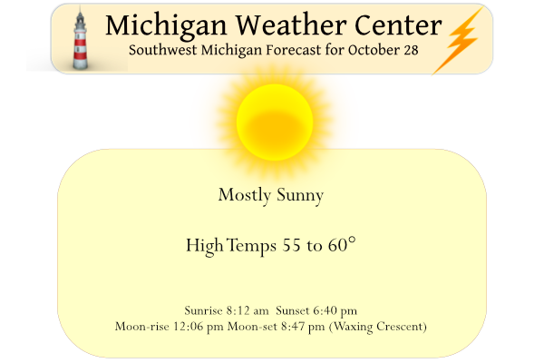
Yesterday we had a low of 29° and a high of 54° with mostly sunny skies. Driving around Kalamazoo and Allegan County yesterday I would say the fall color is reaching past its prime. Most of the leaves around my house have fallen most of which I have mulched back into the ground. The only crops left in the garden are some lonely parsnips. Now it is time to mourn the loss of fresh-picked tomatoes and peppers that store-bought can not replicate in flavor.
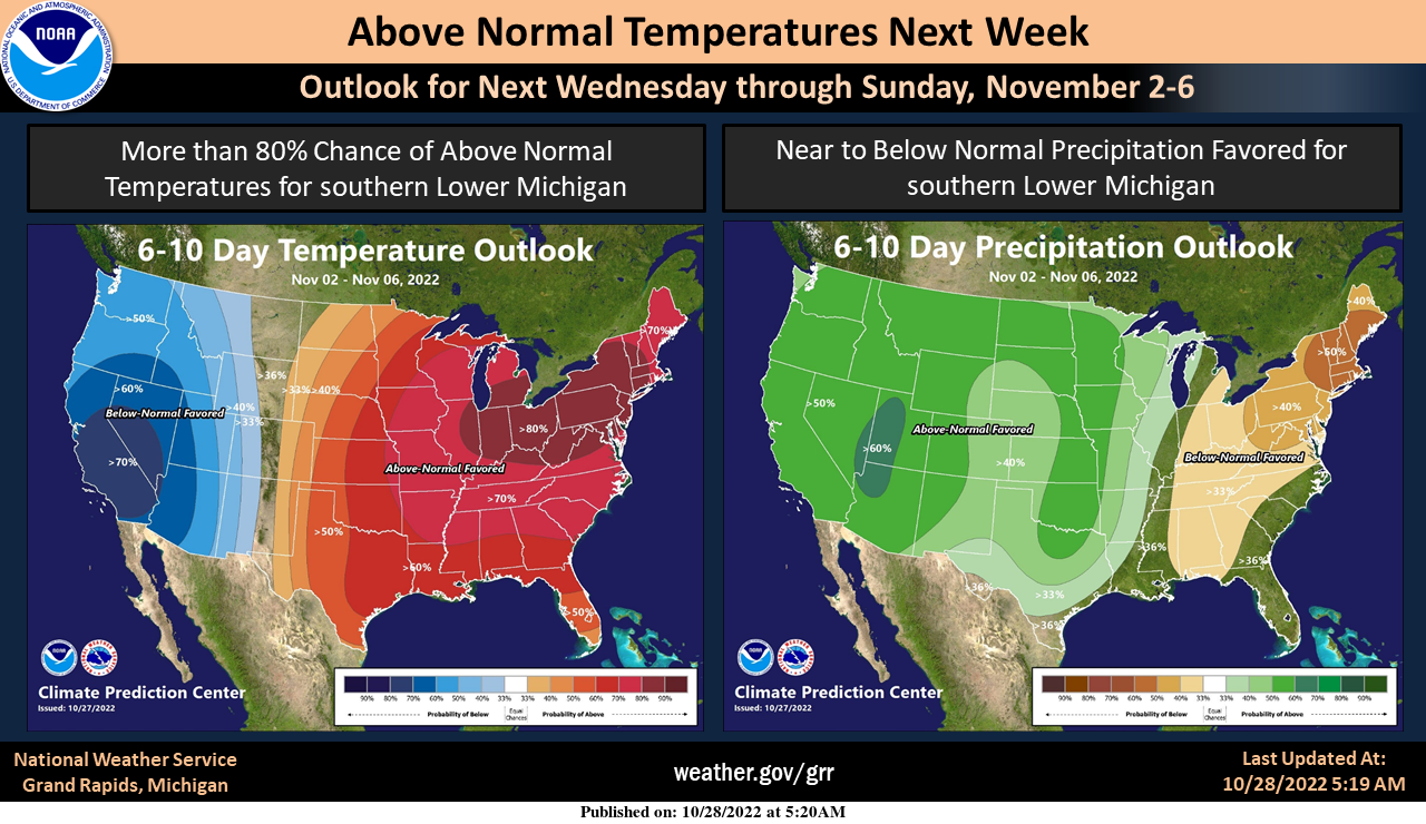
Expect highs around 60 and light winds through the weekend. Mostly sunny skies today and Saturday will be followed by clouds on Sunday with a slight chance of rain late. Above-normal temperatures will continue into the first week of November.
Forecast Discussion
--Fog Possible Next Few Mornings--

High pressure will dominate the pattern through Saturday.
Night time microphysics show mid to high level clouds. Winds
through central Michigan remain calm, however light easterly winds
persist west of US 127. So even though the sfc should decouple
the above factors will preclude fog formation. The exception will
be along the US 127 corridor.

 With high pressure continuing to dominate tonight into Saturday,
patchy fog will be possible again. However the area will be drier
through low dewpoint depressions near the intersection of the US
10 and US 127 corridors could allow for patchy fog.


--Next chance of showers late Sunday--

The models remain fairly consistent on the overall pattern. An
upper level trough will move eastward Saturday into Sunday with a
large upper level low moving through the Texarkana region and
then move through the plains and head towards the northeast. This
closed low will bring decent moisture advection northward and
into Lower Michigan Sunday. NAEFS anomalies show strong moisture
along with slightly anomalous PWATS Sunday afternoon through
Sunday evening. Latest NAM has a difference of timing, delaying
precipitation to late Sunday night into Monday morning. So a
period of showers will be possible into Monday.

--Warm temperatures on the horizon--

Though timing varies, the low will exit by mid next week with warm
850mb temperatures advecting into the region mid to late next
week. This will increase temperatures upwards into the low to mid
60s. So another mild Autumn period is on its way.
Wow another day with near to below normal temps! What a stretch of cool temps! Get ready for more frost tonight! Incredible!
An exactly average day is now shocking? Then the fact that we are now below average yet again for snowfall must be near heart stopping.
https://forecast.weather.gov/product.php?site=grr&product=cli&issuedby=grr
Another cold frosty morning! Wow this cold is persistent!
Yeah so persistent that Lansing has seen a warm May, June, July, August, September, and October LOL
Forgot to post this on the 26th but anyone remember all the tornado warnings we had on October 26, 2010? I certainly won’t forget that day. Not sure what all school policies were but our district closed if there is a tornado watch. Some schools that morning were “closed due to tornado watch” on TV including ours (Byron Center). I remember being in the drive through in Wayland with my mom and remember them saying we are not taking orders due to the tornado warning. While no tornadoes were reported here, there were many warnings. Tornadoes did occur to our… Read more »
“another mild Autumn period is on its way”
I love it! I keep pinching myself when looking at the forecast the next 2-3 weeks.
35 with frost and fog here as the sun is rising.
Michael,
We mourn no tomatoes here as well. I still have some raspberries hanging in there. I keep saying we need to build a green house. Lol!!!
Yesterdays official H/L at Grand Rapids was 52/29 that 29 is the coldest official reading for this fall season so far. There was no rain fall and there was 84% of possible sunshine. The overnight low here in MBY was 33 and the official low at GRR looks to have been 35 so far. At this time it is 35 here with cloudy skies. For today the average H/L is now down to 55/38 The record high for today is 74 set in 1989 and the low for the date is 23 set in 1965 and 1969. The record snow… Read more »
This is an interesting piece by Torregrossa:
https://www.mlive.com/weather/2022/10/a-triple-dip-la-nina-winter-is-coming-like-1976-and-2001.html
Another interesting item. This November looks it will have a warm/mild start. Well November 1975 the 1st 12 days were all warmer than average and on November 6, 1975 the high reached 77 at Grand Rapids and Lansing. While not as warm November 2000 had 9 of the first 10 warmer than average.
Slim
And then four days later on November 10, 1975, we all (should?) remember what happened.
Wow you’re right… things can change quickly in November