Halfway point of summer!
Today is the halfway point of Meteorological Summer. At Grand Rapids the sunrise/set time today is 6:18 AM/9:21 PM. The current 30-year average for today is 83.4/62.7 for the 15-year average it is a warmer 84.3/63.5. Starting on July 22nd we start the slow downward trend and head towards winter.
At Grand Rapids the warmest 1st halves of meteorological summer were 1919, 1933, 1921 and 1934. In 1919 the 1st half seen 14 days of 90 or better. The high was 97 and the low was 49. In 1933 there were also 14 days of 90 or better and the high was also 97 the low the 1st half was 42. In 1921 there were 22 days of 90 or better in the 1st half and the highest reading was 100 and the lowest was 41. In 1934 there were 16 days of 90 or better in the 1st half the highest was 102 and the lowest was 52. The coldest 1st halves were 1958, 1945,1915 and 1947. In 1958 there were 0 days of 90 or better 6 days with highs less than 70 the high was 88 and the low was 37. 1945 there were 0 days of 90 or better 14 days of less that 70 the high was 88 and the low was 32. In 1915 there were 0 day of 90 or better and 10 days of less than 70. The highest was 88 and the lowest was 41 and in 1947 there were 2 days of 90 or better and 8 days that had highs less than 70 the highest was 91 and the lowest was 38. Note that on the warmest side that 1936, 1988 and 2012 were not on the list and on the cold side 1992 was not on the list So far this meteorological summer there have been (officially) 7 days of 90 or better. There have been 2 days of 70 or less. The highest is 91 and the lowest is 47. For the warm season so far (since mid-May) there have been 9 days of 90 or better at Grand Rapids and Lansing, a whopping 10 days at Muskegon (with a lot of east winds) 7 at Holland to the east at for the warm weather season so far Detroit and Flint have had just 2 days of 90 or better and Saginaw has had 4. Here is a fun fact at Grand Rapids so far this meteorological summer there have been 28 HDD’s that is -10 below average and there have been 249 CDD’s that is -17 below average. At Detroit there have been 19 HDD’s that is -9 below average and 263 CDD’s and that is -38 below average. So all in all at both Grand Rapids and Detroit the energy used so far this summer is below average at this point in time.
The official H/L at Grand Rapids for yesterday was 84/59 there was 0.04” of rain fall before midnight (here in MBY I recorded 0.64” as of 5AM. There was 30% of possible sunshine yesterday and the peak wind gusts was 26 MPH out of the SW. For today the average H/L is 83/63 the record high of 95 was set in 1995, 2006 and 2013. The record low of 47 was set in 1987.
AREA FORECAST DISCUSSION
NATIONAL WEATHER SERVICE GRAND RAPIDS MI
338 AM EDT SAT JUL 15 2023
LATEST UPDATE…
SHORT TERM/LONG TERM
SHORT TERM
(TODAY THROUGH SUNDAY)
ISSUED AT 301 AM EDT SAT JUL 15 2023
– PRECIPITATION MAY INCREASE AGAIN AROUND DAYBREAK
THE HRRR INDICATES A FAIRLY STRONG LOW LEVEL JET WILL DEVELOP IN
IN/IL IN THE NEXT COUPLE HOURS AND THEN LIFT INTO FAR SOUTHWEST
LOWER MI. THERE ARE SOME INCREASING SHOWERS/STORMS IN THAT GENERAL
REGION AND VWP’S SHOW AROUND 30 KNOTS FOR ILX. IF THIS FEATURE
FORMS, INDICATIONS ARE THAT IT WILL NOT HAVE MUCH INSTABILITY TO
WORK WITH. HOWEVER IT DOES LOOKS LIKE AN INCREASED POTENTIAL FOR
SHOWERS/STORMS TO MOVE BACK INTO SOUTHERN PARTS OF THE CWA EARLY
THIS MORNING. WE WILL FEATURE RELATIVELY HIGH POPS TO START THE
DAY.
– WILL HAVE TO MONITOR SUNDAY AFTN/EVE CLOSELY
A STRONGER MID LEVEL WAVE DROP INTO THE CWA FROM THE WEST
NORTHWEST WITH WINDS UP TO AROUND 60 KNOTS. INSTABILITY WILL TRY
TO BUILD DURING THE DAY AND IT WON’T TAKE MUCH TO CREATE SOME
ORGANIZED CONVECTION. ENSEMBLE MEMBERS FROM THE MODELS ARE
SCATTERED WITH THE DEGREE OF INSTABILITY SO CONFIDENCE WITH THE
STORM POTENTIAL IS LOW AT THIS TIME. WE WILL MAINTAIN THE LOW
CHANCE POPS FOR THUNDERSTORMS AT THIS TIME.
LONG TERM
(SUNDAY NIGHT THROUGH FRIDAY)
ISSUED AT 301 AM EDT SAT JUL 15 2023
– HIGH PRESSURE BUILDS IN FOR EARLY NEXT WEEK
BEHIND THIS PASSAGE OF THE SUNDAY WAVE, MID LEVEL RIDGING MOVES
INTO THE REGION. SUBSIDENCE ASSOCIATED WITH THIS SYSTEM WILL ACT
TO KEEP THE POTENTIAL FOR PRECIPITATION LOW. THE COLD AIR
ADVECTION AS THIS SYSTEM BUILDS IN WILL KEEP MAX TEMPERATURES
A FEW DEGREES BELOW NORMAL. THE GFS AND ECMWF ENSEMBLE FEATURE
MAX TEMPERATURE STAYING BELOW 80 DEGREES BOTH DAYS.
– SLOWLY MODERATING TEMPERATURES FOR THE MIDDLE PART OF THE WEEK
A SOUTHEAST FLOW WILL TRY TO SET UP FOR THE MIDDLE PART OF THE
WEEK AND MOST ENSEMBLE TEMPERATURE FORECASTS SHOW A SLIGHT
INCREASE. WE WILL BRING THE TEMPERATURE UP CLOSER TO NORMAL AND
KEEP IT THERE UNTIL MORE CLEAR TRENDS IN THE VALUES OCCURS.
Detailed Forecast for Grand Rapids
Saturday
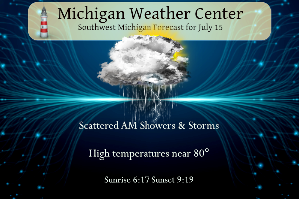
A chance of showers and thunderstorms before 8am, then showers likely and possibly a thunderstorm between 8am and 10am, then a chance of showers and thunderstorms after 10am. Cloudy, then gradually becoming mostly sunny, with a high near 80. Southwest wind 7 to 9 mph. Chance of precipitation is 60%. New rainfall amounts between a tenth and quarter of an inch, except higher amounts possible in thunderstorms.
Saturday Night
A 20 percent chance of showers and thunderstorms before 3am. Partly cloudy, with a low around 64. West southwest wind 5 to 8 mph.
Sunday
A 20 percent chance of showers after 9am. Mostly sunny, with a high near 80. West wind 5 to 14 mph.
Sunday Night
A 50 percent chance of showers and thunderstorms, mainly after 9pm. Partly cloudy, with a low around 62. West southwest wind 7 to 11 mph.
Monday
A 30 percent chance of showers before 9am. Sunny, with a high near 76.
Monday Night
Mostly clear, with a low around 58.
Tuesday
Mostly sunny, with a high near 79.
Tuesday Night
A chance of showers after 3am. Partly cloudy, with a low around 59.
Detailed Forecast For Lansing
Saturday
Showers likely and possibly a thunderstorm before 3pm, then a chance of showers and thunderstorms after 3pm. Cloudy, with a high near 79. South wind 7 to 10 mph. Chance of precipitation is 70%. New rainfall amounts between a tenth and quarter of an inch, except higher amounts possible in thunderstorms.
Saturday Night
A 30 percent chance of showers and thunderstorms before 2am. Partly cloudy, with a low around 64. South southwest wind around 7 mph.
Sunday
A slight chance of showers, then a chance of showers and thunderstorms after 11am. Mostly sunny, with a high near 83. West wind 6 to 14 mph, with gusts as high as 22 mph. Chance of precipitation is 30%.
Sunday Night
A 30 percent chance of showers and thunderstorms. Partly cloudy, with a low around 63. Southwest wind 6 to 10 mph.
Monday
Mostly sunny, with a high near 79.
Monday Night
Mostly clear, with a low around 57.
Tuesday
Sunny, with a high near 80.
Tuesday Night
A chance of showers after 2am. Partly cloudy, with a low around 60.
Get ready for a LONG string of below normal temps! Incredible!
Okay, we get it.
The facts still need to be repeated, so people will not believe the warm weather hype that gets posted on here!
Been at the lake all day. Lows 80s and a little humid with sun this afternoon. I keep applying sunscreen but I continue to get tanner. Hope everyone is having a great weekend.
Heading for Gaylord Michigan for Summer vacation tomorrow we rented a cabin on a lake in the middle of nowhere I have.packed more hoodies then shorts this year the weather looks beautiful and cool no major heat in sight the fishing should be pretty darn good this year i am excited …INDY
Have a blast. It looks like highs in the 70s and lows in the 50s up there. That’s shorts weather for me. Give us a mosquito report. I have not been bit once this year.
Have a great time!!
Well to report further on the storms last night we did end up getting water in our basement from last night storms in our laundry room so we have fans running down there right now. The strong winds picked up our metal pool cover roller and that was sitting inside pool. Part of it broke. My bird feeder took flight last night. There is some minor tree damage around here as well. I’m guessing we may have had maybe a small microburst.
Air quality alerts for tomorrow. Expected to reach the Unhealthy range. Lately we haven’t had it and it’s been nice. I’m not happy to see it coming back we have had more than enough smoke issues for one year.
.23 of an inch here bringing us to 1.63 for the month surpassing our .84 for the month of June.
Minimal rain compared to my location! For the month I am well over 7 inches!
Picked up about 0.75” of rain last night. The storm last night was much more powerful than the night when we got over 3” of rain. It was extremely windy I estimated between 40-50mph. Could have been higher but that was just my estimation. Velocity spiked right over Portland almost like a microburst sort of thing then dissipated a few scans later. One of the better storms of the year. Plus the thunder was loud.
We picked up 0.8”. Everything looks great!
Yeah things are looking much better out there!
I love cool summers! Let’s keep it rocking!
What? More rain and below normal temps! How is that possible!
Meteorological spring was above average in temps for both GR and Lansing. Yes I know two of the three months were below average for GR but if you consider the three months as a season, it was above average. Met summer started off hot (already surpassed yearly average total of 90-degree days). but has been floating right around average the past couple of weeks – for various reasons including the Canadian smoke. We should count our blessings. The south and southwest has been so very hot. Phoenix May break the all time record for most consecutive days of 110+ temps.… Read more »
We are locked into a near to below normal temp pattern and no change is in sight! Incredible!
I agree Mark it’s really been a pretty nice summer not a cool summer and not a hot summer. The racking up of 90s was impressive for so early in the season. 70s and 80s look to rule for the foreseeable future and we may even see a return of the wildfire smoke, unfortunately.