| EL NIÑO/SOUTHERN OSCILLATION (ENSO) |
| DIAGNOSTIC DISCUSSION |
| issued by CLIMATE PREDICTION CENTER/NCEP/NWS |
| 14 March 2024 |
|
ENSO Alert System Status: El Niño Advisory / La Niña Watch |
|
Synopsis: A transition from El Niño to ENSO-neutral is likely by April-June 2024 (83% chance), with the odds of La Niña developing by June-August 2024 (62% chance). During February 2024, sea surface temperature (SST) anomalies continued to weaken across most of the equatorial Pacific Ocean. In the last week, below-average SSTs emerged in a small region of the eastern equatorial Pacific Ocean (~100°W; [Fig. 1]). The weekly Niño indices weakened but remained positive, with the latest value in Niño-3.4 standing at 1.4°C [Fig. 2]. Area-averaged subsurface temperature anomalies were slightly negative [Fig. 3], reflecting the consequences of an upwelling Kelvin wave and associated below-average temperatures across the equatorial Pacific Ocean [Fig. 4]. Low-level winds were near average over most of the equatorial Pacific, while upper-level wind anomalies were easterly over the east-central Pacific. Convection was enhanced near the Date Line and was suppressed near Indonesia [Fig. 5]. Collectively, the coupled ocean-atmosphere system reflected a weakening El Niño. The most recent IRI plume indicates a transition to ENSO-neutral during spring 2024, with La Niña potentially developing during summer 2024 [Fig. 6]. While different types of models suggest La Niña will develop, the forecast team favors the dynamical model guidance, which is slightly more accurate for forecasts made during this time of year. Even though forecasts made through the spring season tend to be less reliable, there is a historical tendency for La Niña to follow strong El Niño events. In summary, a transition from El Niño to ENSO-neutral is likely by April-June 2024 (83% chance), with the odds of La Niña developing by June-August 2024 (62% chance; [Fig. 7]). This discussion is a consolidated effort of the National Oceanic and Atmospheric Administration (NOAA), NOAA’s National Weather Service, and their funded institutions. Oceanic and atmospheric conditions are updated weekly on the Climate Prediction Center web site (El Niño/La Niña Current Conditions and Expert Discussions). Additional perspectives and analysis are also available in an ENSO blog. A probabilistic strength forecast is available here. The next ENSO Diagnostics Discussion is scheduled for 11 April 2024. |
![[Fig. 1]](https://www.cpc.ncep.noaa.gov/products/analysis_monitoring/enso_advisory/figure01.gif)
![[Fig. 2]](https://www.cpc.ncep.noaa.gov/products/analysis_monitoring/enso_advisory/figure02.gif)
![[Fig. 3]](https://www.cpc.ncep.noaa.gov/products/analysis_monitoring/enso_advisory/figure03.gif)
![[Fig. 4]](https://www.cpc.ncep.noaa.gov/products/analysis_monitoring/enso_advisory/figure04.gif)
![[Fig. 5]](https://www.cpc.ncep.noaa.gov/products/analysis_monitoring/enso_advisory/figure05.gif)
![[Fig. 6]](https://www.cpc.ncep.noaa.gov/products/analysis_monitoring/enso_advisory/figure06.gif)
![[Fig. 7]](https://www.cpc.ncep.noaa.gov/products/analysis_monitoring/enso_advisory/figure07.gif)
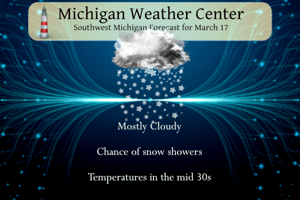
NWS Forecast
Weather History
1943: Heavy rains and melting snow result in flooding across southwest Lower Michigan. Childsdale Dam on the Rogue River gave way. Several families were evacuated from Comstock Park near Grand Rapids.
1973: A record snowstorm dumps over a foot of snow across southern Lower Michigan. Jackson is buried under 19 inches of snow and Lansing has a record 16.5 inches.
On March 17, 1973, a powerful winter storm hit all of Southeast Michigan. The storm started on the evening of March 16, 1973. Detroit received 9.9 inches, Flint had 13.7 and Saginaw was buried under 21.3 inches. This storm stands as the 3rd heaviest snowfall in Saginaw history and the 4th heaviest in Flint history.
1892: A winter storm in southwestern and central Tennessee produced 26.3 inches of snow at Riddleton and 18.5 inches at Memphis. It was the deepest snow on record for those areas.
1906: The temperature at Snake River Wyoming dipped to 50 degrees below zero, a record for the U.S. for March.
1906: A magnitude 7.1 earthquake caused significant damage in Taiwan. According to the Central Weather Bureau in China, this earthquake caused 1,258 deaths, and 2,385 injuries, and destroyed over 6,000 homes.
1952: The ban on using the word “tornado” issued in 1886 ended on this date. In the 1880s, John P. Finley of the U.S. Army Signal Corps, then handling weather forecasting for the U.S., developed generalized forecasts on days tornadoes were most likely. But in 1886, the Army ended Finley’s program and banned the word “tornado” from forecasts because the harm done by a tornado prediction would eventually be greater than that which results from the tornado itself. The thinking was that people would be trampled in the panic if they heard a tornado was possible. The ban stayed in place after the Weather Bureau; now, the National Weather Service took over forecasting from the Army. A tornado that wrecked 52 large aircraft at Tinker Air Force Base, OK, on 3/20/1948, spurred Air Force meteorologists to begin working on ways to forecast tornadoes. The Weather Bureau also began looking for ways to improve tornado forecasting and established the Severe Local Storm Warning Center, which is now the Storm Prediction Center in Norman, OK. The ban on the word “tornado” fell on this date when the new center issued its first Tornado Watch.
1990: Showers and thunderstorms associated with a slow-moving cold front produced torrential rains across parts of the southeastern U.S. over two days. Flooding claimed the lives of at least 22 persons, including thirteen in Alabama. Up to 16 inches of rain deluged southern Alabama with 10.63 inches reported at Mobile AL in 24 hours. The town of Elba, AL, was flooded with 6 to 12 feet of water causing more than 25 million dollars in damage, and total flood damage across Alabama exceeded 100 million dollars. Twenty-six counties in the state were declared disaster areas.
Forecast Discussion
- Impactful lake effect event likely tonight and into Monday

Confidence continues to increase that we will see a period of
accumulating snow that will likely impact the Monday morning commute
for the NW and SW sections of our forecast area. We will not issue a
headline quite yet, but believe one is likely going to be needed.

There are a few areas of light precipitation falling across the area
early this morning. Based on observations around the area, these are
only producing some light sprinkles or flurries, with maybe a light
shower under the strongest radar echoes. Cooler air continues to
filter in with upper troughing in place over the area. We will have
a couple of short waves move through, and keep the chances of light
precipitation going. The dominate p-type will likely become snow
this morning as freezing levels continue to fall with the colder air
moving in. We are not expecting any accumulation through most of the
day with sfc temps in the 30s and mid-March solar radiation.

We will see the snow showers increase in coverage and intensity,
especially for the NW and SW quadrants of the area later this
afternoon and especially tonight. The short waves moving through
today will allow the cyclonic flow and coldest air aloft to move
overhead tonight and much of Monday.

850 mb temps dropping down to around -12C will provide good
instability over the 3-4C Lake Michigan waters to get some good lake
effect bands going. In addition, the coldest air aloft will allow
for inversion heights to climb to around 10k ft. This will help to
produce some good NW to SE lake effect bands with the flow from the
NW. The favored areas will be areas west of a Grand Haven to
Kalamazoo line, and west of a Whitehall to Cadillac line.

Right now, we are expecting a 1-4 inch range for these areas, with
some locally higher amounts from late this afternoon through Monday
morning. It does look like that with accumulations overnight and
ongoing snow showers Monday morning, the Monday morning commute for
these areas will be impacted. Something that has been fairly rare
this winter. We expect that an advisory will likely be needed at
this point. By later Monday afternoon, the favorable ingredients for
lake effect will be diminishing as the upper trough and the
coldest of the air will be moving out.

- Chance of Snow/Mix Late Week

A clipper tracks southeast out of Canada late Tuesday/Tuesday night
in fast northwest flow but the low center remains to our north and
moisture is limited. Currently no POPs in the forecast but we will
have to watch Tuesday night across the northern zones where WPC does
have some light QPF.

Complex evolution of the flow regime across the CONUS middle and
late next week with a rex block across the West breaking down and
upper low moving east. The Euro has trended towards the GFS and GEM
showing a polar vortex across Hudson Bay by Friday. The GFS still
has lower heights extending south into the Great Lakes, allowing
more shortwave troughing here and creating a baroclinic zone where
there is frontogenetic forcing.

An area of snow blossoms in this baroclinic zone across the NW
CONUS/SW Canada on Wednesday and moves southeast, arriving in Lower
Michigan by late Thursday into Friday. This could bring at least a
light accumulation of snow.

There is some uncertainty by the weekend with ensemble support for
continued unsettled weather along the baroclinic zone and a
potential inverted trough bringing snow and mixed precip into
Saturday. THere is also some support for a stronger shortwave trough
with the cold front pushing south and lake effect snow showers into
the weekend.
Here you go, have fun cross country skiing this week. Warm air coming back in a week or so!

Still got you marked down for your prediction of 8 inches of snow for this area on March 27. We’ll see how that plays out!
I wonder why Andy has not been constantly posing CPC maps lately? Maybe it is because they show no warm air till April! Incredible cool pattern we are locked in! Have fun golfing this week!
Let it snow!
Another funny thing, Rocky’s prediction map is showing over 30 inches of snow for Cedar Falls, Iowa by Wednesday March 27. That will also be interesting with this forecast! But I’ve marked that down as well!
https://weather.com/weather/tenday/l/214a499b46197b9ad8281393d0ec87d9d6fb0236bdf10dc66b74288316c50229?traffic_source=footerNav_Tenday
That prediction should be interesting with the high temps that week!
https://weather.com/weather/tenday/l/52aab230ef88e4f2bb12857231a5dd58392e78a71b90e01d57a11d827658eb55
I’ll mark this down, Rocky is predicting around 8 inches of snow for our area come March 27th!
Let it SNOW!
https://www.pivotalweather.com/model.php?p=snku_acc-imp&rh=2024031712&fh=240
Just had a heavy snow shower pass through here a bit ago. Heaviest of the day I’d say. Briefly had a nice dusting on grass and trees.
Multiple snow chances this week! How is that possible? I thought winter was over? Rock n roll will never die! Have fun golfing this week!
Going from a El Nino to La Nina happens frequently. Since 1950 El Nino has flipped to La Nina in 1954,1963,1983,1987,1995,1998,2005,2007,2010 and 2015. It looks like it may be happening more often recently. I will do a report sometime in the weeks ahead on how the weather here in west Michigan was during the years that it flipped. Already know the winter of1982/1983 was very warm and that has been the case for the winter of 2023/2024.
Slim
Let it SNOW, let it SNOW, let it SNOW!! Great winter day!
Snow showers on St PARTY day! Happy Spring westerners Michigan’s best!! INDY
Sometime in the weeks ahead I will do a report on what happened during the years that went from El Nino to La Nina.
Slim
https://www.mlive.com/weather/2024/03/confidence-grows-on-el-nino-ending-quickly-replaced-with-la-nina.html
Happy St Patrick’s day. The official H/L yesterday was 53/30 there was 0.04” of rainfall there was 26% of possible sunshine. It was another windy day with the highest wind speed of 47MPH out of the SW. For today the average H/L is 45/27 the record high of 78 was set in 2012 the record low of -4 was set in 1949 the most rain fall of 1.47” was in 1919 the most snowfall of 7.5” fell in 1973. The most on the ground was 15” in 1904. Last year the H/L was 49/27 and there was 0.35” of rain… Read more »
GR NWS gives GR a high of only 34 degrees on Wednesday! Not too far off from the WOOD forecast from a few days ago that the warm weather nuts said would be way off! Some things never change! They say winter is over months ago and say Wood is always way off on temp forecast! Wrong on both counts! Incredible!
The weather words for next week are: COLD, WINDY and SNOW! just think some people have been telling us for months that winter is over!