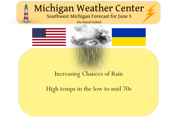
Yesterday we had a high temperature of 72° and the low was 43°.
From our Gaylord Office
An unsettled stretch lies ahead for northern lower and eastern upper Michigan. A few showers will be possible through the day today in northern lower Michigan before a more organized system passes through the region overnight into Monday, overspreading the whole area with steadier periods of rain. As of now, the heaviest amounts from this rainfall look to favor northern lower Michigan, but uncertainty remains as to where this heaviest swath of precipitation falls. High pressure briefly returns on Tuesday, giving us partly sunny skies with near to just below normal temperatures. Wednesday looks to remain drier than not, but a spotty pop-up shower cannot be completely ruled out.
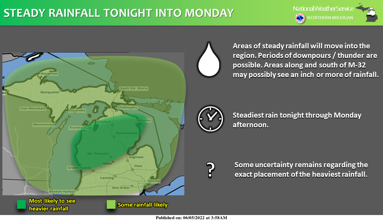
An area of low pressure will lift into the region tonight into Monday, bringing much-needed rainfall to the region. Rain will begin as scattered showers later today before becoming more widespread through the overnight. Periods of downpours and thunder are possible tonight into Monday before activity begins to taper off Monday evening. There is some uncertainty over where the exact placement of the heaviest rainfall will be. At this time, the areas most likely to see an inch or even locally higher amounts of rainfall will be along and south of M-32. Given recent dry conditions, flooding concerns will likely be limited to the occasional ponding of roads during heavier periods of rain.
Forecast Discussion
- Showers and a Few Storms into Monday -

Scattered light rain continues to spread across areas south of I-96
while warm advection lift spreads north. These showers will
gradually lift further north later on this morning and into the
afternoon as a warm front stalls south of MI. Steadier rain will
focus north of M-20, but additional pockets of light rain will be
possible elsewhere as warm advection lift persists north of the warm
front. Cannot rule out a few rumbles of thunder this afternoon, but
general consensus seems like the better instability will set up
Monday as the front lifts further north. Temperatures will vary
greatly geographically today as the warm front approaches the
southern state line. Temperatures along and south of the I-94
corridor may hit into the mid to upper 70s while areas to the
north stay in the 60s.

A southern stream shortwave will phase with a northern stream
shortwave leading to a increased warm air advection across our
area Monday ahead of a surface low. Widespread rain showers and a
few storms are expected to develop Monday afternoon. Overall
total rainfall amounts today through Monday will range from 0.5"
to 1.25" with the highest amounts falling north of I-96.

High pressure will nose back into the region late Monday into
Tuesday leading to dry weather Tuesday.

- More Showers and Storms Wednesday into Thursday -

High pressure holds in place through the first half of Wednesday
before another shortwave ejects out of the Rockies. Scattered
showers will return Wednesday afternoon then clear the area early
Thursday.
We are entrenched in a cool pattern! Get used to it!
Kinda like this weather. Like someone said you don’t need the a/c or the heat on.
Yes and I would rather have this than the upper 80’s to 90’s!! Nothing worse than 90’s with humidity!
Just got back from a walk. There are now some breaks in the clouds (more like thin spots) anyway it is not bad out side at all. At the current time here it is 72 with that sun thru thin clouds. The next question is how much rain will we see on Monday? After that is we are in for a cool week until next week and then we could see some summer like temperatures with highs in the 80’s ??
Slim
The sun came out here about the same time. I noticed it actually warmed up a bit. Not looking forward to the rain Monday. Not good roofing weather.
I remember a time back in 2009 when we went on a fishing trip in I believe the end of June 2009. We were up at Lake Leelenau. The first day there was nice then it just went to crap. I believe an area of low pressure was spinning over northern Michigan. We got quite a bit of rain. We were taking bucket fulls out of the back of the boat because it was taking on water. We were in winter coats in the morning and sweatshirts and jeans in the afternoon. It was COLD for that time of year.… Read more »
There was a period of hot weather in June 2009 from the 23rd to the 27th when temperatures reached the mid to upper 90’s Then there was a sharp cool down on the 30th and that cool down lasted into July. The 1st few days of July 2009 were well below average with highs only in the low 60 at Traverse City. At Grand Rapids July 2009 is the coolest July on record and that year July was cooler then June and August. The highest reading in July 2009 at Grand Rapids was only 84 and that is the coolest… Read more »
Nice day if you live south of I-94. North of there is just chilly and rainy.
The sample size of only 4 days is very small but here are the departures from average around West Michigan.
Grand Rapids -1.9. Muskegon -3.7. Holland -3.4. Kalamazoo -1.5. Battle Creek -2.6. With 4 days in the record books only Lansing with a current departure of +1.4 is above average. At this time today looks to be mild to the south and cool to the north. And while this could change the rest of the week thru Saturday look to be cooler than average so by next weekend the departures for June should contune.
Slim
Yesterdays official H/L at Grand Rapids was 71/56 there was no rain fall and 39% of possible sunshine. The overnight low here was 55 and there has been 0.20” of rain fall as of 10AM. For today the average H/L is 77/56 the record high was 95 set in 1925 and the record low is 36 is 1945. Last year the H/L was 87/67.
Slim
Looks like we may bring back the 80s again around mid-month or so. Of course that is subject to change as it’s a ways out, but it will be welcomed by me if it does return. We are in the best time of the year IMO. June and July are my favorite months. It’s goes quick though.
I need to look at the historical temps from last June, but if I remember quickly we had a cool start with a big rain event around the 20th and then a sustained warmup after through July. This June seems to be similar… but we will see about the rain event.
Edit- By “cool” start I mean by temps currently in the 70s, we are still *above* average so far this June
Nathan, Last year June started off on the warm side. It became very warm to hot between the 4th and the 20th. There was a sharp cool down from 21st to the 26th that is the day of that big rain event. The last 4 days were warm but not hot. July 2021 was mostly a up and down month. June 2021 ended up with a departure of +2.0 July ended up with a departure of -0.5. Note the first 5 days of June have been below average in West Michigan. See above.
Slim
Crazzy im getting invited to Fall shows and partys on fb already won’t be long we will be talking about Labor day …The next 7 to 9 days our the longest of the year seems like as we get older time flys enjoy the 60’s and rain today INDY
Blah… Well, I suppose my grass/garden could use a little watering of the natural variety, so I won’t whine too loud. Will be a good afternoon to read a book or binge on popcorn and movies. Happy Sunday everyone :< )