This has been a good place to come for your thoughts and ideas on the pandemic and the weather as of late. Strange stuff going on in both. I thank you all for coming as we are another family of concerned citizens coming together for comfort and expressions of concern for all the things we are going through as one. We are all in the same boat which is a rarity in history. The playing field is leveled. It all goes to show how things can change in our lives which brings us to be dependant on each other as a community rather than just ourselves.
We are brought to our knees signaling a new era of change, a new normal which we as the human race will struggle to climb back up the hill and climb we will because we are strong and resilient. Yes, we may complain but we are lucky to live in a free country where we are allowed to do so. During this time patience is a virtue so fight the good fight and hold your heads high for we will come out of this a stronger people and nation. OORAH!
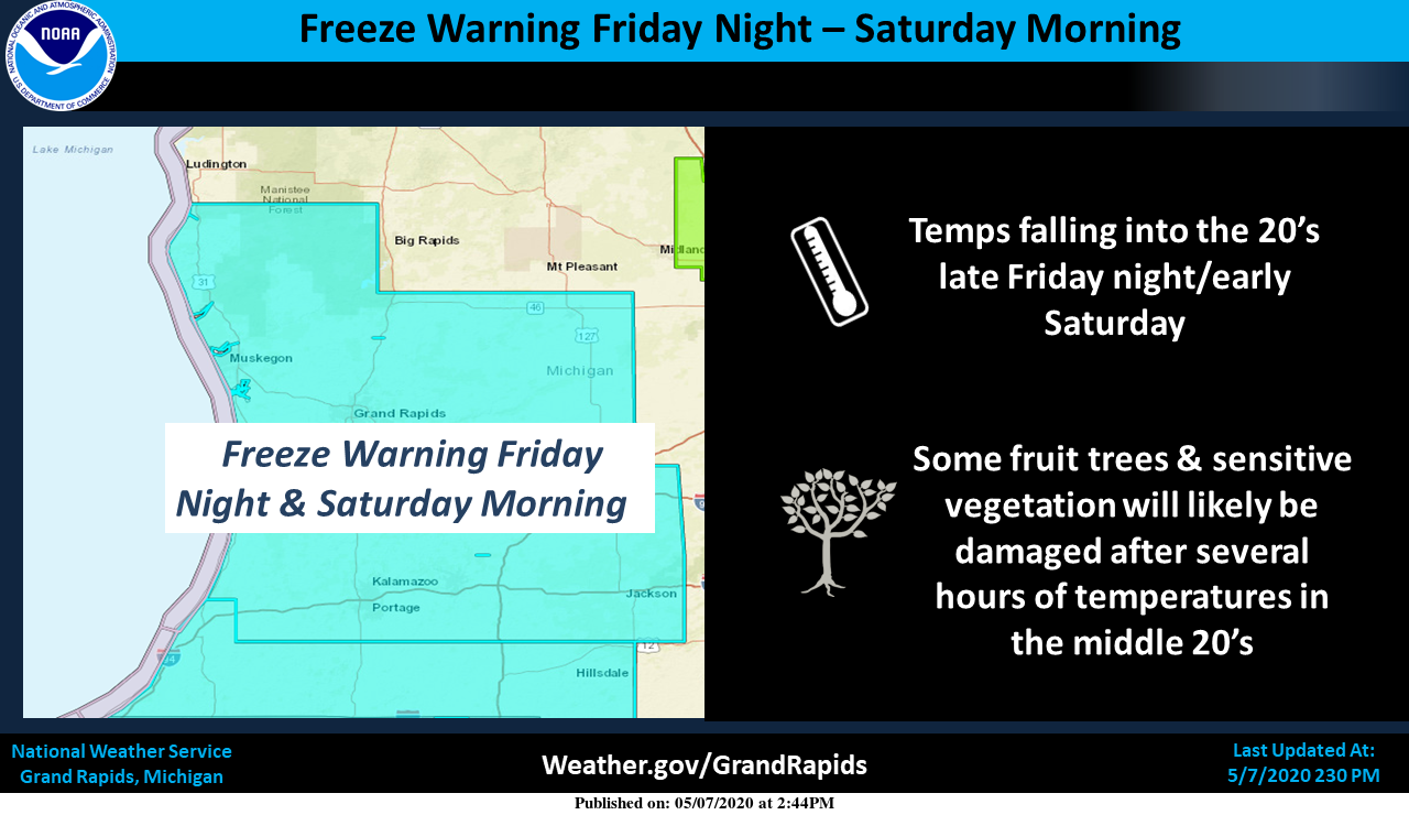
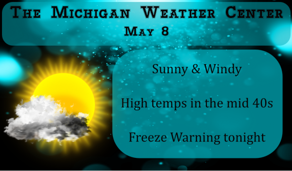
We have a freeze warning for tonight and early tomorrow morning with low temps dropping into the mid-20s for an extended time. If you have strawberries or other sensitive plants it will be a good time to cover them up when the sun sets.
From the NWS this morning:
- Overall Pattern the Next 7 Days

- Freezing Temperatures Expected Tonight

- Precipitation in the Forecast for Sunday

- Next Threat for Some Rain Next Thursday/Friday
-- Overall Pattern the Next 7 Days --

Not much has changed tonight in the latest models runs as compared to
last night with the overall pattern. We will see an upper low drift
southeast through Ontario and Quebec with a trough pivoting through
Lower Michigan today. This trough will usher in very cold air for this
time of year with 850mb temps forecast to dip to around -11C this
afternoon and tonight, which is some of the coldest air we ever see
in the month of May according to sounding climatology. Northwest upper
flow remains in place behind this trough into early next week. So, the
colder than normal temperatures (we should be seeing highs in the
middle 60s) will continue. Highs look to be 10 to 20 degrees below
normals for this time of year into early next week. Zonal upper flow
returns mid next week with temperatures rebounding towards normals. Two
main weather systems in the forecast are centered on Sunday and next
Thursday/Friday.

-- Freezing Temperatures Expected Tonight --

Freeze Warning still looks very much on track for tonight as forecast
lows are expected to dip into the middle to upper 20s at most locations.
There will be a wind off the lake in the western portions of the
lakeshore counties. This may keep temperatures up in the township or
two closest to the lake. Inland away from this moderating influence
(the Port Sheldon Buoy water temp this morning is in the mid 40s),
temperatures should fall off rapidly after sunset. We are probably
looking at 12 hours of sub freezing conditions. There is the potential
for some lake stratocumulus with delta t`s in the middle teens C, but
models are not consistent in showing widespread clouds. We are expecting
partly cloudy conditions tonight with patches of stratocu moving
through.

Sunday night will be another potential night for frost and freezing
temperatures if the clouds can clear out with a better threat on
Monday night. Owners of fruit trees will need to continue to be
vigilant as we head through the next 5 days.

-- Precipitation in the Forecast for Sunday --

We may have a few scattered showers around today, but the next good
chance for precipitation will come late Saturday night and especially
into Sunday. The surface low is associated with an upper wave that
dives our way from the Canadian Rockies over the weekend. The surface
low is not all that impressive, but the upper wave is fairly strong
looking and is actually a phasing of a couple upper waves according to
the ECWMF. Precipitation type is a question even though the calendar
has flipped to May. Models are showing colder air filtering in Sunday
afternoon and we may see some wet snowflakes. The best chance of this
occurring is up north across Central Lower Michigan where some light
accumulation is possible along U.S. 10. The precipitation winds down
into Sunday night.
38* degrees out at thee YARDofBRICKS NE of GR currently it’s feels great outside!!! May 9th love it!! INDY
On another note Spring is the time for babies…we have a new Robin in a nest we can see and new foal was born today in the stable.
SWEET!
At this time it is partly cloudy here with a temperature of 41 the DP is only 13 at this time and with winds gusting to 30 MPH yes there is a wind chill. And at 2 PM the report from Bellaire. MI was heavy snow with a temperature of 29. And at the Sault it was 31 with light snow falling. Not a nice day for the merry month of May.
Slim
Is that snow falling outside? Interesting for May 9th ….INDY
Yes it was. I had some here too about the same time. Didn’t last long. I had just been looking at some pretty flower baskets a farmer had on a wagon for sale and it started snowing.
Michael, thank you for providing this forum. I enjoy keeping in contact with the fine folks that frequent your site.
Have a great day, all.
Hooah! (Army version of Oorah! 😁)
Agree Mark… We have been the cool ones social distancing for years on this blog… Lol!!!!
At least it is sunny today!!! Have to look on the bright side… 😉
Get ready for a COLD weekend! What a below normal temp pattern we are entrenched in! WOW!
As long as the sun shines- that helps. It looks warmer than it is.
At this time the official reading at GRR is 36. Here at my house it is 38 with partly cloudy skies. The DP is currently in the teens that and the wind just makes it feel that much colder. Today will be one of the coldest maximums for this date. The record coldest high for today is 41 set in 1947. The forecast high for today is at 42. The average high for today is 67. The record high for today is a warm 89 set in 1926. The record low for tomorrow AM is 23 set in 1947. In… Read more »
Thanks for the facts and the areas Slim …INDY
DP is 17.6 here with a balmy 41.5 degrees – as Mr. Negative would say another beautiful day in the southern Arctic… 🙂
😉
If you enjoy enjoy the cold, I hope you enjoy the next couple days. Looks like we’ll be back in the 60’s shortly next week!
Gee, I wonder if we will have any record heat anytime this summer. If we have near record cold now it would be great if we have record heat in July.
Slim
We recorded a few record highs only a month or two ago I remember. One was like 7 degrees above the old record high! I’m sure they will come again.
We hit 60 degrees yesterday with 97% total sunshine! Exceeded forecasts once again. I love it!
More great fire weather love cold Springs and guess what September is only 4 in a half months away called Fall amazing ….Let’s keep the cold a going have a super duper Friday happy monther’s day weekend!! INDY