Yesterday’s high was 66° and the low was 41° in Otsego.
This week will feature fairly nice weather as far as fall standards go, we may even reach record-high temperatures on Thursday when they soar into the low 70s. If you have any yard work to do this week it would be a great opportunity to get it done. Several weather models are pointing to some accumulating snow thanks to lake Michigan and cold air sweeping across it this weekend. The Dakotas may see their first blizzard of the season! It is inevitable we see vast climatic changes in the month of November.
Forecast Discussion
- Most Locations Stay Dry Through Thursday

Upper ridging will hold in place across the Great Lakes into late
week. Today will be the coolest day through Friday with a pretty
sharp 850mb temperature gradient across the CWA. Winds will veer
from westerly to N/NE this evening, and our high temperatures won`t
climb much today with mid 40s north to low 50s south. With easterly
low level flow into Tuesday, there really won`t be much change in
daytime temperatures compared to today.

Warm air advection out ahead of a deepening longwave trough across
the western U.S. midweek will catapult our temperatures back into
the low 70s on Thursday as 850mb temperatures make a run at 15C!
This will threaten record high temperatures for Thursday which are
in the low to mid 70s across the area. Lakeshore areas especially
north of Holland will be held cooler with highs in the 60s.

As this longwave trough approaches, lee cyclogenesis is forecast
with both the GFS and ECMWF developing a blizzard across the
Dakotas and a heavy rainfall event north of the warm front,
stretching from Minnesota to the Upper Peninsula. Our region will
largely stay south of the warm front as the low occludes across the
Upper Midwest, but our far northern forecast area near and north of
U.S. 10 could get brushed by some rain showers as early as
Wednesday. Most locations in our region will stay dry until Friday.

- Windy Friday, then Lake Effect Snow for the Weekend into Monday

Good agreement exists with medium range guidance in FROPA occuring
Friday afternoon into the evening. This will likely be the only rain
that areas get from this storm system, and it won`t be a lot. Windy
conditions are likely Friday into Saturday with ECE ensemble members
supporting inland gusts of 30-40 mph and lakeshore gusts of 40-50
mph.

The weekend will feature mid level height falls, vort maxes, low
level cold air advection, W to NW sfc winds over the waters of Lake
Michigan, and abundant moisture up to 700mb potentially. Beginning
Saturday afternoon and especially Saturday night into Monday, lake
effect snow showers are looking increasingly likely with impacts to
travel particularly at night with temperatures falling into the 20s.
Wind direction and duration will be key to where the accumulations
will be greatest.

Right now there is excellent ensemble support from the ECE/GEFS/CMC
for 1"-3" near and west of U.S. 131, while the higher resolution
deterministic runs of the ECMWF and GEM support more than that.
Plenty of time to watch of course, but even at this forecast range
we have growing confidence in some accumulating snowfall with the
first travel impacts of the season for our area especially late this
weekend into early next week. GEFS and ECE forecast maximum
temperatures actually keep highs in the 30s for our part of the
state potentially for a full 7 days beyond this weekend.
Wow, snow and cold is in the forecast! Get ready for winter! Rock n Roll will never die!
Hard to say goodbye to this beautiful early Fall weather but it is November lets get real here wouldn’t surprise me if west Michigan gets in our first Winter weather advisorys this coming weekend as lake effect will be cranking up as much below average temperatures blow in with a pretty big pattern change.. Get ready for Winter folks …INDY
Wow! Muskegon and Detroit are now +12.9 degrees above average for the month. Lansing is +13.5 degrees.
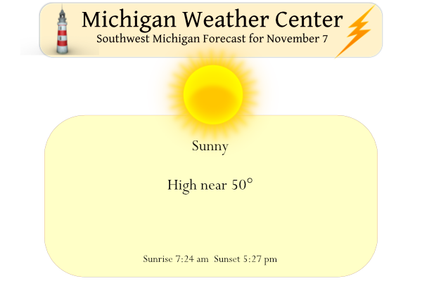
Has this been the best start to November we have ever seen? Sunny and warm!
For those that don’t like the cold/snow, the good news is that it rarely stays consistently in the 30s from Mid November through all of December. I think even in the 2013 winter we warmed up a bit in December before the vortex in January. So if I had to guess… this will probably be a 1-2 week pattern before we return to some 40s and 50s. This is just my guess, we will see 😀
Either way though, I am definitely looking forward to the first snow of the year. It is always fun for the first couple days
I’m not seeing any big storms. Outside of lake effect areas, the weather still looks very quiet the next couple weeks.
The Detroit and Lansing Accuweather forecasts both have mainly 40’s and 50’s for the rest of November.
I am thinking of hanging the Xmas lights the early part of this week. They don’t go on until after Thanksgiving though… Lol..
This is what we do too.
Yesterday was yet another very warm early November day. The official H/L at Grand Rapids was 64/43 There was no rain fall and 65% of possible sunshine. That 64 was the 12th warmest November 6th on record at Grand Rapids. The overnight low here in MBY is the current temperature of 39 with clear skies. For today the average H/L is now down to 51/35. The record high of 71 was in 2020 and the record low of 14 was in 1991. The snow fall record of 6.0” was in 1951. Last year it was a mild 65/37. It looks… Read more »