We had a nice extended period of dry weather with both cool and warm temps which is now come to an end. We have had .31 of an inch of rain since midnight (5am reading) which is just a taste of what is to come. Temps have risen to 46°.
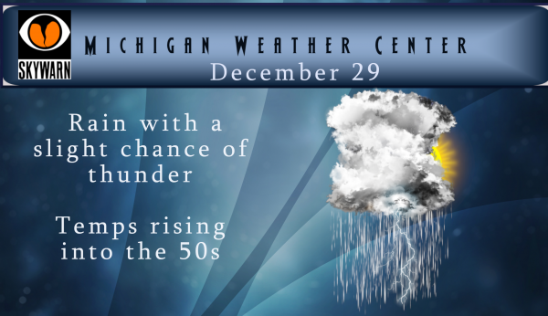
The rain will be locally heavy at times into late morning. Isolated thunderstorms are possible during the mid to late morning. Once the rain comes to an end by early afternoon temperatures near and south of I-96 will rise into the mid to upper 50s. It will remain cooler near and north of Route 10 through. Rain overspreads the area once again by midnight and becomes heavy at times with isolated thunderstorms possible. This second area of rain will be heavier than the rain today.
We will close out the year with a mixed bag of weather with rain, wind and some snow and some freezing rain thrown in for good measure. Snow fall amounts at this time look to be around three or four inches. We will start out the new year with temps rising back into the 40s.
The second week of January we may see a return to near normal temps with chances of above normal snowfall. The cold Arctic air remains locked in northern Canada, Siberia and Alaska keeping us in a zonal flow with our weather coming from the Pacific.

Hey …..I’m Outta Head on Mnday MOANIN…..3-6 inches of Snow. Causing Difficult Driving Tues AM. Be Safe….God Bless and HAPPY 2020 SOON!
https://youtu.be/GaH25Sghoqc
Two inches of rain from this weekend’s “rain event”?…going to take some work.
The latest Cpc gives us a good chance of near to below normal temps and above average snowfall! Winter is here baby! Rock n roll will never die!
A WWA for southern Michigan? It’s about time. It’s almost January.
Crazy foggy out tonight with all the humidity. Visibility was only a couple hundred feet at best coming home.
WWA for all of west Michigan ….4-7 inches of snow with wind gusts of 50mph sounds like a blizzard to INDY Great Scotty …Let’s add to the berrymetter woo whoo..INDY
Yes blizzard conditions are coming! What a great looking storm and more to come!
Looks to be a long stretch of cold and snowy weather! It might last for months!
Looks to be no major cold outbreaks for quite some time. Our mild Winter keeps plugging along.
https://www.yahoo.com/news/brutally-cold-air-alaska-way-145202050.html
Nice snow map! Who said cold, wind, snow and And a WWA? Incredible! Get ready for a rough Tuesday am commute!
Winter weather advisory’s coming stay tuned ..INDY
Who would have thought?
Slim was right about the dew points. After reading his post I looked up the Michigan dew point map, and wow, it is approaching humid levels! Most areas around us are around 55 with the high in the state being 57. Unprecedented!
http://www.usairnet.com/weather/maps/current/michigan/dew-points/
A new record high for December 29th has been set at Muskegon with a temperature of 58. At Grand Rapids the current reading of 54 is still in 2nd place. Down at Benton Harbor the high there so far has been 61. With the DP’s in the mid 50’s that must be some of the highest DP’s ever recorded in Michigan in late December and maybe some of the highest ever in the month of December. The current temperature here at my house is 54.
Slim
Looks like a reading of 58 at Muskegon with the clouds and all and 61 at Benton Harbor with clouds there as well. 54 here at my house.
Slim
Wow. Don’t ever remember hearing about dew points this time of year!
Up to 56 here, only 24 degrees above our average high for the day. If the sun would pop out we’d probably make a run at 60 again today. Incredibly mild holiday week and December we’ve had.
Looks like a reading of 58 at Muskegon with the clouds and all and 61 at Benton Harbor with clouds there as well. 54 here at my house.
Slim
Well…at the very least, it won’t be a surprise. The snowfall and cold temps get underway next week. Continuous snowfall will accumulate into the triple digits. Life altering, extended periods of never before seen cold temps, will leave Statewide impacts on infrastructure, institutions, and property. Early winter forecasts used the term “Catastrophic”…best of luck to all.
The current official temperature of 52° and Muskegon makes today the 2nd warmest December 29th in Grand Rapids and 3rd warmest at Muskegon recorded history. The record of 65 at Grand Rapids is safe the number 2 and record at Muskegon is 54 in 1984 and 53 in 1908. The current temperature here at my house is now at 50
Slim
More 50’s today. I love it! We are now a foot below average of snowfall and December is a balmy +3.1 above average.
The 52 at GRR makes today the 2nd warmest December 29th on record. The record of 65 is safe. Muskegon’s record of 54 we will have to wait on.
Slim
Attention Attention out at thee YARDofBRICKS NE of GR the berrymetter is at 16.4 inches of snow for the Young winter season we look forward to adding on to it In the GR area Monday Into Tuesday when it could be 5+ inches of snow …Stay tuned..INDY
Mr. Rocky keep up the good work with the winter weather maps boy does it get the mental state of juices a flowing on here!! I LOVE IT!! …Let me remind some of you this is a weather blog the great and Snowfull INDY has blogged …Have a nice Sunday…Let it snow let it snow let it snow ..INDY!
January could be very up and down but there is a chance of some cold in February and maybe even March we shall see how the next 3 months play out. The end results I think will be near to a little warmer than average. Snow fall is too hard to guess at but at this time it looks to be below average. We shall see.
Slim
Had some moderate rain fall here and the current temperature is 47. Grand Rapids now has a good shot at getting over 50″ of rain fall this year. GR has already set a new annual rain fall amount we just have to see how high it will go.
Slim
Bring on the snow! Who wouldn’t want cold and snow this time of year? It is going to wild rock n roll party this winter! We will be getting pummeled with cold, snow and wind!
Well with almost one third of Winter already gone we’ve been pummeled with sun, rain, and record breaking high temps. What could be better than that?
At this time the best long range guess is for a rather up and down pattern for the month of January. While there likely will be periods of cold and snow there also looks to be periods of more mild temperatures as well. As always this is subject to change but that is the way things stand as of now. With all the cold that is bottled up to our north do not be surprised if February or March end up cold can not even rule out a cold April as well. Of all the winter months March now has… Read more »
Nothing like heavy rain and a few thunderstorms on the final days of December. Might as well set the new rainfall for the year record high while we’re at it. 50 degrees and already 0.70” of rainfall here.
Looking good! Bring it!
http://wxcaster.com/gis-gfs-snow-overlays2.php?STATIONID=GRR
😂
West Mi will look like the North Pole be Tuesday morning! Enjoy!
And better yet it will all be gone and melted 2 days later as temps will be back in the 40’s! Perfecto!