After an extended period of warm weather, we will see a more fall-like pattern developing today with temps in the 60s. Yesterday our high was 80° and the low was 61°. We have had 1.10 inches of rain from the low passing through the area thus far which brings us to 2.78 inches for the month with more on the way this week. It is currently 61° at 6:00 am. Our normals for this time of year are low to mid-60s.
We will be in an unsettled pattern for the rest of the week with periods of rain and temps in the 60s to low 70s until Saturday when daytime highs will be only in the 50s.
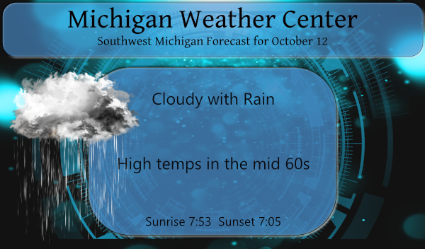
Forecast Discussion
- Showers and cooler today into this evening

Today will be more fall like then we have been used to over the
past two weeks. This will be due to cooler temperatures, low
clouds, and periods of lake enhanced showers into early tonight.
The early fall storm that caused the thunderstorms Monday evening
has occluded and will slowly lift northeast over the next 24
hours. It will take until nearly sunrise Wednesday to bring us out
of the cyclonic flow around that system. We will loose the deep
moisture by sunrise as the upper trough passes east of Southwest
Michigan. However we stay in the deep cold air aloft and we remain
on the cyclonic side of the upper jet feature around that system.

So, even though the clouds will not be deep enough for
heterogeneous nucleation, we will have vigorous enough lift the
the shallow clouds that remain to process warm process rain. So,
expect showers into early tonight as a result of that. In fact the
HREF 6 hour ensemble probability of measurable rain is greater
than 90 percent near US-131 through noon and 60 to 80 percent
through the afternoon. Even tonight through midnight is has
between 30 and 50 percent near and west of US-131. So we do
feature showers today into tonight.

We will still average nearly 10 degrees above normal today even
with the clouds and showers. This is mostly due to the warm low
temperatures Wednesday morning. The normal low for this time of
year is from the upper 30s north and lower to mid 40s central and
south. Our actual lows Wednesday morning will be in the 50s. This
morning we will struggle to even get near 60 degrees. So, again,
while cooler than the past 5 days, we will still be significantly
warmer than normal.

As an aside, the mean low temperature, for the month of October,
through the 10th of the month, at Grand Rapids, Lansing,
Muskegon, Holland, Jackson, Battle Creek, and Kalamazoo are the
warmest on record. At Muskegon, Holland, Battle Creek and
Kalamazoo, the current mean low is around 60 degrees, for all
four sites that is 4 warmer than the previous record! At the other
sites it is warmer than the previous record by 3 degrees. Given
most of these stations have well over a 100 years of data, that is
quite impressive.

- Brief break in the rain Wednesday during the day

As the current system lifts out and the next, stronger and larger
system heads this way, shortwave ridging will bring some sunshine
and warmer temperatures on Wednesday.

- Next threat for showers and storm late Wed into Thu

The next system is complex since we have the interaction of
two very strong Pacific shortwaves that are to close in wavelength
to bring us much of break between them. The trailing system causes
the lead system to lift out of the Southwest CONUS Wednesday.
That creates quite the early fall storm over the high plains,
which will feature heavy snow over parts of western ND, SD,
eastern WY and eastern MT. For us, we get the triple point
feature coming through northern Lower Michigan area early
Thursday. This will mean another convective event. It will be at
night and any instability will be aloft. So I do not seem much of
a severe storm threat. Like with the event last night, the jet
feature weakens as it comes into our area, as does the 1000/850
moisture transport vectors. So, whatever is coming our way will be
weakening as it does so. This will result in a rainy night
Wednesday into the early morning hours of Thursday.

The front will stall just south of Michigan Thursday but most of
the daylight hours of Thursday may end up mostly dry for us, maybe
the I-94 area could see lingering showers through the day.

- Wave on front brings more rain Saturday

We then have that trailing system, which is the strongest of all
of them currently. That will dive into the western trough and lift
out by Saturday. It will cause a wave on the front, so with the
front not all that far from us in the first place, you just know
we will get the rain and maybe thunderstorms from this system too.
This could be a very wet system for us given it will have Gulf
moisture to work with and it has a strong Pacific jet feature to
help the cause.

- Cooler and more fall like Saturday into next week

Finally, we get a long break in the wet weather, starting Sunday
and continuing into midweek. We do have the coldest air of the
season coming in behind the Saturday system. While not in our
forecast yet, I could see a general freeze Monday morning over
northern sections if the sky can clear. It should noted stronger
cold front will come through this area with more showers in the
Wednesday time frame, then much colder air follows. It will surely
feel like fall then!
64 here currently. Actually feels a bit chilly.
Boy, this was just a couple hundred yards down the road from me. Gotta watch out for them things this time of year.
https://www.woodtv.com/news/ottawa-county/man-killed-after-hitting-deer-near-zeeland/
Oh yeah, dude. They are EVERYWHERE.
Picked up .6 inches of rain last night and now cloudy, cooler and more rain! The wet Fall keeps rocking!
Phew, 80 degrees yesterday! +18.2 degrees above average for the day.
81 here. I think I will finally be able to put the cover over the A/C unit.
More rain and temps in the 60’s today love it its been a wet Fall soon it will be snow bring it onnn..INDY
You know it and we could be seeing record cold and snow this winter! All signs point towards a rocking winter! Get ready!
It will be nice to have temps that are more Fall like. I have decided I need to get a rain gage for my house. That was quite the thunderstorm that rolled thru here yesterday evening.
Here at my house I recorded 0.57″ of rain fall yesterday and overnight. In the area yesterday was another very warm (for October) day. At Grand Rapids the high of 80 was the 3rd warmest for the date but in a 5 way tie with 2011, 2010, 1993 and 1973. The low of 63 was the 2nd warmest minimum for the date with a tie with 1954 and 1928. At Holland the high of 81 was the 4th warmest for the date and the low of 64 was the 4th warmest. At Muskegon the high of 79 was the 4th… Read more »