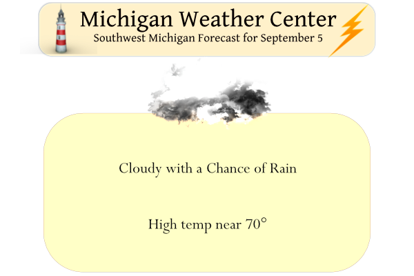
Yesterday was cool and cloudy all day in Otsego, the low was 60° and the high was 68°. We had .11 of an inch of rain which fell in the early evening. A repeat of yesterday is expected for today. Plenty of clouds will hang on which will lead to below-normal temperatures. Our highs today will range from the middle 60s to lower 70s in most areas. Average highs are in the upper 70s. Northeast winds of 5 to 15 mph are anticipated. Tuesday through Friday should feature more sun and temps rising to the upper 70s on Tuesday to the mid-80s by Friday – Rain begins to move into the picture for next weekend.
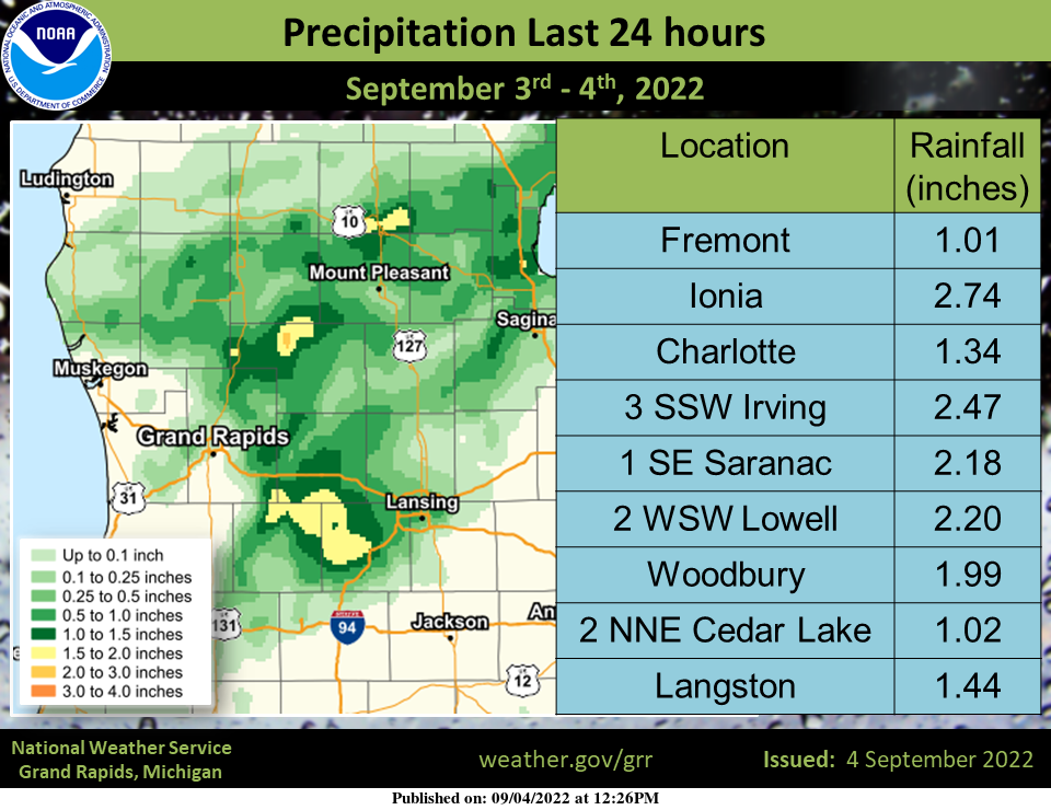
Here are the rainfall reports and precipitation map from Sept 3 rainfall. The heaviest amounts fell west of Lansing in the Lowell and Saranac region along with localized heavy rainfall in Montcalm county.
Forecast Discussion
-- Continued cool today; cloudy for many areas into Tue --

A quasi-stationary frontal boundary remains situated across IN/OH.
To the cool side of this boundary, a frontal inversion/stable layer
persists over Lower MI (sampled by the 00z DTX sounding) and
continues to foster widespread low stratus. A few breaks in the
clouds are possible today, but weak low-level dry advection on NE
flow is likely being compensated by surface moisture flux over
Lake Huron, suggesting that the overall clearing line will make
little southward progress today. Accordingly, forecast high temps
for today have been nudged cooler. A few afternoon
showers/sprinkles are again possible, mainly south of I-96.

For Tue, forecast profiles suggest that extensive clouds will likely
linger into midday for many areas. However, as the cloud layer
becomes thinner, daytime mixing should encourage a southward advance
of the post-frontal clearing line. High temps are expected be a
few degrees warmer than today--topping out in the mid 70s.

-- Sunnier and dry for Wed-Fri --

Surface high pressure will build into the region on Wed, then
continue eastward into the Canadian Maritimes by Fri. Aloft, an
anomalously strong mid/upper anticyclone will remain centered over
the Great Basin into Thu, with an associated ridge axis extending
NE into the western Great Lakes, facilitating large-scale
subsidence and settled weather for the forecast area. A warming
trend is expected to continue into this period.

-- Rain chances next weekend --

Global ensembles (EPS and GEFS) and their deterministic counterparts
(ECMWF and GFS) have recently shown greater support for a system to
affect the region next weekend. A NE Pacific trough is expected to
reach British Columbia on Wed, likely inducing surface cyclogenesis
over Alberta/Saskatchewan. This trough should crest/flatten the
western CONUS mid/upper anticyclone, then possibly interact with
the remnant Gulf cutoff low (and its deep moisture plume) on
Fri/Sat. Still, sizable ensemble spread in the 500-mb height field
suggests that the details of this trough/low interaction and
possible phasing are uncertain, as are the particulars of frontal
placement and possible secondary cyclogenesis. These uncertainties
notwithstanding, shower/t-storm chances are in the forecast
between Fri night and Sun.
Great Fall weather outside love it plus seeing lots of trees turning already its the most wonderful time of the year around here …INDY
Yes, it was another below normal temp day! Wow!
Will it even hit 70 degrees today! The below normal temps keep rocking!
The official H/L at Grand Rapids yesterday was 69/54 that was only the 3rd time it has not reached 70 or better since June 1st The other sub 70 days being 65 on June 8th and a cool 62 on a wet August 13th officially there was 0.03” of rain fall and a reported 1% of possible sunshine (not sure when that happened) The overnight low and current reading at GRR of 58. Here in MBY the low and current reading was a little warmer 60. For today the average H/L is 78/57 the record high of 92 was set… Read more »