We had .81 of an inch of rain yesterday which gives us 3.79 inches of rain and melted snow for the month. We had a dusting of snow overnight. The high temp yesterday was 51° and the low was 26°. We have 25° at 4 am.
The only hazard we have this morning in the lower peninsula is for Ottawa county which continues its flood watch until 4 pm. In the upper peninsula, the winter storm warning expires at 7 am this morning.
If anyone wants to send in a weather-related photo you can email them to me at michael.vanlent@michigan-weather-center.org
“This was the icing this afternoon where I was in Northern Gladwin County about 7 miles northwest of the city of Gladwin.”

Forecast Discussion
Ongoing cold advection and convergent northwesterly flow with
remnant surface troughing across northern Lower has allowed for
continued light snow showers mainly across portions of the northern
CWA early this morning. Wind will gradually veer to the north and
weaken through the late morning and allow the area of snow to shift
to more along the immediate lakeshore with minor additional
accumulations. The cold air mass settles into the region today with
850mb temps bottoming out in the negative mid teens by midday. The
cold advective regime keeps the boundary layer well mixed with a
breezy start - gusting to around 25 to 30 mph this morning - with
high temps topping out mainly in the 20s today. Dry conditions
prevail for the majority of the forecast area as high pressure
extends eastward from the upper Midwest. Some breaks in the clouds
will be possible late as light wind shifts to the northeast and
ushers any lake induced clouds out. Dry conditions continue tonight
under light northeast wind - lows dip to the teens with some single
digit readings likely along and north of US-10.

The stalled 850-700mb baroclinic zone positioned across the Ohio
Valley then becomes the focus for the next low pressure system to
track south of the Great Lakes late Thursday into Friday. A digging
shortwave currently seen in WV imagery over the west coast is
progged to move across the intermountain west today then begin to
shear out and accelerate ENE across the central Plains on Thursday.
After a dry start to the day, the approaching system induces
isentropic ascent in a deep layer below 500mb Thursday
afternoon/evening with light accumulating snow set to spread in from
the south as favorable saturation and lift are achieved. Synoptic
snowfall continues across the state overnight into Friday with
deformation forcing taking over as the surface low tracks well to
the south and east. This will be aided by height falls and DCVA
Friday morning as the midlevel wave tracks overhead. Around the same
time, soundings show a cooling of the column to allow for a deep
intersection with the DGZ which would likely enhance snow ratios for
a brief period centered on 12z. So there may be a period of more
efficient rates mid Friday morning. Still, modeled QPF remains
relatively lean and keeps snow totals mainly in the 1 to 3 inch
range before snow tapers off quickly during the late morning.

High pressure fills in across the central Mississippi Valley and
builds eastward Friday night, but some lingering troughing and fresh
cold advection may be enough to trigger some additional light lake
effect snow showers before sunrise Saturday. Temperatures moderate a
bit during the day Saturday as the coldest air departs to the east.
The next cold front is quick to sweep in from the northwest Saturday
night however. With its arctic origin and the resident dry air mass,
thinking that fropa will stay mainly dry. Mid-range guidance then
favors a dry period to start the work week as another area of high
pressure tracks across the Great Lakes.
Weather History for SW Michigan
February 20
1898: A snowstorm dumps over a foot of snow on parts of Lower Michigan from the 20th to the 21st. Grand Rapids has 11 inches from this storm and almost 30 inches for the month of February.
1951: Ice jam flooding along the Grand River in Portland damages several buildings and forces the evacuation of some neighborhoods near the river.
2015: This is the coldest morning of one of the coldest months on record at Grand Rapids as the temperature falls to a record cold 13 degrees below zero. The monthly mean temperature of 13.3 degrees makes this the coldest February on record and the fourth coldest month ever.
February 21
1986: Lake Michigan water levels are near record highs. Coastal flooding and erosion is a concern during winter storms along the shore.
February 22
1930: Record warmth prevails with highs in the upper 60s across much of southern Lower Michigan. At Grand Rapids, highs are in the upper 50s or 60s every day from the 19th to the 25th.
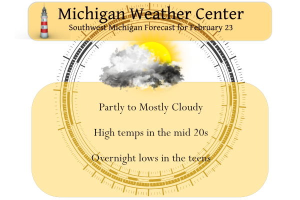
February 23
2000: Warm air surges into Lower Michigan with temperatures reaching the 60s. Grand Rapids sets a record high of 63 degrees and Muskegon hits 60 degrees.
February 24
1989: Temperatures fall below zero as a late-season blast of arctic air moves in. Grand Rapids falls to a record 9 below and Muskegon hits 2 below, just missing the record of 3 below set in 1924.
February 25
1957: Mild and rainy weather prevails with lows in the 40s and highs in the 50s. The low of 47 degrees at Grand Rapids sets a record for the warmest low temperature for the date. Over an inch of rain falls as a cold front moves through.
February 26
2000: Record warm weather continues during a week-long spell of balmy weather across Lower Michigan. The temperature hits 66 degrees at Muskegon for a record high. The low temperature at Grand Rapids is 53 degrees, setting a record for the warmest low temperature for the month of February.
Weather History for SE Michigan
February 20
On February 20, 2015, another calm and clear night during this frigid month allowed the temperature to fall to -25 in Flint, tying January 18, 1976, for the coldest temperature ever recorded there. The NWS office in White Lake also set a new all-time low of -25 degrees, albeit with a much shorter climate record. The temperature in Saginaw and Detroit reached -15 and -12 degrees respectively, also both records for the date. As temperatures struggled to rebound from cold early-morning lows, the average temperature for the day in Flint and Saginaw only reached -5 and -1, both records for the date.
Also on February 20, 2014, A brief burst of heavy snow led to minor accumulations of 1 to 2 inches across the metro area. There were numerous reports of thunder accompanying the snowfall.
Also on February 20, 2011, a winter storm impacted southeast Michigan, with 5 to 10 inches of snow falling across the majority of the area. Snow turned to ice near the Ohio border, where a major ice storm occurred. Downed trees and powerlines occurred over Lenawee and Monroe counties due to ice accumulations half an inch to one inch. Power outages lasted 4 to 5 days.
Also on February 20, 2005, much of Southeast Michigan was hit with a snowstorm with generally 6 to 9 inches of snow. The Tri-Cities area was the hardest hit with many locations reporting 12 inches of snow.
February 21
On February 21, 2018, a 3-day period of heavy rain came to a close. Total rainfall from the period ranged from 1 to 3 inches with peak measurement of 3.36″ in Livingston County. Combined with melting snowpack, this caused the Clinton River near Mount Clemens to reach a moderate flood stage while the Tittabawassee at Midland fell just short of reaching a major flood.
Also on February 21, 2014, the same storm that brought a round of thundersnow the day before moved off to the northeast. As this occurred, widespread wind gusts of 40 to 50 mph spread into Southeast Michigan with gusts up to 56 mph at Detroit Metro Airport and in Saginaw.
Also on February 21, 1930, the temperature rose to a record high of 63 in Detroit. This day was one of a three-day record-high streak from the 20th with 61 degrees to the 22nd with 65 degrees. Saginaw also experienced this three-day streak with temperatures of 62 degrees on the 20th, 64 degrees on the 21st, and 67 degrees on the 22nd.
February 22
On February 22, 2010, low pressure moved out of the Central Plains and tracked northeast through the Ohio River Valley. Snowfall totals were generally in the 2 to 8-inch range, with the higher totals occurring along and south of I-69. There were isolated totals up to 9 inches reported across Washtenaw county. Some of the higher snowfall totals across the area included Ann Arbor reporting 9.0 inches, Saline with 8.5 inches, West Bloomfield had 8.0 inches, Wyandotte 7.7 inches, and Macomb Township received 7.5 inches.
Also on February 22, 1930, the daytime temperature soared to 67 degrees in Saginaw, which is the record high for the month of February in this city. This day also marked the fourth day in a row (February 19-22) of daily record high temperatures in Saginaw!
February 23
On February 23, 2003, Port Huron received a foot of snow from a snowstorm that lasted from the 22nd – to the 23rd.
February 24
On February 24, 2016, a prolonged snowstorm that lasted into the 25th dumped heavy snow across most of the area. The rain-snow line was stark and aligned perfectly along the glacial ridge of SE Michigan. Detroit received nearly all rain. In fact, Royal Oak in Oakland County only measured 3 inches of snow while 12.4 inches fell just up the road in Lake Orion. A wide swath of 10 to 12 inches fell between the northern suburbs of Detroit and Flint. The highest total of 14.1 inches occurred in Peck in Sanilac County. At 9.9 inches, the storm ranks 16th on the all-time snowstorm list for Flint.
Also on February 24, 1894, a temperature of -11.2 degrees set a record low for the day in Detroit.
February 25
On February 25, 1965, a snowstorm left all of Southeast Michigan covered under nearly a foot of snow. Saginaw received 17.9 inches, Flint had 12.9 inches, and Detroit had 11.0 inches.
February 26
On February 26, 2020, a long-duration snowstorm occurred with widespread reports of 3 to 6 inches of snow over much of the county warning area.
On February 26, 2019, a snowstorm brought about 2 to 4 inches across areas along and north of I-69, while areas to the south saw 2 inches or less.
On February 26, 1944, the temperature rose to 68 degrees at Detroit Metro airport. This is a record maximum temperature for the month of February in Detroit.
Michael V
test two
test
Get ready for the snowstorm! Incredible!
The RDB gives GR 2 to 4 inches of snow! So yes, a snowstorm! and the NWS should issue a WWA tomorrow! Wow, winter keeps rocking!
I’ve lost track, but I know I’m well over a foot of snow for the month of February at my house. That is pretty incredible especially for those of us in inland areas. No averages for this area but I’m sure this area would be around or slightly above average for snowfall
Currently we have GREAT skiing conditions up in Snow Country! Incredible!
https://www.nubsnob.com/conditions-tables/
Don’t tell anyone, but my wife and I are going snowshoeing on the Whaleback Trail in Leland on Sunday, we’re staying in TC all weekend. Shhhhhhh……,
It should be simply incredible up there!
I think it will be! Looks like around 7 or 8 inches up there now with a couple more inches on the way! I’m perfectly fine with that in snow country!!
Breaking News>><<we still have about one MONTH left of winter! Enjoy the cold and snow!
1. We are below average snowfall on the season – like we have been for 95% of winter
2. December was very warm with not much snow so we’ve had a short winter this year
3. We currently have little to no snow on the ground
4. Conditions are horrible for pretty much all winter activities unless you actually like fake man-made snow
5. The upcoming week looks quiet, outside a few inches at most
6. Next week looks much warmer with no end in sight
7. The days are getting longer
8. Meteorological spring starts in less than a week!
Do you feel better about yourself now?
+1 million!
With all of the warm weather nonsense and delusion on here it is time to review the facts! 1. Counting Feb we have seen below normal temps and above normal snowfall 3 out of the last 4 months! 2. A snowstorm is in our short term forecast! 3. Mid winter cold for at least the next 5 days! 4. No above normal temps in the short term CPC out at least 3 weeks! 5. it has been a great year for outdoor winter sports, especially ice fishing and ice skating! 6. No! warm Spring weather is not right around the… Read more »
When is this snowstorm event you are pointing out in #2?? Not seeing any winter storm watches for our area. These are supposedly facts, where’s the evidence?
#4 is straight up fake news too!
I will agree that map does not look great for snow!
LOL!! You’re coming around now!
Lol
What a joke! How many times do we need to explain to Barry and yourself? You do not need 6 inches or more to qualify as a snowstorm! In fact many of the daily snowfall records are under 6 inches! Get a grip and keep the facts straight!
And for #8, last March we had just a trace of snow for the whole month, so that’s definitely not a fact for this upcoming March.
For the winter crazies, I just got off the phone with my brother who lives in the highlands 20 miles west of Marquette. In the past 24 hours or so he’s received 30 inches of densely packed snow. I think they’re now over 150 inches so far this year.
Marquette reported 21.6″ of snow yesterday and are now reported 50.5″ for February and are now up to 164.3″ for the season. Note that the NWS office for Marquette is west of the city of Marquette.
Slim
Sounds awesome! If I didn’t have family downstate, I move up there in a heartbeat!
yah, my buddy in Marquette said he got 31″ too.
Nice photo, Kyle. That’s some significant icing.
Thanks! Yeah it was quite the ice storm!
Let it snow let it snow let it snow …DDDDDD..InDY
What a winter this year and it just keeps rocking!
This has to be sarcasm, right?
Wrong! Great skiing, ice fishing, ice skating, sledding, etc, etc, etc! Face the facts!
You only have to look at the weather history above to see the wild swings that can happen this time of the year. In 1898 cold and snow. 2015 cold. 1930 warm. 2000 warm. 1989 cold. 1957 warm. 2000 warm.
Slim
While not much more than a trace or so there is a covering of new snow on the ground here and there is light snow falling at this time. With that light snow falling it in now 21 here.
Slim
Thanks for sharing my pic MV. It was a significant ice storm where I was in Gladwin County. Many side roads still very icy so if anyone is heading north use caution. Even U.S. 127 is showing slower than normal speeds I see in Clare County. Lots of sagging Birch trees around here makes for great photos.
Boy, I hope we see a March like we had in 2021! Last year, we saw 18 days in March between 50 and 74 degrees. The best time of year!
To each their own. My best time of the year is June, July and August. With warm temperatures, long days with lots of sun and with a chance of thunderstorms. Who could ask for more?
Slim
I love summer. But the feeling of the first couple warm days in spring can’t be beat. Everyone is in a great mood around town. Plus, early spring has the anticipation of 6 months or more of warm temps to look forward to.
Mookie, the only issue with spring (for me) are allergies! But I agree, the first few warm days in early spring before allergies kick in are really nice.
Im trying to remember the last time we have had this much Winter fun since November probably when the polar vortex hit west Michigan in 2016 maybe …The ice fishing has been fantastic talk about a peaceful time when you are out on the middle of a lake and the sun is shining and all is quiet and the fish are bitting pure Michigan baby I sometimes talk to myself lol…InDzy
Cold weather crazies do this every year, grasp at the final straws of winter, calling a couple inches of snow a “snowstorm” and ignoring the 40’s in the forecast a few days from now! Oh well, let them stay in their winter fantasyland! LOL!!!
https://weather.com/weather/tenday/l/b4ea0280869baa46799dc75eacef8904785ec43ad2f6fb098355fbc208a55e2c
Honestly I am really looking forward to the warmer weather. But I have noticed the temperatures keep wavering back and forth on TWC. It showed a high of 29 on Monday, now it shows 40… I think anything over 10 days out is probably not very accurate when we enter the springtime. But for the next 10 days, we have 5 below average days and then 5 above average days.
Keep in mind the average climbs above 40 by the end of next week, so even 40 would be considered “below average” at that point.
You are exactly right! It’s the same song and dance towards the end of February every year from the winter crazies.
While this winter was very short (basically 6 or 7 weeks), I’m still ready for spring and summer!
Just under 3 quarters an inch of rain yesterday. Combined with the 1.25” a week or so ago, that’s a lot of rain for February. Must be all those phantom snow storms we keep hearing about every week but never materialize.
With a current total precipitation of 4.07″ this will be one of the wettest February’s at Grand Rapids.
Slim
I don’t suppose they keep track of how much was rain and how much was melted snow? Be interesting to know.
“If you are ready for spring, warmer air appears to be on the horizon starting Wednesday of next week.” WOOD is now on board too!
You have been saying that since January just so you know …Lol…Pretty cold day on tap in Rockford well below average just the facts …InDY
You are spot on Indy! He basically says that every day during winter! Total and utter delusion!
Like our old friend UJ says its the same old bong and dance he or she is not the only one ….InDY
Kyle…nice pic!!!
I think I may be able to ice skate.on some of our puddles.
Thanks!
I love this time of year! Every year in mid Feb, the warm weather nuts say winter is over and then we get hammered with cold and snow! That is exactly what is happening right now! How could it be?
Current conditions = we are getting pummeled with snow and it looks like mid winter right now! Wow!
The snow is gone, the grass is showing, flowers are coming out, and the final warmup into spring starts next week. And, besides a small 1-3” light snow, it looks very quiet.
I love this time of year!
We have another great weekend for outdoor winter sports on tap! More snow this week, cold temps and great conditions! It just keeps getting better and better! Wow!
19* degrees outside did we go back in time thats January cold …GREAT SCOTT MARTY ..InDzy
Yes, mid winter cold for the rest of this week and then more snow after that! Incredible!
Look at all this snow! No winter is not over!!
https://www.pivotalweather.com/model.php?p=snku_acc&fh=306
A nother well below average February Day on tap who knew ??? InDY ..
+1 million!
The snowstorm for Thursday night is still on track and mid winter cold is here for many days in a row! Enjoy!!!!