Yesterday’s we had a high of 26° and a low of 20°. We are now at that time of year we should start seeing temps creep up to springtime levels with fewer incursions of cold air. Sure we will see a few bumps in the road, things will be looking up for those of us who are tired of the cold.
Our next system moves in tonight which will bring another two or three inches to the area from I96 to the south. We will have to wait and see if the NWS decides we reach advisory criteria for the rest of our area.
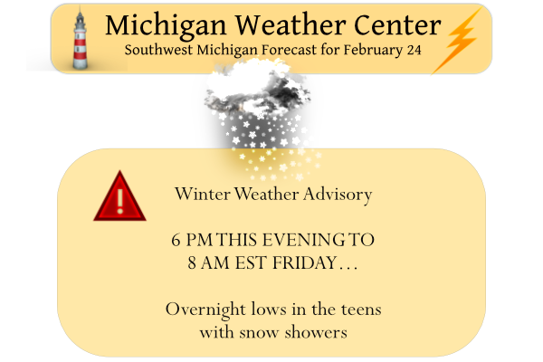
We have a winter weather advisory for the extreme southern counties from 2 pm until 8 am Friday:
* WHAT...Snow accumulations of 2 to 4 inches.

* WHERE...Portions of northern Indiana, southwest Michigan and
  northwest Ohio.

* WHEN...From 2 PM EST /1 PM CST/ today to 8 AM EST /7 AM CST/
  Friday.

* IMPACTS...Plan on slippery road conditions. The hazardous
  conditions will likely impact the commute this evening and the
  commute Friday morning.
Forecast Discussion
Lake effect snow showers have come to an end this morning after
winds shifted northeasterly cutting off lake moisture. Expect quiet
conditions to persist through this morning with some persistent
cloud cover holding temperatures in the teens to single digits.

Snow chances return tonight as a mid to upper level trough
approaches from the west this afternoon and evening. This area of
low pressure will track northwest along an associated baroclinic
zone draped across the Ohio Valley. As the low advances into
southern Ohio this evening, the leading edge of the isentropic ascent
will likely reach up into the I-94 corridor by 0z tonight with light
snow overspreading the entire area by 06z. Guidance suggests snow
rates and snow ratios will increase between 06-12z with snow
rates up towards 0.5"/hr possible. Ratios will also increase
towards 15/18:1 as 850mb temps drop on the backside of the low
allowing for deeper saturation in the DGZ. This will lead to
snowfall accumulations of around 1-3 inches across the area, with
locally up to 4 inches possible mainly from about I-96/69 south.

This system will clear the area Friday morning with
widespread snow ending but some lake effect snow may linger into the
evening. High pressure will move back into the region by Friday
night tapering off any lingering lake effect snow. Conditions should
then stay quiet through the rest of the weekend and into early next
week with temperatures hovering into the 30s.
Snow to the North and snow to the South. The West Michigan weather dome is in full effect tonight.
That will change and fill in! GR will pick up 2 to 4 inches of snow tonight/tomorrow morning! Get prepared now!
I’m preparing by going to sleep! I’ll get the leaf blower out in the morning to blow the dusting of snow off my driveway! Love the giant dry slot over Kent County!! Keep it there all night!
I have 4 wheel drive so bring on 1 inch or 12 inche snow winter weather advisory or not other then a bad ice storm I will get there let it snow let it snow let snow ..InDY
That is the spirit!
I see that there are some people that are complaining about the NWS issuing a winter weather advisory well while 2 to 4″ may or may not be enough for a advisory but the real issue is that no matter what you can not please everyone. I don’t have a big issue with a 4″ adversary but come the warmer months I do have a issue with a thunderstorm warming for a one or two flash “thundershower” and you know that will happen it seems to be happing more and more each summer.
Slim
Breaking News >>>>it will be another great weekend for winter sports! Just another of many in a row! What a winter!
Great weekend for winter sports if you’re driving to Grand Marais! Or if you like skiing on grass here closer to home?
Andy exactly where do you live? Well not exactly but your general area?
Slim
Andy lives a little north of me and he always says he has and gets less snow! He is reminding me of mookie!
Ignorant!
Great call by the NWS! 2 to 5 inches of snow on the way and very bad roads! Incredible!
Another overreaction by the NWS, but that has been the case all winter season! Give me a break!!
I knew the NWS has been handing these WWA’s out like cupcakes this year, they don’t even follow their own criteria anymore. Seems like every time we get a dusting of snow they throw out WWA!! See their own criteria: Winter Weather Advisory: This product is issued by the National Weather Service when a low pressure system produces a combination of winter weather (snow, freezing rain, sleet, etc.) that present a hazard, but does not meet warning criteria. Weather conditions are expected to cause significant inconveniences and may be hazardous. Caution should be used if traveling. This generally indicates in… Read more »
I tend to agree with you. Like I’ve said previously, a WWA is basically what the old school Traveler’s Advisory used to be. If there is a possibility of slick roads, BOOM, here’s your WWA.
Exactly, by this time in the winter if you haven’t figured out how to drive in 1 or 2 inches of snow, you should move to Florida! What a joke!!
You do know that there are people that have lived here all their life and still do not know how to drive in the snow. Of course there are some people that just don’t know how to drive.
Slim
+ 1 million!
Yawn….wake me up when there is a 6 inch storm forecasted, not these run of the mill snow showers. What is this Texas??
Oh well, either way it will be melted Saturday or Sunday.
Your ignorance shows no limits!
You must have moved to Phoenix to think an inch or two of snow is worthy of anything from the NWS! Get real!!
No in Phoenix a inch or two of snow would be a winter storm warning and I think the national guard would be called out to remove the snow.
Slim
Wow absolutely ridiculous!
…WINTER WEATHER ADVISORY IN EFFECT FROM 6 PM THIS EVENING TO
8 AM EST FRIDAY…
* WHAT…Snow expected. Total snow accumulations of 2 to 4
inches.
* WHERE…All of southeast Michigan.
* WHEN…From 6 PM this evening to 8 AM EST Friday.
It is nice to see the GR NWS has caught up with the RDB model and the IWS! The RDB nailed this forecast yesterday, even though the warm weather nuts said no storm for GR! Wow!
…WINTER WEATHER ADVISORY IN EFFECT FROM 6 PM THIS EVENING TO
8 AM EST FRIDAY…
* WHAT…Snow expected. Total snow accumulations of 2 to 4
inches.
* WHERE…Portions of central, south central, southwest and west
central Michigan.
* WHEN…From 6 PM this evening to 8 AM EST Friday.
Winter Weather Advisory for every county except Oceana and the US-10 row of counties. 2-4” Iso. 5” total.
From the latest Forecast Discussion:
“This is one of those classic coupled jet response events and they are very reliable in producing measurable precipitation. This will be no different. The retreating jet entrance region lift will cause a warm advection lift snow event early tonight, that should be good for 1 to 3 inches of snow, heaviest near I-69 were the lift is strongest.”
Looks like we may be in the sweet spot once again. 🙂
Wow might be in the sweet spot yet again! Been a great February for snow!
Agreed. We’ve had a bunch, that’s for sure.
Area Forecast Discussion National Weather Service Grand Rapids MI 1203 PM EST Thu Feb 24 2022 LATEST UPDATE… Update/Aviation .UPDATE… Issued at 1203 PM EST Thu Feb 24 2022 We are planning on issuing a Winter Weather Advisory for the snow event tonight. The main question is how far north to go with the headline. Very likely from Muskegon to Mt Pleasant and south will be in the Advisory for 2 to 4 inches of snow. The snow will likely impact the morning commute as the snow should be ending in the 7 am time frame. There are two parts… Read more »
Who knew?
Get ready, the NWS should issue a WWA for Kent county this afternoon! If they do, is up for debate, because they missed one recently. Here are the facts, with the cold temps and 2 to 4 inches of snow this will make the roads snow covered and hazardous! You heard it here first and get prepared now! Who loves winter and snow?
Even mookies and Andy’s trusted AccuLESS weather says we have a SNOWSTORM coming! AccuLESS weather is a joke!
https://www.accuweather.com/en/winter-weather/gigantic-winter-storm-spreading-heavy-snow-ice-across-1800-mile-stretch-of-us/1147169
Hmmm….it actually says just an inch or maybe two for Rockford, how could that be??
https://www.accuweather.com/en/us/rockford/49341/winter-weather-forecast/2211654
Because they are horrible at forecasting snowfall! Incredible questions that you ask?
AccuLESS really is the worst at snowfall forecast! Absolutely horrendous!
I always rely on weather.com much more reliable! Also Acculess makes zero sense, why wouldn’t you call it InAccuweather, that actually makes sense!
Get ready for the snowstorm! The RDB still shows a solid 2 to 4 inches! We still have mid winter temps! The great winter keeps rocking! We will see more accumulating snows in the first half of March, so no, nice warm Spring temps are not right around the corner! Get prepared for winter to hang on for weeks! Incredible!
Sunny and 17 here now
Slim
I should clarify my comment below… the first day where it *looks* like very late winter/early spring. Definitely is cold out there today
That is OK Nathan. But yes the sun looks nice this morning.
Slim
My drive to work today was the first drive where it felt like early spring. The sun is clearly higher in the sky and there is no snow cover… that will change tonight, but looks like the “worst” of winter is definitely over. I guess we might as well enjoy the snow we get tonight, there may not be many more chances
Looks like about 2-4” for my house with this next system. As some have commented shouldnt stick around long but it will be another few inches to add to the February monthly total. Been a snowy February for areas Southeast of Grand Rapids over here towards Lansing.
You know it and the above normal snowfall for February keeps getting better and better, despite the incessant warm weather delusion! Wow!
GR sure got “hammered with snow” as some on here were saying yesterday. A whole 0.1″ reported.
Right on schedule, I see WOOD now has 38, 40, 45 for early next week!
Nice warmup next week!! BRING IT!!
Days with highs 40’s are common in early March. In fact by next Thursday the range has been from 72 in 1983 to just 12 in 1943. And for the overnight lows the range is from 40 in 1974 to a cold -9 in 1943.
Slim
1-3″ of snow on snow-free ground followed by quiet conditions into next week. What a “snowstorm” LOL
That will melt whatever we get tomorrow very quickly! In fact it will probably be gone by Saturday with temps in the low 30’s and full sun!
Friday
Partly sunny, with a high near 27. North wind 7 to 9 mph, with gusts as high as 18 mph.
Friday Night
Mostly cloudy, with a low around 16. Northwest wind 6 to 8 mph becoming southwest after midnight.
Saturday
Mostly sunny, with a high near 31. West southwest wind 10 to 18 mph, with gusts as high as 30 mph.
Depending on what time the snow starts and depending on how much falls that 3″ of snow would be a top ten one day snow fall for either February 24th or 25th of course if the snow starts before midnight and carries over into tomorrow that will not be a “one day snow fall total” Bottom line is that snow falls of 3″ or more this time of the year are not all that common.
Slim
The overnight low here was 13 with clear skies. The ground here is mostly snow free now. So it could have gotten colder if there was snow on the ground. It looks like most areas will end February near to below average in the temperature department (Grand Rapids has the best chance of below average temperatures) As of 2/23 here is the run down Grand Rapids a mean of 24.4 a departure of -1.6. Muskegon a mean of 26.3 a departure of -0.8 Kalamazoo 26.2 a departure of -0.2 Holland 26.3 a departure of -0.5 and to the east Lansing… Read more »