Yesterday’s high was 76° and the low 62°. We have had only .04 of an inch of rain in the past 11 days. We had .24 on the 16th and 1.07 on the 14th. Our next chance of rain comes tomorrow late afternoon/evening.
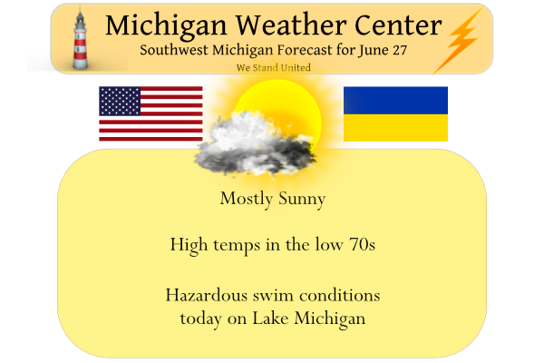
Cool and dry air will continue to pour into Michigan today on the heels of gusty northwest winds. Highs today will be only in the upper 60s to lower 70s, followed by chilly lows tonight in the mid-40s to lower 50s. These readings are about 10 degrees below normal for this time of year.
Forecast Discussion
- Cool today -

It will be rather cool for this time of year today due to nw flow
caa and h8 temps down around 5 to 7 C. As a result high temps
today will struggle to reach the upper 60s to lower 70s in spite
of a fair amount of sun.

- Moderating temperatures and mostly dry mid to late week -

A consensus of latest medium range guidance and ensembles for the
rest of the week continues to suggest temps will undergo a
significant moderating trend Tuesday through Thursday. High temps
will reach the upper 70s to lower 80s Tuesday as winds back to the
sw.

A cold front and upper shortwave dropping down from the northwest
Tuesday night will bring a chance of showers and storms. Although
moisture with this system looks rather limited an upper level pv
max will likely help to boost pcpn potential over our northern
fcst area.

There really is no appreciable airmass change for Wednesday and
high temps in the lower 80s are forecast with a high pressure
ridge in control Wed/Thur. By Thursday h8 temps will moderate to
around 20 C and this with sw flow waa will result in max temps
reaching the upper 80s to lower 90s.

The next system moving in from the NW will bring a chance of
showers/storms late Thursday night into Friday. However moisture
with this system again looks rather meager. So the overall
forecast message for the week is to look for predominantly dry wx
to continue along with a moderating trend of temps for mid to late
week leading to abnormally dry/potential drought conditions given
the forecast and dry antecedent conditions.
48 degrees in GR! Now that is cold for late June! Wow, just wow!
Get ready! Lows in the 40’s! Incredible!
Great cool weather! Wow, just wow!
Feels like Fall outside love it! InDY
It is beautiful outside today!! I hope everybody can get out and enjoy it.
06/27/2022 The official H/L yesterday at Grand Rapids was 80/65 once again there was no rain fall and there was 87% of possible sunshine. The overnight low in MBY was a cool 52 and at the current time with clear skies it is 59. For today the average H/L is 82/61 the record high of 97 was set in 1933 and 1944 the record low of 45 was set in 1902 and 1905. The big weather-related event this week continues to be how dry it has become. Today will start the week off on the cool note with highs in… Read more »
Gorgeous morning. Windows are open and the cool dry air feels amazing. We had dinner last night on the back deck. By the time we were done with our meal, it actually felt chilly. It has become very dry out but on the bright side, we have had so much sunshine lately. Have a great day, my fellow weather nerds.
I agree, Mark… I am also liking the September like weather, with some hot spells mixed in to keep everyone happy.
Yes it has been very sunny the last couple of weeks now. And with the high sun angle that sun has dried out the grass a lot. As long as it stays this dry it can both get hot and it can get very cool. So there can be some bigger temperature swings.
Slim