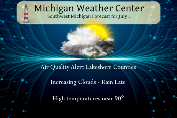
We are in store for another hot muggy day with temperatures rising to around 90° and dewpoints in the 60s. Clouds will increase this afternoon bringing our next shot at rain this evening and overnight. There is an outside chance of a strong storm for the western half of the state. We also have an Air Quality Alert for the lakeshore counties.
…Air Quality Alert for Wednesday, July 5th…
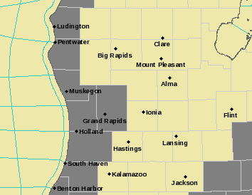
The Action Day is in effect for the following Michigan counties…
Allegan, Kent, Mason, Muskegon, Oceana, Ottawa, and Van Buren.
Grand Rapids Forecast
7 5 grrWeather History for SW Michigan
July 2
1973: A tornado struck two miles east of Leslie in Ingham County, damaging a car, mobile home and several farm buildings.
2001: Frost and freezing temperatures were observed in some locations with a 29-degree temperature recorded in Grant, Michigan in Newaygo County. The 39 degrees at Muskegon was the coldest July temperature on record there.
2008: A line of severe thunderstorms brought high winds, large hail, and some flooding from Muskegon to Grand Rapids and Lansing, south to Kalamazoo. In western Allegan County, winds estimated up to 75 mph brought down dozens of trees and snapped eight power poles. A roof was blown off a home in Kalamazoo County. Hail up to 1.75 inches in diameter caused damage in Muskegon County.
July 3
1966: A five-day heat wave peaked with temperatures in the upper 90s. The high of 99 degrees set a daily record at Lansing, the second in a row following a high of 98 degrees on the 2nd.
July 4
1911: The phrase Hot as the Fourth of July gains new meaning as temperatures soar to near 100 degrees, for Michigan’s hottest Independence Day on record.
1969: Nature’s fireworks turn violent as severe thunderstorms form in the evening and drop several tornadoes across Lower Michigan. More than 60 people are injured, most of them from a tornado that hit Flat Rock in southern Wayne County. This tornado destroyed a tile factory, carrying sheet metal over a mile. Another tornado injured eleven people about four miles east of Jackson as it damaged a dozen mobile homes.
1974: Tornadoes strike Lower Michigan during the early afternoon. One person is injured as a tornado damages several houses between Charlotte and Potterville in Eaton County. Tornadoes also damage barns and outbuildings in Huron and Tuscola Counties.
1977: A widespread severe weather outbreak hit Lower Michigan with tornadoes and downbursts. Two people were injured and almost a million dollars in damage was done. A tornado injured one person and destroyed two mobile homes and one barn near Maple Ridge in Arenac County. Another person was injured by a tornado at Otisville in Genesee County as four mobile homes were destroyed there. Two homes and a camper unit were heavily damaged as a tornado moved from southern Isabella County into northern Montcalm County, ending northeast of Vestaburg.
2003: The July 4th holiday turns tragic as seven people drown in rip currents on the eastern shore of Lake Michigan. A line of thunderstorms earlier in the day had produced strong winds across the middle of the lake, and the dangerous currents formed several hours later.
July 5
1921: A record high of 100 degrees at Grand Rapids contributes to July 1921 becoming the warmest month on record there with a mean temperature of 79.8 degrees.
1972: Temperatures fell to record lows in the upper 30s and lower 40s across the region. The 37 degrees at Lansing was the coldest July reading of the 20th century there.
1994: Thunderstorms with hail and heavy rain pound areas of West Michigan. The 3.56 inches of rain at Grand Rapids makes this the wettest July day on record.
1921: One person was injured by a tornado that destroyed three barns while passing north of Alma and Saint Louis in Gratiot County.
July 6
1983: Cool high pressure settles over Lower Michigan and temperatures fall to record lows. The 41 degrees at Grand Rapids is the lowest ever recorded during the month of July for the Furniture City.
2014: Severe thunderstorms roll through on the night of July 6-7th. At least four tornadoes struck from near Grand Rapids to Saint John’s. A tornado with top winds estimated at 110 mph did heavy damage in the Grand Rapids suburb of Kentwood.
July 7
1991: Tornadoes strike across southern Lower Michigan. A tornado damaged about 20 homes near Highland in Oakland County. More damage occurred near Okemos in Ingham County and a home and some outbuildings were damaged as a tornado moved northeast of Rockford in Kent County. A tornado also briefly touched down northwest of Plainwell in Allegan County but did no damage.
1988: Lower Michigan is in the midst of another heat wave as the hot and dry summer of 1988 continues. Temperatures peak at 100 degrees on the 6th at Lansing and Grand Rapids, followed by a record high of 98 degrees on the 7th at Grand Rapids.
July 8
1885: A tornado damages several farms in and near Allegan, Michigan.
1936: The greatest heat wave on record gets underway across Michigan. Grand Rapids will see high temperatures at or above 100 degrees on six of the next seven days, including an all-time record high of 108 degrees on the 13th. Lansing will peak at 101 degrees on the 14th.
1951: Severe thunderstorms strike West Michigan with dozens of trees knocked down. Some of the trees block roads and damage cars and buildings
1984: Record low temperatures are set as cool air from Canada dominates the Great Lakes region. Grand Rapids falls to 46 degrees and Muskegon to 45.
Weather History for SE Michigan
July 2
On July 2, 2019, a round of severe thunderstorms moved through the region, mainly along the I-96 corridor southeast from southern Shiawassee/northern Livingston to the coast of Lake St. Clair and east along the Washtenaw-Lenawee and Wayne-Monroe County lines. These mainly produced wind gusts to 60 mph and some hail up to 1 inch was reported near the Livingston-Washtenaw County line.
On July 2, 2011, a hot and humid day with heat indices around 100 degrees ended with numerous severe thunderstorms across southeast Michigan as a cold front moved through the region. There were over 50 reports of severe weather including hail up to 2 inches in diameter and measured wind gusts to 65 mph at Willow Run and Detroit Metro Airports.
On July 2, 2009, high temperatures only reached the mid to upper 60s across Southeast Michigan including 68 at Detroit, 65 in Flint, and 67 in Saginaw. This was just a day past high temperatures of 72 in Detroit, 67 in Flint, and 63 for Saginaw. The cold start to July 2009 continued through most of the month as both Flint and Saginaw recorded their coldest July on record, and Detroit recorded the 3rd coldest July.
Also on July 2, 1997, A strong cold front spawned a very notable severe weather event over Southeast Lower Michigan which was marked by 13 tornadoes. This is the largest number of tornadoes in SE Mich reported in a single day since records have been kept! The tornadoes included two F3s in Genesee County and an F2 tornado in Detroit-Highland Park. Two deaths resulted from the tornadoes (one in Genesee County and one in Oakland) and 5 deaths from severe thunderstorm winds in Wayne County, Grosse Pt Farms.
July 3
On July 3, 1947, the temperature rose to 96 degrees in Flint, which is the record-high temperature for the day. This marked the fourth day in a row (June 30 – July 3) that record daily high temperatures were recorded in Flint.
July 4
On July 4, 2012, the temperature rose to 102 degrees in Detroit, a record for the day and its hottest temperature in nearly a quarter of a century. The temperature in Flint also reached the century mark.
Also on July 4, 1977, the “Independence Day Derecho of 1977” left a path of destruction from Minnesota to Ohio. Winds of up to 115 mph destroyed property and leveled forests over Wisconsin. By the time the derecho had reached southeast Michigan, winds had weakened to 60 to 70 mph. The storm did, however, spawn F1 tornados in Genessee, Lapeer, and Monroe counties.
Also on July 4, 1957, the strongest tornado since 1950 in Livingston County occurred at 6:55 PM. This tornado was categorized as an F4 and caused 4 injuries and up to $500,000 in damage. Also on this day in 1957, another F4 tornado swept through Oakland County, injuring two people.
July 5
On July 5, 2012, thunderstorms over northern lower Michigan quickly organized into a line of severe thunderstorms shortly after midnight. This line of storms pushed through southeast Michigan in the very early morning hours producing widespread severe winds that damaged homes and left 200,000 without power, some for several days during one of the hottest stretches of summer.
On July 5, 1988, one notable hot stretch of weather brought a string of record-high temperatures to Detroit, Flint, and Saginaw. Record highs occurred from the 5,6 and 7 in Detroit at 96, 100, and 101 degrees. At Flint on the 6th and 7th, temperatures of 101 and 101 degrees. At Saginaw, on the 6th and 7th, had temperatures of 100, 99 degrees.
July 6
On July 6, 2003, spotters reported a 65mph wind gust at Birch Run at 9:50 pm.
July 7
On July 7, 2021, a cluster of severe storms moved across the Metro Detroit region with numerous reports of damage to trees and power lines across Oakland and Macomb Counties. Heavy rainfall accompanied these storms with some locations receiving over an inch of rain in about 30 minutes.
On July 7, 2012, the temperature reached 100 degrees in Detroit for the second time in four days. This was the first time that Detroit had reached 100 twice in one year since 1988.
Also on July 7, 2010, the hottest day during a five-day heat wave from July 4th-July 8th occurred. High temperatures climbed into the lower 90s across most areas, producing heat indices in the mid-90s to around 100 degrees. Little relief occurred during the overnight hours as lows hovered at or above 70 degrees. Two heat-related fatalities were reported.
Also on July 7, 1991, A powerful derecho surged rapidly east across Southeast Lower Michigan during the early evening hours and brought widespread wind damage and power outages. Wind gusts of 75 to 85 mph were common in the Ann Arbor, Detroit, and Pontiac areas.
July 8
On July 8, 1936, the second-highest all-time temperature was recorded in Detroit. The mercury rose to 104.4 degrees! This was the beginning of a string of seven days in a row (July 8-14) of record daily high temperatures, which were all above 100 degrees!
Forecast Discussion
.SHORT TERM...(Today through Thursday)
Issued at 350 AM EDT Wed Jul 5 2023

Main focus today through Thursday is convective potential related
to a slow moving sfc cold front and a moist/unstable air mass
preceding it. Sfc dew pts close to 70 send ML Capes to 1500 J/KG
or greater this afternoon and evening, and PWATs rise to near 2
inches tonight as the front draws closer.

CAMS suggest only isolated coverage of showers and storms through
00Z this evening due to lack of any decent sfc convergence. Any
storms that do develop this afternoon east of the lake shadow will
be slow movers due to weak deep layer shear of only 10-15 kts.
The storms could contain locally heavy downpours as well as gusty
winds with DCAPE values near 1000 J/KG and inverted-V looking
HRRR soundings.

Attention this evening will be on a line of semi-organized
convection ahead of the sfc front in ern WI which will move out
over Lk MI after 00Z. Should these storms survive the trek across
the cool waters of Lk MI, a few of them could be strong to severe
with wind gusts and locally heavy rain being the primary threats.
The storms are expected to weaken after midnight as instability
wanes.

The sfc cold front will still be in the vicinity on Thursday due
to slow eastward movement of the H5 trough currently over the nrn
Plains. Expect convection to re-invigorate by afternoon with the
diurnal cycle and convection should favor areas east of Hwy 131. A
threat of a few strong or severe storms may still potentially
exist/develop as deep layer shear values are shown to ramp up to
35-40 kts by 18Z Thursday. Convective threat expected to end by
00Z Friday with fropa.


.LONG TERM...(Thursday night through Tuesday)
Issued at 350 AM EDT Wed Jul 5 2023

Summary: Friday continues to look dry. Saturday into early Sunday
features precipitation brushing the southern forecast area,
generally south of I-96. Next work week features nearly constant
precipitation chances that are climatologically on the low side and
associated with poor predictability.

With respect to precipitation chances and timing this weekend, there
is a wide variety of solutions among the deterministic and ensemble
guidance. Predictability is limited by a combination of:

1) A Hudson Bay upper low providing varying amounts of upper
cyclonic flow to the western Great Lakes.

2) A much more active upper jet axis spanning the CONUS at a
latitude that`s not far south of the Great Lakes.

The Hudson Bay low shows less southward extension of its associated
PV "reservoir" compared to before. This is just a fancy way of
saying that upper forcing from the low for our forecast area looks
weaker and more ephemeral. On the other hand, the mid-latitude jet
looks more like a player by occasionally buckling northward/poleward
and is the driver for the aforementioned weekend PoPs.

Predictability after the weekend gets no better as ensemble
solutions remain very scattershot. Related to this, there was a
major upgrade to the ECMWF ensemble (ECE) in late June that, among
other things, reduced ensemble member grid spacing to 9 km (the same
as the deterministic). The implications are interesting. Using a 5-
7X grid spacing rule of thumb to estimate actual resolution,
features with a horizontal scale of 45-63 km (or about 30-40 miles)
can now be reasonably resolved by each ensemble member. That is
highly comparable to the scale of many of the MCSs we actually
observe.

This convergence in scale may help explain why a small minority of
ensemble members show precipitation at different times early next
week, and yet many of those members forecast surprisingly large
amounts of precipitation well in excess of an inch. It will take
some time to recalibrate how to interpret these types of solutions
from the ECE.
Prediction for Owosso was .2- .5 depending on your weather app.
We got 4.2!!! And crazy winds with downed trees
Another inch of rain last night! Wow, just wow, WOW! Incredible!
Another hot day today. Lake Michigan water temps this morning ranged from 67-75. The water at our inland lake this weekend was nice – well into the 70s.
These storms are so localized. We just missed a small cell by about a mile. Is it too much to ask for a widespread rain event? Haha.
90 degrees for the 11th time here, but today feels the worst of all of them with a heat index of 96. Can’t even stand to be outside for 10 minutes. Hope we actually get some rain tonight for a change.
It looks like we have cooler weather starting tomorrow for the next 1-2 weeks, so hopefully no more 90s
Anything with lower dew points will be a welcome change.
The Grand Rapids radar has been down for a couple days, no info when it will be repaired. For today’s storm tracking we can use KGRB, KMBX (Wisconsin) – KLOT (Chicago), KIWX (northern Indiana) and of course KDTX (Detroit) and KAPX (Gaylord)
What do you think will be the timing on this late afternoon or overnight? Trying to plan a dip in a pool. LOL!!!
After 8 pm
Ok thanks…
Have a good day!!!
KGRR is now back online
Yesterday looked promising on radar for rain. Nice big downpour with some lightning headed for me. Before you knew it the sky to the west got lighter, it fell apart and absolutely nothing fell. What a joke!
It reached 90 at my house yesterday so that’s I believe the 9th one of the year with a 10th likely today.
I stopped counting 90-degree days. We reached our yearly average just one week into summer.
Yeah we’ve had a lot so far this year
90 at my house right now and it’s only coming up on noon.
We will be off to Detroit later today for our annual trip for a Tiger game, yes we go in years they are good, and bad. They have been on a long losing streak on days we have gone, and I can not remember the last time they won when we went. Heck even in the years they were good we would pick a game that they would lose. Oh well the trip is nice. I work for the West Michigan Whitecaps so we like to see some of the players that have played here play. The weather looks very… Read more »
Enjoy the game!
The official H/L yesterday at Grand Rapids was 89/62. At GRR they reported 0.06” of rain fall. Here in MBY I recorded no rain fall. There was 86% of sunshine yesterday. For today the average H/L is 83/62 the record high of 101 was set in 2012 the record low of 44 was set in 1972 and the record rain fall amount of 3.56” fell in 1994. The coldest maximum of 65 was set in 1956 and the warmest minimum of 82 was set in 1902. Last year the H/L was 87/70. So far this year there have not been… Read more »