After the fog burns off this morning the sun will make its grand appearance after the clouds were sluggish to move out of the state yesterday. We did manage to make it to 76° yesterday with the brief peeks of the sun throughout the day, the low was 63°. The rest of the week will feature sunny, warm days and cool nights with patchy fog. Rain chances will begin to ramp up over the weekend, particularly on Sunday.
Weather History for SW Michigan
September 4
1965: A tornado struck east of Grand Haven, destroying a barn, silo and factory. Debris was carried over two miles.
2008: The remnants of Hurricane Gustav brought heavy rains to southern Lower Michigan. Muskegon sets a daily rainfall record of 3.25 inches and Grand Rapids sets a record of 2.82 inches.
September 5
1997: Cool weather prevailed with scattered frost and a record low of 34 degrees at Lansing.
September 6
1881: Temperatures hit the mid and upper 90s as a four-day heat wave peaked across Lower Michigan. Lansing reached 97 degrees for their second record high in a row, both records that still stand.
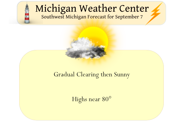
September 7
1960: A three-day heat wave peaked with record highs of 96 at Grand Rapids and 94 at Lansing.
2001: Severe thunderstorms produced widespread wind damage. About a dozen trees and several telephone poles were blown down in Saranac in Ionia County.
September 8
1874: One of the longest heat waves in the month of September is underway with Lansing hitting 95 degrees. Lansing would have eight consecutive days with high temperatures in the 90s from September 7th to the 14th.
1951: A cool air mass settled into Lower Michigan bringing frost and freezing temperatures. Grand Rapids fell to a record low of 31 degrees.
September 9
1968: A tornado injures one person as it damages several businesses in Cedar Springs in Kent County. Another tornado damages a farm west of Monroe, Michigan.
2001: A tornado moved through Delta Township and into the western outskirts of Lansing causing heavy damage over an eight-mile-long path. There were minor injuries and several barns and other buildings were damaged or destroyed.
September 10
1917: High temperatures were only in the middle 50s as cool and cloudy conditions prevailed.
1931: A record high of 94 degrees was set at Grand Rapids, contributing to the warmest September on record there.
1943: The USS Grand Rapids is launched from Superior, Wisconsin. The weather in Grand Rapids, Michigan is cool with a low of 39 degrees. The ship was outfitted to take weather observations but was damaged by a hurricane as it sailed towards Bermuda. It was repaired and provided vital weather observations in the North Atlantic through the end of World War Two.
1946: A weak tornado hit near Albion in Calhoun County around 730 AM, with damage limited to several downed trees.
Weather History for SE Michigan
September 4
On September 4, 1973, the Detroit daytime temperature rose to 92 degrees, which is the record high temperature for the day. The very next year, in 1974, the overnight temperature dropped to 40 degrees, which is the record low temperature for this day!
September 5
On September 5, 1984, Detroit experienced a record low of 42 degrees. This was the first of 2 consecutive days to experience a record low. On the 6th, the temperature dropped to 38 degrees.
September 6
On September 6, 1990, rush hour traffic came to a halt when an F1 tornado hit St. Clair County at 5:20 PM.
September 7
On September 7, 2010, winds gusted between 40 and 50 mph across Southeast Michigan, with the strongest winds occurring over the Detroit Metro area. A few trees and tree branches were blown down, some of which fell onto power lines. Very low humidity levels, less than 25 percent, allowed the sparking wires to touch off fires across Wayne County. The wind-swept fires destroyed 90 occupied homes and damaged 71 vacant homes and garages. No injuries were reported.
Also on September 7, 2001, Livonia experienced winds of 58 mph with a thunderstorm at 4:55 pm. Chesaning and Buena Vista also experienced winds with this storm which gusted up to 63 mph.
September 8
On September 8, 1997, a waterspout was sighted over western Lake Erie. It was located offshore from Bolles Harbor which is just south of Monroe.
September 9
On September 9, 2001, a cold front finally passed through Southeast Michigan ending an unusual three-day severe weather outbreak in September. The cold front slowly approached the western Great Lakes region on the 7th and 8th while warm and unstable air ahead of this front allowed thunderstorms to develop during the afternoon and evening hours on all three days. Most of the thunderstorms that developed over this three-day period produced severe wind gusts. The most common type of damage from these storms was trees being blown down or broken.
On September 9, 1931, the temperature rose to 98 degrees in Saginaw, which is the record high temperature for the day. This day also marked the beginning of a four-day period (September 9-12) of record high temperatures.
September 10
On September 10, 2017, Flint tied the record low of 36 degrees last reached in 1969. This was the 3rd day of reaching or exceeding record lows in the first 10 days of September.
On September 10, 2002, a strong cold front moved through eastern Michigan during the afternoon. Due to the drought conditions that year, the thunderstorms resemble those of the high plains with high cloud bases, less rainfall and strong winds. Hundreds of power outages were blamed on these thunderstorms. The more widespread tree damage in eastern Michigan occurred across portions of Shiawassee, Huron and Livingston counties.
Also on September 10, 1950, a record 6.04 inches of rain fell in Flint. The yearly precipitation average in Flint is 24.44 inches. In one day, Flint received nearly a quarter of its yearly precipitation average.
Forecast Discussion
-- Continued dry and settled through Fri --

Midlevel drying/subsidence over the region is apparent in recent
GOES water-vapor imagery. This subsidence is occuring downstream
of an elongated ridge axis that extends from the prominent western
CONUS mid/upper-level anticyclone and into Quebec. At the surface,
high pressure is centered over the northern plains. This high will
build into the Great Lakes tonight, then continue eastward on Thu.

With light winds, clear skies, and appreciable low-level moisture,
radiational cooling has resulted in areas of fog across portions
of the forecast area. This fog may be locally dense through dawn,
particularly in areas south/east of Grand Rapids. The thin fog
layer should do little to hinder surface warming after daybreak,
and fog should largely lift by 10 AM. With similar conditions
tonight, fog development again appears possible.

Otherwise, abundant sunshine is expected through Fri, along with a
modest warming trend.

-- Sat and beyond --

Global models continue to indicate that a trough will crest/flatten
the mid/upper anticyclone over the western CONUS on Thu, with this
trough then emerging into the plains on Sat. An associated cold
front will advance southeastward, likely extending from near Lake
Superior southwestward into the central plains by Sat night.
Meanwhile, another mid/upper trough--currently situated over the SE
CONUS--is expected to evolve into a cutoff low near the Gulf on Thu.
This cutoff low/trough is then forecast to lift northeastward during
the Sat-Sun timeframe in response to the approaching northern
trough. The subsequent interaction and weak phasing/merging of these
troughs (PV anomalies)--with possible surface cyclogenesis--is a key
driver of forecast uncertainty for late in the weekend and into
early next week.

Among the global ensembles at 00z Tue, the EPS mean exhibits a
deeper midlevel trough/low than the GEFS, along with a more westward
position (in the vicinity of IL). The EPS normalized spread in the
500-mb height field is large from Sun onward over the region,
indicating greater-than-average spread among members at this
forecast range. These factors continue to limit forecast confidence
at this stage.

However, these considerations aside, ensemble guidance has been
consistent in signaling low precip probabilities on Sat, with many
areas likely to remain dry into Sat night. Better chances of rain
appear to exist for Sun/Mon. During this time, guidance suggests
that a plume of deep moisture will at least glance the region, with
ensemble-mean PWs near 1.5 inches by Sun night. This suggests at
least some potential for locally heavy rainfall, pending greater
confidence in the evolution of the main upper trough/low and related
surface features into early next week.
GR will barely hit 80 degrees the next 2 days and then a cold front! Then highs barely 70 degrees! Wow the pattern continues! Incredible!
81-86 degrees and sunny the next 4 days. Wow!
Great early fall weather that’s for sure.
Slim
No fog here this morning. Not a cloud in the sky. Looks to be another spectacular day in southern Michigan.
Yesterdays official H/L at Grand Rapids was 76/61 there was no reported rain fall and the sun was out 24% of the time. The overnight low here in MBY and officially at GRR was 56. At the current time it is clear and 59 here in MBY. For today the average H/L is now down to 77/56 the record high of 96 was in 1960 and the record low of 38 was in 1986. The rest of this week looks to continue to have great early fall weather.
Slim