We had .23 of an inch of rain overnight bringing us to 3.07 inches for the month. There is a lot of variability in rainfall totals across the area due to the hit-and-miss nature of storm cells. Yesterday’s high was 81° and the low 62°.
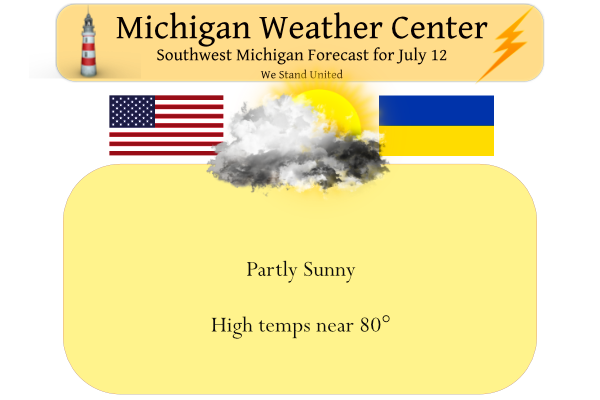
Today will be partly sunny and pleasant with highs in the mid-70s near the lake shore, but near 80 degrees inland. Winds will be 10 to 20 mph from the northwest with some higher gusts.
Forecast Discussion
--Chance of showers/storms tonight and Wednesday morning--

Water vapor imagery shows a short wave moving over northern Lake
Michigan early this morning. This wave will drag down some cooler
temperatures aloft today as it moves over the state. H5 temps fall
from -8c to around -12c this afternoon which will increase the mid
level lapse rate. Initially, showers/storms will likely develop over
Wisconsin and then move southeast toward the northern half of the
cwa this afternoon. We`ll have chc pops in the forecast for this. A
second short wave still over Manitoba will follow a similar track
tonight into Wednesday. However, coverage may be a bit more limited
due to lower instability. Areas north of I-96 have the highest
chance of seeing showers.

--Dry Thursday/Friday, then showers/storms Saturday/Sunday

High pressure will build south over the state Thursday and Friday.
While temperatures will warm into the mid 80s late in the week,
dewpoints will remain in the 50s which will limit the humidity.

Another short wave will roll through over the weekend and provide a
chance at showers/storms. It`s still a bit early to pin down timing,
especially since the models aren`t in great agreement with the
timing yet.

--Warmer next week--

Both the ECMWF and GFS show the large ridge over the Plains nosing
into the western Great Lakes Monday and Tuesday next week. Heights
rise considerably and we may be looking at highs around 90 again
along with dewpoints in the mid to upper 60s, which will make the
air very humid.
930pm and its getting dark already where is Summer going?? Yeahhhh INDY
Another warmup? Get ready!
Just another below normal temp summer day! Get ready for some lows in the 50’s again! Wow, just wow!
Well last night was interesting by my house with the Tornado Warning. The lightning was almost constant. Got some pictures of the lowering where the rotation was some cool lightning video.
It was quite a light show as the cell slid by off to the north. We didn’t get diddly squat for precip. 🙁
Check out the hook echo near Westphalia:
https://www.youtube.com/watch?v=v4aDJGhosXQ
Yes it was a very impressive looking storm. Wasn’t expect a tornado warning last night!
Here in MBY I recorded 0.19” of total rain fall yesterday while not much that is still better than the official amount of just 0.02” at GRR. So, yesterday’s rain fall was mostly light and hit and miss. The official H/L yesterday at Grand Rapids was 81/63 there was that official 0.02” of rain fall and there was 25% of possible sunshine. For today the average H/L remains 83/63 the record high of 106 was in 1936 and the record low of 42 was way back in 1898. While there are chances of some rain the rest of this week… Read more »