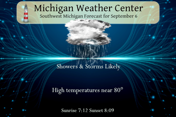
Yesterday we had another 90° muggy day after a morning low of 69°. We have some rain and storms moving in our direction from Chicago which will be the beginning of a flip in our weather pattern. There is a marginal risk of severe weather today (level one of five). Showers and thunderstorms will be likely today. Cloud-to-ground lightning, heavy downpours, and local wind gusts over 40 mph will be possible with any thunderstorm. Tomorrow we will begin a period of temperatures struggling to reach 70°.
Grand Rapids Forecast
9 6 grrWeather History for SW Michigan
September 3
1946: There was an early taste of autumn as Grand Rapids fell to 32 degrees for its earliest freeze on record.
September 4
1965: A tornado struck east of Grand Haven, destroying a barn, silo, and factory. Debris was carried over two miles.
2008: The remnants of Hurricane Gustav brought heavy rains to southern Lower Michigan. Muskegon sets a daily rainfall record of 3.25 inches and Grand Rapids sets a record with 2.82 inches.
September 5
1997: Cool weather prevailed with scattered frost and a record low of 34 degrees at Lansing.
September 6
1881: Temperatures hit the mid and upper 90s as a four-day heat wave peaked across Lower Michigan. Lansing reached 97 degrees for their second record high in a row, both records that still stand.
September 7
1960: A three-day heat wave peaked with record highs of 96 at Grand Rapids and 94 at Lansing.
2001: Severe thunderstorms produced widespread wind damage. About a dozen trees and several telephone poles were blown down in Saranac in Ionia County.
September 8
1874: One of the longest heat waves in the month of September is underway with Lansing hitting 95 degrees. Lansing would have eight consecutive days with high temperatures in the 90s from September 7th to the 14th.
1951: A cool air mass settled into Lower Michigan bringing frost and freezing temperatures. Grand Rapids fell to a record low of 31 degrees.
September 9
1968: A tornado injures one person as it damages several businesses in Cedar Springs in Kent County. Another tornado damages a farm west of Monroe, Michigan.
2001: A tornado moved through Delta Township and into the western outskirts of Lansing causing heavy damage over an eight-mile-long path. There were minor injuries and several barns and other buildings were damaged or destroyed.
Weather history for SE Michigan
September 3
On September 3, 2011, in the late afternoon and evening, several thunderstorms fired up ahead of a cold front that was draped across lower Michigan. Ahead of the cold front temperatures soared into the 90s with heat indices near 100 degrees. The areas hardest hit with strong winds and hail were along I-94 from Ann Arbor to downtown Detroit including River Rouge where festival tents were blown down injuring about 10 people and at the University of Michigan where the football game ended early due to the thunderstorms. Another hard-hit area was from Huntington Woods to Madison Heights where winds were estimated up to 75 mph with numerous downed trees. About 100,000 DTE customers lost power due to the storms.
Also on September 3, 1953, the temperature rose to 100 degrees in Detroit, which was the record high for the day. This also marks the sixth day in a row (August 29-September 3) of record daily high temperatures.
September 4
On September 4, 1973, the Detroit daytime temperature rose to 92 degrees, which is the record high temperature for the day. The very next year, in 1974, the overnight temperature dropped to 40 degrees, which was the record low temperature for this day.
September 5
On September 5, 1984, Detroit experienced a record low of 42 degrees. This was the first of 2 consecutive days to experience a record low. On the 6th, the temperature dropped to 38 degrees.
September 6
On September 6, 1990, rush hour traffic came to a halt when an F1 tornado hit St. Clair County at 5:20 PM.
September 7
On September 7, 2021, a line of storms brought extensive tree damage and power outages to the Tri-Cities region where large hail to 1 inch in diameter was also observed.
On September 7, 2010, winds gusted between 40 and 50 mph across Southeast Michigan, with the strongest winds occurring over the Detroit Metro area. A few trees and tree branches were blown down, some of which fell onto power lines. Very low humidity levels, less than 25 percent, allowed the sparking wires to touch off fires across Wayne County. The wind-swept fires destroyed 90 occupied homes and damaged 71 vacant homes and garages. No injuries were reported.
Also on September 7, 2001, Livonia experienced winds of 58 mph with a thunderstorm at 4:55 pm. Chesaning and Buena Vista also experienced winds with this storm which gusted up to 63 mph.
September 8
On September 8, 1997, a waterspout was sighted over western Lake Erie. It was located offshore from Bolles Harbor which is just south of Monroe.
September 9
On September 9, 2001, a cold front finally passed through Southeast Michigan ending an unusual three-day severe weather outbreak in September. The cold front slowly approached the western Great Lakes region on the 7th and 8th while warm and unstable air ahead of this front allowed thunderstorms to develop during the afternoon and evening hours on all three days. Most of the thunderstorms that developed over this three-day period produced severe wind gusts. The most common type of damage from these storms was trees being blown down or broken.
On September 9, 1931, the temperature rose to 98 degrees in Saginaw, which was the record-high temperature for the day. This day also marked the beginning of a four-day period (September 9-12) of record-high temperatures.
Forecast Discussion
Our main focus in the short term portion of the forecast is on the
convective trends for the area through Thursday afternoon. The worst
of the heat is over for our area, so no concern there.

On the regional radar imagery this morning, there is a very weak
band of light showers out over Lake Michigan as of 3:15 am this
morning, and then there are a couple of small clusters of storms
over the North Central IL and South Central WI area. The leading
band of light showers is most likely associated with the nose of the
low level jet that is now in the process of weakening over the
region. The second area further west is pretty close to the cold
front.

The initial line of showers does not have much hope to grow over the
area. This is because the nocturnal peak of the low level jet has
been reached, and will only steadily diminish as it tries to move
through the area. There is a bit of hope for rainfall over the north
and northwest portion of the area with the second batch. That is
because in addition to the sfc front, the upper wave and better
instability is also nosing in.

MU CAPEs are forecast to increase to around 2,000 J/kg up over the
NW portion of the area with the upper wave moving right through that
area, and then swinging ENE. This area seems to have the most
widespread area of showers and storms a little later this morning.
Elsewhere, there is instability present, but the dynamics are not as
strong, and therefore the coverage and strength will not be as good.

With regards to the severe threat, the ingredient that really seems
to be lacking in this event is deep layer shear. The winds aloft are
not bad, with values around 35 knots or so at 700 mb/10k ft. The way
that this system is evolving and moving through, the sfc winds are
not significantly different than the core of winds aloft, so speed
and directional shear is not high. Still, with the instability and
forcing present, can not rule out an isolated microburst of wind, or
isolated hail up to quarter sized. Thus, the Marginal Convective
Outlook looks good at this time.

The cold front at the sfc and upper wave moving through by mid-
evening will sweep out the best instability, in addition to losing
any heating from the day. This should also take the most widespread
chances of rain with it. We will stay under the influence of long
wave trough aloft, with embedded short waves riding through the jet.
This will keep scattered showers and a few storms possible Wednesday
night and Thursday. The more likely scenario is we get widespread
stratus/stratocumulus clouds holding over the area for a dreary
couple of days.


.LONG TERM...(Thursday night through Tuesday)
Issued at 333 AM EDT Wed Sep 6 2023

- Cooler than normal stretch of weather for the end of the week

Ensemble temperatures forecasts from the models continue to support
a cooler than normal stretch of weather for the end of the week.
Both Friday and Saturday`s mean max T values have a high probability
to stay below 75 degrees.  Friday will be the coolest day with
ensemble mean max temps likely to stay below 70 degrees.  Also for
Friday, the low level moisture is shown to be abundant so, the
region may see a fairly extensive status deck for part of the day. A
slight rebound in temperatures may occur Sunday into Monday as weak
warm air advection occurs.

- Cold front tracks through Monday into Tuesday then much cooler -

Models are showing a cold front tracking through the region during
this time.  Forcing looks relatively weak so only some scattered
showers/isolated storms look possible.  However, models are in good
agreement in showing a much cooler airmass coming down from Ontario.
The northerly flow may be carrying moisture from Hudson Bay.  The
latest GFS ensemble max T for next Wed at GRR is in the upper 50`s.
That would support cloudy, cool and wet conditions as moisture from
the Great Lakes would generate lake effect clouds and showers with
those kind of temperatures. The latest 00z deterministic ECMWF shows
850 mb temps of 0 deg C over Lake Superior at 18z Wed, which would
support the GFS lake effect scenario.
Fall weather at its finest 60’s and rain showers wow to the wow … INDY
Just had rotation move over my house. It was broad but there was no doubt spin. A one point a funnel looked to be forming but then it dissipated. So wild! Got some great pictures. My place has been a weather magnet lately.
And just a bit north, maybe 4 drops of rain. Haha. We could actually use the rain now. It’s been a dry few weeks.
— Storms likely this evening — An unstable air mass remains in place late this afternoon ahead of a surface low and attendant cold front which is located just upstream. The surface low is located Sheboygan WI. A cold front stretches to the southeast out over Lake Michigan and can be seen over Berrien County in the far southwest corner of the state where storms have developed ahead of it. SPC mesoanalysis page shows 2,500 surface based CAPE values nosing northward into our CWA ahead of the front. The front and low are expected to track east across the area… Read more »
Get ready – BELOW NORMAL temps will rule for the next couple weeks! I love it and who wouldn’t love below normal temps this time of year?
Hottest summer ever:
https://edition.cnn.com/2023/09/06/world/hottest-summer-record-climate-intl/index.html
Yes and fortunately our summer was cooler than normal! Hard to believe many people still don’t believe in climate change and say who cares and there is nothing we can do about it! Incredible!
Let’s see some rain today! Bring it!
Yesterday was a very warm September day. A record high and low was set at Muskegon with a high of 92 and a record low of 79. In Grand Rapids the official high yesterday was 91 and the low was a record warmest minimum of 71. There have now been 14 days this year of 90 or better. The average is 12 and this is the most since 2020 when there were 17. There was no rain fall and the sun was out 75% of the possible time. For today the average H/L is 77/57 the record high of 97… Read more »
Is that low of 79 for Muskegon correct? If so that is a pretty warm for a low temp near the lake.
I’ve had about 15 90 degree days at my house. Above average! Incredible summer!
In looking at Muskegon hourly reports it looks correct. The temperature fell to 76 but that was before midnight.
Slim
Above average number of 90+ degree days? I love it!