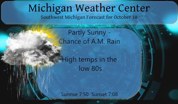
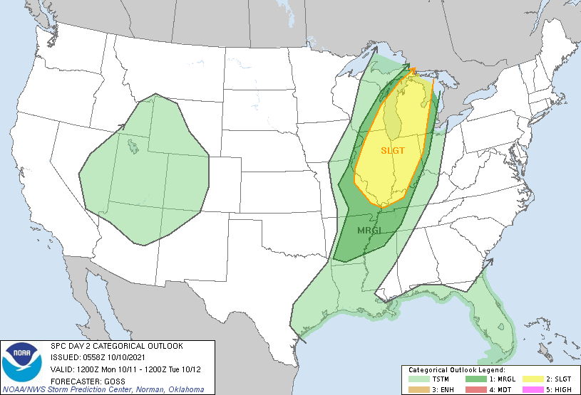
We have some rain moving in this morning thanks to a warm front pushing through the state. We will see occasional showers and thunderstorms and very warm temperatures the next few days. The highest coverage of storms is expected to be Monday evening into Monday night. A few of these storms may become severe. High temperatures will reach into the upper 70s to low 80s Sunday and Monday. The SPC has us in the slight risk area for severe weather mainly tomorrow evening and overnight.
Yesterday’s high was 74° with a low of 56°. We have a warm 66° at 6 am this morning.

The next few days will be very warm for October with occasional showers and storms. Forecast high temperatures Monday are only a few degrees below records. The best coverage of showers and storms is expected Monday evening into Monday night, when a few storms could become severe. We cool down a little for mid-week but high temperatures will still stay above normal.
The CPC continues guessing above-normal temps for the rest of October.
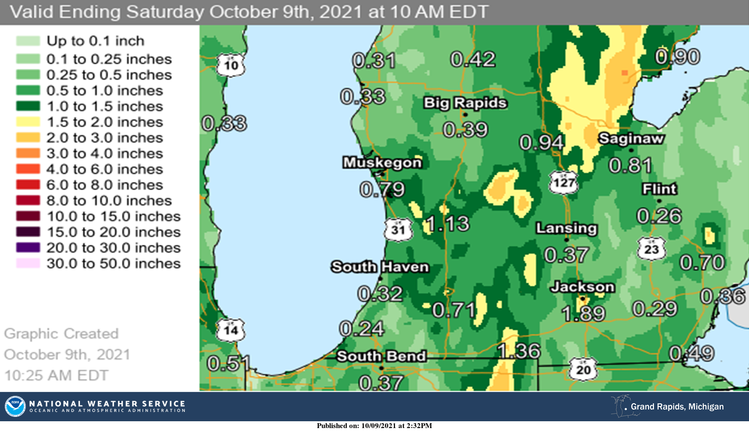
Here is the NWS rainfall map depiction of how much rain fell from 10 am Thursday through 10 am Saturday.
Forecast Discussion
- Convection this AM then clearing and warmer

Typical of a warm front, the convection is over preforming
compared to recent model of forecasts early this morning. Most
areas in our CWA will see measurable rain between now and mid
morning today. There is strong warm advection at low to  mid
levels this morning over our area ahead of the surface warm front.
We have decent mid level instability (1000 to 1500 j/kg of
elevated cape) to work with. Precipitable water increases from
around an inch to around one and a half inches as the warm front
moves through the area. The 850 LI index falls to near -5c as just
ahead of the warm front over our area. Already there are at at
least 3 lines of showers (parallel bands of convection) heading
into our CWA and new line of thunderstorms has just formed off
shore of MKG to BIV. All of this is moving east and will cross our
CWA between now and mid morning. I do not see any real severe
threat as the convection is elevated and is well ahead of the
surface warm front. Rainfall amounts should not be excessive but
a quick 1/4 to 1/2 inch is possible from the stronger storms. Some
small hail is possible to as there is enough cape in the -10 to
-30 range with this convection.

Once the warm front clears the area we should have enough
subsidence to clear the skies and result much warmer
temperatures. Most areas near and south of Route 10 should get
close to or just above 80 today.

Well I have to admit our northwest CWA may have a risk of storms
later this afternoon into this evening as the cold front that
trails the initial surface storm heading into Southest Ontario
will get close enough to that area that convection is possible. I
am thinking through it will mostly stay north and west of our CWA.

Tonight as the system to our south continues to develop there
should be enough mid level ridge building in front of that system
to result in dry weather over the entire CWA. It will remain
warmer than normal too.


- Fall storm brings severe risk Monday evening

As we have been writing about all week, the upper trough to our
west has two systems embedded in it. The first one is what has
created the warm front convection this morning. The second one,
which is currently over Utah (06z) will deepens and close off a
rather impressive upper low by Monday morning over MO. This
significantly increases the mid and upper level heights over us by
mid morning Monday. That should keep us dry, breezy and warm into
midday Monday (Columbus Day).

The system goes negative tilt at upper levels as it moves into
Michigan during the evening. The results in strong FGEN, we have
decent coupling of surface convergence and upper divergence, the
upper jet core crosses our CWA during the evening and MU capes
push 3350 j/kg. This does create decent deep layer shear too
(crossing low and upper level jets). Clearly we would get
organized storms as this system moves into the area. Some could
have damaging winds and large hail. There is some question as to
the timing of this with the Hi Res models but given the upper jet
comes into our area by early evening, I am thinking late afternoon
into early evening for the strong convection.

Once that comes through, we will have lingering light rain showers
into mid afternoon Tuesday as the system does get seriously
wrapped up as it moves through this area. It does lack real cold
air so that will keep surface winds from getting to strong on
Tuesday. Even so Tuesday should be the coolest day in nearly a
week.

- Pleasant weather mid week

As I have been writing for over a week now, we have a larger and
stronger upper trough to our west yet. That does finally move east
enough by mid week to close off upper lows in central Canada and
the Southwest CONUS. That of course builds our eastern upper ridge
back in full force by Wednesday. So at least for Wednesday that
upper ridge should provide some day time sunshine and warm
temperatures.

- Next system late in week brings October temps by weekend

Of course the nice weather will not last long as that upper level
storm gets "kicked" out of the southwestern CONUS by yet another
Pacific system coming on shore. This system is a little more
glitchy than the one we had Friday and the one today and the one
on Monday night. That is because the next upstream to that system
has to close of wavelength to the one it is kicking out. The
interaction of those two storms is unusually not handled well by
the models. At some point from Thursday into Friday we will get
more showers but it will stay warm yet. It will not get cooler
until that trail Pacific system comes into the area. This is more
in the Saturday time frame. I would expect some showers with that
too.

The bottom line to all of this is it may well rain at least a
little bit and some days quiet a bit, just about every day this
week. Only Wednesday is looking dry at this point. Temperature
remain above normal till around the Saturday time frame, then the
get close to normal but not colder than normal.
It has been a very warm start to October this year. After 9 days the mean at Grand Rapids is 65.6 that is a departure of +9.9 and that is the smallest departure from average in the area. At Muskegon the mean is 66.4 and that is a departure of +10.4 and at Holland the mean is 67.5 and that is a departure of +11.7 that mean is more typical of June. To the east at Lansing the mean is 65.8 and that is a departure of +10.8. We will have to see how the rest of the month plays… Read more »
Just another humid July day. In mid October.
Not quite July by any means but it is very warm and somewhat humid for October in Michigan that’s for sure. All most what Florida sees in the winter time (all most) I seen it warmer and more humid in the winter down there.
Slim
Warm October = winter to remember! Bring on the snow! Incredible!
Of the top 5 warmest Octobers at GR 3 had near average snow fall two were below average. The snowiest month in the winters after the top 5 warmest October was January. Depending on how October ends up I will look at the winters that came after a warm and cold October to see how they played out.
Slim
Great, that means we are due to get absolutely hammered!