Before we get into some information on November here is a brief summery of October 2019 at Grand Rapids. The mean was 50.2° that is a departure of -0.8° The high for the month was 77 set on the first and the low was for October a mild 31 set on the 26th There was 7.13” of rain and snow fall that is a departure of +3.87” as for snow fall a 0.3” was reported at GRR that is a departure of -0.2” There were 3 thunderstorms reported during the month. It ended up being a rather cloudy month as there was only 35% of possible sunshine.
Now for the month of November. During this month the average high/low starts out at 54/37 and ends the month at 40/28° Grand Rapids will lose 1 hour and 1 minute going from 10 hours 18 minutes on the 1st to 9 hours 17 minutes on the 30th The average November will see 3.51” of rain fall. The wettest was 7.90” in 2003 and the driest was 1904 when only 0.4” was reported. The average snow fall is 6.8” the most snow fell in 2014 when 31.0” fell. In 1906 and 1907 no snow fall was reported. The average mean temperature is 40.1° the record high was 81° on November 1st 1950 and believe it or not the record low was -10° on November 25th 1950 it looks like just before midnight the low reached -9 on the 24th It can and has gotten into the 70’s in November (I mention this just in case we do get into the 70’s and we know how Mookie will react to that if it happens) over the years it has gotten 70 or better in 36 Novembers. The most days over 70 are 4 in both 2005 and 2015 and in 2016 it reached 70 or better 2 times. And the odds of it reaching 60 or better are very good as only 10 years since 1894 has it not gotten to at least 60. In fact in 1975 14 days reached 60 or better in November and in 2012 the number was 12. The last time no days reached 60 or better was just last year with a high for the month of just 52 on November 4th The mean last November was just 34.6° and that was a departure of -5.5° and good for the 10th coldest November on record at GRR. as stated the high for the month was 52 on the 4th and the low for the month was 20 on the 22nd There was 14.4” of snow fall That was good for the 15th snowiest November at Grand Rapids. Now for some top 10
The warmest mean temperature for November at Grand Rapids
1. 1931 47.6°
2. 2001 46.8
3. 2005 45.5
4. 2016 45.4
5. 1975 44.7
6. 1909 44.4
7. 1934 44.2
8. 2009 44.1
9. 1963 44.1
10. 1902 43.9
The coldest mean temperature for November at Grand Rapids
1. 1951 31.0°
2. 1976 31.4
3. 1995 32.0
4. 1996 33.2
5. 1959 33.5
6. 2014 34.3
7. 1950 34.4
8. 1967 34.5
9. 1898 34.7
10. 2018 34.6
The top 10 snowiest Novembers for Grand Rapids
1. 2014 31.0”
2. 1951 26.9
3. 1991 25.3
4. 1995 20.8
5. 1989 19.4
6. 1950 17.5
7. 2005 17.3
8. 1940 17.3
9. 1966 16.6
10. 1959 15.3
The least snowy Novembers at Grand Rapids.
1. 1906 0
2. 1907 0
3. 2001 T
4. 1984 T
5. 1948 T
6. 1946 T
7. 1931 T
8. 2010 0.1
9. 1999 0.1
10. 1927 0.1
Here the latest 90 day outlook from Accuweather as always take all long range outlooks with a grain of salt.
November
Western Ohio Valley, Midwest, central/northern Plains – Some snow and colder air for the region. Temperatures start out the month well below normal in the central Plains and Midwest. Temperatures could rebound week two and back and forth later in the month. Still, temperatures can run several degrees warmer compared to 2018. Risk that we are not wet enough in northern areas and too wet in southern areas; use of winter products increase in this section, higher heating demand, especially early month (moderate confidence).
December
Western Ohio Valley, Midwest, central/northern Plains – Just like the Northeast, this will be a risky area from this far out, most modeling and analogs trend toward above-normal temperatures in December for northern Plains and parts of Midwest, but some analog years are still showing cold. We again are conservative from this far out, but temperatures and storm track can change drastically as we get closer, up or down on temperatures (low confidence).
January 2020
Western Ohio Valley, Midwest, central/northern Plains – There will be more extremes for this part of the nation. Arctic air may plunge at times in the northern/central Plains into the Midwest and Great Lakes, with blocking over northern Canada and Alaska. Couple of big snow events in the Midwest, especially Upper Midwest. Lake-effect snow is at a premium (moderate confidence).
One thing to keep in mind is all long range guesses are subject to change.
Slim
What a day! Well below normal temps with rain, sleet, snow, etc! Just a sign of things to come! Get ready for a monster winter!!!!!
Nice compilation of stats Slim. Hope it didn’t take you hours and hours to look them all up!
Sun spot cycle 25 looks to have begun. At this time there is one sun spot on the sun the magnetic polarity of this sunspot has reversed. This is a indication of new Solar Cycle 25 has begun.
https://spaceweather.com/
Slim
Just noticed that. The sun has been pretty quiet for a while now but should slowly start ramping up again as it swings back to solar maximum.
…SCATTERED THUNDERSTORMS WITH LIGHTNING AND SMALL HAIL THIS
AFTERNOON…
Scattered thunderstorms are expected this afternoon. Severe weather
is not forecast, but cloud to ground lightning strikes and small
hail will be possible as the activity moves east through the area.
The heavier bursts of precipitation will contain both rain and snow
at times, along with the threat of lightning and small hail.
If outdoors this afternoon, be aware of the possibility of brief
heavy downpours, cloud to ground lightning and some small hail.
Temps in the low 40’s cold Thunderstorms ..Thanks MV…INDY
Great post Slim … October was a wet and cool month September and October combined was the second wettest months ever in GR I look for November to be below average and above average in precipitation more rain and snow coming with storm track still over Michigan ..8 out of the last 10 months below average a cool man’s dream ..Have a good Saturday INDY
Good morning. At this time, it is cloudy and 37° here at my house. The official H/L for Grand Rapids yesterday was 44/33. For the year Grand Rapids is now up to 44.72” of total precipitation. This year will end up with one of the highest precipitation amounts in Grand Rapids recorded history as GR is already in 10 place. The record in recorded history is 48.80” in 2008. For today the average H/L is 54/37 the record high is 77 set in 1936 and the record low is 18 set in 1951. The coldest maximum is 31 set in… Read more »
Thanks Slim – as you said, take the Accuweather forecast with a grain of salt….
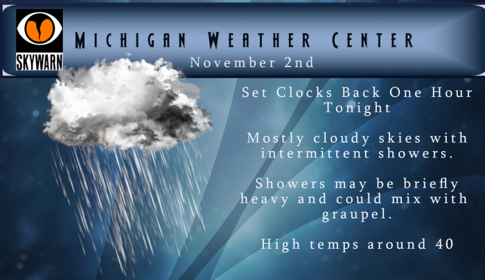
As a reminder – don’t forget to set your clocks back tonight – our biological clocks will be messed up for a week or two 🙁