[columns] [span6]

SW Michigan
[/span6][span6]
SE Michigan
[/span6][/columns]
[columns] [span6]
Northern Lower
[/span6][span6]
U.P.
[/span6][/columns]
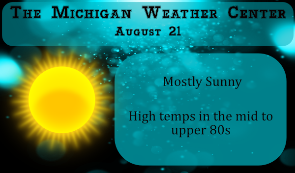
We continue with our warm and dry conditions across southern Michigan with lots of sun right on through next week. We have had only three days this month with rain and our last decent rain was back on the 11th when we picked up .56 of an inch. Our next chance comes on Sunday, however, there is only about a 16% chance which is pretty meager. Through next Wednesday looks to be less than 10%. Temps will remain above normal in the mid to upper 80s with increasing humidity through the weekend.
As we get into late next week precip chances begin to increase according to the CPC which continues on into the first week of September.

The September outlook released yesterday guesses a 35% chance of above-normal temps and equal chances of precip.

Forecast Discussion – North
SHORT TERM...(Today and tonight)
Issued at 338 AM EDT FRI AUG 21 2020

Areas of fog and thunderstorms are the stories this morning as
latest RAP soundings show lingering low-level moisture trapped
beneath an inversion. Moderately steep mid-level lapse rates are
allowing between 500-800 J/kg of elevated CAPE that the ongoing
storms have been able to tap into. There is some low-level
convergence in the wind field that likely attributed to the
convective initiation as ongoing storms are holding together off
each other`s outflows this morning. Through the rest of the morning,
expecting continued areas of fog with change of air mass and little,
if any, wind to help mix the boundary layer. As for the
thunderstorms, expecting these to continue on a track from western
Marquette County towards Munising this morning, though latest
lightning trends suggest these storms are starting to lose their
steam.

Today, as the ridge over the desert SW remains firmly in place,
downstream troffing will lead to WNW flow over Upper Michigan this
morning. Modeled theta-e suggests stalled boundary over MN this
morning is progged to lift NE this afternoon. This increased theta-e
advection will help create an increasingly unstable atmosphere as
models suggest upwards of 2000 to 2500 J/kg of 1km MUCAPE by 21Z
this evening. As you`d expect, MLCAPE is lower, but still right near
2000J/kg. Aside from this advancing front, there isn`t too much in
the way of deep forcing and model q-vector conv mirrors this
thought. Bulk shear values are forecast to be around 25 to 30 knots,
so we`re not expected widespread severe thunderstorms, but if storms
are able to tap into upwards of 2000 J/kg this afternoon/evening
there could be an isolated strong to severe storm across the west
and central. CAMs are a little all over the place though for this
afternoon/evening convection so went with broad PoPs and coverage
wording for the forecast with scattered to numerous thunderstorms
possible this evening. One area of concern would be the potential
for slow-moving, training thunderstorms given mean winds of around
20 knots from the SW, which is oriented parallel to storm
development as well. With PWATs near 1.5 inches, any clusters that
are able to develop could produce localized ponding of water and
flooding of poor drainage areas.

Tonight, an embedded shortwave trof riding along the western NOAM
ridge will traverse the Dakotas and northern MN, reaching western
Lake Superior late tonight into tomorrow morning. Theta-e advection
will continue across western Upper Michigan as CAMs show generally
the same idea for scattered convection over the region, but little
agreement on timing, coverage, or location. Will keep a broad brush
coverage PoP approach into the overnight hours, with the best
chances across the west half...diminishing from the central into the
eastern half of the CWA. Bulk shear values weaken into the evening,
so strong to severe storm chances will likely diminish with it. Will
likely need to monitor how CAMs handle convection this afternoon and
adjust the fcst for tonight accordingly.

.LONG TERM...(Saturday through Thursday)
Issued at 415 AM EDT FRI AUG 21 2020

For the next few days, ridging over western Canada and troughing
over se Canada will leave Upper MI under wnw flow. Then, during the
first half of next week, the flow over Canada may flatten some,
leading to a zonal flow regime along the U.S./Canada border for a
time. Later next week, ensembles suggest a trend toward lowering
heights over the e half of Canada as a broad low pres trough takes
shape. This will shift the flow into the Upper Lakes back to the
wnw. For Upper MI, this evolution of the pattern will lead to temps
being overall above normal through the middle of next week. The last
half of next week should then trend cooler as the eastern Canada
trough develops. As for pcpn, with wnw flow over Upper MI and heat
over the Northern Plains trying to build eastward, expect periodic
shra/tsra into the first half of the weekend. Progression of
shortwaves in the westerly flow thru the first half of next week
will likely continue to lead to periodic shra/tsra. How active it
becomes will depend on the proximity of the associated frontal
boundary to the Upper Great Lakes in the westerly flow.

Beginning Sat...the advancement of a shortwave trough into the Upper
Lakes should provide better chances of shra/tsra, but the timing and
placement of the better coverage will largely depend on the position
of the associated frontal boundary across the fcst area. Although
model agreement on the evolution of the convection is not great at
this point, there is a signal from most of the models that the
better coverage of convection Sat late morning into afternoon will
be over the western and northern tiers of the fcst area, in closer
proximity to the frontal boundary. The 3 km NAM soundings indicate
dewpoints in the mid to upper 60s, which provided there is enough
insolation Sat, could yield afternoon MLCAPE values 1000-1500 j/kg.
Deep layer shear values increasing near 30 knots over the western
fcst area late in the day might be enough to support a stronger
storm there toward evening, but otherwise SPC`s day2 marginal threat
of severe storms across the much of the cwa seems a bit overdone.

By Sat night, any remaining convection with waning instability
through the evening into overnight hours should slowly push into the
southeast half of the fcst area following the slow movement of the
frontal boundary.

Flow over the area on Sun looks benign with gradual height rises.
Under a weak sfc flow, afternoon lake breezes could enhance
convergence along slow-moving frontal boundary and pose a small risk
for isold shra/tsra development central and east. With pooling of
mid to upper 60s dewpoints along the frontal boundary the GFS
indicates the potential of MLCAPE values of 500-1000 j/kg.

Model resolution of shortwaves in a westerly flow regime early next
week will remain a challenge this fcst package. A couple of weaker
shortwaves could have the potential to impact weather over our area
early next week with the potential of a stronger wave and associated
frontal boundary moving through during the midweek period (likely
Wed-Thu) which would bring greater chances for widespread rainfall.
Forecast Discussion – South
-- Continued predominately dry and very warm --

Corridor of very dry air from Missouri to srn Lwr MI remains in
place through the weekend and the stationary sfc front to our
north moves little through Saturday.

On Sunday a weak shortwave dropping in from the northwest helps
push the sfc front down in our direction. However with the dry
air still holding on and the sfc front looking more ill-defined
with time, only a slgt chance for a shower or storm is warranted.
Weak/diffuse sfc boundary stalls overhead on Monday and a few
isolated showers or storms may still be possible.

-- Potentially even warmer (hot) for next Wednesday/Thursday --

As we move toward the middle part of next week, there is some
uncertainly on whether the sfc front remains stalled overhead or
becomes situated to our north again as the ECMWF indicates. If
this solution is correct, Wednesday and Thursday of next week
could be quite hot with highs in the lower to mid 90s as H8 temps
push toward 22C. Can`t rule out this hot air arriving as early as
Tuesday depending on the location of the sfc front.

-- Next decent chance of rain probably about a week from now --

Perhaps our next decent chance of rain will come next Thursday
night and Friday when the remnants of the two tropical systems
will be lifting north in our direction from the Gulf. At the same
time, a large Canadian sfc high should be pushing the baroclinic
zone over the Upper Midwest and nrn GrtLks southward. The
interaction of these features may finally result in much needed
rain for our area, but obviously too far out to bank on.

-- Cool down likely for the weekend of Aug 29th --

That large Canadian sfc high delivers a cool air mass for the
weekend of August 29th. Northerly flow sends H8 temps down to
around 6C during that time, so highs probably only around 70 a
week from this Saturday.
Just about a hour ago Detroit a
Had earthquake 4.3 anybody fell any shaking going on ?? INDY
Currently 81* degrees out at thee YARDofBRICKS NE of GR feels wonderful outside not sure how a couple bloggers on here think this is hot lol.. actually the breeze makes me feel even cooler love it …..INDY
Always 3-5 degrees cooler at Indy’s house LOL
I’ve told you before it’s the Grand River effect thank. You currently 79* degrees now very hot outside lol….INDY
Sureee lol meanwhile, upper 80’s in GR today.
Interesting day at work……the front of the building where the offices and customers are has air conditioning, but the back where we work does not. So the big AC unit on the roof went out and it was 88 degrees out front, and boy what a bunch of howling and hollering about how hot it was out there. I just had to smile as it is routinely in the 90’s to over a hundred back by us every day.
Way back when I first started working that the way the first location where I worked was like. Air in the offices but were the hard work was done no air at all. In that location it could reach up to 120° of course they had fans to throw the hot air around. Sunny and 87 here at this time.
Slim
Sure going to miss Friday night lights in the Fall nothing better then the sights and sounds of high school football driving into small towns smelling the leafs burning the best it’s sure going to be different with no football…..INDY
No argument here…this Summer has been wonderful. Breezy, consistently warm, solid sunshine. Hard to hope for more than that…other than hoping it continues for many more months. We’ve all noticed the cold nights that “visited” over the past few weeks, as the true Southern Arctic reminds us of our standard climate. A fine Summer regardless.
Now for anyone here who is into the analog method of long range guessing. Accuweather has this fall into the winter season with 2016, 1985, 1995, 1964 and 1983 as some year that they claim to look at. Note I am not a big believer in the analog method. But that said I will take a look over the next few weeks at each of the above years and see how that fall and winter seasons ended up.
Slim
MV posted the CPC’s long range guess for September (it will be updated on August 31st) now for the total fall season here is their guess for September thru November
https://www.cpc.ncep.noaa.gov/products/predictions/long_range/seasonal.php?lead=1
And the guess for meteorological winter
https://www.cpc.ncep.noaa.gov/products/predictions/long_range/seasonal.php?lead=4
Slim
Their winter forecast looks like it was influenced by the developing La Nina.
I’m thinking even bigger weather news then a couple days at 90 degrees in west Michigan in the Summer with be the gulf of Mexico two major hurricanes coming next week all eyes will be on the tropics shuuuu currently another beauty of a night no fans attached out at thee YARDofBRICKS NE of GR makes for great fire nights getting dry though around here and with all the dead leafs falling make great fire starter …Have a super weekend…INDY..
I hope not. Hurricane aftermath almost always gives Michigan cool and cloudy weather.
This is a possiblity at the end of the month
A couple days ago you said weather happening thousands of miles away didn’t matter with regards to the posts on the relentless heat wave and fires out West, but now you flip the other way with possible storms thousands of miles away? Can’t have it both ways.
He only focuses on Michigan weather when it’s cool. When it’s hot, he deflects.
NWS says lower to mid 90’s… oh my! This hot summer just won’t stop.